
More news on this day
For travelers who have already checked America’s marquee national parks off their list, the next great hiking trip in 2026 may lie just beyond park borders on lesser-known trails that deliver national park views without national park crowds.
Get the latest news straight to your inbox!
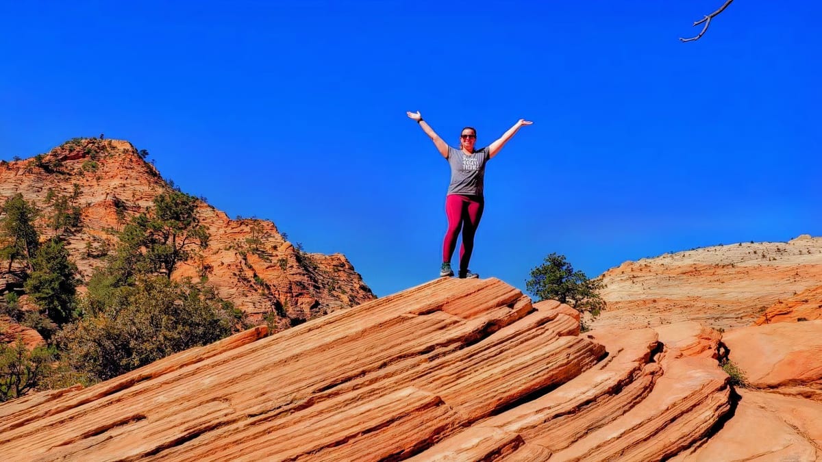
Image by TheTravel
Tuscarora Trail: A Quieter Counterpart to the Appalachian Mainstream
Stretching roughly 250 miles across Virginia, West Virginia, Maryland and Pennsylvania, the Tuscarora Trail was originally conceived as a high-country alternative to crowded portions of the Appalachian Trail. Publicly available trail descriptions show that it follows long ridge lines and remote forest corridors, often within a short drive of Shenandoah National Park yet with a fraction of the foot traffic. For hikers who loved Shenandoah’s Skyline Drive overlooks but found the Appalachian Trail congested, Tuscarora offers similar Blue Ridge vistas in a far more contemplative setting.
The route is typically broken into manageable day-hiking and backpacking sections, which makes it practical for 2026 travelers planning long weekends rather than months-long thru-hikes. Wayfinding has steadily improved as local trail clubs update signage and guide materials, and many access points are close to small towns with basic lodging and resupply. For national park fans used to well-marked corridors, Tuscarora feels adventurous without being intimidating.
Conditions in recent seasons have underscored the value of choosing this type of secondary long-distance trail. Coverage of federal budget constraints and trail maintenance backlogs on some of the country’s marquee routes has highlighted how storms and heavy use can quickly degrade popular paths. By contrast, regional reports indicate that many stretches of the Tuscarora have seen lighter wear, leaving tread in relatively stable shape for 2026, with downed-tree issues more localized and often addressed by volunteer crews.
Travel planners weighing this trail for the coming year should still treat it as true backcountry. Segments traverse high, exposed ridges that can turn hazardous in spring storms, and water sources may be intermittent by late summer. As with any long-distance corridor, updated maps, a flexible itinerary and conservative mileage targets remain essential.
Foothills Trail: Big Views Between National Park Destinations
In the southern Appalachians, the 76-mile Foothills Trail in South and North Carolina has been steadily gaining attention among hiking publications as a standout route that ties together state parks, reservoirs and the forested escarpment just outside Great Smoky Mountains and Blue Ridge Parkway road-trip circuits. The path threads lake shores, hardwood forest and high viewpoints, offering a cross-section of the region’s landscapes in a single, well-marked corridor.
The Foothills Trail is particularly attractive to travelers who have sampled headline national park routes in the Smokies and are now seeking something quieter without sacrificing comfort. The corridor passes near established campgrounds and popular day-use areas, meaning hikers can mix backpacking segments with lodge or cabin stays. Several access points at trailheads near Table Rock, Oconee and state-managed recreation areas make it easy to break the walk into manageable two or three-day sections.
Recent regional coverage notes that improvements to signage, bridge work and staircases along steep ravines have kept the trail accessible in the wake of heavier rainfall patterns. While parts of the southern Appalachians have seen washouts on smaller unofficial paths, mainline Foothills segments have largely remained open, making it a reliable option for 2026 itineraries. That resilience is a key selling point for travelers trying to lock in trips months ahead.
Because the trail crosses varying elevations, it also extends the hiking season for park-focused travelers. Lower reaches can be pleasant in late winter and early spring, when higher-elevation routes in Great Smoky Mountains National Park may still hold ice and snow. Conversely, shaded river gorges provide cooler walking in early autumn when popular national park overlooks are still crowded with peak-season visitors.
Lesser-Known Paths in Great Smoky Mountains Country
Great Smoky Mountains National Park remains the most visited park in the United States, and coverage ahead of the 2026 season continues to emphasize parking strain at marquee trailheads such as Alum Cave and Laurel Falls. At the same time, local guides and visitor information outlets have been highlighting a different story: a network of underrated interior trails that see far lighter use despite starting on the same park roads.
Routes such as Curry Mountain and Chestnut Top, cited in recent regional roundups of “underrated” Smokies hikes, showcase steep coves, wildflowers and views over the Little River valley, but attract only a fraction of the hikers seen on nearby flagship paths. Likewise, quieter waterfall approaches like Spruce Flat Falls have been singled out by 2025 and 2026 visitor guides as options for travelers seeking a short, scenic outing away from congestion. These recommendations are particularly relevant to repeat visitors who have already completed Clingmans Dome or Chimney Tops and are now hunting for new perspectives.
Current information indicates that the park’s ongoing parking reservation and fee updates are directing more people toward well-publicized trailheads, unintentionally leaving lesser-known routes even calmer. For trip planners, that dynamic suggests a strategic opportunity: a base in Gatlinburg, Townsend or the North Carolina gateway communities can still support day hikes that feel surprisingly secluded, even in busy months, if travelers target these secondary trailheads.
Safety expectations, however, should match backcountry conditions rather than busy nature walks. Many of these paths climb aggressively, cross creeks without bridges and receive less frequent grading. For 2026, hikers are advised to check the latest park alerts for storm damage or temporary closures and to approach route descriptions as starting points rather than guarantees, particularly after heavy weather.
Kolob Corner and Side Corridors Beyond Zion’s Main Canyon
Zion National Park’s main canyon continues to rank among the country’s most crowded hiking destinations, with published visitation figures keeping it near the top of national rankings. In response, state tourism campaigns and local outfitters have been directing attention to peripheral sections of the park and nearby public lands, especially Kolob Canyons and Kolob Terrace, as alternatives that preserve Zion’s red-rock drama without the shuttle bus lines.
Recent travel articles featuring “day hikes that avoid the crowds” around Zion emphasize that these side regions offer everything from short canyon walks to mellow rim strolls at higher elevation. Trails like Taylor Creek in Kolob Canyons and longer routes from Lava Point on Kolob Terrace have been repeatedly described as comparatively uncrowded, with visitors often reporting long stretches of solitude compared to the Narrows or Angels Landing. For national park enthusiasts planning a 2026 Utah circuit, building a full hiking day in these corners can meaningfully change the overall experience.
Beyond the park boundary, state-managed areas such as Red Mountain Wilderness and other desert plateaus near St. George and Virgin feature signed paths over slickrock and through pinyon-juniper forest that deliver expansive views back toward Zion’s cliffs. Official tourism sites and regional guides now routinely package these routes with Zion itineraries, framing them as ways to “expand” a visit rather than dilute it. That messaging reflects a growing consensus that the park’s ecological health and visitor satisfaction both depend on dispersing use.
Travelers weighing these options for 2026 should factor in evolving shuttle schedules, timed-entry policies and changing parking rules inside Zion, which can influence how much time remains for peripheral hikes on any given day. As of early 2026, publicly available planning documents for the park’s commercially guided hiking operations suggest that demand for peak-season permits will remain high, reinforcing the case for having several non-main-canyon routes on a trip planner’s shortlist.
American Discovery Trail Segments: A National Sampler Between Parks
For hikers who have fallen in love with the diversity of the U.S. national park system and now want to see the country’s in-between spaces, the American Discovery Trail provides a compelling framework. This coast-to-coast route stitches together existing local and regional paths, country roads and rail trails from the Atlantic to the Pacific, with sections that swing close to or directly through multiple national parks and forests.
Recent updates to national trail resources and advocacy materials emphasize that the American Discovery Trail is not a single continuous wilderness footpath, but a flexible system where travelers can cherry-pick segments that match their interests. For 2026 trip planning, this makes it particularly appealing to those building road trips between parks such as Rocky Mountain, Canyonlands or Cuyahoga Valley. A day or two on a Discovery Trail segment can introduce prairie preserves, small historic towns or river corridors that rarely appear on mainstream park itineraries.
The trail’s relatively low profile compared to routes like the Pacific Crest or Appalachian has also kept many sections quieter. Coverage of crowding and storm damage on high-profile thru-hikes has led some long-distance enthusiasts to look toward alternatives where nightly campsites are less impacted and resupply points more relaxed. With coordinated local trail groups maintaining pieces from the Midwest to the central Rockies, the American Discovery Trail is increasingly presented as a more flexible, less pressured way to experience extended walking.
For 2026 travelers, success on this route depends heavily on logistics. Because the trail incorporates road walking and passes through private land mosaics in places, up-to-date segment descriptions, permission notes and closure notices are crucial. Hikers who are accustomed to the clear boundaries and uniform regulations of national parks will find that planning an American Discovery Trail section demands more pre-trip research, but rewards that effort with a closer look at how everyday American landscapes fit between the country’s flagship protected areas.