
Skimming the southern shore of Lake Erie, a relaxed road trip can weave together broad sandy beaches, wildlife-rich parks, nostalgic lake towns and rolling vineyards. This inland sea feels at times like an ocean, with long horizons, working harbors and changing light that rewards slow travel. Driving east along the water from Ohio into Pennsylvania and western New York, you can assemble a flexible itinerary that favors scenic detours, shoreline walks and unhurried evenings watching the sky fade over the lake.
Planning Your Lake Erie Lakeshore Route
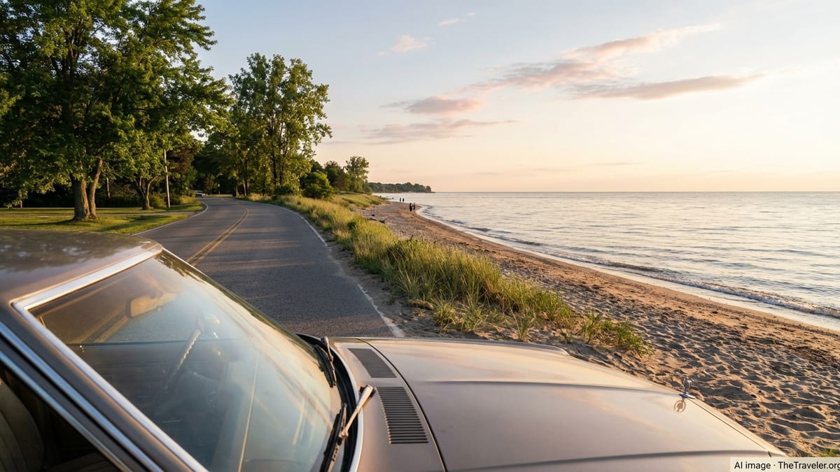
The south shore of Lake Erie stretches for hundreds of miles from the Toledo area in western Ohio through Pennsylvania and into western New York. For a focused lakeside trip, many travelers follow a loose route from Maumee Bay State Park near Toledo across northern Ohio, then onward through Erie in Pennsylvania and into the vineyards and villages of Lake Erie Wine Country toward New York. Driving this corridor keeps the water close at hand and strings together a cluster of accessible beaches, compact downtowns and parklands without requiring long highway days.
The region is best enjoyed at a measured pace. Rather than racing from one end to the other, plan for several nights in two or three bases and treat each as a hub for short day trips along the shore. Summer brings warm lake breezes and the fullest menu of beach and boating options, but it also draws the largest crowds to popular parks. Late spring and early fall can be more tranquil, with cooler temperatures that suit trail walking, cycling and winery visits, and a better chance of securing lakeside lodging.
Weather on Lake Erie can change quickly, especially on open water, and lake-effect clouds and storms are part of the local character. Build flexibility into your schedule so a day that starts with gray skies can become an opportunity to explore museums or neighborhood cafés inland from the shore. When conditions clear, you can pivot back to the water for sunset walks and open-air dining. This kind of adaptable planning allows the trip to feel relaxed rather than rushed.
Before setting out, check the latest updates for state parks and local attractions along your intended route. Maumee Bay State Park in Ohio, Presque Isle State Park in Pennsylvania and the wineries of Lake Erie Wine Country all maintain seasonal information on hours and services, and some bookable experiences, such as guided boat tours or popular lodging, may require advance reservations during peak periods. With basics in place, you can let the rest of the journey unfold organically as you follow the shoreline east.
Western Gateway: Maumee Bay and the Toledo Shoreline
Many road trippers begin their Lake Erie journey at Maumee Bay State Park just east of Toledo, where marshland, beach and open water meet. This Ohio state park spans more than a thousand acres along the lakeshore and offers an easy first taste of Lake Erie scenery. A broad sand beach curves along the lake, while inland wetlands are laced with a long boardwalk that passes through stands of cattails and low forest. The contrast between open lake views and sheltered marsh makes for varied walking in a compact area.
The park’s lodge, cottages and campground create a self-contained base if you prefer to settle in for a night or two. Families appreciate the mix of paved trails, playgrounds and picnic areas, along with calm shallows on suitable days for wading and swimming. Cyclists can link the park’s paths with nearby roads to form longer rides along the flat coastal plain, and birdwatchers often use Maumee Bay as a gentler introduction to the wider western Lake Erie marshes, which sit on major migration routes.
From the park, it is a short drive into Toledo, where you can explore neighborhoods that developed around the port and the Maumee River. A stop in the city can provide museums, galleries and dining before you swing back out to the shoreline. For travelers who enjoy a blend of outdoor time and urban diversions, spending a night between the park and the city offers a balanced entry into the trip before you point the car east toward the more continuous string of beach towns along Ohio’s north coast.
As you leave the Toledo area, choose a route that favors smaller highways close to the water rather than the faster inland interstates. Secondary roads pass marinas, farm stands and small communities that do not always appear in guidebooks but collectively give the shoreline its texture. In good weather, keep an eye out for informal pull-offs and township parks that may offer public lake access and uncrowded vantage points for photos or a short walk.
Ohio’s Classic Lake Towns and Beaches
Driving east across northern Ohio, familiar names like Sandusky, Huron, Vermilion and Lorain line up along the shore, each with its own relationship to the lake. Sandusky has long been known as a departure point for ferries and recreational trips, while neighboring towns showcase quieter marinas and municipal beaches. Threading your way through these communities, you can balance time on the sand with strolls through restored downtown blocks where brick storefronts now hold cafés, ice cream shops and independent boutiques geared to seasonal visitors as well as year-round residents.
Sandy stretches and pocket parks appear at regular intervals, often managed by cities, counties or the state. Many public beaches provide restrooms and seasonal lifeguards, with nearby parking that makes them easy stops during a driving day. Some waterfronts feature paved promenades and fishing piers that extend into the lake for unobstructed views. On calm days, Lake Erie can resemble a vast sheet of glass, but even a modest shift in wind direction can send surf rolling toward the shore, changing the character of these small beaches from hour to hour.
Inland from the water, the coastal plain supports orchards, vineyards and traditional farms. Local produce stands appear during the growing season, offering a chance to sample fresh fruit or pick up picnic supplies. Many visitors time their road trip to coincide with regional festivals that celebrate cherries, peaches or grapes, especially in late summer and early autumn. These events, often organized by small towns, introduce you to local traditions and a sense of community pride that can be easy to miss on a quick pass along the highway.
As you move closer to Cleveland, the shoreline takes on a more metropolitan feel, with urban parks, harbor views and distant glimpses of freighters using the shipping channels that keep the Great Lakes economy in motion. Even here, you can often find small lakefront green spaces tucked between residential neighborhoods. Taking a slower route through this stretch allows you to see how Lake Erie functions as both a recreational resource and a working waterway for Ohio’s largest city, before the landscape grows more rural again as you head toward the Pennsylvania line.
Presque Isle State Park and the Erie Peninsula
Crossing into Pennsylvania, the shoreline narrows and then bends around the natural arc of Presque Isle State Park, a sandy peninsula that shelters the harbor of Erie. This state park is one of the great highlights of any Lake Erie road trip. It forms a broad, curved arm that reaches into the lake, creating Presque Isle Bay on one side and open lake frontage on the other. Within a relatively compact footprint of a few thousand acres, the park concentrates beaches, lagoons, trails and historical sites, all linked by a loop road of roughly thirteen miles.
Presque Isle is often described as Pennsylvania’s only seashore, a reference to its long sandy beaches and the surf conditions that can develop along its outer edge. In summer, designated swimming beaches operate with lifeguards during posted hours, while other stretches of shoreline are reserved for quieter pursuits such as walking, wildlife viewing and photography. Picnic areas, pavilions and trailheads are scattered along the loop road, so it is easy to plan a full day that alternates between time on the sand and time under the trees.
The park’s interior holds calm lagoons and marshes where paddlers can explore sheltered water on suitable days. Rental concessions and marinas in and near the park make it possible to access the bay by kayak, canoe or small boat, and scenic tour boats offer cruises that reveal the park and the Erie skyline from the water. Nature programs and interpretive displays, frequently centered at the Tom Ridge Environmental Center near the park entrance, highlight the peninsula’s role as a stopover for migratory birds and as a dynamic landscape continually reshaped by wind and waves.
Downtown Erie sits just across the bay, giving visitors easy access to restaurants, lodging and cultural venues without sacrificing the feeling of being close to nature. Many travelers park the car for a day or two here, using bikes or the park’s trails to explore at a slower pace. Sunsets at Presque Isle can be particularly striking when clouds catch the last light over the open lake. Plan to linger at one of the park’s designated viewpoints in the evening, and remember that conditions at the water can be cooler and breezier than in town, even on warm summer days.
Lake Erie Wine Country and New York’s Vineyard Shore
East of Erie, the shoreline gradually transitions into a long belt of vineyards that signals your arrival in Lake Erie Wine Country. This cross-border wine region follows roughly fifty miles of shoreline between Harborcreek in Pennsylvania and Silver Creek in western New York, with member wineries spread along a corridor of small towns, country roads and gentle slopes rising from the lake. Grapes have been grown here for generations, and today the area blends large commercial plantings with smaller family-run operations that welcome visitors to tasting rooms and seasonal events.
The lake itself plays a quiet but important role in this landscape by moderating temperatures and extending the growing season along the shore. For travelers, the result is a pleasing contrast between green rows of vines and the blue band of water often visible in the distance. Many wineries are located only a short detour off the main lakeshore road, and several have outdoor seating areas where you can sample local wines while looking out over the surrounding farmland. Tasting fees are typically modest, and hours can vary by season, so it is wise to confirm opening times with individual wineries before planning an intensive day of visits.
Between tasting stops, you will pass through compact communities with a mix of historic houses, small churches and practical businesses that serve both locals and travelers. Roadside stands may sell grapes, juice and other produce in late summer and autumn, and some farms open their fields for you-pick experiences. For those interested in the broader wine story of the Great Lakes, interpretive materials and regional visitor centers provide context about the American Viticultural Area that encompasses the Lake Erie shoreline and outlines how soil, climate and history have shaped the industry here.
Continuing into New York, you can follow the lake toward towns that function as natural endpoints for a leisurely trip, such as Dunkirk or the marina and harbor areas farther east. From here, some travelers continue on to explore more of western New York, while others loop back inland toward interstates that will carry them home. Regardless of where you choose to turn around, the vineyard-lined stretch between Erie and western New York offers a memorable closing chapter to a journey that began among marshes and beaches in Ohio.
Seasonal Highlights, Wildlife and Practical Tips
A scenic road trip along Lake Erie’s southern shore looks and feels different in each season. Summer is prime time for beach days, boating and evening walks along busy waterfronts, with warm water temperatures and long daylight hours. Spring and autumn are more changeable and often less crowded, rewarding travelers who are comfortable adjusting their plans to match the weather. In autumn, hills above the shoreline can show pockets of color that frame the blue of the lake, while vines in wine country move through their own seasonal shift from green to gold and russet.
Wildlife is a constant thread along the route, especially in parks and preserved wetlands. The western marshes near Maumee Bay and the protected habitats of Presque Isle are well known among birdwatchers as important rest stops for migrating species. Even casual observers are likely to see gulls, terns and waterfowl along the shore, and patient visitors may spot herons, egrets or raptors hunting above fields and marshes. In more wooded stretches, songbirds and small mammals make their presence known in early morning and evening hours when traffic quiets and trail use thins.
A few practical considerations can make the trip smoother. Lake Erie’s weather can shift quickly, so carry layers and rain protection even on apparently settled days. Local authorities sometimes issue swimming or water quality advisories at public beaches, particularly after heavy rain, so check posted notices before entering the water. Parking at popular parks and city beaches can fill quickly on prime summer weekends, and arriving earlier in the day often means easier access and a more relaxed visit.
Fuel, food and basic supplies are widely available in the towns that dot the shoreline, but some of the most scenic stretches between communities may have limited services. It is wise to keep a comfortable fuel margin and carry drinking water and snacks for spontaneous stops. Respect private property along the shore and use designated public access points rather than informal paths across lawns or fields. By traveling thoughtfully and leaving places as you found them, you help preserve both the natural and human communities that give this lakeshore its enduring appeal.
The Takeaway
A Lake Erie road trip stitched along the southern shore offers a satisfying blend of landscapes and experiences in a relatively compact region. Starting among the marshes and beaches of Ohio, arcing through the sandy peninsula of Presque Isle in Pennsylvania and finishing amid the vineyards and villages of western New York, you can witness the many ways people have adapted to and embraced this inland sea. The drive rewards curiosity and an unhurried mindset more than any strict checklist of sights.
What stands out along the way is the variety within a single body of water. One day you might watch wind push waves onto an exposed beach, the next you could paddle quietly along a sheltered lagoon or wander between vineyard rows that owe their existence to the lake’s moderating influence. Small towns and cities contribute their own layers of history, from working harbors to reimagined waterfronts, while state parks and preserves protect natural spaces where dunes, marsh and forest meet.
By planning loosely, remaining alert to changing conditions and making room for unscripted detours, you can turn the simple act of following the shoreline into a deeper encounter with the Great Lakes. Whether you travel for a long weekend or stretch the route into a week or more, the combination of beaches, towns and parks along Lake Erie’s southern coast provides a road trip that feels both approachable and unexpectedly rich.
FAQ
Q1. How many days should I plan for a Lake Erie road trip along this route?
Most travelers find that four to seven days allows a comfortable pace, with time to explore key parks, towns and wine country without rushing.
Q2. What is the best time of year to drive the Lake Erie shoreline?
Late spring through early fall is ideal for this route, with summer offering the warmest beach weather and shoulder seasons providing fewer crowds and milder temperatures.
Q3. Can I swim in Lake Erie at public beaches along the way?
Yes, many municipal and state park beaches provide designated swimming areas in season, but always follow posted lifeguard hours and any water quality advisories.
Q4. Is this Lake Erie road trip suitable for families with children?
It is generally family friendly, with parks, short trails, playgrounds and sandy beaches offering plenty of low-cost activities, provided you supervise children closely near the water.
Q5. Do I need to book accommodations in advance during summer?
Advance reservations are strongly recommended for summer weekends and holidays, especially for popular lakeside lodges, campgrounds and accommodations near major parks.
Q6. Are there opportunities for wine tasting along the route?
Yes, the stretch between Erie in Pennsylvania and western New York passes through Lake Erie Wine Country, where numerous wineries welcome visitors for tastings and seasonal events.
Q7. Is it necessary to have a four wheel drive vehicle for this trip?
No, the main routes and access roads to parks and towns are paved and generally suitable for standard vehicles, though always drive cautiously in wet or winter conditions.
Q8. Can I visit the area outside of summer and still enjoy the trip?
Absolutely, spring and autumn can be excellent for hiking, birdwatching and winery visits, though some seasonal services and facilities may offer reduced hours.
Q9. Are there good options for cyclists along the Lake Erie shoreline?
Many communities and parks provide bike friendly roads, paths and relatively flat terrain, making segments of the shoreline well suited to cycling with proper safety precautions.
Q10. How far in advance should I check on park conditions and closures?
Checking official park and tourism sources a few days before arrival, and again on the day of your visit, helps you stay current on any temporary closures or advisories.