
Wisconsin is larger and more varied than many visitors expect, stretching from the busy Milwaukee–Chicago corridor to quiet lake towns, Northwoods forests, and Lake Superior cliffs. Getting around efficiently means understanding not only the major highways and airports, but also how regional rail, buses, and ferries fit together. Whether you are flying into Milwaukee or Madison, driving up to Door County, cutting across farm country, or stitching together a car-free itinerary, a bit of planning will help you move smoothly between Wisconsin’s cities, small towns, and outdoor areas.
Understanding Wisconsin’s Geography and Travel Distances
Before choosing how to get around, it helps to visualize the shape and scale of Wisconsin. Milwaukee anchors the state’s southeast corner on Lake Michigan, roughly 90 minutes north of Chicago by car. Madison, the capital, sits inland to the west of Milwaukee. From there, highways spread out toward the Mississippi River towns such as La Crosse and Prairie du Chien, and north toward Wausau, Rhinelander, and the lake country of the Northwoods. Farther still, the city of Superior hugs the western tip of Lake Superior, across the bridge from Duluth, Minnesota.
Distances can be longer than they look on a map. Driving from Milwaukee to Madison is about 80 miles, but Milwaukee to Door County’s tip is closer to 155 miles, and Milwaukee to Superior can be roughly 325 miles, often taking five to six hours in good conditions. Seasonal weather, construction, and traffic near larger cities can all affect travel time, so it is wise to build in extra time, especially in winter or around summer holiday weekends when lake traffic peaks.
Wisconsin’s landscape also shapes how you move around. Much of the state is rolling farmland, interspersed with rivers, lakes, and forest. While the highway grid is strong between major cities, secondary roads twist through hills in the Driftless Area in the southwest and wind past lakes in the north. This makes for scenic road trips but can slow average speeds compared with flat interstates. Travelers who plan to rely on buses or trains will find the most options along the state’s southern tier, especially between Milwaukee, Madison, and the Twin Cities corridor.
Understanding this geography helps set realistic expectations. It may not be practical to base in one city and sightsee the entire state in a couple of days. Instead, many visitors choose one or two regions, such as Milwaukee and Door County or Madison and the Driftless Area, and plan transportation within those areas. With that mindset, the mix of driving, flying, and public transport options in Wisconsin can support a broad range of itineraries.
Driving Wisconsin’s Major Highways and Scenic Routes
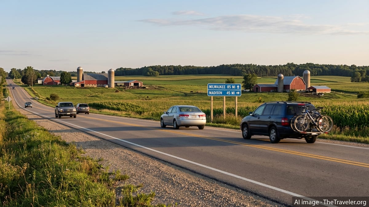
Driving is the most flexible way to get around Wisconsin, particularly if you want to explore small towns, state parks, and lake country beyond the main urban corridors. The state’s backbone is Interstate 94, which crosses southeastern Wisconsin between Illinois and Minnesota, passing through or near Kenosha, Milwaukee, and Eau Claire. For many visitors arriving from Chicago, this is the primary route into the state. Expect heavier traffic on I‑94 near Milwaukee and along the Illinois border, particularly during rush hours or weekend getaways.
Interstate 90 joins I‑94 near the Wisconsin Dells area and continues northwest through La Crosse toward the Mississippi River and on to Minnesota. Interstate 39 runs north–south through central Wisconsin, linking Rockford, Illinois to cities such as Stevens Point, Wausau, and Merrill. These three interstates form the spine of many longer drives, enabling efficient movement between regions even in winter, when they are typically among the first roads to be plowed after snow.
In addition to the interstates, several U.S. and state highways are key for regional travel. U.S. 41 and U.S. 45 carry travelers up the Lake Michigan side of the state from Milwaukee through the Fox Cities toward Green Bay and onward into the Upper Peninsula of Michigan. For trips to Door County, many drivers follow I‑43 from Milwaukee to Green Bay, then continue north on state highways through the waterfront towns of Sturgeon Bay, Fish Creek, and Sister Bay. Farther west, U.S. 61 and U.S. 35 trace scenic segments of the Mississippi River, connecting historic river towns with sweeping bluff views.
Road trippers seeking scenery often choose slower but more picturesque byways. The Driftless Area in southwestern Wisconsin, which escaped the flattening of glaciers, offers curvy state roads dipping in and out of valleys and winding past farms and trout streams. Northern Wisconsin features forest-lined highways leading to lakeside communities such as Minocqua, Eagle River, and Hayward. These routes reward patience and daylight driving; wildlife crossings, occasional fog, and limited lighting can make night driving more challenging in rural areas.
Seasonal Driving, Weather, and Safety Considerations
Weather is the single biggest variable affecting road travel in Wisconsin. Winters, typically from November through March, can bring snow, ice, and freezing rain. Plow crews prioritize interstates and major highways, but rural roads may take longer to clear and can remain slippery. Forecasts often warn of lake-effect snow along Lake Superior and localized heavy snow bands near Lake Michigan. Drivers should expect to reduce speed, increase following distance, and carry extra warm clothing and emergency supplies if traveling in colder months.
Spring and fall can bring rain, fog, and rapidly changing temperatures. In rural areas, you may encounter farm equipment on roads during planting and harvest seasons, especially on two-lane state or county highways. Summer is generally the easiest driving season, but it is also peak road construction time. Construction zones can mean reduced lanes and lower speed limits on interstates and key connectors, particularly around Milwaukee, Madison, Green Bay, and Wisconsin Dells, where traffic volumes are highest.
Wildlife is another consideration. Deer are common across the state and are especially active at dawn and dusk in spring and autumn. Slowing down in wooded stretches and watching the road edges is important, particularly on secondary highways in northern and western Wisconsin. In winter, darker mornings and evenings can further reduce visibility, so planning drives during daylight hours when possible is wise.
Basic preparation goes a long way. Renting a vehicle with good all-season or winter tires, maintaining at least half a tank of fuel on longer rural stretches, and saving offline maps for areas with limited mobile coverage can reduce stress. Many visitors choose larger towns such as Madison, Eau Claire, or Wausau as overnight bases, using them as hubs for day trips to more remote parks and lakes, which helps limit night driving on rural roads.
Airports and Flying Into Wisconsin
Most visitors who fly into Wisconsin land at Milwaukee Mitchell International Airport, the state’s largest commercial airport. Located south of downtown Milwaukee, it offers a wide range of domestic routes and some seasonal international service, with regular connections from major hubs. The airport sits near Interstate 94, making it relatively straightforward to drive toward Chicago, Madison, or north along Lake Michigan. A dedicated rail station on the Hiawatha and Borealis routes allows some travelers to step directly from plane to train for trips toward downtown Milwaukee or Chicago.
Dane County Regional Airport in Madison is the second major gateway. It primarily serves domestic routes, with frequent flights to Midwest hubs and select coastal cities. For travelers whose itineraries focus on Madison, Wisconsin Dells, or the Driftless Area, flying into Madison can reduce drive times compared with landing in Chicago or Milwaukee. The airport connects easily to Madison’s beltline highways and is close enough to downtown that taxis, rideshares, and local buses are feasible for car-free visits.
Several regional airports extend commercial air service to other parts of the state. Green Bay–Austin Straubel International Airport serves the Green Bay and Door County region, while Appleton International Airport is a common choice for those visiting the Fox Cities, Oshkosh, and central eastern Wisconsin. La Crosse Regional Airport connects the Mississippi River region, and Central Wisconsin Airport near Mosinee serves Wausau and Stevens Point. Smaller facilities such as Chippewa Valley Regional Airport at Eau Claire and Rhinelander–Oneida County Airport provide limited commercial flights, often to major hubs, along with extensive general aviation activity.
When choosing an airport, compare not only airfare but also ground transport time and rental car availability. For example, flying into Appleton or Green Bay can significantly shorten the drive to Door County, while using La Crosse or Central Wisconsin Airport can save hours for trips into western or northern regions. In winter, reducing highway miles after dark can be worth slightly higher fares into a regional airport closer to your final destination.
Rail and Intercity Bus: Getting Around Without a Car
While Wisconsin is most easily explored by car, rail and intercity buses provide solid options along key corridors, allowing some travelers to avoid driving altogether. Amtrak’s Hiawatha Service operates multiple daily round-trips between Chicago and downtown Milwaukee, with stops at Milwaukee’s main intermodal station and intermediate stations such as Sturtevant. The trains are heavily used by both commuters and visitors and connect directly to local buses and The Hop streetcar in Milwaukee.
For longer distances across the state, Amtrak’s Empire Builder and the newer Borealis service link Chicago with the Twin Cities through southern Wisconsin. These routes stop at several communities including Milwaukee, Columbus, Portage, Wisconsin Dells, Tomah, and La Crosse. Borealis added a second daily frequency on this corridor, improving flexibility for travelers moving between Wisconsin’s southern cities and neighboring states. From many of these stations, local transit or shuttle services provide onward connections to nearby attractions, although options are generally more limited in smaller towns.
Intercity buses fill in many gaps that trains do not cover. Milwaukee Intermodal Station serves as a major bus hub, with companies such as Greyhound, Jefferson Lines, Badger Bus, Indian Trails, Lamers, and others operating routes around the state and to neighboring states. Common corridors include Milwaukee–Madison, Madison–Wisconsin Dells, Milwaukee–Green Bay, and routes linking college towns and regional centers. In Madison, intercity bus stops are located near the downtown campus area, providing walkable access to the university district and central city hotels.
For a car-free itinerary, it often works best to string together rail for long distances and buses or local transit for the final leg. For example, a traveler might take the Hiawatha from Chicago to Milwaukee, change to a bus toward Green Bay, or ride an Amtrak train to Wisconsin Dells and use a local shuttle to reach water parks and resorts. Schedules can change seasonally, and some services run only once or twice a day, so careful advance planning and flexible timing are important when relying solely on public transport.
Regional Transit, Ferries, and Local Mobility
Within Wisconsin’s cities, local transit systems help with short-distance travel. Milwaukee offers a bus network and The Hop streetcar in and around downtown, which can be handy for visitors staying near the city center. Madison’s buses connect downtown to the university, medical centers, and residential areas and provide frequent service along key corridors during the academic year. Green Bay, Eau Claire, La Crosse, and several other cities operate local bus systems, typically focused on daytime and early evening service.
Outside of cities, transit thins out but does not disappear entirely. Regional services, often funded in part by counties or state grants, connect smaller communities to larger hubs for work, medical appointments, and shopping. In western Wisconsin along the Mississippi, for instance, regional buses link river towns to La Crosse, while in central and northern Wisconsin, shared-ride taxis and demand-response shuttles operate in some counties. These services usually require pre-booking and are designed with resident needs in mind, but patient travelers can sometimes use them to reach trailheads, parks, or small towns.
Ferry routes provide unique seasonal connections. On Lake Michigan, the car ferry linking Manitowoc, Wisconsin with Ludington, Michigan operates seasonally, offering an alternative to driving south through Chicago when moving between Wisconsin and Michigan’s Lower Peninsula. While not a day-to-day transport tool within the state, this ferry can be an appealing component of a longer road trip loop around the Great Lakes. Elsewhere, small river ferries operate in limited locations, mainly as local curiosities rather than primary travel links.
For most visitors, local mobility still relies on walking, rideshares, and bicycles once they arrive in a neighborhood. Many Wisconsin downtowns are compact and pedestrian-friendly, especially in older river or lakefront towns. Bike rentals or bike-share programs exist in a few cities and resort communities, though availability can be seasonal. Combining a rental car for intercity travel with walking and local transit in the core of Milwaukee or Madison often strikes an effective balance between flexibility and ease of parking.
Planning Efficient Routes for Popular Wisconsin Trips
Many itineraries in Wisconsin fall into a few broad patterns, and understanding their typical routes can simplify planning. For city-focused trips, travelers often fly into Milwaukee or Madison, spend several days exploring museums, restaurants, and lakefronts, then add a short side trip by car or bus. From Milwaukee, a common extension is to drive north along Lake Michigan to the harbor towns of Port Washington and Sheboygan, perhaps continuing to Kohler for golf or spa visits before circling back.
For those aiming at Door County, a classic route starts in Milwaukee or Green Bay and follows the Lake Michigan shoreline north. This allows for stops at lighthouses, orchards, and small harbors en route to the peninsula’s tip. In high season, traffic can slow on the final stretches, and lodging in small communities fills quickly, so planning departures earlier in the day is helpful. Some travelers shorten the drive by flying into Green Bay or Appleton and renting a car there instead of driving up from Milwaukee or Chicago.
Families and outdoor enthusiasts often target Wisconsin Dells and the Driftless Area. From Chicago or Milwaukee, I‑90 and I‑94 offer direct highway access to Wisconsin Dells, while U.S. and state highways branch off into the rolling terrain of the southwest, passing through towns such as Spring Green, Viroqua, and Prairie du Chien. Time-conscious travelers might ride Amtrak to Wisconsin Dells and rely on resort shuttles, while others prefer to have a rental car for flexibility in reaching hiking areas, Frank Lloyd Wright sites, and river overlooks.
Northern and western Wisconsin require more deliberate planning because distances between towns are greater and transit options fewer. A route from Madison or Milwaukee to the Northwoods might follow I‑39 toward Wausau and then continue on state highways to Minocqua, Rhinelander, or Eagle River. For Lake Superior destinations such as Bayfield or the Apostle Islands area, many drivers follow I‑94 toward Eau Claire and then curve north and east on two-lane highways. On these longer legs, gas, food, and rest stops can be spaced farther apart, so checking services ahead of time is wise, especially outside peak summer.
The Takeaway
Moving around Wisconsin is less about mastering a single mode of transport and more about combining options that match your route, season, and tolerance for driving. The state’s central highways and interstates connect cities efficiently, while regional airports position you closer to Door County, the Mississippi River, or Northwoods lakes. Rail and bus corridors add car-free alternatives between major hubs, especially in the southern part of the state, though they generally require more schedule planning than driving.
For most visitors, a rental car remains the most practical way to reach state parks, small towns, and rural accommodations. Yet even drivers can take advantage of trains and buses to avoid congestion on certain stretches or to make a one-way journey more convenient. Being realistic about distances, allowing for weather and construction delays, and choosing two or three focus regions instead of attempting to cover the entire state in a single trip will lead to a more relaxed experience.
Ultimately, Wisconsin rewards those who embrace its varied landscapes rather than rush past them. Whether you are cruising along the Lake Michigan shore, ambling through hill country in the southwest, or threading between pine forests in the north, thoughtful transportation planning turns the journey itself into part of the adventure. With a clear sense of the state’s routes, airports, and regional options, you can tailor your travels to match both your schedule and your style of exploration.
FAQ
Q1. Do I need a car to travel around Wisconsin?
In most cases a car is the most practical way to explore Wisconsin, especially for reaching small towns, parks, and lake areas beyond the main rail and bus corridors.
Q2. Which airport is best for visiting Milwaukee and nearby towns?
Milwaukee Mitchell International Airport is the main gateway for the city and nearby Lake Michigan communities, with direct highway and rail links to downtown and Chicago.
Q3. What is the easiest way to get from Chicago to Milwaukee without driving?
Amtrak’s frequent corridor trains and several intercity bus services provide direct connections between Chicago and downtown Milwaukee, making car-free travel straightforward.
Q4. How can I reach Door County efficiently?
Many travelers fly into Green Bay or Appleton and rent a car, then drive north along the Lake Michigan shore; others drive the full route from Milwaukee or Chicago.
Q5. Is winter driving in Wisconsin safe for visitors?
Winter driving can be safe with preparation, slower speeds, and attention to forecasts, but snow and ice are common and may warrant extra time or flexible plans.
Q6. Are there train options across southern Wisconsin?
Yes, Amtrak services connect Chicago to Milwaukee and continue across southern Wisconsin with stops in communities such as Columbus, Wisconsin Dells, Tomah, and La Crosse.
Q7. Can I visit Wisconsin Dells without renting a car?
It is possible to reach Wisconsin Dells by train or bus and then use resort shuttles and local services, though having a car offers more flexibility for exploring nearby areas.
Q8. How far apart are major Wisconsin cities?
As a general guide, Milwaukee to Madison is about 80 miles, Milwaukee to Green Bay roughly 115 miles, and Milwaukee to the Lake Superior region can exceed 300 miles.
Q9. What are good base cities for exploring different regions?
Milwaukee and Madison work well for southern and central areas, Green Bay or Appleton for Door County and the Fox Cities, and Eau Claire or Wausau for western and northern trips.
Q10. Are ferries useful for getting around inside Wisconsin?
Ferries are limited and mostly seasonal; they are more helpful for connecting Wisconsin with neighboring states or providing scenic experiences than for everyday in-state transport.