
Crossing Alabama efficiently is about more than simply getting from Mobile to Huntsville or skimming along Interstate 65. The state’s mix of interstates, scenic byways, regional airports and modest but useful bus and rail links gives travelers several options, each with its own quirks. Whether you are planning a business trip between major cities, a civil rights history itinerary or a weeklong road journey to the Gulf Coast, understanding how transportation in Alabama really works will save you time and stress.
Understanding Alabama’s Geography and Main Travel Corridors
Efficient travel in Alabama starts with a mental map of the state. Alabama stretches from the Tennessee border in the north to the Gulf of Mexico in the south, with the Appalachian foothills giving way to Black Belt plains and coastal lowlands. The main population centers form a rough triangle: Huntsville in the north, Birmingham slightly south and central, and Mobile in the southwest on the coast, with the capital Montgomery sitting near the center of that triangle. Most long journeys you will make in Alabama connect some combination of these four cities.
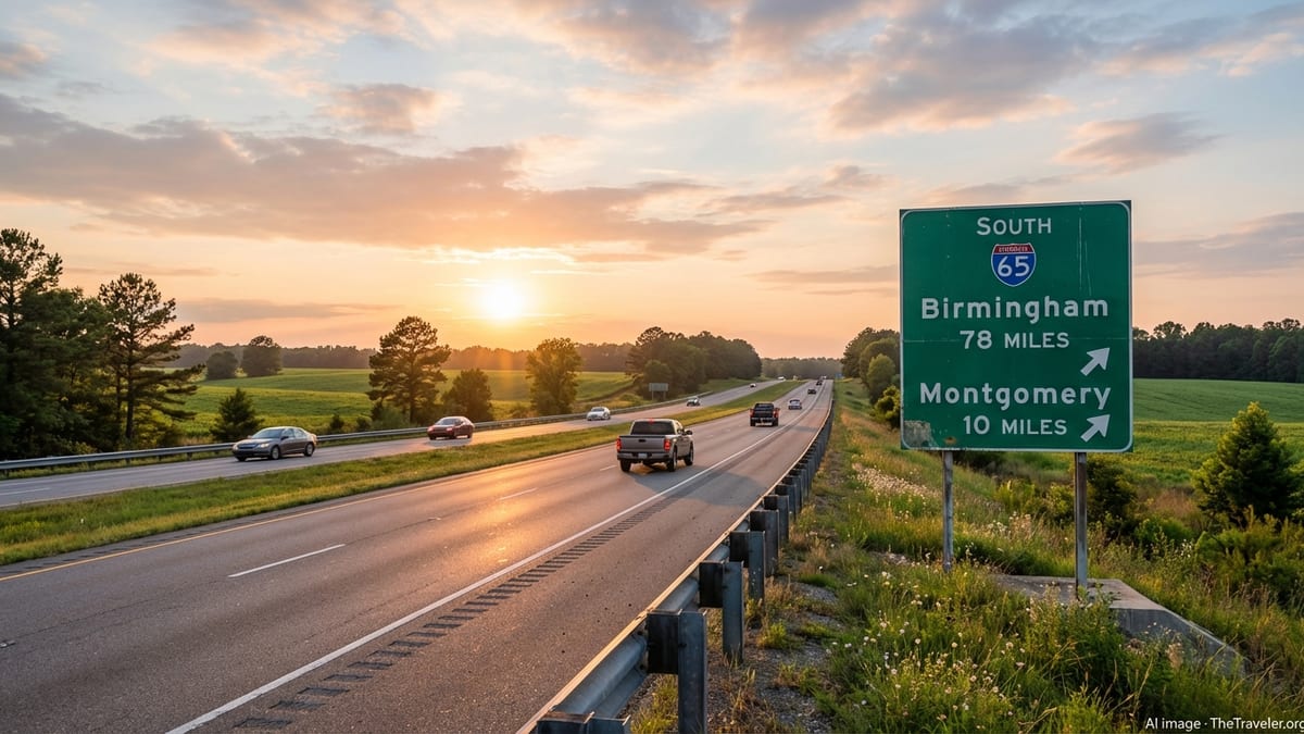
The backbone for crossing the state by road is Interstate 65, which runs north to south from the Tennessee line through Decatur, Birmingham and Montgomery before ending in Mobile. For east–west movement across the central part of the state, Interstate 20 / 59 links Birmingham with Tuscaloosa and continues west to Mississippi, while Interstate 20 also branches east toward Atlanta. In the south, Interstate 10 runs along the Gulf Coast through Mobile and provides quick connections to Mississippi and Florida. Understanding these three interstates, plus secondary routes like U.S. 280 between Birmingham and Auburn–Opelika, makes planning point to point trips far easier.
Driving times between major cities are manageable if you plan around peak periods. The run from Birmingham to Montgomery typically takes around 90 minutes in light traffic, Birmingham to Huntsville about 1.5 hours, and Montgomery to Mobile roughly 2 hours, give or take conditions and work zones. North–south trips that cross both Birmingham and Montgomery, such as Huntsville to Mobile, are generally feasible in a single day but can be more comfortable if you schedule a break in Birmingham or Clanton. Interpreting distance in terms of time rather than miles will help you cluster stops efficiently and avoid trying to cover too much ground in one stretch.
While interstates are the fastest option for covering distance, Alabama’s network of U.S. and state highways can be surprisingly efficient for shorter hops between regional centers. Routes such as U.S. 231 from Huntsville to Montgomery or U.S. 98 and U.S. 43 around Mobile can provide alternatives when major corridors are congested or under construction. When speed is your priority, plot primary interstate routes first, then use these secondary roads to create sensible loops for sightseeing or to bypass local congestion.
Driving Across Alabama: Licenses, Laws and Timing
For most visitors, driving is the most efficient way to cross Alabama, particularly outside the biggest cities. You will need a valid driver’s license from your home state or country, and renting a car is straightforward in major cities and at principal airports such as Birmingham–Shuttlesworth, Huntsville, Montgomery Regional and Mobile. International visitors should check well in advance whether their license is recognized and whether an International Driving Permit is recommended for their rental company.
Alabama’s traffic regulations are broadly similar to those in neighboring states, but a few rules are especially important for efficient, low stress travel. The maximum speed limit on interstate highways in Alabama is typically 70 miles per hour, with lower posted limits in urban stretches, work zones and areas with heavy merging traffic. You are required to use headlights when it is raining, which is as much a safety measure as a legal one, and seat belts are compulsory for front seat passengers. Rural interstates can encourage drivers to drift above the limit, but enforcement can be strict, so keeping to reasonable speeds will reduce the risk of delays and fines.
Timing matters as much as route choice. Rush hours are most pronounced in and around Birmingham, Huntsville, Montgomery and Mobile on weekday mornings and late afternoons. If you are planning to cross Birmingham on I‑65 or I‑20 / 59, build extra time into your schedule or plan those legs for midmorning, midday or evening. Summer weekend traffic toward Gulf Shores and Orange Beach via I‑10 and Alabama 59 can be extremely heavy, especially on Saturdays, so consider arriving on a weekday or early in the morning to avoid long backups near the coast.
Weather is another factor for efficient driving plans. Alabama summers are hot and humid, with frequent thunderstorms that can quickly reduce visibility on open interstates. Winters are usually mild, but occasional ice or snow events in the northern part of the state can disrupt travel, particularly on elevated bridges and mountain passes. Checking forecasts before long drives and allowing flexibility in your itinerary will help you avoid unpleasant surprises. Keeping your fuel tank at least half full is wise in rural stretches, where exits with services may be spaced further apart.
Using Intercity Buses and Local Transit Systems
Although Alabama is still strongly car oriented, travelers without access to a vehicle can cross much of the state using a combination of intercity buses and local transit networks. Companies such as Greyhound and other regional carriers serve key hubs including Birmingham, Montgomery, Mobile and Huntsville, often stopping at intermodal facilities shared with local buses. Services can be less frequent than in larger states, so planning ahead is essential for efficient connections.
Birmingham functions as the main node for bus and rail integration. The Birmingham Intermodal Terminal in the city center houses the Birmingham–Jefferson County Transit Authority bus platforms along with Greyhound, Megabus style services and Amtrak’s Crescent line, allowing you to step off a long distance bus or train and connect directly to local routes. This setup is especially useful if you want to break a long north–south journey with a day in Birmingham and use public transport to explore downtown and nearby neighborhoods.
Local transit options in other cities are more modest but still helpful for travelers staying near their cores. Montgomery’s bus system, branded as The M, provides fixed route coverage within the city, while Tuscaloosa Transit Authority runs trolleys and buses that connect key districts and the University of Alabama. In Auburn and Opelika, Tiger Transit primarily serves Auburn University but can be valuable if you are staying near campus during the academic year. Schedules, routes and operating hours vary significantly, and weekend service can be limited, so verify times before relying on buses for early flights or evening events.
Because state support for public transit is relatively limited, it is wise to treat buses as one component of a broader toolkit rather than your sole means of mobility. For example, if you are visiting multiple cities, you might use an intercity bus to reach Birmingham or Montgomery, then rely on rideshare services, taxis, or short term car rentals for local excursions. In college towns such as Tuscaloosa and Auburn, rideshare coverage is generally strong, particularly during the academic year and around major sporting events.
Rail and Air Options for Crossing the State Quickly
Rail choices within Alabama are not as extensive as in some regions, but they can play a valuable role in efficient long distance travel when paired with other modes. Amtrak’s Crescent service connects Birmingham and Tuscaloosa with major out of state cities like New Orleans, Atlanta, Charlotte and New York. For travelers combining Alabama with a broader regional itinerary, it can be efficient to enter the state by rail, disembark in Birmingham, and then continue by car or bus to other destinations such as Montgomery, Huntsville or the Gulf Coast.
On the Gulf Coast, Amtrak’s Mardi Gras Service provides passenger rail between New Orleans and Mobile, resuming a long awaited link along the coast. While this route does not yet continue deep into the interior of Alabama, it offers an efficient and scenic way to reach Mobile without driving, particularly for travelers flying into New Orleans and then continuing east. From Mobile, you can connect to local buses, rideshare services, rental cars or regional shuttles to reach beach communities and inland cities.
For travelers prioritizing speed over scenery, Alabama’s regional airports are often the most efficient option. Birmingham–Shuttlesworth International Airport is the state’s busiest commercial facility and functions as a central gateway to northern and central Alabama. Huntsville International serves the Tennessee Valley and is well placed for trips that include research centers and aerospace facilities. Montgomery Regional Airport provides commercial connections to hubs such as Atlanta, Dallas–Fort Worth and Charlotte, and Mobile International serves the coastal region with growing service options.
If you are visiting multiple regions of Alabama in a short window, combining flights with a one way rental car can be time efficient. For example, you might fly into Huntsville, spend several days in the north, then drive south on I‑65 through Birmingham and Montgomery before flying home from Mobile. When planning such one way itineraries, compare drop off fees and check whether smaller airports have limited rental car office hours, especially on weekends and late evenings.
Planning Efficient Road Trips and Themed Routes
Alabama lends itself naturally to road trips, and thoughtful route planning will help you cover more ground without feeling rushed. The state’s official scenic byways, including stretches through the Appalachian foothills and along the Gulf Coast, can be woven into itineraries that still rely on interstates for the long hauls. For instance, you might use I‑65 to move quickly between Huntsville and Birmingham, then branch onto smaller roads to explore state parks, historic towns and river valleys before rejoining the interstate further south.
Many visitors organize their travel around themes, which can help structure efficient routes. A civil rights history itinerary, for example, might follow a roughly central corridor: beginning in Birmingham with its civil rights district, traveling along I‑20 and U.S. routes to Anniston and then south to Montgomery, home to sites such as the Freedom Rides Museum, and finally continuing to Selma and the Edmund Pettus Bridge before looping back toward your starting point. By focusing on a specific topic, you can cluster stops in the same region and reduce unnecessary backtracking.
Coastal trips often combine Mobile, Dauphin Island, and the beach communities near Gulf Shores and Orange Beach. The most efficient way to link these is often to treat Mobile as a base, using I‑10 and Alabama 59 or the Baldwin Beach Express to reach the shoreline. In peak summer, building in extra time for congestion near beach exits is essential. If you are driving from the north, consider scheduling your arrival at the coast for a weekday or early morning to avoid the heaviest flows, then traveling inland again on a different route to experience small towns and nature preserves.
Whatever theme you choose, pacing is critical. Distances that look short on a map can stretch into long days when you factor in scenic detours, museum visits and meal stops. Aim to combine one major drive with one or two substantive activities each day instead of trying to fit in every landmark. When possible, book accommodations close to walkable downtowns, such as in Birmingham, Montgomery or Mobile, so you can park the car in the evening and explore on foot, saving both time and energy.
Budgeting, Safety and Practical Logistics
Efficient travel across Alabama hinges on practical details as much as on routing. Fuel prices in the state are often competitive compared with national averages, but they fluctuate. Planning fuel stops around major junctions such as Birmingham, Montgomery or the intersections of key U.S. highways typically yields better prices and more choice of services. In rural stretches, top off your tank when you have the chance, especially at night, since some smaller stations close early.
Lodging costs vary widely between large cities, college towns and smaller communities. During major events such as university football games in Tuscaloosa or Auburn, or large festivals in Mobile and Birmingham, hotel prices can rise sharply and sell out far in advance. If your priority is efficient movement rather than being in the middle of the action, consider staying slightly outside event zones, near interstate exits where accommodation turnover is high and access to the highway is fast. This strategy can reduce both cost and time spent navigating congested downtown streets after long drives.
Safety considerations are largely common sense. Interstate travel is generally straightforward, but long, flat sections can encourage fatigue. Rotate drivers when possible, build in short rest stops at highway plazas, and avoid driving late at night after a full sightseeing day. In cities, secure your belongings, park in well lit areas and avoid leaving luggage visible in vehicles, particularly in tourist districts or at trailheads. Weather related alerts, especially in spring and late fall when severe storms can occur, deserve close attention; local radio, smartphone apps and statewide alert systems can all help you adjust plans quickly if necessary.
Finally, prepare for limited connectivity in some rural areas. While mobile coverage is reasonably broad along interstates and around cities, pockets of weaker service still exist in remote or heavily wooded regions. Download offline maps for your routes in advance, keep printed confirmations of key bookings, and store important numbers such as roadside assistance and accommodation contacts locally on your device. These small steps can turn potential delays into minor inconveniences instead of major disruptions.
The Takeaway
Traveling efficiently across Alabama means understanding the state’s geography, choosing the right combination of road, rail, air and bus travel, and planning around local realities such as weather, traffic patterns and event calendars. Interstates connect the major hubs of Huntsville, Birmingham, Montgomery and Mobile, while secondary highways and scenic byways allow you to add character and variety to your itinerary without sacrificing too much time.
Public transit, intercity buses and limited rail services can complement driving, particularly in and around Birmingham and the Gulf Coast, but a car remains the most flexible and time efficient way to explore. By pacing your journey sensibly, budgeting for fuel and lodging with peak events in mind, and keeping an eye on safety and weather, you can cross the state confidently and still have room in your schedule for detours to beaches, historic sites and mountain overlooks.
Ultimately, the most successful Alabama itineraries are those that balance efficiency with a willingness to pause. Leaving time for an unscheduled barbecue stop on a county road, a walk through a small town square or a sunset over Mobile Bay will enrich your experience without undermining your broader travel goals. With thoughtful planning, Alabama’s diverse regions link together into a journey that is both streamlined and memorable.
FAQ
Q1. Do I need a car to travel efficiently across Alabama?
While it is possible to move between major cities using buses, trains and flights, a car is by far the most efficient and flexible way to travel across Alabama, especially if you plan to visit smaller towns or natural areas.
Q2. How long does it take to drive from Huntsville to Mobile?
The drive from Huntsville to Mobile typically takes between five and six hours, depending on traffic and stops, following Interstate 65 through Birmingham and Montgomery.
Q3. Is public transportation reliable in Alabama’s major cities?
Public transportation in cities such as Birmingham, Montgomery and Tuscaloosa can be useful within city limits, but routes and hours are limited compared with larger metropolitan areas, so schedules should be checked carefully.
Q4. Are there passenger trains that run within Alabama?
Amtrak’s Crescent line serves Birmingham and Tuscaloosa on a route that connects to other states, and a separate coastal service connects New Orleans and Mobile, but there is no dense in state rail network.
Q5. When is traffic heaviest on Alabama’s highways?
Traffic is heaviest on weekday rush hours around major cities and on summer weekends toward the Gulf Coast, particularly near popular beach exits and bridge crossings.
Q6. Are Alabama’s roads safe for night driving?
Alabama’s interstates are generally well maintained and safe at night, but drivers should watch for fatigue, reduced visibility in rural areas and changing weather, especially during storm seasons.
Q7. How should I budget for fuel when driving across the state?
Fuel prices are often competitive, but they vary by region; planning stops near major junctions and keeping the tank at least half full in rural areas is a practical approach.
Q8. Can I rely on mobile navigation in rural Alabama?
Mobile coverage along interstates and near cities is usually strong, but remote areas may have weak signals, so downloading offline maps and saving key directions in advance is wise.
Q9. What is the best time of year to drive across Alabama?
Spring and fall generally offer the most comfortable driving conditions, with milder temperatures and fewer severe storms than peak summer, though weather can vary by region.
Q10. Are one way rental car trips practical across Alabama?
One way rentals between major cities and airports are common and can be efficient for north to south or coastal itineraries, but you should check potential drop off fees and operating hours when planning.