
More news on this day
Fresh rounds of snow, freezing rain and bitter cold are converging on New York, Maine and Alaska, as forecasts point to another stretch of dangerous winter weather that is expected to snarl travel and complicate late-season trips across large areas of the United States.
Get the latest news straight to your inbox!
Wintry Pattern Reasserts Itself Across the Northeast
Publicly available outlooks from the National Weather Service indicate that Arctic air lingering over the northeastern United States is combining with a series of passing disturbances to produce fresh snow and pockets of ice from upstate New York into northern New England. Recent regional briefings highlight freezing rain and sleet potential in interior sections, with heavier snow favored in higher elevations of Vermont, New Hampshire and Maine.
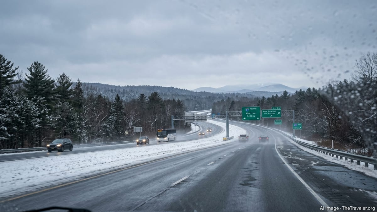
In New York, forecasters describe a setup favoring a glaze of ice on untreated roads and sidewalks, especially away from the immediate coast where temperatures are expected to hover near or just below freezing at key commuting hours. Light accumulations of additional snow on top of compacted, older snowpack could quickly turn secondary roads and rural highways slick, particularly overnight and during the early morning period.
Across Maine, discussions from weather offices and regional forecast products point to a renewed risk of icy travel, even in areas that have already endured repeated snow events this winter. In valleys and along interior corridors, a thin coating of freezing rain is expected to bond with existing snow and slush, making black ice difficult to spot. Drivers on smaller state routes and less-traveled county roads are likely to face the most treacherous conditions.
The latest regional weather summaries circulated by meteorology enthusiasts, who compile information from federal forecast centers, emphasize that the combination of subfreezing ground temperatures and intermittent wintry precipitation can create hazardous conditions even when accumulations are relatively light. Brief bursts of heavier snow, particularly in the higher terrain of northern New York and western Maine, may also reduce visibility and create rapidly changing conditions for travelers.
New York Travelers Face Disruptions on Roads and in the Air
For New York State, the shift back to snow and ice comes only weeks after a historic February blizzard buried New York City and much of the Interstate 95 corridor under more than a foot of snow and triggered widespread transportation delays. According to published coverage of that event, blizzard warnings extended across downstate New York for the first time in years, with strong winds and heavy snowfall creating whiteout conditions and leaving behind a deep, uneven snowpack.
While the current system is not expected to rival that February blizzard in intensity, its timing and temperature profile raise concerns for those on the move. Public forecast discussions indicate that mixed precipitation during morning and evening peaks could lead to spinouts and minor collisions on major commuter arteries such as the New York Thruway and feeder highways into the New York City metropolitan area. Even a light coating of ice can significantly increase stopping distances and reduce traction on bridges, ramps and overpasses.
Air travel into and out of New York area airports remains sensitive to bursts of snow and low clouds. In recent weeks, multiple airlines have issued winter weather travel waivers for the Northeast when similar setups have appeared in the forecast, allowing passengers to rebook trips without change fees. A comparable pattern of preemptive schedule adjustments and delays is possible if snowfall intensities or icing risks increase near key hubs.
Rail and bus operators are also monitoring the evolving pattern. Past winter storms this season have shown that even modest snowfall can lead to slower train speeds, temporary service curtailments and bus reroutes, especially when combined with lingering icy patches at stations and on access roads. Travelers are being urged, through public advisories and service updates, to build extra time into their itineraries and to check operating status before departing.
Maine and Northern New England Confront Repeated Icing Threats
Farther north, Maine is once again in the path of wintry hazards following a series of potent storms earlier this winter that brought heavy snow, high winds and coastal flooding to the state. State-level winter weather preparedness bulletins and emergency planning documents, updated in recent months, stress that a combination of deep cold and wet snow has already tested infrastructure and emergency response resources across the region.
Recent community reports and regional forecast roundups point to freezing rain spreading across large portions of Maine, New Hampshire and Vermont, with particularly dangerous conditions possible where cold air becomes trapped in sheltered valleys. In these locations, rain falling through a slightly warmer layer aloft can freeze on contact with roads, sidewalks and power lines, producing a nearly invisible but extremely slick surface.
Road safety guidance from state and local agencies, as reflected in public advisories issued after previous winter events this season, urges residents and visitors to avoid nonessential travel when ice is expected and to be prepared for sudden changes along longer routes. Rural stretches of highway, including sections of interstate and key north-south corridors, can transition quickly from wet to icy, catching unfamiliar drivers off guard.
In addition to travel challenges, the cumulative weight of snow and ice on trees and utility lines remains a concern across the region. Earlier winter storms in 2026 led to scattered power outages and downed branches, particularly in wooded and coastal areas. Even a modest new round of icing could bring renewed issues, especially where recent thaws have saturated the ground and weakened root systems.
Alaska Balances Fresh Snow With Travel and Event Impacts
On the opposite side of the continent, Alaska is experiencing its own stretch of impactful winter conditions as new snowfalls interact with ongoing cold. Coverage of this year’s Iditarod Trail Sled Dog Race, which wrapped up in mid-March, described slightly warmer-than-average temperatures accompanied by fresh snow along portions of the route. That pattern, while favorable for sled travel in some sections, also highlighted the variability that winter sports and tourism operators must navigate.
In the days since the race concluded, broader forecast products for Alaska continue to flag waves of snow, gusty winds and shifting temperatures across both coastal and interior regions. For travelers, this means that aviation-dependent routes, smaller regional airports and remote road links can be affected by low visibility, drifting snow and changing runway conditions with relatively little notice.
Publicly available information from state transportation resources notes that even in areas accustomed to heavy snow, rapid swings in temperature can create an icy sheen on highways and urban streets. When fresh powder falls on top of refrozen slush or compacted ice, traction can deteriorate quickly, especially for rental vehicles and out-of-state visitors unfamiliar with local driving practices.
Tour operators and lodging businesses that cater to winter tourism in Alaska have spent much of the season adapting to these shifts, balancing the appeal of fresh snow for northern lights excursions and backcountry trips with the reality of flight disruptions and road closures that can strand guests or force itinerary changes. Travelers are encouraged through public advisories and destination guides to maintain flexible plans and to carry extra cold-weather gear, even for short journeys.
National Travel Ripple Effects and Safety Considerations
The convergence of winter hazards from New York and Maine to Alaska is also producing ripple effects across the broader U.S. travel network. Major storms earlier in the season, such as the late January winter system that spread snow and ice from the Southwest to New England, demonstrated how quickly a single multi-day event can cascade into cancellations and delays across dozens of airports and long-distance corridors.
As the current pattern evolves, national forecast centers and private weather services are emphasizing the importance of watching not only local conditions but also upstream weather systems that may affect connecting flights and transcontinental routes. A snow and ice event in the Northeast, for example, can have knock-on impacts for travelers in the Midwest and South as aircraft and crews are repositioned and schedules are rebuilt.
Road travelers crossing multiple states are being reminded through widely shared safety guidance to check forecast details at various points along their route, rather than relying on a single point forecast. This is particularly important for those driving from milder regions into colder zones, where pavement that begins wet can transition to snow-covered or icy with rising elevation or overnight temperature drops.
Late-season storms can also catch travelers off guard psychologically, as many begin to focus on spring plans. Emergency managers and transportation agencies, through publicly released seasonal outlooks and preparedness campaigns, continue to stress that serious winter hazards can persist well into March and even April in northern states. With New York now joining Maine and Alaska under the threat of renewed snow and ice, the message for travelers remains consistent: stay informed, remain flexible and treat any forecast mention of freezing rain or mixed precipitation as a signal to plan ahead.