
More news on this day
A sprawling late-winter storm system sweeping from the Midwest to the East Coast has upended air travel across the United States, triggering widespread delays and cancellations at some of the nation’s busiest transportation hubs just as spring break and major sporting events drive passenger volumes higher.
Get the latest news straight to your inbox!
Storm Complex Hits Key Aviation Corridors
Publicly available meteorological analyses describe a large storm complex affecting much of the central and eastern United States between March 13 and March 17, 2026, combining heavy snow, high winds and severe thunderstorms into one broad system. The setup has produced blizzard conditions around the Upper Midwest and Great Lakes while simultaneously fueling bands of damaging winds and potential tornadoes farther south and east. This mix of winter and severe weather hazards intersects directly with several of the country’s most critical aviation corridors.
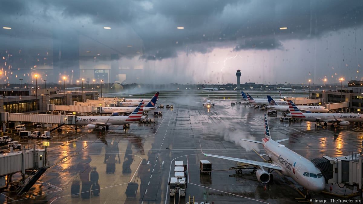
Reports indicate that snow and strong crosswinds have reduced visibility and complicated ground operations at airports in the Midwest, including Chicago’s O’Hare International Airport, a primary national and international hub. At the same time, fast-moving squall lines and embedded thunderstorms are sweeping across the Ohio Valley, the Southeast and into the Mid-Atlantic, where major hubs such as Atlanta, Charlotte, Washington and the New York City area are experiencing rapidly changing conditions. The combined effect is a patchwork of local weather impacts that translate into systemic stress for airline networks.
According to published coverage of the current weather pattern, the unsettled conditions are tied to a sharp contrast between lingering winter air over the northern states and much warmer, more humid air surging north from the Gulf of Mexico, with the jet stream acting as a conveyor belt for disturbances. The result is a highly dynamic environment in which conditions at a given airport can deteriorate quickly, forcing air traffic managers and carriers to adjust schedules and routings with little lead time.
Ground Stops, Cancellations and Rolling Delays
Data compiled by flight-tracking services on the morning of March 17 indicate that nearly 900 flights into, out of or within the United States were canceled, with close to 1,800 more delayed after the worst of the storms first struck on March 16. Additional cancellations and late-running flights continue to accumulate through the day as airlines work through aircraft and crew imbalances caused by the earlier disruptions. These figures come on top of thousands of flights affected on Monday, underscoring how quickly a single day of severe weather can cascade across the system.
Published aviation operations summaries show that major hubs have been among the hardest hit. New York’s LaGuardia and John F. Kennedy airports, along with Newark Liberty International Airport in New Jersey, have all experienced significant delays as low clouds, heavy rain and gusty winds reduce arrival and departure rates. In the Southeast, Atlanta and Charlotte have faced intermittent slowdowns and holding patterns as thunderstorms move through already congested airspace, while Houston’s primary international hub has also reported operational constraints in connection with recent rounds of storms.
Federal air traffic planning documents and industry tracking tools describe the use of ground delays and periodic ground stops at several of these airports, particularly during the most intense periods of wind and thunderstorm activity. These measures restrict the flow of inbound traffic to match what controllers and ground crews can safely handle, protecting runway operations but creating long departure queues and knock-on delays across airline networks. Even after local weather improves, it can take many hours for schedules to recover.
Travelers Confront Long Lines and Itinerary Changes
The storm has arrived at a difficult moment for travelers. According to published coverage from national outlets, the mid-March period is already placing heavy demand on airport infrastructure, with spring break vacations and travel to men’s and women’s college basketball tournament sites filling flights and terminals. At the same time, a partial federal government shutdown that began on February 14 has strained staffing at some security checkpoints, contributing to longer lines at busy airports.
Passengers transiting through affected hubs are encountering a combination of weather-driven delays and capacity constraints in terminal operations. Reports from major airports describe extended waits at security, rebooking counters and boarding gates as airlines consolidate flights, issue travel waivers and attempt to reassign aircraft and crews. With many flights already near capacity, same-day alternatives are limited in some markets, pushing some travelers to accept next-day departures or significant reroutings.
Publicly available airline advisory notices over recent days show a series of weather-related travel waivers covering regions from the Midwest to the East Coast, including Chicago, parts of Iowa and surrounding states, and now major East Coast and Southeast cities. These waivers generally allow customers booked on affected dates and routes to change flights without additional change fees, subject to fare and routing rules, helping some passengers adjust plans ahead of the worst conditions.
Hub-and-Spoke Networks Amplify Disruption
Academic research and industry analyses of U.S. air traffic patterns emphasize that the nation’s reliance on a hub-and-spoke system magnifies the impact of localized shocks such as severe weather. When a handful of high-volume connecting hubs experience operational constraints, aircraft and crews can quickly become out of position, and delays ripple outward to secondary airports that may be experiencing relatively benign weather. The current storm system, with its broad geographic footprint, is testing that structural vulnerability.
This week’s conditions have affected multiple tiers of the hub network simultaneously, from transcontinental gateways like New York and Chicago to regional connectors in the Midwest and interior South. As a result, even travelers whose journeys do not pass directly through the hardest-hit storm zones are encountering disruptions because their aircraft are arriving late or their crews have timed out under duty regulations. Industry data from similar past events suggest that such cascading effects can persist well after the last band of precipitation clears a given airport.
Public information from airlines and aviation analysts indicates that carriers are relying on a mix of tactical cancellations, schedule thinning and selective retiming of flights to contain the disruption. By canceling a portion of the schedule in advance, airlines can free up aircraft and crews to focus on routes where demand is highest or weather windows are most favorable, an approach that can shorten overall recovery time but still leaves many passengers facing interrupted plans.
Forecast: Ongoing Impacts as System Moves Offshore
Short-range forecasts from national meteorological centers suggest that the core of the storm system will continue to migrate northeastward and off the Atlantic coast late on March 17, with gradually improving conditions across parts of the Midwest and interior regions. However, lingering bands of rain, gusty winds and residual low clouds may continue to affect operations along the Northeast corridor and portions of the Mid-Atlantic for several additional hours, keeping arrival and departure rates below normal at some of the country’s most crowded airports.
Even once weather conditions improve, historical patterns from comparable mid-latitude storm events indicate that aviation disruptions often persist into at least the following day. Aircraft and crews must be returned to their scheduled positions, maintenance checks completed, and passenger backlogs cleared. For travelers with upcoming itineraries through major hubs such as New York, Chicago, Atlanta, Washington and Houston, publicly available guidance from airlines and travel advisors consistently recommends monitoring flight status frequently, allowing extra time at the airport and considering early rebooking when flexible fare rules or waivers apply.
Looking beyond the immediate event, climate and transportation analysts note that the current storm fits within a broader context of increasingly volatile weather intersecting with aging aviation infrastructure and high demand. While today’s focus is on restoring normal operations, the pattern of repeated weather-driven disruptions at key hubs is intensifying discussions about resilience investments, more flexible scheduling practices and improved communication tools for passengers when severe weather targets the nation’s busiest skies.