
More news on this day
Singapore’s next major rail upgrade, the Downtown Line 2 extension to Sungei Kadut, is emerging as a strategic catalyst for eco-tourism and slow, rail-based city exploration, promising smoother links between downtown hotels, heritage rail trails and new nature-focused districts in the north-west.
Get the latest news straight to your inbox!
A New Green Gateway from Downtown to the North-West
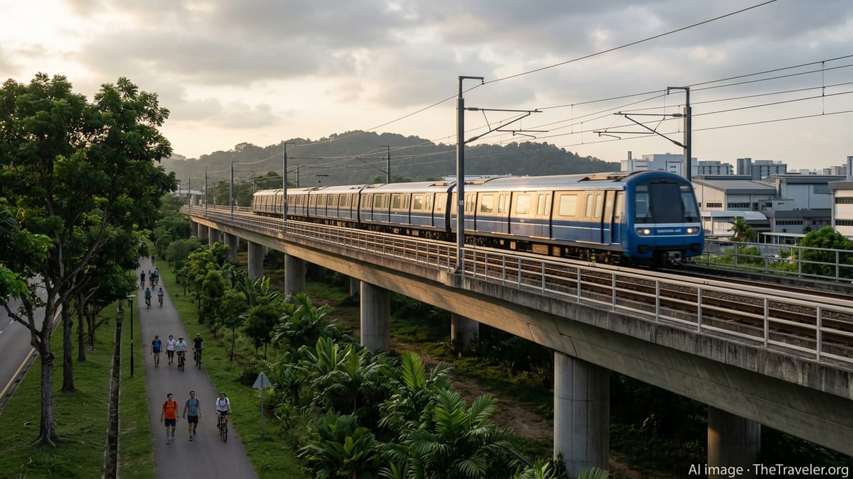
According to publicly available transport plans, the Downtown Line 2 extension, known as DTL2e, will push the blue line beyond its current western terminus at Bukit Panjang to a new interchange hub at Sungei Kadut by around 2035. When completed, the line is expected to span 39 stations, offering a one-seat ride from central districts such as Bugis, Chinatown and Bayfront to the industrial-turned-innovation belt of the north-west.
Land Transport Authority information indicates that three new stations will form the extension, connecting the existing Bukit Panjang station to the North-South Line at Sungei Kadut and opening up areas around Yew Tee Village and the future Sungei Kadut Eco-District. This transforms what has long been a largely utilitarian, logistics-focused zone into a more accessible destination for visitors interested in industrial heritage, creative production spaces and green urban design.
For travelers, the most immediate impact will be time savings and route simplicity. Instead of multiple interchanges across different MRT lines and buses, visitors will be able to ride directly from downtown hotels to the doorstep of new parks, eco-districts and trailheads, encouraging more spontaneous day trips beyond the traditional Marina Bay and Orchard Road circuits.
Travel analysts note that Singapore has progressively used rail infrastructure as a tool to diversify its tourism geography, from bringing visitors closer to food-centric neighbourhoods along the Thomson-East Coast Line to linking cultural districts on the Circle Line. DTL2e fits this pattern by wiring the north-western green belt directly into the city’s core.
Boost for the Rail Corridor and Nature-Based Itineraries
The 24 kilometre Rail Corridor, which traces the former Malaysia-Singapore railway line from Woodlands in the north to the fringes of Tanjong Pagar in the south, has steadily become one of Singapore’s most distinctive outdoor attractions. National development agencies describe it as a linear green spine combining heritage, biodiversity and recreation, threading past conserved truss bridges, the restored Bukit Timah Railway Station and pockets of secondary forest.
DTL2e is positioned to deepen access to the northern and central segments of this corridor. Planning documents and an environmental study for the extension highlight its proximity to biodiversity-sensitive areas near Sungei Pang Sua and the Rail Corridor, indicating that new stations and track alignments are being conceived with trail connectivity and ecological safeguards in mind.
For eco-conscious visitors, this means the future ability to step off an air-conditioned train and within minutes be walking or cycling along shaded paths where monitor lizards, kingfishers and jungle fowl are part of the urban backdrop. The prospect of seamless transitions from MRT platforms to trailheads could support a new wave of half-day itineraries that combine coffee at repurposed railway buildings, slow walks along former tracks and side trips to nearby nature parks.
Tourism operators are already curating Rail Corridor themed experiences anchored on existing Downtown Line access points at Hillview, Beauty World and Hume. With DTL2e on the horizon, similar products are likely to emerge further north, linking industrial heritage, street art, maker spaces and riverside walks into one coherent story of Singapore’s rail past and green future.
Sungei Kadut Eco-District as an Emerging Visitor Magnet
Government planning materials describe the Sungei Kadut Eco-District as a major regeneration effort, turning a long-established industrial cluster into a low-carbon hub for agri-tech, environmental technology and advanced manufacturing. The future Sungei Kadut interchange, where the Downtown and North-South lines will meet, is slated as the primary public transport anchor for this transformation.
The combination of an interchange station and eco-district branding has clear implications for tourism. Visitors with an interest in sustainability, circular economy concepts and urban innovation may find in Sungei Kadut a new type of sightseeing: tours of high-tech farms, design-forward recycling facilities, green-roofed factories and learning centres, all reachable via metro from the central business district.
Urban planning agencies have increasingly framed such districts as part of a broader “City in Nature” strategy, in which economic areas are layered with greenery, waterfront access and park connectors. In practice, this could see hotels and tour companies packaging visits to Sungei Kadut with excursions along Pang Sua Park Connector, birdwatching stops at wetlands and photography walks on adjacent stretches of the Rail Corridor.
As DTL2e construction advances, more detailed station designs and streetscape plans are expected to reveal how walking and cycling routes will plug directly into the new eco-district. For the travel sector, those details will be crucial in determining the ease with which small-group tours, independent travelers and local residents can combine urban discovery with nature immersion in a single outing.
Integrated Trails, Park Connectors and MRT: A New Model for City Exploration
Singapore’s park connector network already weaves together waterfront promenades, neighbourhood parks and nature reserves into cross-island routes popular with cyclists and runners. The north-west, anchored by Bukit Batok Nature Corridor and the Rail Corridor, has emerged as one of the most significant clusters, with official data pointing to more than 125 hectares of nature parks and some 10 kilometres of ecological trails.
DTL2e dovetails with this landscape by effectively turning the Downtown Line into a spine for low-carbon city exploration. A visitor could, for example, start the day at a downtown museum, board the MRT to Bukit Panjang or a future DTL2e station, rent a bicycle near the station and then follow green corridors through residential heartlands, forest edges and riverbanks before looping back into the city by train.
This model of travel aligns with shifting visitor preferences toward slower, more immersive experiences that prioritise local rhythms over point-to-point sightseeing. It also reduces reliance on tour buses and ride-hailing vehicles, lowering emissions and easing pressure on road networks while spreading visitor spending across a broader swathe of neighbourhoods.
Publicly available environmental studies for the DTL2e project underscore the attention being paid to construction impacts on sensitive habitats and waterways. For travelers, such safeguards are another selling point, reinforcing Singapore’s reputation as a destination where infrastructure expansion is consistently paired with conservation and liveability goals.
Timelines, Hume’s Recent Opening and What Travelers Can Do Now
Current plans indicate that DTL2e is targeted for completion around 2035, placing it within the broader horizon of the Land Transport Master Plan 2040. Well before that, however, upgrades elsewhere along the Downtown Line are already reshaping eco-tourism access patterns, most notably the opening of Hume station on 28 February 2025 between Hillview and Beauty World.
Hume has rapidly become a preferred launch pad for visits to Rail Corridor (Central) and nearby attractions such as Singapore Quarry and Bukit Timah Nature Reserve, with local coverage highlighting how it trims travel times between the city centre and this cluster of parks. For visitors arriving in the next few years, Hume effectively previews the kind of rail-to-trail connections that DTL2e aims to extend further north.
Until the Sungei Kadut interchange comes online, travelers can still build rail-based eco-itineraries by using existing Downtown Line stations like Beauty World, King Albert Park and Hillview, in combination with buses, to reach various park connectors and Rail Corridor access points. Tourist information platforms increasingly feature self-guided route suggestions that start and end at MRT stations, helping visitors navigate without private transport.
By the mid-2030s, once DTL2e is operational, Singapore’s blue line is expected to function as a continuous eco-travel backbone from the eastern gateway at Sungei Bedok through downtown and on to the green-industrial frontier of Sungei Kadut. For a compact city that markets itself as a “City in Nature,” that evolution could make the humble MRT ride one of the most powerful tools for exploring both its wild edges and urban heart.