
More news on this day
Singapore’s next major rail upgrade, the Downtown Line 2 extension (DTL2e), is emerging as a pivotal project for eco-tourism and urban exploration, promising faster, car-free access to nature corridors, heritage sites and future green districts in the city’s north-west.
Get the latest news straight to your inbox!
A New Spine Connecting City, Heartlands and Nature
Publicly available plans show that the DTL2e will push the Downtown Line beyond its current Bukit Panjang terminus towards Sungei Kadut, creating a key interchange with the North-South Line and extending rail coverage deeper into Singapore’s north-western region.
According to information released by the Land Transport Authority, the first civil contract for the extension was awarded in early 2026, marking a tangible step from long-term blueprint to construction reality. When completed, the line is expected to shorten travel times between suburbs in the north and north-west and central Singapore, while also adding capacity on a corridor that already serves residential estates, schools and business hubs.
For visitors, the extension cements the Downtown Line’s role as a through-route from Changi’s eastern gateway, across the historic civic district and Marina Bay, into the city’s green interior. The added stretch into Sungei Kadut, earmarked for an eco-district and new industrial clusters, is positioned to become a launchpad for low-carbon itineraries that combine factory tours, creative spaces and wetlands exploration in a single, rail-linked journey.
Travel analysts note that the Downtown Line has already been described in official materials as a “game changer” for public transport. The new extension reinforces that reputation by turning what was once a city-fringe line into a continuous blue corridor linking airport-proximate stations, downtown attractions and nature-oriented neighbourhoods on a single transfer-light route.
Gateway to the Rail Corridor and Bukit Timah’s Green Heart
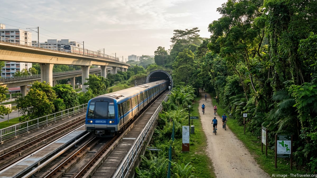
The DTL2e builds on earlier improvements along the Bukit Timah stretch, where the opening of Hume station in February 2025 created a new access point to Bukit Timah Nature Reserve, Bukit Batok Nature Park, the Former Ford Factory and the Rail Corridor. Reports indicate that the station immediately cut public-transport travel times between the Upper Bukit Timah area and the city centre, encouraging more residents and visitors to reach trailheads by train rather than by car.
NParks and the Urban Redevelopment Authority have progressively upgraded the Rail Corridor, especially its central and northern sections, to serve as a continuous green route linking heritage railway structures, community spaces and restored forest habitats. Information from previous project updates highlights habitat restoration, new bridges and additional access points as central features intended to make the corridor both ecologically robust and visitor-friendly.
With the DTL2e drawing the Downtown Line closer to the northern stretches of the Rail Corridor and to forthcoming nature corridors around Kranji, the rail network is poised to act as a high-capacity feeder into some of Singapore’s most distinctive outdoor experiences. This includes birdwatching and wetland walks near the Kranji Nature Corridor, as well as cycling and hiking routes that trace the former rail alignment through old truss bridges and conserved stations.
For eco-conscious travellers, this convergence of metro access and green infrastructure means it will be increasingly realistic to plan full-day itineraries that rely almost entirely on rail and walking paths. The result is a shift away from isolated nature pockets towards a genuinely interconnected “city in nature” that can be explored like an open-air museum, one train stop and trail junction at a time.
Eco-Tourism Potential at Sungei Kadut and the Northern Fringe
Beyond improving connectivity to established parks, the DTL2e is closely tied to the planned Sungei Kadut Eco-District, an area flagged in public planning documents as a next-generation industrial and innovation cluster with a strong environmental focus. Coverage by local transport observers notes that the new terminus at Sungei Kadut, together with an intermediate DE1 station, is slated to anchor refreshed land uses ranging from advanced manufacturing to circular-economy businesses.
The co-location of rail infrastructure and an eco-district creates opportunities for behind-the-scenes experiences that appeal to a growing segment of travellers interested in sustainability in action. Factory conversions, urban farming facilities, materials recovery plants and design studios could, over time, become visitable attractions that showcase how Singapore manages waste, water and energy in compact industrial spaces.
As rail access improves, the surrounding northern fringe, including reservoirs, nature parks and farms, becomes more viable as a day-trip zone. Publicly available information from NParks on expanding park connectors and new nature corridors suggests that more green links are planned to stitch together these destinations, potentially allowing travellers to combine rail journeys with cycling loops that begin and end at DTL stations.
For tour operators, the extension unlocks the possibility of curated low-emissions itineraries that move seamlessly from industrial showcases to wetlands, bird hides and reservoir lookouts, all timed to train frequencies rather than chartered buses. The DTL2e, in that sense, functions not only as transport infrastructure but also as a backbone for new kinds of eco-tourism product design.
Transforming How Visitors Navigate Singapore Car-Free
Even before the extension opens, the Downtown Line functions as a linear guide to many of Singapore’s best-known visitor districts, with stops at or near Bugis, Chinatown, Little India, Marina Bay, the museum precinct and popular shopping belts. The addition of new northern stations intensifies this role, turning the line into an intuitive axis for visitors who want to experience both skyline and rainforest during a short stay.
Travel guides are increasingly presenting Singapore’s metro map as an exploration tool in its own right, with the Downtown Line highlighted as a simple way to plot themed days that stitch together food, culture and outdoor experiences. With DTL2e, the same logic will extend further into the island’s interior, reducing the need to understand complex bus routes or rely on ride-hailing for last-mile connections to parks and trails.
Advances in digital wayfinding are likely to amplify this shift. As more data is made available on trail conditions, park connector gradients and station amenities, apps and journey planners can optimise routes that balance accessibility, shade and crowd levels. Visitors may increasingly be nudged towards rail-plus-walking combinations that lower emissions while still delivering access to well-known attractions.
Crucially, the extended line supports Singapore’s broader positioning as a sustainable, transit-oriented destination. For international travellers weighing regional stopovers, the prospect of stepping off a long-haul flight and relying almost entirely on high-frequency metro services to reach mangrove boardwalks, hilltop forests and heritage corridors gives the city-state a distinctive competitive edge.
Balancing Visitor Numbers with Sensitive Habitats
The convenience created by the DTL2e will also bring familiar questions about how to manage visitor pressure on ecologically sensitive sites. NParks has previously outlined strategies for protecting biodiversity along the Rail Corridor and in nearby reserves, including habitat restoration, designated trails and signage that guides behaviour.
As rail extensions and new park connectors draw larger numbers of residents and tourists into these landscapes, planners are expected to rely on a mix of design interventions and public education to keep impacts in check. This may include dispersing visitors across multiple access points, improving wayfinding so hikers stay on marked trails, and integrating rest areas and lookouts that channel footfall away from habitat hotspots.
The Downtown Line’s role in shaping eco-tourism therefore comes with a parallel responsibility to support responsible visitation. For operators and travellers, that translates into itinerary planning that respects opening hours, seasonal sensitivities and codes of conduct, even as the metro makes wild spaces feel closer than ever to the city’s hotel clusters.
If executed as envisaged in current plans, the DTL2e is positioned to demonstrate how heavy rail infrastructure, nature conservation and tourism can be aligned. For Singapore’s visitors, it signals a future in which a single blue line on the transit map can unlock an increasingly rich spectrum of low-carbon adventures, from conserved shophouses to canopy forests and beyond.