
More news on this day
Late day thunderstorms moving across the Mid Atlantic on Wednesday triggered temporary ground stops and rolling delays at all three major Washington region airports, disrupting hundreds of afternoon and early evening flights.
Get the latest news straight to your inbox!
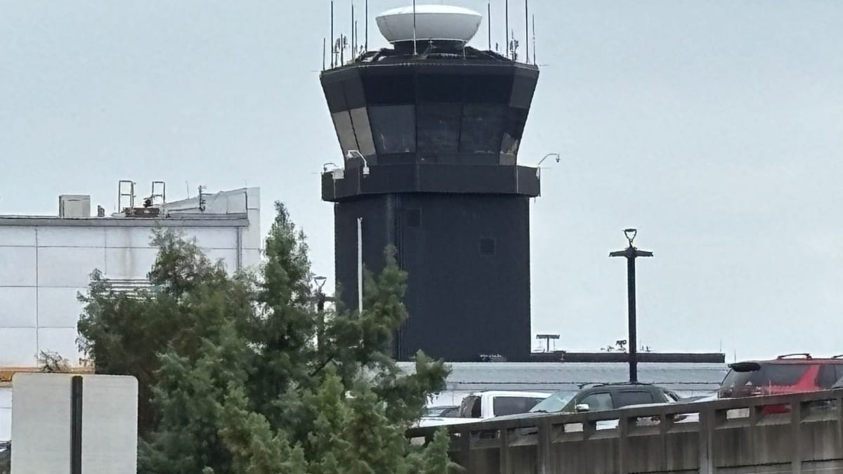
Image by WJLA
Weather System Slows Air Traffic Across Capital Region
Publicly available forecasts show a line of thunderstorms developing along the Interstate 95 corridor around Washington on April 1, with the most intense activity expected between late afternoon and early evening. Meteorological guidance points to damaging wind gusts, brief downpours and isolated hail, conditions that often prompt air traffic managers to slow or temporarily halt operations for safety.
Regional coverage indicates that the Federal Aviation Administration implemented ground stops for airports serving the nation’s capital as storms approached, including Ronald Reagan Washington National Airport, Baltimore/Washington International Thurgood Marshall Airport and Washington Dulles International Airport. Television and online outlets in the region reported that the interruptions were tied directly to convective weather in the arrival and departure paths.
Separate airport tracking and status dashboards showed a sharp increase in both departure and arrival delays around the same time, consistent with a temporary pause on flights, followed by a gradual resumption at reduced rates. These data suggested that the most significant impacts were concentrated in the late afternoon peak, when business travelers and early leisure departures typically converge.
The timing coincided with a broader pattern of unsettled early spring weather in the Mid Atlantic, with warm, humid air feeding rapidly developing storms. Local climatological records highlighted that the region can see summerlike temperatures and fast-building thunderstorms as early as April, creating challenging conditions for airlines and air traffic planners.
Ground Stops and Delays In Place Until Early Evening
According to airport-focused news coverage and real time status tools, the most restrictive measures for Baltimore/Washington International involved a formal ground stop window from approximately 4:40 p.m. to 6 p.m. Eastern time. During this period, flights bound for the airport were held at origin, while some departures already at the gate remained on the ground as thunderstorm cells passed near key flight paths.
For Reagan National and Dulles, publicly accessible FAA status pages and media reports pointed to similar weather related constraints, including inbound flow metering, departure holds and route adjustments. While the precise parameters varied by airport, the general pattern involved slowing the rate of arrivals and departures until the most hazardous cells cleared the immediate vicinity of the airfields.
By around 6 p.m., radar imagery and forecast discussions showed the strongest storms shifting east and northeast of the urban core, allowing air traffic managers to begin lifting the strictest restrictions. Even as ground stops expired, however, the system continued to cause residual delays as airlines worked through backlogs, repositioned aircraft and reallocated crews whose schedules had been disrupted earlier in the afternoon.
Operational planning documents for large airports in the region note that even short ground stops can ripple through the system for hours, especially when they overlap with daily peaks in demand. As a result, travelers with flights later in the evening were still being advised through airline channels and airport messaging to monitor their flight status closely.
High Volumes Magnify Passenger Disruptions
The Washington region’s three major airports collectively handle tens of millions of passengers each year, and early April typically marks the start of a busier spring and summer travel period. Traffic statistics released by airport operators for recent years show steady growth in domestic leisure travel, along with robust demand on key business routes along the East Coast.
When weather interrupts operations at all three airports simultaneously, the impact can quickly become visible in crowded gate areas, long lines at customer service counters and congested roadways approaching terminals. Images distributed by photo services and local outlets in recent days, capturing long security lines during earlier disruptions, illustrate how quickly terminals can strain under irregular operations.
On Wednesday, online flight tracking boards for DCA, BWI and Dulles showed clusters of delayed departures and arrivals across a range of major carriers. Some flights were held at origin, while others diverted temporarily to outlying airports to wait out the storms, adding complexity for travelers attempting to make tight connections or reach evening events in the capital region.
These conditions are further complicated by the ongoing peak construction and infrastructure upgrades at several large U.S. airports, including BWI, where federal reports have recently flagged reduced capacity and heightened delay sensitivity during certain phases of work. When combined with convective weather, such constraints can extend recovery times once restrictions are lifted.
Recent Operational Strains Heighten Traveler Frustration
The latest round of weather related slowdowns comes on the heels of several notable disruptions affecting Washington area air travel in March, including operational issues at an air traffic control facility that temporarily halted flights across the region. News reports and social media accounts from those events described cascading delays, diversions and missed connections for travelers heading into and out of the nation’s capital.
In late March, a separate incident involving a reported chemical odor at the regional approach control center led to another series of ground stops for DCA, BWI and Dulles. Coverage of that episode underscored the central role of the Potomac TRACON facility in managing traffic for the broader metropolitan region and highlighted how a localized issue can rapidly affect multiple airports simultaneously.
The combination of earlier operational interruptions and Wednesday’s storm related measures has added to a sense of accumulated strain for frequent travelers and airlines serving the corridor. Industry analysts have noted that even when each disruption is short lived, repeated irregular operations in a compressed time frame can challenge staffing, equipment maintenance schedules and passenger patience alike.
Public reports also indicate that airport operators and airlines are continuing to refine contingency plans that address both infrastructure issues and severe weather scenarios. These efforts are designed to speed recovery after an event, improve communication with travelers and reduce the risk of prolonged tarmac delays or confusing terminal conditions.
Guidance for Travelers With Upcoming Flights
Travel industry observers recommend that anyone scheduled to fly into or out of the Washington region on days with active thunderstorms build extra time into their plans. Airline advisories for similar weather events routinely encourage customers to check their flight status frequently, sign up for text or app based alerts, and consider earlier departures when flexible.
Passenger rights materials from government agencies and airports also emphasize that when disruptions are caused by weather, airlines are generally not required to provide hotel or meal vouchers, though some carriers may do so on a case by case basis as a customer service measure. Travelers with tight connections or important same day commitments are often advised to consult with their carrier about rebooking options as soon as significant delays appear likely.
On the ground, regional transportation agencies typically remind passengers to account for potential congestion on airport access roads and regional highways when storms move through, particularly during the evening commute. Heavy rain and strong winds can slow highway speeds and increase travel times for those attempting to reach or leave the terminals by car, bus or rideshare.
Looking ahead to the remainder of the evening, forecasts suggest that storm intensity should gradually diminish after the prime convective window, allowing airports to work through the backlog of delayed flights. For travelers heading out later at night or early the next morning, conditions are expected to be more typical for early spring, with cooler temperatures, lingering clouds and routine volumes of air traffic.