
More news on this day
Thunderstorms moving into the Mid Atlantic on Wednesday afternoon prompted temporary ground stops and delays at all three major Washington area airports, disrupting late day travel as federal air traffic managers capped operations until 6 p.m.
Get the latest news straight to your inbox!
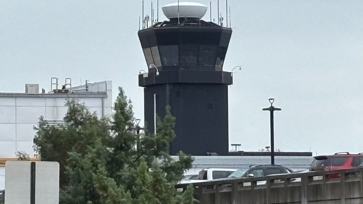
Image by WJLA
Ground Stops Hit All Three Washington Area Hubs
Publicly available Federal Aviation Administration advisories on Wednesday indicated that Ronald Reagan Washington National, Washington Dulles International and Baltimore/Washington International Thurgood Marshall were each placed under weather related ground stops in the 4:40 to 4:45 p.m. window. The measures temporarily halted or sharply limited departures and arrivals while thunderstorms approached the region.
Coverage from regional broadcasters described the action as affecting all major commercial airports serving the capital area, with the restrictions currently expected to remain in place until 6 p.m. Eastern time. The window could shift if storm intensity or timing changes, but for now airlines are required to hold many flights on the ground rather than launching into constrained airspace.
Ground stops and related flow control measures are used when expected arrival demand would exceed what an airport and its surrounding airspace can safely handle. On days with fast developing convection, the practical capacity of a runway system can drop quickly, forcing air traffic managers to meter traffic until conditions stabilize.
Flight tracking boards on airline and airport sites showed mounting delays by late afternoon at the three hubs, with some departures pushed back by 60 minutes or more as carriers waited for clearance to launch aircraft.
Thunderstorms Build After Unseasonable Warmth
Forecast discussions for the Washington region on Wednesday highlighted an unusually warm and humid air mass, with temperatures soaring well into the 80s before a cold front approached from the west. Meteorologists anticipated scattered to numerous late day thunderstorms, some capable of producing heavy rain, frequent lightning and gusty winds as they moved across the metro area.
Such convective setups often pose multiple hazards for aviation. Strong updrafts and downdrafts can create wind shear and turbulence along final approach paths, while lightning and torrential rain reduce visibility and complicate operations on ramps and taxiways. Even if storms remain relatively brief, their timing during the late afternoon and early evening peak can ripple through airline schedules for hours.
Radar imagery and live television weather segments during the midafternoon period showed cells beginning to flare west of the Beltway, with forecasters expecting a more organized line to push east toward the Potomac River corridor around the evening commute. That timing aligned with the FAA decision to meter traffic at DCA, BWI and IAD before the worst of the weather moved directly over the airports.
Storm related constraints added to a spring pattern of weather disruption across the eastern United States, where repeated frontal passages and lingering moisture have produced episodes of severe weather, low ceilings and gusty winds at several major hubs.
Travelers Face Cascading Delays and Possible Cancellations
As of late afternoon, national delay data compilations showed hundreds of late running flights systemwide, with Washington airports contributing a growing share. Baltimore/Washington, Reagan National and Dulles had already logged dozens of delayed operations by 5 p.m., according to aviation analytics platforms that track departure and arrival performance.
When ground stops are in place, aircraft scheduled to depart for an affected airport are typically held at their origin until a controlled release time becomes available. That approach keeps airborne holding to a minimum but can leave passengers waiting at gates or on tarmacs far from their destination. If storms linger longer than forecast, airlines may convert some delayed flights into cancellations to reallocate aircraft and crews.
Airline communication channels urged travelers to monitor their carrier’s mobile apps and email alerts for the latest information on specific flights. Same day rebooking and travel waivers are sometimes offered when prolonged weather disruption is expected, although policies vary by carrier and route.
Even once the formal ground stops expire, residual delays usually persist into the evening as airports work through backlogs. Turn times for arriving aircraft can stretch, crews may run up against duty limits and connecting passengers can miss onward departures, creating additional knock on effects across the network.
Recent Operational Strains Heighten Sensitivity to Disruptions
The latest weather slowdown comes after multiple recent interruptions to Washington area air traffic for non weather reasons. In mid March, a strong chemical odor at the Potomac Consolidated Terminal Radar Approach Control facility in Warrenton led to an evacuation and prompted a regional halt of flights into DCA, BWI and IAD. Publicly available reports and traveler accounts described diversions, tarmac delays and aircraft returning to gates while controllers were relocated and the building was checked.
Later in the month, another environmental issue at the same facility triggered additional temporary restrictions, again forcing airlines to pause flights into the capital region while air traffic managers worked around reduced staffing and capacity. Those events followed a broader pattern of stress in the national airspace system, with staffing, technology outages and episodic hazards occasionally intersecting with routine weather challenges.
Industry observers note that when a region experiences several notable disruptions in quick succession, even a standard weather related ground stop can generate heightened attention and concern among travelers. Many passengers already planning spring and early summer trips through Washington may interpret the latest advisories in the context of those earlier episodes.
Operational planners at airlines have been emphasizing the need for flexible scheduling and contingency options as the busy travel season approaches. With limited slack in aircraft rotations and crew availability, relatively brief constraints can still translate into crowded gate areas and longer lines for customer service assistance when conditions deteriorate.
What Passengers Can Expect Through the Evening
If thunderstorms move through on roughly the anticipated timetable and ground stops end around 6 p.m., Washington’s three major airports are likely to spend the remainder of the evening working through accumulated queues of arrivals and departures. Historically, evening operations can recover within several hours when weather improves decisively and no new convective cells redevelop.
However, if storms stall or redevelop over key departure and arrival corridors, air traffic managers may extend or reconfigure flow control initiatives, possibly shifting from full ground stops to ground delay programs that meter traffic at slower but still continuous rates. In that scenario, travelers could see rolling delays deepen, especially on routes that depend on tight connections through the capital region.
Publicly shared guidance from airlines and airport operators consistently encourages passengers to arrive on the earlier side of recommended check in windows during active weather but not to show up excessively early, in order to avoid compounding congestion at security and boarding areas. For those with flexibility, later evening or next morning departures sometimes offer a smoother experience once the weather system and its immediate knock on effects have passed.
With thunderstorms a recurring feature of mid Atlantic spring and summer, Wednesday’s disruptions are unlikely to be the last weather related constraints on the capital region’s air travel. The episode underscores how quickly conditions can shift from routine operations to tightly managed traffic flow when storms, recent infrastructure incidents and heavy demand intersect over one of the country’s most closely watched airspace regions.