
More news on this day
Stormy spring weather sweeping across the Washington region prompted temporary flight halts and delays at Ronald Reagan Washington National, Baltimore/Washington International Thurgood Marshall and Washington Dulles International Airport on Wednesday afternoon, with cascading schedule disruptions expected to linger into the evening hours.
Get the latest news straight to your inbox!
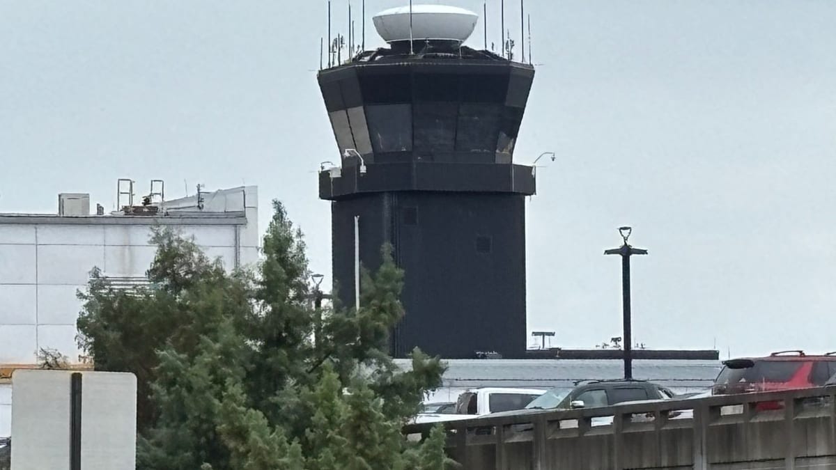
Image by WJLA
Thunderstorms Prompt Ground Stops Across DC Airspace
Publicly available Federal Aviation Administration status reports on Wednesday afternoon showed traffic management programs in effect at all three major Washington area airports, as a line of strong storms approached the region. By around 5 p.m. Eastern time, Washington Dulles International Airport, Ronald Reagan Washington National Airport and Baltimore/Washington International Thurgood Marshall Airport were all subject to temporary ground stops or ground delays tied to convective weather in the area.
Television weather coverage and local forecasts indicated that scattered thunderstorms were developing along a cold front pushing through the Mid Atlantic, bringing heavy rain, gusty winds and the potential for brief severe cells late in the day. The unstable conditions reduced arrival rates into the congested Washington airspace and limited departures while storm cells passed near airport approach and departure corridors.
Initial FAA planning advisories pointed to restrictions extending into the late afternoon and early evening, with some programs indicating impacts until at least 6 p.m. Airlines adjusted schedules and held some departures on the ground as controllers worked to meter traffic safely into and out of the region.
While the weather system was expected to move east through the evening, aviation planners signaled that residual disruption could continue beyond the strict end time of any ground stops. Turnaround times, crew schedules and aircraft rotations were all likely to be affected as operations ramped back up.
What Travelers at DCA, BWI and IAD Are Experiencing
For passengers at DCA, BWI and IAD, the weather related constraints translated into a mix of ground holds, extended taxi times and rolling departure and arrival delays. Airline status boards on Wednesday afternoon showed a growing number of flights posted as delayed, particularly those scheduled in the late afternoon window when storms were moving through the region.
At Ronald Reagan Washington National, which sits directly along the Potomac River and relies on tightly choreographed arrival and departure paths, even small disruptions in weather can quickly reduce capacity. Travelers there reported via social media that some departing flights pushed back from gates only to wait on the tarmac for updated release times into the national airspace system.
At Baltimore/Washington International Thurgood Marshall, north of the District, periodic lightning and heavy rain bands led to short term pauses in ramp activity and slower boarding and deplaning. Public flight tracking tools showed arrival flows being periodically metered, resulting in airborne holding patterns for some inbound aircraft and later gate arrival times.
Washington Dulles International, which typically handles a high share of long haul and international operations, saw knock on effects as transcontinental and overseas flights contended with altered departure slots. Even modest delays out of the Washington area can ripple across airline networks, affecting downline flights in other regions well into the night.
Forecast Timing and Expected Improvement After 6 p.m.
Regional forecast discussions on Wednesday pointed to the most active storm window running from late afternoon through early evening, roughly between 4 p.m. and 8 p.m. Meteorologists highlighted the potential for quickly intensifying thunderstorms as daytime heat and humidity interacted with the approaching front, particularly along and east of the Blue Ridge.
Guidance indicated that by around 6 p.m., the core of the storm activity would begin shifting east of the immediate Washington and Baltimore metro area, with intensity gradually diminishing into the evening. As the line moved offshore and cooler, more stable air filtered in behind the front, conditions at the airports were expected to improve, allowing air traffic managers to lift the most restrictive programs.
Even as skies begin to clear, however, air travel typically takes longer to normalize. Aircraft and crews may be out of position, and airlines often need several hours of steady operations to work through accumulated delays. Travelers booked on later evening departures from DCA, BWI and IAD were advised through airline and airport communications to monitor their flight status closely and be prepared for gate or schedule changes.
For early morning flights on Thursday, current outlooks suggested a return to more routine conditions, with cooler temperatures and lower storm chances. The primary remaining impact for those departures would likely come from aircraft arrivals that were delayed or rerouted the night before.
Recent Strains on Washington Area Air Travel
The latest weather related disruptions add to a challenging stretch for air travel in the Washington region. In recent weeks, the three major airports have already experienced operational slowdowns linked to air traffic control facility issues in the Potomac Consolidated TRACON area, as well as earlier rounds of storms that affected the broader East Coast corridor.
Published coverage has noted that the region’s complex airspace and high traffic volumes can make it particularly sensitive to both weather and infrastructure problems. When thunderstorms line up along key approach paths or when a critical control facility reduces capacity, effects are often felt simultaneously at Reagan National, Dulles and BWI.
Industry analyses of delay patterns consistently rank weather as one of the leading causes of air traffic slowdowns in the United States, and the dense Northeast and Mid Atlantic corridors are frequent hotspots. Washington’s position along major north south and east west routes means that even flights merely passing through the area’s airspace can be affected when capacity is constrained.
The combination of strong demand for spring travel and a series of recent operational challenges has left little slack in airline schedules. As a result, individual storms or short term restrictions can more easily cascade into widespread delays, prompting carriers to encourage customers to build in extra time and flexibility when traveling through the capital region.
Advice for Flyers Navigating the Disruptions
Travel guidance shared by airlines and airports on Wednesday emphasized the importance of checking flight status frequently, using mobile apps or text alerts, and allowing extra time at the airport. With changing weather and evolving FAA traffic management programs, departure times and gate assignments were subject to adjustment with relatively short notice.
Passengers with tight connections, particularly those connecting from Washington to international or last flight of the night departures at other hubs, were encouraged through carrier communications to explore rebooking options if significant delays appeared likely. Some airlines activate flexible travel policies during disruptive weather events, allowing same day changes without additional fees.
For those still planning trips later in the week, publicly accessible forecasts pointed to a more stable pattern following the passage of Wednesday’s front, suggesting a lower risk of severe storm related ground stops in the immediate term. However, aviation analysts often recommend that travelers in the Washington to Boston corridor maintain awareness of forecast trends, as rapidly developing thunderstorms can alter conditions with limited lead time during the warm season.
Travelers already at DCA, BWI or IAD were advised via airport information channels to stay close to their gates, monitor overhead announcements and digital displays, and be prepared for boarding to begin quickly once an updated departure release time is granted. In many cases, flights that experience weather related holds can still depart within the same evening if crews and aircraft remain available once conditions improve.