
More news on this day
Thunderstorm risks in the Greater Toronto Area are putting renewed focus on weather-related flight delays at Toronto Pearson International Airport, as carriers and passengers brace for potential disruption to one of Canada’s busiest air hubs.
Get the latest news straight to your inbox!
Stormy skies over the Greater Toronto Area
Forecasters are tracking a line of unsettled weather across southern Ontario on March 31, with conditions that support heavy rain, lightning and strong winds in pockets around the Greater Toronto Area. Environment Canada outlooks for communities surrounding Toronto Pearson International Airport point to a risk of thunderstorms developing into the evening, increasing the likelihood of brief periods of reduced visibility and gusty crosswinds that can complicate takeoffs and landings.
Publicly available meteorological data for locations near the airport, such as Halton Hills and Vaughan, indicate warm, humid air moving over the region, a combination that can fuel fast-building storm cells. Even when severe weather does not remain parked directly over the airfield, the presence of electrical activity or rapid wind shifts in the approach and departure corridors can trigger slowdowns as air traffic controllers space aircraft farther apart and pilots navigate around towering clouds.
The developing thunderstorm pattern follows a late winter and early spring marked by frequent, disruptive weather systems across Canada. Earlier in 2026, a series of snow and ice events produced widespread operational challenges at major airports, highlighting how quickly conditions can swing from blizzard risks to convective storms as temperatures rise.
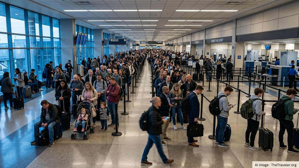
Pearson’s recent history of weather disruption
The threat of thunderstorm delays is unfolding against a backdrop of months of elevated operational strain at Toronto Pearson. Industry-focused coverage in recent weeks has pointed to repeated waves of delays and cancellations linked to winter storms, freezing rain and lake-effect snow, with Pearson often described as the hardest-hit Canadian hub when systems sweep across southern Ontario.
Reports from January documented significant snowfall and ice that forced airlines to pare schedules and stretched ground handling and de-icing capacity. Travel media analysis has highlighted how a single intense storm day at Pearson can lead to hundreds of delays, and how the resulting backlog can persist for several days as carriers work to reposition aircraft and crews.
Travel and aviation publications have repeatedly noted that Pearson’s role as Canada’s busiest airport makes it particularly vulnerable to knock-on effects. When weather disrupts operations in Toronto, the impact is quickly felt along domestic corridors to cities such as Vancouver, Calgary, Montreal and Halifax, as well as on key transborder and transatlantic routes. The latest convective outlook heightens concern that this pattern could recur, even outside the peak winter period.
Thunderstorms add complexity to already strained schedules
Thunderstorms present a different set of challenges than snow and ice, often leading to ground holds and rerouted traffic rather than large blocks of outright cancellations. Safety protocols commonly require ramp workers to clear exposed areas when lightning is detected nearby, temporarily halting refuelling, baggage loading and aircraft pushbacks. Even short suspensions of ground activity can cascade into longer delays when airports are already operating near capacity.
Travel-industry reports on Canada-wide disruptions published on March 31 describe a national picture of elevated delay counts, with Toronto Pearson appearing among the most affected airports. While the bulk of the latest statistics point to late departures rather than a spike in cancellations, the imbalance still has consequences for passengers, who face missed connections and tighter turnaround times on onward flights.
Operational data reviewed by aviation analysts suggest that airlines serving Pearson have been juggling recovery from earlier winter events at the same time as they prepare for convective weather. This combination can leave limited slack in the system. When a storm cell passes near the field, creating a brief window of reduced movements, carriers can struggle to absorb the lost time without reshuffling aircraft rotations and crew assignments across their networks.
Travelers urged to prepare for possible knock-on effects
Given the current forecast and recent experience, passenger advocates and travel commentators are advising travelers using Toronto Pearson to plan for the possibility of same-day schedule changes. Common recommendations include allowing extra time for check-in and security screening, building a wider buffer into connections through Toronto and monitoring flight status closely via airline channels and airport information boards.
Consumer-facing travel coverage has emphasized that even if thunderstorms remain scattered, the associated air traffic management measures can be felt across a wide geography. Flights bound for Pearson from other Canadian cities or from the United States and Europe may face departure holds until the weather risk near Toronto decreases, leading to late arrivals and missed onward connections.
Observers also note that travelers on evening departures may be particularly exposed when storms develop late in the day. With fewer later flights available to accommodate missed connections, passengers whose itineraries are disrupted can find rebooking options more limited, especially on heavily traveled domestic and transborder routes.
Longer-term questions about resilience and climate volatility
The renewed focus on thunderstorm-related delays is feeding into a broader discussion about how Pearson and other Canadian airports adapt to increasingly volatile weather. Research on climate resilience in aviation has drawn attention to the growing frequency of extreme events, from intense winter storms to more frequent summer convective outbreaks, and the pressure these patterns place on existing infrastructure and operating procedures.
Policy and industry briefs examining Canadian air travel over the past several seasons describe an environment where “ripple effect” disruptions have become more common. A single bout of severe weather in Toronto can trigger missed crew connections, aircraft out of place and schedule disruptions that spill into subsequent days across the national network.
In the near term, the focus for airlines and passengers remains squarely on the current risk of thunderstorms and the potential for fresh delays at Pearson. As forecasters track the evolution of storm cells around the Greater Toronto Area, carriers continue to balance safety and schedule reliability, while travelers weigh contingency plans for journeys that pass through one of North America’s busiest weather-sensitive hubs.