
Crossing Ohio can be a pleasure rather than a chore if you plan with the state’s seasons, traffic patterns, and diverse landscapes in mind. From lakefront cities to rolling Appalachian hills, a little preparation goes a long way toward keeping your trip on time, on budget, and stress free.
Understanding Ohio’s Geography Before You Go
Ohio may look compact on the map, but its regions feel remarkably different once you are on the road. The flat farmland and industrial corridors of the northwest give way to the suburbs and lakefront neighborhoods around Cleveland, while central Ohio is anchored by Columbus and its growing ring of commuter communities. To the south and east, the terrain grows hillier, with winding routes through Appalachian foothills, old river towns, and state parks that reward careful planning and slower speeds.
For a smooth trip, sketch a mental map of the routes that connect the state’s main hubs. Interstates 70 and 80/90 cut east to west, carrying heavy long-haul traffic, while Interstates 71, 75, and 77 run north to south, tying together Cincinnati, Columbus, Cleveland, Toledo, and Akron-Canton. If you know whether your journey will be mostly interstate cruising or a mix of freeways and rural highways, it becomes much easier to estimate your driving time and build in realistic breaks.
Ohio’s travel experience also changes significantly with the seasons. Winter lake-effect snow can blanket the northeastern corridor, while heavy summer storms can slow traffic along flat, open stretches of interstate. In autumn, leaf-peepers flock to southeast Ohio’s scenic byways, while spring weekends can be crowded with festivals and sporting events in the major cities. Understanding these regional and seasonal patterns early in your planning phase will help you choose the best time of day and the best roads for your own priorities, whether that is speed, scenery, or a balance of both.
Timing Your Trip Around Seasons, Events, and Traffic
Ohio’s busiest travel periods tend to mirror the national calendar, but there are local nuances that matter if you want to avoid bottlenecks. Summer weekends bring heavier traffic to popular lake destinations and amusement parks, particularly around Sandusky, while college move-in and game days add congestion around Columbus, Athens, Oxford, and other university towns. Holiday weekends can back up interstates around all major metro areas, especially on the Friday afternoon and Monday return windows.
Winter requires special attention. Snow squalls and freezing rain are common between December and March, particularly in northern and eastern Ohio. Even when interstates are open, speed restrictions and reduced visibility can slow traffic far below posted limits. If your trip crosses this part of the state in colder months, build extra time into your schedule, keep an eye on changing forecasts, and consider planning your longest driving days around midday, when temperatures and visibility are typically better.
Weekday rush hours can also have an outsized impact on cross-state trips. Morning and late-afternoon congestion around Cincinnati, Columbus, Cleveland, and Dayton often extends well beyond downtown cores, affecting key interchanges where travelers change from one interstate to another. When possible, time your route so that you pass through major metro areas between mid-morning and mid-afternoon or later in the evening. Leaving an hour earlier or later than you first planned can easily save that same hour in traffic.
Major events matter too. Professional sports schedules in Cincinnati, Cleveland, and Columbus, along with large concerts and fairs, can flood specific corridors with traffic for a few hours before and after. If your schedule is flexible, check ahead for home games, festivals, or big conventions in the cities along your route. Adjusting your timing or routing slightly can transform a stop-and-go grind into a smooth glide through the city.
Choosing the Right Routes: Interstates vs Scenic Byways
Ohio’s interstate network is efficient and generally well maintained, making it the default choice for travelers focused on getting across the state quickly. Interstates 70 and 80/90 form the primary east-west corridors, with the Ohio Turnpike offering a relatively fast but more monotonous path across the state’s northern tier. Interstates 71 and 75 carry most of the north-south traffic, while Interstate 77 provides a key corridor between the Akron-Canton area and southeastern Ohio.
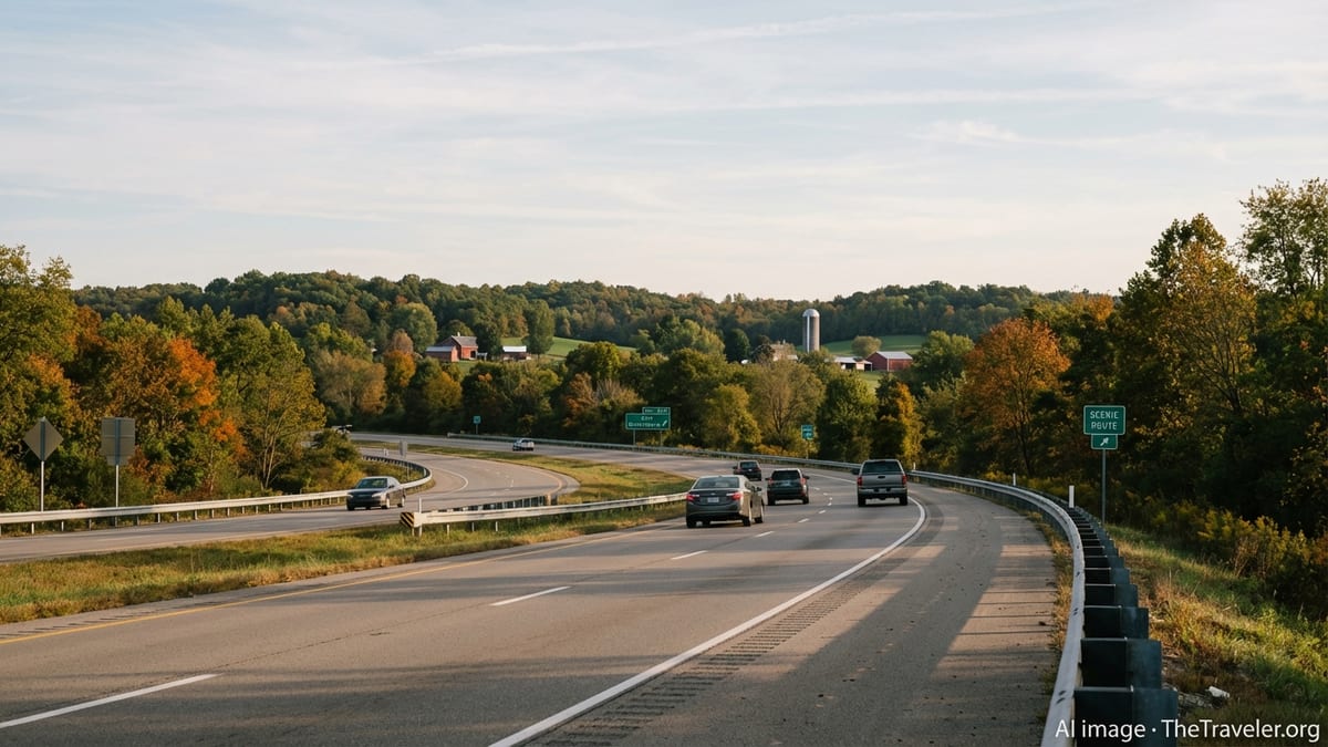
For drivers willing to trade a little speed for scenery, the state’s network of scenic byways and numbered state routes provides an entirely different experience. Southeast Ohio in particular is known for winding two-lane highways that trace ridgelines and river valleys. Routes such as State Route 78, often noted for its sweeping curves and overlooks near Burr Oak State Park, reward unhurried driving and extra caution. These roads are best enjoyed in daylight and in fair weather, so plan enough time to take them at a comfortable, safe pace.
Cyclists and walkers have their own parallel world of routes, especially in the southwestern region. Long-distance trails such as the Little Miami Scenic Trail, which stretches between the Springfield and Cincinnati areas, allow you to break up a driving-heavy itinerary with a day on foot or on two wheels without leaving the state. If your trip involves bikes, plan your overnight stops near trailheads or communities that cater to outdoor recreation, and confirm seasonal trail access and surface conditions before you commit to a rigid schedule.
If you are new to Ohio, it can be tempting to rely solely on your GPS, but a bit of advance research on route options will help you avoid being directed onto slower backroads when time is tight or onto demanding scenic routes in bad weather or after dark. Pair your navigation app with a broad look at the state map before you depart so you understand how smaller roads fit into the bigger picture, and adjust your preferences to favor either faster highways or more direct minor roads depending on your priorities that day.
Staying Informed on Road, Weather, and Construction Conditions
Real-time information is one of your best allies for a smooth trip across Ohio. The Ohio Department of Transportation provides a dedicated traveler information platform that aggregates live traffic speeds, incidents, and active construction zones across the state, along with winter road condition reports in colder months. Checking conditions shortly before departure, and again during breaks, can alert you to accidents, lane closures, or icy stretches that might not yet appear in general mapping apps.
During winter and shoulder seasons, pay particular attention to alerts about snow and ice. A route that looks straightforward on a clear day can become significantly more demanding with slick pavement, reduced visibility, and refreezing sections after sunset. When possible, build a few alternative paths into your plan so that you can divert around problem areas rather than pushing through deteriorating conditions. Even short detours on parallel highways or local roads can save time and reduce stress if you make the choice early.
Construction is a regular feature of Ohio travel, especially from spring through fall. Major projects along key interstates can involve narrowed lanes, reduced shoulders, or temporary speed limits. Knowing about these zones in advance allows you to adjust your expectations and resist the temptation to make up time in constrained areas. Consider planning fuel and rest stops just before or after long work zones, so you enter them refreshed and with a comfortable buffer of daylight if conditions are already challenging.
In addition to state resources, local radio traffic reports, navigation app alerts, and digital message boards often provide early notice of incidents and slowdowns. Designate a passenger to monitor updates if possible, and try to make routing decisions well ahead of bottlenecks. The goal is not to chase every minor delay, but to avoid major disruptions that could throw off your entire day’s schedule.
Navigating Ohio’s Cities and Airports Smoothly
Ohio’s cities each have their own driving personality, and understanding a few basics can lower your stress level considerably. Cincinnati’s network of hills, river crossings, and overlapping interstates can feel complex to newcomers, while Columbus traffic can build quickly along the beltway and main radial routes at peak times. Cleveland’s lakefront geography and older freeway system require some advance lane planning, particularly near major interchanges and bridges. Studying a simple map of the routes into and out of each city you plan to enter will help you anticipate where ramps, merges, and lane drops are likely to occur.
If your journey includes air travel within or out of Ohio, plan your airport connections with local geography in mind. Cleveland Hopkins International Airport serves as the primary gateway for northeast Ohio, with a single main terminal and multiple concourses reached via consolidated security checkpoints and an on-site rapid transit station that links directly to downtown Cleveland. In the southwest, Cincinnati/Northern Kentucky International Airport sits just across the state line in northern Kentucky and is accessed via major interstates that feed into the greater Cincinnati area.
Arriving and departing smoothly at these airports depends in part on how you time your drive relative to local traffic. Morning and afternoon rush hours can significantly extend travel times between the city center and airport terminals, especially when weather or construction is a factor. Build in extra time when connecting from outlying cities such as Akron, Dayton, or Toledo, where you may need to navigate more than one busy corridor to reach your flight. Wherever possible, confirm parking, rental car returns, and ground transportation options at your chosen airport before departure so you are not searching for signs or shuttles at the last minute.
Within cities, consider leaving your vehicle parked and taking advantage of local transit, rideshares, or walkable neighborhoods for sightseeing. Downtown areas in Columbus, Cleveland, and Cincinnati have compact cores where driving and parking are often less convenient than using other options for short hops between attractions, especially during events. Planning your city time with a mix of modes can reduce parking costs and give you a more relaxed view of urban Ohio.
Planning Stops, Lodging, and Fuel With Intention
Careful planning of your breaks can make a long day of driving across Ohio feel manageable rather than exhausting. On interstate routes, aim for a stretch or rest every two to three hours, whether at a formal rest area, a service plaza, or a town just off the highway. Use these breaks not only for fuel and food, but also to check traffic and weather updates and to adjust your schedule if necessary.
Lodging choices can shape the rhythm of your trip. For straightforward overnight stops along the interstates, many chains cluster near major exits serving larger cities such as Dayton, Toledo, and Akron, as well as at key crosspoints like the intersection of Interstates 70 and 75. If you prefer a more local experience, consider staying in historic river towns or small communities near state parks in southeast or eastern Ohio, where you will find a quieter atmosphere and easier access to scenic detours the next morning.
Fuel planning matters, especially if your route takes you into more rural corners of the state. While most interstates have frequent fuel options, some scenic byways and lightly populated routes have longer stretches between reliable stations, particularly late at night. Try to refuel when your tank reaches a half rather than waiting for a warning light, and pay attention to signage indicating distances to the next services. This is particularly important in winter, when keeping your tank comfortably full can also help in the event of unexpected delays.
Food can be an opportunity rather than an afterthought. Instead of relying solely on generic highway stops, consider planning at least one meal in a town known for local specialties or historic main streets. Whether you are stopping in a neighborhood near Cleveland’s lakefront, a small community near the Little Miami Scenic Trail, or a riverfront district in southern Ohio, targeted dining breaks can punctuate your drive and turn a simple transit day into a more memorable part of your trip.
Staying Safe and Prepared on the Road
Safety planning for an Ohio road trip begins with your vehicle. Before departure, check tire pressure and tread, fluid levels, wiper blades, and lights. In winter and early spring, consider whether your tires are appropriate for the potential of snow or ice, especially if you will be traveling in northern or eastern regions. Keeping an emergency kit with basic tools, a flashlight, blankets, water, and snacks is a prudent step year-round, and particularly valuable if you are venturing onto rural highways or traveling at night.
Weather awareness should be continuous rather than a one-time check. Conditions can change quickly across the state, from dense fog along rivers to sudden thunderstorms across open farmland. Enable severe weather alerts on your phone and monitor them periodically at rest stops. If conditions deteriorate significantly, do not hesitate to delay your departure, adjust your route, or take a longer break until visibility and traction improve. A modest schedule change is a small price to pay compared with the risks of pushing forward in unsafe conditions.
Responsible driving habits are especially important on Ohio’s variety of road types. On interstates, maintain a steady speed within posted limits and leave extra following distance during rain, snow, or heavy traffic. On scenic two-lane roads, expect slower vehicles, sharp curves, and limited passing zones; resist the urge to overtake unless you have a completely clear view and ample time. Wildlife crossings are more common at dawn and dusk in rural areas, so reduce speed and stay attentive during these times.
Communication backups can provide peace of mind. Mobile coverage is generally strong along major corridors and in cities, but there are still pockets of weaker reception in remote areas. Share your general route and expected arrival times with a friend or family member, especially if you are traveling solo or exploring less populated regions. Keeping your phone charged and carrying a basic paper map as a fallback adds an extra layer of security that costs little but can be invaluable if technology fails at an inconvenient moment.
The Takeaway
Planning a smooth trip across Ohio is less about rigid schedules and more about informed flexibility. By understanding the state’s regional differences, timing your travel around seasonal conditions and local events, and choosing routes that match your comfort level and interests, you can reduce surprises and make room for enjoyable detours.
Stay plugged into real-time traffic and weather information, particularly during winter or when construction is active along your route. Make deliberate choices about where you will stop for fuel, food, and rest, and adjust your expectations when passing through the busiest urban corridors. Above all, allow enough time so that you are not constantly racing the clock; a relaxed pace will leave you better able to appreciate both Ohio’s landscapes and its cities.
With a bit of foresight and the right tools, driving across Ohio can be more than a means to an end. It can become a comfortable, engaging part of your travels, offering glimpses of small-town life, regional history, and shifting scenery from Lake Erie’s shores to the Appalachian foothills.
FAQ
Q1. How much time should I plan to drive across Ohio from east to west?
Driving time varies by route, but most east to west crossings on major interstates take roughly five to seven hours of wheel time, not counting rest stops or traffic delays.
Q2. When is the best time of year to plan a road trip across Ohio?
Late spring through early fall generally offers the most predictable driving conditions, with autumn providing particularly scenic views in southeastern and eastern Ohio, though popular routes can be busier on weekends.
Q3. How can I check real-time road and traffic conditions in Ohio?
You can use Ohio’s official traveler information resources and major navigation apps to monitor live traffic speeds, incidents, construction zones, and winter road conditions across the state.
Q4. Are Ohio’s scenic byways suitable for inexperienced drivers?
Many are manageable for cautious drivers, but some routes in the Appalachian region have sharp curves and steep grades, so less experienced drivers should plan extra time and avoid these stretches in poor weather or after dark.
Q5. What should I pack in my car for a winter drive across Ohio?
In addition to routine essentials, carry warm clothing or blankets, a scraper and brush, extra washer fluid, basic tools, a flashlight, and extra food and water in case of delays or closures.
Q6. How far in advance should I book lodging along Ohio’s interstates?
On quieter weekdays you can often book same day, but during peak travel seasons, large events, or holidays, it is wise to reserve at least a few days in advance, especially near major cities or attractions.
Q7. Is it safe to rely only on GPS when driving in rural parts of Ohio?
GPS is helpful, but it is safer to also review a map in advance and, if possible, carry a paper backup, since cellular and data signals can be weaker in some remote or hilly areas.
Q8. How often will I find fuel stops on major Ohio highways?
On interstates, fuel is available regularly, often every 20 to 40 miles, but on rural state routes and scenic byways you may encounter longer gaps, so refuel when your tank reaches about half full.
Q9. Are there good options to combine driving with cycling or walking in Ohio?
Yes, several long-distance multiuse trails, including paved rail trails, run through different regions, allowing you to park nearby and spend part of your journey on foot or by bike.
Q10. What is the best way to avoid heavy traffic when passing through Ohio’s big cities?
Try to schedule your arrival outside of weekday rush hours, check live traffic before entering the metro area, and, if feasible, route around known choke points or use beltways rather than driving directly through downtown.