
More news on this day
From the Binnenhof’s medieval courtyards to the wide sands of Scheveningen, a new wave of Den Haag city maps is reshaping how visitors read and move through The Hague.
Get the latest news straight to your inbox!
City beside the sea mapped for modern tourism
Den Haag, known internationally as The Hague, has long combined government buildings, residential neighborhoods and North Sea beaches in a compact urban footprint. Recent tourism materials place stronger emphasis on this geography, presenting the city as a “city beside the sea” where visitors can understand at a glance how tram corridors, bike routes and walking streets tie the center to the coast.
Printed city maps distributed by local tourism offices now highlight the close distances between the historic core, the business district and coastal quarters. These maps typically show the old center clustered around the Binnenhof and Mauritshuis, the leafy avenues leading toward the Peace Palace, and the tram and bus lines that extend out to Scheveningen and Kijkduin. The result is a clearer spatial picture for travelers who may only have a day or two to explore.
Publicly available mapping also reflects the city’s dual identity as a royal residence and international hub of law and diplomacy. Key sites such as the Peace Palace, the International Court of Justice and various tribunals are given prominent placement, while royal landmarks and cultural institutions are clearly marked within walking distance of central tram stops. The cartography underlines how closely these worlds sit together on the ground.
Tourism reports indicate that visitors are increasingly using a combination of printed maps and digital navigation. Many of the latest printed city plans mirror the conventions of smartphone apps, with simplified icons for museums, beaches and entertainment districts, designed to be quickly understood by international travelers.
Historic core: compact streets, layered maps
The historic center of Den Haag appears densely packed on most city maps, reflecting the tight weave of streets and courtyards around the Hofvijver lake. Detailed city-center maps show a network of shopping streets, museums, churches and civic buildings within a short walk of the main railway stations. Landmarks such as the Grote Kerk, Noordeinde Palace and Lange Voorhout form the main points of reference.
Tourist-focused maps typically cluster symbols for galleries, theaters and government buildings inside this small area, making it easier to plan short walking circuits. The city’s primary visitor information point in the center is usually indicated prominently, emphasizing its role as a starting point for orientation and the collection of free printed city plans.
Specialized tourist maps go further by suggesting logical walking routes through the core. These routes often link Den Haag Centraal or Hollands Spoor stations with the Binnenhof, the royal quarter and the Peace Palace area, before continuing toward residential districts with cafes and independent shops. Although these paths are suggested rather than signposted, their appearance on maps encourages visitors to treat the center as an easily walkable cluster of neighborhoods.
Publishing trends show a growing interest in city-center diagrams that balance visual clarity with fine-grained detail. Map designers have been simplifying color palettes, refining street labels and adjusting typefaces so that international visitors can distinguish tram lines, pedestrian streets and bike-friendly corridors without previous knowledge of Dutch urban layouts.
Linking city and coast on the map
One of the most visible developments in Den Haag mapping is the stronger graphic connection between the inner city and the coastal districts. Scheveningen, the principal beach resort, now appears on many tourist maps as an integral extension of the city rather than a distant outpost. Thickened tram lines, clear color blocks and beach icons guide travelers from the central squares to the pier and boulevard.
Regional brochures and tourist maps also emphasize that the journey from the city center to the sea can be completed quickly by tram, bike or even on foot for determined walkers. This framing encourages day visitors to combine museum visits with time on the waterfront, using the map as a planning tool for mixed itineraries that shift from urban streetscapes to dunes and sea views.
Secondary coastal areas such as Kijkduin and the dune landscapes southwest of the center are increasingly visible on larger-format maps. These areas are presented as quieter alternatives to the busier Scheveningen strip, with cycling paths and walking trails highlighted to appeal to visitors looking for nature within the metropolitan area.
Tourism material indicates that this city-to-coast perspective is important for local businesses. By showing how districts interconnect, maps encourage travelers to move across different quarters during a short stay, spreading visitor spending from the inner city out to seaside restaurants, beach clubs and accommodation options.
Public transport and neighborhood orientation
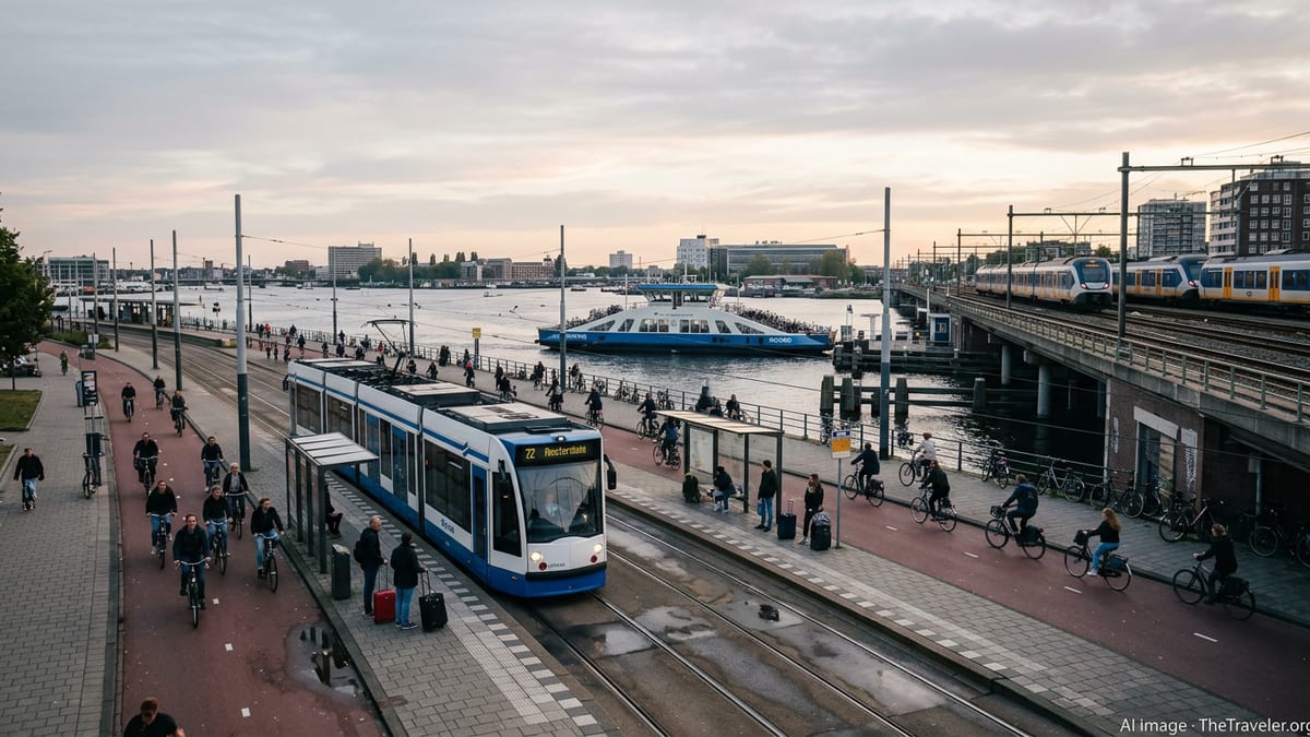
Public transport diagrams have become an essential counterpart to standard city maps. The Hague’s tram network, in particular, is depicted as a backbone that threads together outlying neighborhoods, satellite towns and major points of interest such as Madurodam, the World Forum area and key shopping streets. Newer diagrams are moving toward cleaner, more schematic representations that highlight transfer points and journey times rather than every intermediate stop.
Discover South Holland and other regional platforms provide simplified tram maps that show how day tickets can be used to move through the network without worrying about zone boundaries. This style of mapping supports visitors who plan to rely on trams during short city breaks, making it easier to connect central stays with excursions to beach districts and neighboring municipalities.
Alongside tram diagrams, city maps increasingly include insets or small panels for distinctive neighborhoods. Areas such as Statenkwartier, Zeeheldenkwartier and the avenues around Haagse Bos are portrayed with a focus on local squares, dining streets and cultural venues. These neighborhood maps help travelers look beyond the traditional landmark circuit and explore residential streets that have developed strong hospitality scenes.
Reports from travel guides and user-generated content suggest that this neighborhood-level mapping aligns with visitor behavior. Many travelers now seek out local cafes, independent boutiques and quieter parks after visiting the marquee attractions, and rely on detailed district maps to navigate without constantly checking their phones.
Digital tools and the future of navigating Den Haag
While printed city maps remain visible in hotels, visitor centers and transport hubs, digital tools are reshaping how travelers navigate Den Haag. Mapping platforms aggregate attractions, transit data and user reviews into interactive layers, and tourism-focused websites increasingly embed dynamic maps that can be filtered by theme, from museums and architecture to family activities and nightlife.
Newer online maps highlight curated collections of points such as “highlights of The Hague,” allowing users to toggle between list and map views. This format lets travelers compare distances, cluster activities by district and check how long it takes to move from the Binnenhof to the beach or from central tram stops to outlying parks.
City organizations are also producing downloadable maps tailored to specific audiences, including internationals settling in the region and conference delegates. These materials often combine a conventional street map with practical annotations on public services, green spaces and cultural venues, blurring the line between a tourist plan and a newcomer’s guide.
As mapping tools evolve, the core message about Den Haag remains consistent. The city is presented as a compact, legible place where a carefully designed map can unlock a mix of historic architecture, international institutions, neighborhood life and wide sandy beaches within a small radius. For travelers arriving with little prior knowledge, the latest generation of Den Haag city maps aims to make that complexity visible at a glance.