
Indiana stretches from the beaches of Lake Michigan to the rolling hills along the Ohio River, and getting around efficiently can make the difference between a rushed itinerary and a relaxed, rewarding trip. Whether you are flying into Indianapolis, road tripping on Interstate 65, or basing yourself near the Indiana Dunes for quick runs into Chicago, understanding your transportation options will help you match how you travel with what you want to see.
Understanding Indiana’s Geography and Travel Hubs
Indiana’s compact, roughly rectangular shape and central U.S. location make it straightforward to cross, but travel feels very different in each region. Central Indiana is anchored by Indianapolis, the state capital and air hub, with a growing network of bus rapid transit lines and the state’s most extensive local bus system. Northern Indiana links tightly to the Chicago metropolitan area through commuter rail and toll roads, while southern Indiana is more rural and scenic, with smaller cities such as Bloomington, Columbus and Evansville spread among state forests and river towns.
Distances are manageable by American standards. Driving from Indianapolis to South Bend or Evansville typically takes around three to four hours depending on traffic and construction, while many regional destinations, including Bloomington, Lafayette and Columbus, are within 90 minutes of Indianapolis. This scale makes day trips achievable but still long enough that you should factor in traffic, weather and roadwork when planning your time.
For most visitors, key gateways are Indianapolis International Airport, Chicago’s airports for access to northwest Indiana, and smaller commercial airports in South Bend, Fort Wayne and Evansville. From these hubs, you can choose between renting a car, riding local or regional buses, or, in the northwest, boarding the South Shore Line commuter train to or from Chicago. Your mix of modes will depend on where you base yourself and how comfortable you are with American-style driving.
Because public transportation outside a few urban corridors is limited, visitors who want to explore smaller towns, state parks or wineries will almost always find a car necessary. Travelers who plan to stay primarily in Indianapolis, South Bend or college towns can rely more heavily on buses, ride-hailing services and walkable neighborhoods, supplementing with an occasional rental car for specific outings.
Driving in Indiana: Highways, Conditions and Safety
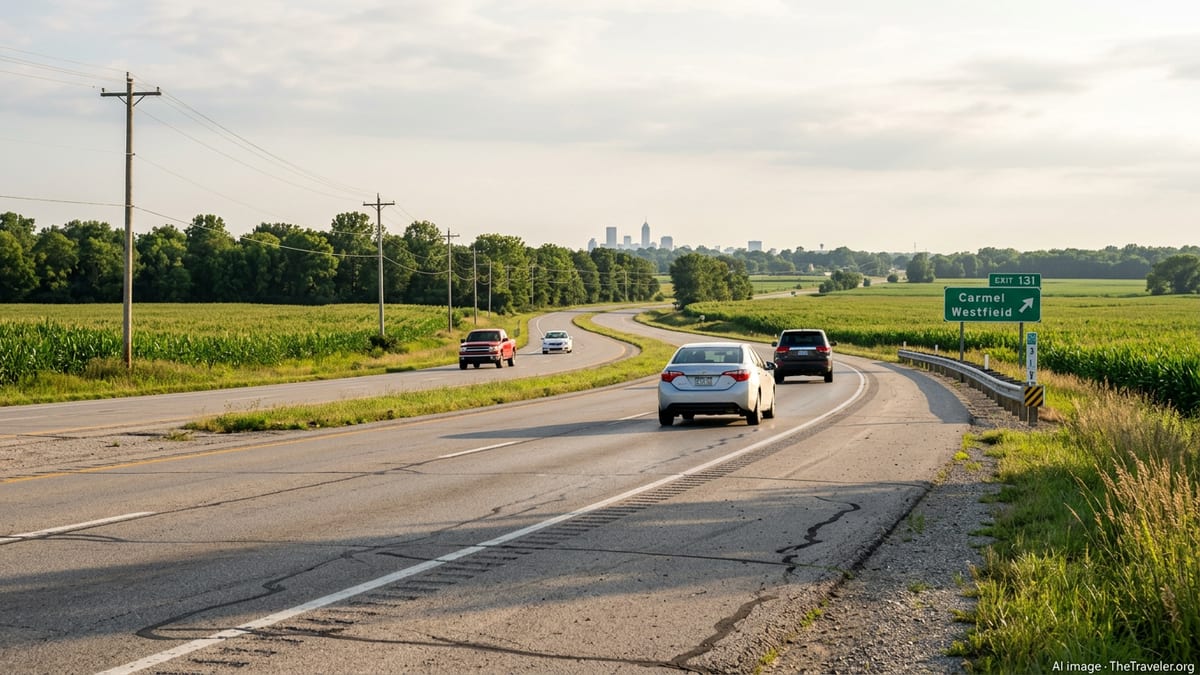
For many visitors, driving is the simplest way to move around Indiana. The state is laced with major interstates such as I-65 between Louisville and Chicago, I-70 between St. Louis and Columbus, I-69 running northeast from Indianapolis toward Fort Wayne, and I-74 cutting across the southeast. These corridors are generally in good condition and clearly signed, although delays from long-term construction projects are common during warmer months.
The Indiana Toll Road, part of Interstate 80/90, runs along the state’s northern edge and connects Chicago with South Bend and points east. The road uses electronic tolling and staffed booths in some sections, and most rental cars can be equipped with compatible transponders or billed by license plate. If you plan to drive this corridor frequently during your visit, ask your rental company in advance how tolls are handled to avoid surprise charges after you return the car.
Weather is a major consideration, especially from late fall through early spring. Northern Indiana can see lake-effect snow off Lake Michigan, and ice storms occasionally affect central and southern parts of the state. In summer, heavy thunderstorms and intense downpours can reduce visibility quickly. Check forecasts nightly if you have long drives ahead, leave extra time for deteriorating conditions, and avoid rushing to keep to a rigid schedule.
Traffic in Indiana is usually moderate, but congestion does build near Indianapolis during weekday rush hours, around college towns on game days, and along interstate corridors when construction narrows lanes. Speed limits on rural interstates are commonly higher than visitors from abroad may be used to, and local drivers often exceed them. Keeping to the right except when passing, using turn signals consistently, and planning fuel and rest stops every couple of hours will help keep long drives more relaxed.
Renting a Car and Practical Road Trip Tips
Car rental remains the most flexible option for exploring Indiana’s smaller towns, covered bridges, and state parks. Indianapolis International Airport has a large consolidated rental car center, and agencies maintain branches in downtown Indianapolis and larger cities such as Fort Wayne, South Bend, Bloomington and Evansville. Booking ahead is advisable during summer, major sporting events and university move-in weekends, when vehicle availability and prices can fluctuate.
Standard rental cars typically come with automatic transmissions, air conditioning and basic navigation systems. If you expect to drive primarily on highways and in cities, a compact or midsize vehicle is usually sufficient. Travelers planning to explore gravel roads near lakes and parks may prefer a small SUV for comfort and ground clearance rather than true off-road capability, which is rarely necessary in Indiana.
Fuel stations are common along interstate exits and near towns, but can be sparse in more rural corners of southern Indiana. Filling up when your tank drops below half, especially late in the evening, will minimize anxiety on quiet stretches. Most stations accept major credit cards, and prices can vary noticeably between urban and rural areas, so you may want to refuel before leaving a metropolitan area on a long leg.
Parking is relatively straightforward across the state. Indianapolis and a few downtowns use a mix of street meters, surface lots and garages. Smaller cities often allow free street parking for limited periods. On busy weekends near university campuses, expect more competition for spaces near central districts and consider using park-and-ride lots or walking a bit further from core blocks. As always, keep valuables out of sight and lock your vehicle, even in seemingly quiet neighborhoods.
Using Public Transit in Indianapolis and Major Cities
While Indiana is known more for driving than transit, visitors who base themselves in Indianapolis or certain regional cities will find public transportation increasingly viable for everyday movement. Indianapolis, in particular, has been investing in bus rapid transit lines that operate more frequently and reliably than traditional local routes, providing a useful spine for visitors without a car.
IndyGo, the Indianapolis transit agency, operates the Red Line, Purple Line and the developing Blue Line bus rapid transit corridors, along with a grid of local and express routes. The Red Line runs north to south through central Indianapolis, linking neighborhoods from Broad Ripple and the north side through downtown to areas near the University of Indianapolis. The Purple Line connects downtown with the city of Lawrence to the northeast, overlapping the Red Line for several miles to offer especially frequent service on that shared segment. The Blue Line, under construction along much of Washington Street with a modified section using Interstate 70 to reach Indianapolis International Airport, is expected to further improve east–west connectivity once major works are complete.
Rapid transit buses usually run more often than standard routes, with relatively long service spans, level boarding platforms and off-board fare payment. For visitors, this means easier access to downtown hotels, museums, dining districts and some university campuses without renting a car immediately upon arrival. Local buses supplement these corridors by reaching neighborhoods and job centers beyond walking distance of the rapid transit stations.
Other cities in Indiana have more modest transit systems. South Bend and Mishawaka, Fort Wayne, Evansville, Lafayette and Bloomington run local bus networks that serve core city areas, university campuses and some shopping districts. Service coverage and frequency are generally best on weekdays during daytime hours, with more limited evening and weekend options. Checking schedules a day or two in advance and planning your last return trip carefully will help you avoid long waits or missed buses in the evening.
Regional Trains, Intercity Buses and Airport Connections
Indiana’s most important rail connection for travelers is the South Shore Line, an electric commuter train that links downtown Chicago with northwest Indiana communities and South Bend International Airport. The route includes roughly a dozen stations in Indiana, serving cities such as Hammond, Gary, Portage and Michigan City, and provides convenient access for day trips to Chicago or the Indiana Dunes area. Schedules have been adjusted in recent years as double-tracking projects have been completed, adding trains and improving reliability, particularly between Chicago and Michigan City.
The line uses a zone-based fare system, and passengers can typically buy tickets at stations, through ticket machines or via a mobile app. Monthlies and multi-ride tickets are popular with commuters, but casual visitors can rely on one-way fares. Northern Indiana Commuter Transportation District, which operates the line, has also been building the West Lake Corridor extension from Hammond to towns such as Munster and Dyer, with test trains operating in preparation for its expected opening around the end of 2025. Once fully operational, this branch will give additional south suburban communities direct rail access to Chicago.
Beyond commuter rail, long-distance travel by train in Indiana is limited to a small number of intercity services passing through cities such as Indianapolis, Lafayette and South Bend on their way between major coastal hubs. These trains can be scenic and relaxing but often run infrequently and may not align neatly with tight itineraries. As a result, many travelers rely instead on intercity buses operated by national brands and regional companies to move between Indianapolis, Chicago, Louisville, Cincinnati and other Midwestern cities.
Airport access varies by region. Indianapolis International Airport benefits from planned bus rapid transit via the Blue Line corridor and is already linked to downtown by existing IndyGo routes. In northwest Indiana, South Bend International Airport’s rail station on the South Shore Line allows rail travel directly from the terminal area to Chicago and points in between. Smaller airports in Fort Wayne and Evansville are primarily accessible by car, taxi or ride-hailing, so anyone arriving without a rental vehicle should confirm shuttle or car service before landing, particularly for late-night flights.
Day Trips and Scenic Drives Across the State
Indiana’s size and highway network make it especially well suited for day trips. Many of the state’s most memorable experiences are reachable within a one- to three-hour drive of the main cities, and a mix of small towns, natural landscapes and cultural attractions can easily fill a week of outings. From Indianapolis, popular destinations include the college town atmosphere of Bloomington and Indiana University, the historic architecture of Columbus, the racing heritage at the Indianapolis Motor Speedway, and lakes and state parks in central and southern counties.
Northern Indiana offers contrasting experiences. The Indiana Dunes National Park and Indiana Dunes State Park feature sandy beaches, dune trails and views across Lake Michigan, all a short drive or a South Shore Line ride from communities such as Chesterton and Michigan City. Amish country near towns like Shipshewana and Nappanee provides a look at rural life, markets and crafts. Travelers based in Chicago or northwest Indiana can comfortably combine a morning of hiking or beach walking with an afternoon meal in one of the lakeside towns before returning to the city by car or commuter train.
Southern Indiana is known for rolling hills, caves and river scenery. Scenic byways trace routes along the Ohio River and through forested areas near towns such as Madison, Corydon, French Lick and New Harmony. These areas are best explored by car, as public transportation is sparse outside the towns themselves. Plan ahead for limited dining hours in smaller communities, and check attraction opening times outside the peak summer and autumn foliage seasons.
Regardless of which region you focus on, building your day around realistic travel times is key. Use conservative estimates for driving distances, add a cushion for construction or weather delays, and avoid stringing together more than two substantial drives in a single day. Where possible, pick one primary destination and one optional stop, rather than several widely separated sights, so you can linger if a town, trail or museum holds your interest longer than expected.
Accessibility, Sustainable Travel and Traveler Etiquette
Indiana’s transportation networks are gradually becoming more accessible, though conditions vary by mode and location. IndyGo’s rapid transit lines feature level boarding platforms, audible announcements and low-floor vehicles that ease access for passengers with mobility devices or strollers. Many local bus systems across the state have fleets with ramps or lifts, and commuter rail services typically provide accessible cars and boarding assistance on request. However, some older stations, sidewalks and bus stops, especially in smaller towns, may present uneven surfaces or gaps.
Visitors who prioritize lower-impact travel can reduce car dependence by basing themselves in walkable neighborhoods close to transit corridors, such as parts of downtown Indianapolis, Broad Ripple, Fountain Square or near university campuses in Bloomington, West Lafayette and South Bend. From these bases, walking, biking, buses and occasional rideshares may cover most daily needs, with car rentals reserved for occasional day trips to rural or natural areas.
Respectful traveler behavior helps keep local systems functioning smoothly. When using buses or trains, be prepared with payment before boarding where required, move away from doors to allow others to enter, and keep bags off adjacent seats on busy trips. On highways, maintaining steady speeds, yielding appropriately at on-ramps and giving snowplows and construction crews plenty of space all contribute to safer conditions for everyone.
In rural areas, remember that many roads are shared by farm vehicles, bicyclists and horse-drawn buggies, particularly in Amish communities. Passing only when it is clearly safe, reducing speed near animals and cyclists, and avoiding loud horn use contribute to a more considerate travel experience. Small courtesies go a long way toward ensuring that visitors and residents can share the road comfortably.
The Takeaway
Getting around Indiana is, more than anything, a question of choosing the right tool for the trip you have in mind. For visitors planning to explore state parks, historic small towns and wine country, renting a car will remain the most practical option, with well-maintained interstates and scenic two-lane highways putting most corners of the state within a half-day drive. For those spending most of their time in Indianapolis or northwest Indiana, a thoughtful mix of bus rapid transit, local buses, commuter rail and occasional ride-hailing can cover much of what you want to see.
Because public transportation outside a few corridors is still developing, building flexibility into your plans is wise. Check construction alerts and weather forecasts, confirm transit schedules within a day or two of travel, and be ready with a backup option if a bus route changes or a train fills. With realistic expectations and a willingness to adapt, you can treat Indiana’s highways as a gateway to varied landscapes and its evolving transit systems as a way to experience daily life in the state’s cities.
Whether you are catching a morning train from the Dunes into Chicago, gliding past traffic on an Indianapolis bus rapid transit line, or following a winding road along the Ohio River at sunset, Indiana rewards travelers who take the time to understand how its transportation networks fit together. With a bit of planning, those networks can turn a simple journey between points on a map into a memorable part of the story of your trip.
FAQ
Q1. Do I need a car to visit Indiana, or can I rely on public transportation?
Public transportation works reasonably well in Indianapolis and a few college towns, and the South Shore Line serves northwest Indiana, but a car is still the easiest way to reach small towns, state parks and rural areas.
Q2. Is driving in Indiana difficult for visitors from abroad?
Most visitors find driving manageable. Highways are clearly signed and traffic is moderate, but you should be prepared for higher speed limits than in many countries and for occasional winter weather.
Q3. How can I get from Indianapolis International Airport to downtown without renting a car?
You can use IndyGo bus service, which connects the airport to downtown and is expected to be strengthened by the Blue Line bus rapid transit corridor, or book a taxi or ride-hailing service.
Q4. What is the South Shore Line and when is it useful for travelers?
The South Shore Line is an electric commuter train between South Bend International Airport, northwest Indiana and downtown Chicago. It is especially useful for day trips between the Indiana Dunes region, lakefront communities and Chicago.
Q5. Are there good day trips from Indianapolis that do not require very long drives?
Yes. Bloomington, Columbus, Lafayette, Muncie and several state parks are typically within about 60 to 90 minutes of Indianapolis, making them suitable for relaxed day trips.
Q6. How reliable is public transit in Indianapolis for getting around without a car?
IndyGo’s rapid transit lines generally offer more frequent and predictable service than traditional bus routes, but schedules can vary by time of day. It is wise to check current timetables and allow a bit of extra time for transfers.
Q7. What should I know about winter driving in Indiana?
Snow and ice are possible from late fall through early spring, especially in northern Indiana. Driving more slowly, increasing following distances and monitoring forecasts closely will make winter travel safer.
Q8. Are ride-hailing services widely available in Indiana?
Ride-hailing services are common in Indianapolis, larger regional cities and around many university campuses. Availability can be limited in small towns and rural areas, particularly late at night.
Q9. Can I visit the Indiana Dunes without a car?
It is possible but easier with a car. The South Shore Line stops near the dunes, and from some stations you can walk or use local transport to reach trails and beaches, though service and distances vary by station.
Q10. How far in advance should I book a rental car for peak travel times?
During summer, major events and university move-in or graduation weekends, booking several weeks in advance is advisable to secure a reasonable rate and ensure that suitable vehicles are available.