
More news on this day
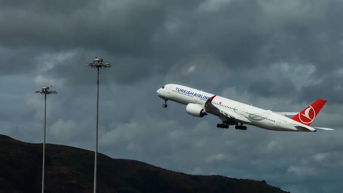
Thunderstorms rolling across the Bay Area on Saturday evening forced a temporary halt to flights at San Francisco International Airport, triggering mounting delays for passengers across one of the nation’s busiest hubs.
Get the latest news straight to your inbox!
Thunderstorms Trigger Evening Ground Stop
Publicly available information from airport trackers shows that San Francisco International Airport implemented a ground stop shortly after 5 p.m. on Saturday, April 11, as a band of intense thunderstorms moved over the Peninsula. The halt paused most arrivals and departures while crews contended with heavy rain, gusty winds and low visibility around the airfield.
Local coverage indicates the ground stop was initially expected to last through early evening, with some operations resuming after about 6:45 p.m. However, the backlog of aircraft on the ground and en route quickly translated into longer waits at gates and on taxiways as airlines worked through the compressed schedule.
Flight-tracking data showed average delays of close to an hour during the ground stop window for both arrivals and departures. Aviation forecasters noted that convective cells over the coast and inland made it difficult to maintain normal runway use, limiting the number of aircraft that could safely land or take off in each hour.
Weather observations compiled by federal aviation dashboards around the same time reported thunderstorms, rain and fog or mist in the vicinity of SFO, with temperatures in the low 50s Fahrenheit and winds blowing from the west. Those conditions, while not extreme, are enough to disrupt finely tuned arrival and departure flows at a tightly constrained airport.
Hundreds of Delays Ripple Through the Airport
By early evening, publicly accessible delay logs indicated that several hundred flights at SFO were running behind schedule, with dozens already categorized as significantly delayed. A smaller number of services had been canceled outright as airlines sought to reset their rotations or avoid having aircraft and crews trapped out of position overnight.
Estimates cited in regional reports pointed to more than 350 delayed flights and at least a dozen cancellations by around 6 p.m., and the figures continued to climb into the night as the system’s impacts worked through the network. Long-haul arrivals from Asia and Europe, as well as transcontinental departures to the East Coast, were among those showing extended waits.
Because SFO serves as a major hub for several domestic and international carriers, disruptions there can quickly extend to airports around the country. Passengers traveling through the Bay Area on connecting itineraries reported through social channels and aviation forums that missed connections and rolling rebookings were becoming increasingly common as the evening progressed.
Real-time boards showed many departure times pushed back in 30 to 60 minute increments, with some widebody flights eventually posting delays of more than two hours. Even after the thunderstorms began to move east, the combination of displaced aircraft, crew scheduling limits and continued congestion on the airfield slowed any rapid return to normal operations.
Storm System Caps Week of Weather and Capacity Strain
The latest round of disruptions comes at the tail end of a week in which forecasters had been tracking an unsettled spring pattern over Northern California. Earlier outlooks from regional meteorologists highlighted the potential for scattered thunderstorms and heavier showers across the Bay Area, including the corridor around San Francisco International Airport.
In parallel, SFO has been preparing travelers for a year of heightened delay risk tied not only to weather but also to changes in air traffic procedures. A new Federal Aviation Administration restriction on certain parallel landing operations at the airport, introduced in response to long-running safety concerns about closely spaced runways, is expected to reduce arrival capacity during busy periods, particularly when conditions deteriorate.
Travel-industry analysis published in recent days has warned that the combination of structural capacity limits and typical coastal weather could mean more frequent and longer holds for inbound flights. Saturday’s thunderstorms created a real-time stress test for that system, as controllers balanced safety requirements with the demand from airlines to land and depart as many aircraft as possible once the worst of the storm had passed.
Historical data from federal transportation statistics and industry studies show that weather remains the single largest driver of flight delays in the United States. Thunderstorms are especially disruptive because they can affect multiple layers of flight operations at once, from ground movement and runway use to en route traffic flows across entire regions.
What Passengers Are Experiencing On the Ground
Inside SFO’s terminals, travelers reported crowded gate areas and longer lines at customer service desks as the ground stop took effect and delay estimates shifted throughout the evening. Some passengers described being held onboard aircraft that had already pushed back from gates, waiting for updated departure slots once traffic flow restrictions eased.
Airport displays and airline apps showed a familiar pattern: early-evening departures pushed later into the night, followed by a growing list of cancellations once it became clear that some aircraft would not be able to operate within crew duty-time limits. For those with onward connections, the rolling delays led to missed flights and, in some cases, overnight stays.
Consumer-advocacy guidance circulating online in response to the storm encouraged passengers to monitor flight status in multiple places, including airline channels and third-party trackers, and to act quickly if rebooking options appeared. Travelers were also urged to keep boarding passes, receipts and documentation of delays in case they became eligible for compensation or travel credits under airline policies.
Nearby airports, including Oakland and San Jose, experienced fewer direct impacts from the thunderstorms but still saw knock-on effects from aircraft and crew rerouting. Some Bay Area travelers sought last-minute alternatives through those fields when it became apparent that their flights from SFO would not operate as planned.
Ongoing Disruptions and What Comes Next
By late Saturday and into early Sunday, operational dashboards suggested that SFO was gradually clearing the most severe of the backlog. Even so, aviation analysts noted that residual delays were likely to extend into the following day, particularly on routes tied to aircraft that had ended up out of position or crews that had reached legal work limits.
Published travel advisories from airlines throughout the week have increasingly highlighted weather-related flexibility for passengers, including options to change travel dates or routes when storms are forecast. The latest thunderstorms over the Bay Area are expected to reinforce that pattern, with carriers facing pressure from customers to offer more proactive waivers when conditions threaten to snarl operations at key hubs.
Looking ahead through the spring, climate and aviation research underlines that short-lived but intense convective systems like Saturday’s can have outsized impacts on major coastal airports, especially those with limited runway redundancy. At SFO, where geography and airspace constraints already limit options, even a relatively brief ground stop can cascade into hours of disruption.
Travel experts advise that passengers flying through San Francisco during the wetter months build extra buffer time into connections, favor early departures where possible and stay alert to changing forecasts in the days leading up to a trip. As Saturday’s thunderstorms demonstrated, a single evening of unstable weather can be enough to halt flights, fill terminals and send delays cascading far beyond the Bay Area.