
More news on this day
California’s Highway 1 has fully reopened through Big Sur after years of landslide disruptions, restoring one of the world’s most celebrated coastal road trips and reshaping how travelers plan the classic Pacific journey.
Get the latest news straight to your inbox!
The Road Is Open Again, But Conditions Still Change Fast
The centerpiece news for Highway 1 travelers in 2026 is that uninterrupted coastal driving is once again possible between Carmel and Cambria. State transportation updates and regional tourism groups report that the critical Big Sur segment at Regent’s Slide reopened in mid-January, ending a three year closure that had forced long inland detours and sharply reduced through traffic along the Central Coast.
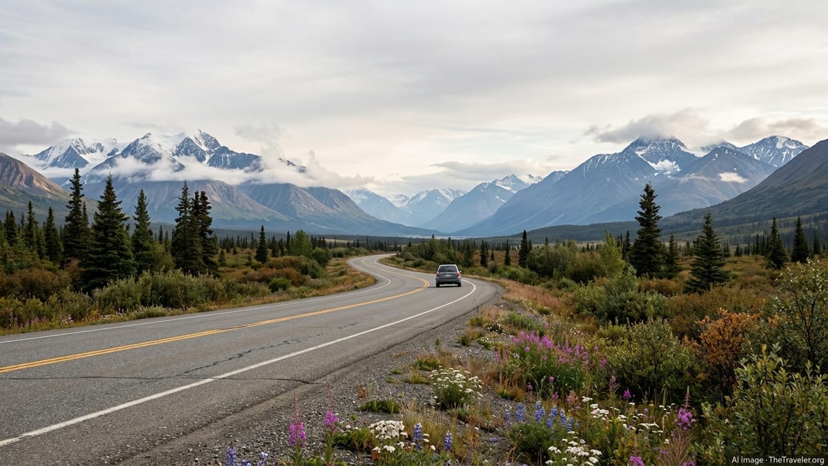
Publicly available information from the California Department of Transportation indicates that while the road is open, it remains an engineering tightrope along unstable cliffs. Sections south of Big Sur periodically shift to one way, signal controlled traffic while crews stabilize slopes or repair winter damage. Travel advisories emphasize that motorists should be prepared for short delays, changing speed limits and sudden fog, especially in spring and early summer.
Recent coverage of winter storms and rockfall also underscores how quickly conditions can change. Even after the major landslide repairs were completed, heavy rain in early 2026 triggered temporary rockslides and localized closures along the central and northern reaches of the route. For visitors, the practical takeaway is that Highway 1 is again a viable end to end coastal journey, but it remains a living, shifting landscape that rewards flexible itineraries.
Transportation bulletins highlight the same simple message for drivers: check conditions just before departure, allow extra time between key coastal towns, and avoid night driving when visibility is low and roadside pullouts are harder to spot.
Iconic Scenery From Big Sur to San Luis Obispo
With the Big Sur corridor restored, some of Highway 1’s most recognizable vistas are back on the classic itinerary. The dramatic stretch south of Carmel, where mountains drop almost directly into the Pacific, has long been considered one of the United States’ premier scenic drives. Travelers can again move seamlessly past headlands, coves and bridges that have become shorthand for the California coast in films and advertising.
Tourism organizations along the Central Coast describe a renewed flow of visitors returning to long isolated viewpoints, state parks and trailheads. Pullouts overlooking Bixby Bridge, the rugged shoreline around Garrapata, and the canyon landscapes near Pfeiffer Big Sur State Park are once again part of continuous road trips rather than isolated out and back excursions.
Farther south, coastal communities between Ragged Point and San Luis Obispo are also feeling the effects of restored through traffic. Travel boards for the region point to increased interest in combining Big Sur’s cliffs with stops in smaller beach towns such as Cambria, Cayucos and Morro Bay. For many visitors, that southern segment offers a gentler driving experience, with wider shoulders, more frequent services and long views across sandy beaches and estuaries.
Even with the road fully reconnected, experts note that Highway 1 is not a fast route. Narrow lanes, curves and view packed pullouts keep average speeds low, particularly through Big Sur. Drivers are encouraged to treat the road itself as a destination rather than a shortcut between major cities.
Coastal Culture: Small Towns, Local Food and Slower Travel
The reopening is not only about asphalt and engineering. Economic impact studies produced during the long closure estimated hundreds of millions of dollars in lost tourism revenue for coastal businesses that depend on visitors traveling the full length of Highway 1. With the corridor restored, many of those inns, restaurants, galleries and outdoor outfitters are recalibrating for a busier 2026 travel season.
Visitor information from Carmel by the Sea, Monterey County and the Central Coast describes a growing emphasis on “linger longer” tourism. Rather than racing through Big Sur in a single day, travelers are being encouraged to spend nights in coastal villages, sample locally sourced seafood, and explore side roads that lead to wineries, farm stands and surf breaks away from the main viewpoints.
Publicly available destination guides highlight Highway 1’s role as a cultural spine as much as a transport link. Along the route, travelers pass through historic fishing harbors, arts focused enclaves and agricultural valleys that feed California’s culinary scene. Towns such as Monterey, Pacific Grove, Cambria and San Luis Obispo have positioned themselves as bases for day trips that blend hiking or beach time with museums, historic districts and evening dining.
That mix of nature and culture is central to the route’s renewed appeal. With the road fully open, travelers can once again design itineraries that weave together coastal trails, state parks, whale watching trips, kayak launches and evening concerts or festivals in nearby towns.
Safety, Climate Risks and the Future of the Drive
Highway 1’s reopening is accompanied by sobering reminders about long term climate and safety concerns. Geological research and hazard assessments released over the past decade describe the Big Sur coastline as inherently unstable, prone to landslides that are likely to become more frequent and severe as intense storms and coastal erosion increase.
Recent analyses of the multi year closure south of Big Sur note that repairs required elevating and shifting the highway inland in certain sections, using new retaining structures and drainage systems designed to better withstand future slides. Transportation planners frame these projects as part of a broader effort to keep the route open while acknowledging that no engineering solution can completely eliminate the risk of future washouts.
For drivers, that reality translates into a few practical considerations. Travel advisories urge motorists to avoid stopping on narrow shoulders near active slide zones, to respect construction closures and to be cautious during heavy rain. Rental car companies and tourism bureaus increasingly include reminders about road conditions in pre trip communications, especially for visitors unfamiliar with mountain driving next to steep drop offs.
Policy discussions around Highway 1’s future continue, including debates over long term maintenance costs and whether some segments may eventually need to be rerouted further inland. For now, state investment has preserved the classic alignment, but officials and researchers alike characterize the route as an evolving project shaped by geology and climate as much as by tourism demand.
Planning a 2026 Highway 1 Trip: What Visitors Need to Know
For travelers aiming to experience Highway 1 in 2026, planning begins with timing and direction. Tourism boards typically recommend at least two to three days between the San Francisco Bay Area and the San Luis Obispo region in order to build in stops, photo breaks and possible construction delays. Many visitors choose to drive southbound so that coastal viewpoints and pullouts sit on the ocean side of the road.
Daylight is another key factor. Because fog and darkness can make the narrow roadway more challenging, many travel advisories suggest completing the most winding sections between Carmel Highlands and Ragged Point during mid day hours. Shoulder seasons in late spring and early fall often bring more stable weather and lighter traffic than peak summer, although weekends can still be busy around popular trailheads and beaches.
Accommodation patterns are shifting as word of the reopening spreads. Some coastal lodges and campgrounds that saw reduced demand during the closure are now reporting a rise in advance bookings for summer and early autumn. Travel planners recommend securing key nights in Big Sur or Cambria well ahead of time, while leaving flexibility elsewhere in the itinerary to adapt to weather and road updates.
Ultimately, current information suggests that Highway 1 is once again delivering the blend of natural drama and relaxed coastal culture that made it famous, albeit with a new awareness of its fragility. For visitors willing to plan carefully, check conditions and travel at a slower pace, 2026 offers a rare opportunity to experience the full sweep of California’s oceanfront highway from one end of the Central Coast to the other.