


More news on this day
Powerful thunderstorms sweeping across the Northeast have triggered thousands of flight delays and cancellations, disrupting peak summer travel and leaving passengers stranded at major hubs from Washington to Boston.
Get the latest news straight to your inbox!
Storms march along the Northeast corridor
Video from the latest ABC News coverage shows towering storm clouds and sheets of rain racing along the Interstate 95 corridor, with lightning and strong winds sweeping into major metropolitan areas including New York City, Philadelphia and Boston. The fast-moving cells have repeatedly trained over the same communities, producing localized flooding, dangerous crosswinds and rapidly changing visibility around key airports.
Publicly available radar imagery and broadcast forecasts indicate that multiple rounds of severe weather developed as warm, humid air collided with cooler air aloft, fueling intense thunderstorm clusters. The storms have been strong enough in some pockets to prompt severe thunderstorm warnings, hail reports and isolated tornado concerns, raising the risk profile for both ground transportation and aviation.
As the atmosphere destabilized through the afternoon and evening, the zone of heaviest weather aligned almost perfectly with one of the busiest air corridors in the world. That overlap between hazardous conditions and heavy flight volume has been a central driver of cascading disruption across the system.
Forecasters expect the unsettled pattern to linger over parts of the Mid Atlantic and New England in the near term, with additional storm development possible as daytime heating returns. Even when the most intense storms shift offshore, lingering low clouds, gusty winds and residual showers can keep operations constrained at the largest airports.
Thousands of delays and cancellations ripple through major hubs
Flight-tracking data cited in recent news coverage show that the storms have coincided with several thousand flight delays and a significant wave of cancellations across the Northeast. The most acute impacts have been felt at the region’s major hubs, where airlines concentrate both domestic and international traffic and rely on tightly timed connections.
New York area airports have seen some of the worst disruption, with schedules repeatedly thinned or reshuffled as airlines hold aircraft at gates, institute temporary ground stops or reroute planes around storm cells. Similar patterns have been reported at Philadelphia and Boston, where heavy arrivals and departures along the East Coast meet transatlantic traffic in already crowded airspace.
When storms force temporary halts or slowdowns to protect safety in the immediate vicinity of an airport, the effects ripple outward as aircraft and crews miss planned rotations. A single cancellation in a hub-and-spoke network can cascade into multiple later cancellations when the same plane or crew was scheduled to cover several additional segments.
Once backlogs build, it can take many hours and sometimes multiple days to fully recover, particularly when severe weather returns in waves rather than clearing cleanly behind a single front. The cumulative result for passengers is a patchwork of long waits on the ground, missed connections, diversions to alternate airports and overnight stays far from original plans.
Travelers face packed terminals and shifting itineraries
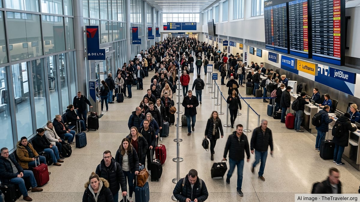
Social media posts and on-the-ground accounts describe crowded terminals, long customer service lines and departure boards filled with yellow and red status updates as travelers scramble to adjust. Families starting summer vacations, international travelers with time-sensitive connections and business passengers alike have all been caught in the disruption.
Passengers have reported instances of spending hours onboard aircraft awaiting clearance to depart, only to face eventual returns to the gate and outright cancellations as the weather window closes. Others have described racing to rebook on the few remaining open seats, sometimes connecting through distant hubs simply to get closer to home or to a scheduled cruise, tour or event.
Publicly available airline advisories indicate that many carriers have issued weather waivers for affected airports, allowing travelers to change dates or routes without typical fees, so long as they rebook within a defined window. These waivers can ease the financial burden for those able to adjust plans, but they do not guarantee open seats or convenient schedules when large volumes of passengers are all competing for limited capacity.
In some cases, travelers have opted to abandon air itineraries entirely, turning to trains, buses or rental cars along the Northeast corridor. While those options can provide a measure of control when skies are unstable, they also face weather-related slowdowns and sellouts when demand spikes suddenly.
Why the Northeast is especially vulnerable to weather disruptions
Aviation analysts frequently point to the structural vulnerability of the Northeast corridor when severe weather strikes. The region hosts a dense concentration of major airports within a relatively small geographic footprint, all feeding into highly congested low-altitude and en route airspace. When storms park directly over that cluster, there are few easy workarounds.
Large hubs such as John F. Kennedy, Newark Liberty, LaGuardia, Philadelphia and Boston Logan often operate close to their maximum practical capacity during peak travel periods. Even minor reductions in arrival or departure rates to preserve safety margins can rapidly translate into queues on taxiways and in holding patterns overhead.
Thunderstorms present a particular challenge because they can be highly localized yet extremely intense, forcing last-minute changes in runway use, approach paths and departure routes. Pilots and air traffic controllers must keep significant distance from the strongest cells, further narrowing the corridors through which aircraft can safely pass.
In addition, the Northeast sits at the crossroads of several long-haul flows, including north-south domestic routes and transatlantic services. When severe weather cuts capacity in this region, it can disrupt not only local flights but also schedules that span multiple continents, multiplying the operational complexity for airline planners.
What travelers can do before the next round of storms
With summer thunderstorm season in full swing, travel experts recommend that passengers build in additional flexibility when planning trips through the Northeast. Booking earlier departures in the day can reduce exposure to the most active storm period, which often peaks in the afternoon and evening as the atmosphere heats up.
Passengers are also encouraged to monitor both their airline’s mobile app and broader weather forecasts in the days leading up to departure. When airlines preemptively trim schedules or post weather waivers, moving flights to a different day or routing around the most threatened hubs can sometimes prevent more serious disruption later.
Carrying essential items in a small carry-on, including medications, chargers and a change of clothes, can make unexpected overnight stays more manageable if a connection is missed or a flight is canceled outright. For those with critical time-sensitive commitments, building a buffer of at least a day on either side of major events can provide some insurance against extended disruptions.
As the latest ABC News video coverage highlights, severe storms in the Northeast are an enduring feature of summer travel, not an anomaly. While airlines and air traffic managers continue refining their playbooks for handling volatile weather, passengers moving through the region in the coming days are likely to face continued turbulence both in the skies and on the departure boards.