


More news on this day
New York’s LaGuardia Airport is bracing for another round of weather-related disruption, as strong thunderstorms and heavy rain in the Northeast threaten flight schedules through Monday and raise the risk of extensive delays and cancellations.
Get the latest news straight to your inbox!
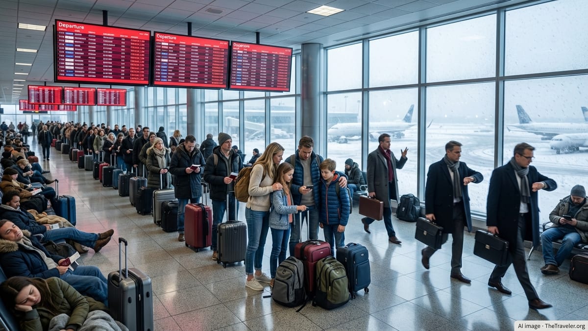
Storm System Targets New York Aviation Hub
Forecasts for the New York City region indicate that a slow-moving storm system will bring periods of heavy rain, thunderstorms and gusty winds from Sunday into Monday, creating challenging conditions for air travel at LaGuardia Airport. Meteorologists expect unstable air and repeated storm cells to move across the mid-Atlantic and New England, with New York City among the areas most exposed to downpours and lightning.
Publicly available aviation and weather outlooks suggest that the most disruptive periods are likely during the afternoon and evening hours, when convective storms typically peak and air traffic volume is highest. Low cloud ceilings, reduced visibility and lightning in the vicinity can trigger ground stops, runway flow restrictions and longer spacing between aircraft, all of which sharply reduce capacity.
The anticipated weather arrives during the busy summer travel season, when LaGuardia is already operating near the limits of its tightly managed flight schedule. Any loss of capacity at the airport or in the wider New York airspace can quickly cascade into delays that affect departures, arrivals and connections across the domestic network.
While the precise timing and severity of individual storm cells remains uncertain, advance planning by airlines and traffic managers typically involves preemptive schedule adjustments and the use of travel waivers to give passengers more flexibility to change plans.
Delays and Cancellations Likely to Ripple Beyond New York
Operational data and recent experience at LaGuardia show that even brief bouts of severe summer weather can produce outsized disruption. When thunderstorms force traffic to slow or pause, the airport’s constrained runway layout and slot-controlled operations leave airlines with limited room to recover, often resulting in rolling delays and a higher-than-average rate of cancellations.
Published coverage of recent storm events in the Northeast has highlighted how quickly impacts at LaGuardia can spread to other cities. Aircraft and crews scheduled to operate multiple legs in a single day may find themselves out of position after a delay or diversion, reducing schedule reliability in markets far from New York. Passengers traveling through the airport on connections are especially vulnerable to missed flights as minimum connection times are eroded by congestion.
Travel industry reports indicate that carriers increasingly rely on strategic cancellations during severe weather to stabilize the rest of the schedule. By trimming flights that are most exposed to storms or congestion, airlines can free up aircraft and crews to protect longer-haul or higher-demand routes. For travelers, this can mean that a flight appears on the schedule only to be proactively cancelled several hours before departure as forecasts evolve.
As the current storm threat develops, passengers flying into or out of LaGuardia on Sunday evening or Monday may encounter gate holds, extended taxi times, reroutes and diversions, even if their specific flight is not cancelled outright. Crowded terminals and longer lines at customer service counters are common side effects during such weather episodes.
Airlines Activate Weather Waivers and Contingency Plans
Major U.S. carriers frequently issue flexible-travel policies ahead of forecast thunderstorms affecting New York-area airports, and publicly available customer advisories indicate that similar steps are being taken around this latest system. These waivers typically allow affected customers to move their travel to alternative dates without change fees, subject to seat availability and defined rebooking windows.
Operational planning teams also adjust aircraft routings, crew pairings and fuel loads to account for the increased likelihood of holding patterns, diversions and weather-avoidance routes. When storms line up along common flight paths into LaGuardia, air traffic managers may impose miles-in-trail restrictions that slow the rate of arrivals, requiring airlines to decide which flights to prioritize.
Public scheduling data and historical performance at LaGuardia suggest that early-morning departures often have the best chance of operating closer to schedule during stormy periods, as they launch before afternoon heating fuels the most intense thunderstorm development. Later flights, particularly those scheduled for the late afternoon and evening, are more exposed to the cumulative effects of daylong disruptions.
Airlines also coordinate with regional partners operating smaller aircraft into LaGuardia, which can be more sensitive to wind shear, turbulence and limited visibility. In some cases, carriers consolidate lightly booked flights or upgauge aircraft to carry more passengers on fewer operations when weather reduces the number of usable slots.
Passengers Urged to Prepare for a Difficult Travel Window
Consumer travel guidance and recent reports from passengers moving through New York-area airports during stormy periods underline the importance of preparation. Travelers heading to or from LaGuardia on Sunday night or Monday are being encouraged by publicly available advisories to monitor their flight status frequently, use airline mobile apps for rebooking and leave additional time to reach the airport in case of heavy rain or localized flooding.
Hand luggage is often recommended during volatile weather periods, as it allows passengers to change flights more easily if cancellations or missed connections occur. Those with tight onward connections or important time-sensitive commitments may wish to explore earlier departures or even alternate airports in the region, depending on availability and personal flexibility.
Airport operations can also be affected inside the terminal when severe thunderstorms pass directly overhead. Lightning in the vicinity may prompt temporary pauses in ramp work for the safety of ground crews, slowing the process of turning aircraft at the gate. This can add further delay even after storms move away from the immediate airfield.
Travelers with special assistance needs, families with young children and those unfamiliar with LaGuardia’s layout may find it helpful to review terminal maps and contingency plans in advance, since crowded concourses and rapidly changing gate assignments are common features of weather-disrupted days.
Infrastructure Constraints Amplify Weather Impacts
Despite significant recent redevelopment, LaGuardia remains a compact airfield with limited runway and taxiway capacity compared with some other major U.S. hubs. Publicly available infrastructure assessments note that the airport’s closely spaced runways and intensive use of slots leave little margin during periods of reduced arrival and departure rates.
Ongoing construction and maintenance projects, including recurring overnight closures and selective runway work during the warm months, can further reduce flexibility when adverse weather arrives. Even when these projects are scheduled outside peak passenger hours, they may influence how quickly the airport can recover from a storm-related slowdown.
Regional airspace constraints also play a role. LaGuardia shares congested arrival and departure corridors with John F. Kennedy International and Newark Liberty International, so storm cells positioned over common approach paths can force widespread rerouting. This interconnectedness means that a thunderstorm line anywhere in the New York terminal area can generate delays across all three airports, raising the baseline risk for travelers.
With severe weather expected to linger into Monday, operational observers anticipate that LaGuardia’s combination of high demand, tightly regulated slots and physical constraints will once again test the resilience of airlines and passengers alike, as the airport navigates another challenging summer weather event.