


More news on this day
A Met Office yellow weather warning for dense fog covering 36 areas of England and Wales on Saturday morning is expected to bring slower journeys, localised delays to public transport and possible disruption to flights as visibility drops sharply during the early peak travel period.
Get the latest news straight to your inbox!
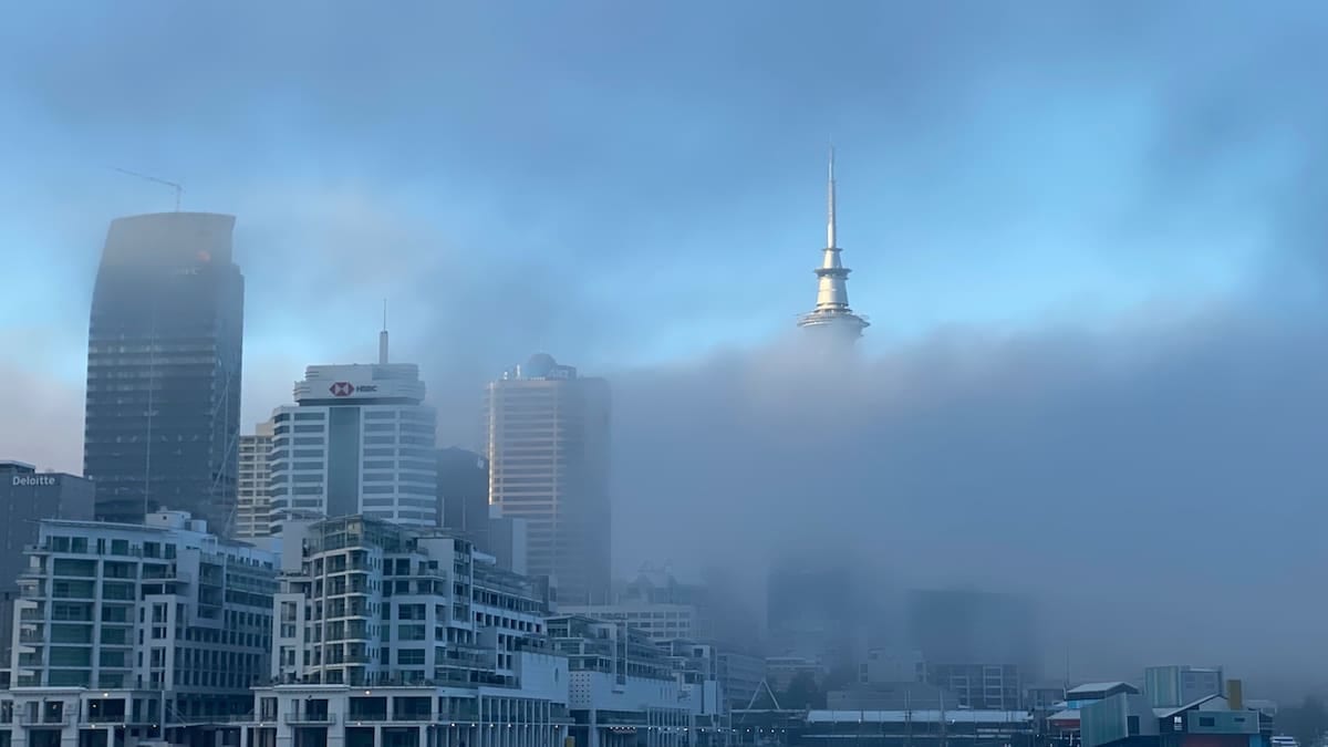
Five-hour fog alert issued for Saturday morning
Publicly available information from the Met Office shows that a yellow fog warning was activated in the early hours of Saturday 31 October, covering a five-hour window between 4am and 9am in some notices, and up to 10am in others, as dense fog formed under lighter winds and clear skies overnight.
The warning focuses on central and eastern parts of England and sections of Wales, where forecasters indicate that visibility could fall below 100 metres at times. Under the Met Office impact scale for yellow alerts, that level of reduction is considered enough to disrupt travel for some road users and to slow public transport services, even though many people may still be able to continue with their normal plans.
Travel reports and forecast summaries describe a “widespread blanket of fog” in places, with patchier conditions elsewhere. While the warning is time-limited to the morning period, some low cloud and mist may linger into late morning in areas where the fog proves slow to lift, particularly in river valleys and low-lying inland locations.
The current fog episode follows a stormy spell linked to named systems Austen and Boelo earlier in October, which brought amber wind warnings, flooding and extensive disruption across parts of Scotland, Northern Ireland and northern England. The return to calmer conditions has allowed fog to form more readily, replacing wind-related hazards with visibility concerns for travelers.
Which regions and local areas are affected
The yellow warning covers swathes of the East Midlands, West Midlands, East of England, London and the South East, the North West of England, Yorkshire and the Humber and parts of Wales. The affected zone stretches from Cheshire and Greater Manchester across to Lincolnshire and down through the Midlands towards the Thames Valley and the Home Counties.
Area breakdowns compiled from the Met Office warning polygon list 36 administrative areas and unitary authorities within the fog zone. These include major urban and commuter regions such as Greater Manchester, Merseyside, West Yorkshire, South Yorkshire, West Midlands (including Birmingham), and the counties of Derbyshire, Nottinghamshire, Leicestershire and Lincolnshire.
In Wales, sections of north and northeast Wales fall under the alert, overlapping with key cross-border routes into northwest England and the Midlands. To the south and east, parts of Buckinghamshire, Oxfordshire, Northamptonshire, Bedfordshire, Cambridgeshire and Hertfordshire are also included, bringing several stretches of the motorway network and busy A-roads within the warning boundary.
Although coastal areas are generally less prone to persistent inland fog, sections of the warning area extend towards estuarine zones and low-lying coastal fringes, where temperature contrasts over land and water can contribute to patches of dense mist around dawn.
Impact on roads, railways and airports
Met Office guidance on fog hazards notes that thick fog can disrupt all modes of transport, from local bus routes to strategic road corridors, railways and air travel. For Saturday’s alert, published coverage from national and regional outlets highlights the possibility of slower road journeys, with drivers urged to anticipate sudden changes in visibility on motorways and dual carriageways such as the M1, M6, M62 and M42 where the warning is in force.
Rail operators often respond to similar fog events by extending journey times or adjusting timetables on affected routes, particularly early in the day. While no system-wide suspensions have been indicated, travelers heading into major hubs such as Birmingham New Street, Manchester Piccadilly, Leeds and Sheffield are being advised through public channels to check live departure boards before setting out.
Airports located within or near the warning area, including Birmingham, Manchester, Leeds Bradford, East Midlands and Liverpool John Lennon, can experience knock-on effects when visibility falls below operating thresholds for some flight movements. Recent fog episodes of similar intensity have led to early-morning arrival diversions and short-notice departure delays while air traffic control spacing is increased and low-visibility procedures are implemented.
Ferry services across the Irish Sea and shorter estuary crossings may also be affected if visibility drops significantly in channel approaches. However, the primary focus of the current warning remains on land transport, particularly commuter and long-distance car and coach journeys in the first half of the morning.
How the Met Office yellow warning system works
The fog alert has been issued under the National Severe Weather Warning Service, which classifies warnings into yellow, amber and red categories based on both the likelihood of severe weather and the potential impact. Official Met Office guidance describes yellow warnings as covering a range of scenarios, from a high chance of minor disruption to a lower chance of more serious impacts.
For fog, a yellow warning typically signals that visibility reductions could cause localised delays and potentially hazardous driving conditions, especially on fast roads and exposed rural stretches. The guidance encourages people to consider whether their planned journeys could be affected and to allow extra time, rather than suggesting that travel must be avoided altogether.
Amber and red warnings, which are not in place for fog on this occasion, indicate progressively higher confidence of more severe impacts, including a risk to life and more widespread disruption to infrastructure. Recent storms this October have demonstrated how quickly lower-tier alerts can be escalated when forecast confidence in damaging wind or rain increases, leading to more extensive travel problems.
With the current fog warning, the Met Office has emphasised in its publicly accessible material that conditions are expected to improve as the morning progresses, with fog lifting into low cloud in many areas by late morning or midday. However, the agency also notes that some pockets of denser fog may be slower to clear, particularly where winds remain very light.
Advice for travelers and timing of improvement
Transport operators and motoring organisations typically recommend that drivers under a fog warning reduce speed, increase following distances and use dipped headlights or fog lights when visibility is seriously reduced. Travelers are also encouraged to avoid sudden braking and to be especially cautious at junctions, pedestrian crossings and motorway slip roads where other road users may be difficult to see until very late.
For those using rail or air services on Saturday morning, publicly available travel bulletins advise checking the latest information from operators before leaving home, as any low-visibility restrictions introduced at short notice can cause knock-on delays later into the morning. Flexible tickets and advance seat reservations may offer some protection if journeys need to be retimed, though specific policies vary by carrier.
Forecasts indicate that the worst of the fog risk is concentrated in the hours just before and after sunrise, when ground temperatures are at their lowest and moisture is most likely to condense. As solar heating increases, visibility should gradually improve across most of the affected region, with many areas expected to see conditions brighten through late morning.
Nonetheless, with 36 areas listed inside the yellow warning boundary and ongoing recovery from earlier storm-related disruption in other parts of the UK, travelers are being urged through open public channels to build extra time into their plans, stay informed of changing conditions and be prepared for journey times that are longer than usual, particularly on routes crossing the Midlands, northern England and north Wales.