


More news on this day
Fresh severe weather linked to Storm Boelo is continuing to disrupt travel across Scotland, with rail, road and ferry services affected as new wind and rain warnings cover large parts of the country.
Get the latest news straight to your inbox!
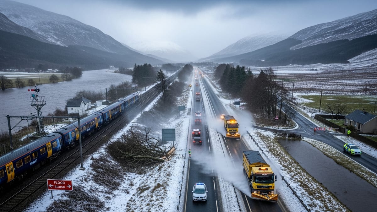
New weather warnings as Storm Boelo impact lingers
The Met Office has issued further weather warnings for strong winds and heavy rain across Scotland following the weekend passage of Storm Boelo, with disruption now extending into Monday 26 October and beyond. National coverage of the storm indicates that northern and western areas bore the brunt of gusts above 80 miles per hour, widespread flooding and power cuts, with travel networks still working to recover.
The wider United Kingdom summary for 2026 shows that Boelo brought high winds and intense rainfall to Scotland, Northern Ireland and northern England from 24 October, triggering amber alerts for high-impact conditions and prompting transport operators to pare back timetables and impose speed restrictions. Although the primary amber warnings expired on Sunday evening, follow-up yellow alerts for wind and rain remain in force over parts of western and central Scotland as crews deal with debris, saturated ground and standing water.
Public information from Police Scotland highlights that an amber warning covering almost all of mainland Scotland, excluding Orkney and Shetland, remained active until 21:00 on Sunday 25 October, with forecasters and transport agencies cautioning that fallen trees, flooding and infrastructure damage would continue to affect journeys into the new week. Travellers are being urged to build in extra time, consider whether their trips are essential and monitor real-time updates before setting out.
Emergency response data from the Scottish Fire and Rescue Service published on Monday 26 October indicates that almost 700 emergency calls were received across the weekend, 163 of them directly weather-related. These incidents included road traffic collisions, reports of fallen trees and debris, damaged power cables and unsafe structures, underlining the scale of disruption on key routes used by both residents and visitors.
Rail passengers face delays, diversions and replacement buses
Rail services across Scotland continue to experience a mix of weather-related disruption and knock-on delays from earlier incidents. According to the live JourneyCheck portal for ScotRail, a signalling fault between Kilmarnock and Kilmaurs is reducing capacity on the route on Monday 26 October, with disruption expected until at least 17:30. Trains on affected lines are subject to delay, cancellation or diversion, and passengers are being advised to check the full journey detail immediately before travel.
Engineering work that had been planned independently of the storm is adding further complexity. ScotRail’s service information confirms that buses are replacing trains between Lochgelly and Glenrothes with Thornton from 05:30 on Monday 26 October until 23:59, with similar arrangements in place on Tuesday 27 October. While these works are not directly caused by the latest weather warning, they reduce flexibility on the network at a time when alternative routes are in high demand.
Long-distance and cross-border services are also affected. National Rail’s disruption page reports that a train fault at Bellshill, north-east of Motherwell, is causing delays to services running between Motherwell or Holytown and Newton on Monday afternoon, leading to cancellations and extended journey times on some Central Belt commuter and regional trains. Passengers heading for Glasgow, Edinburgh and intermediate stops are being advised to use journey planners to confirm whether trains are running and what connections remain viable.
Overnight operations are still adjusting after the worst of Storm Boelo. Travel updates from Caledonian Sleeper show that services between London Euston and Glasgow Central were amended on Sunday 25 and Monday 26 October due to forecast severe weather along the West Coast Main Line. The operator has since reported that the specific disruption notice linked to Storm Boelo has been cleared, but timetables remain altered on some dates and passengers are encouraged to recheck departure and arrival times.
Road flooding, fallen trees and bridge restrictions
Scotland’s trunk roads and local networks are dealing with a range of issues from surface water to downed trees as the latest warning period unfolds. Traffic Scotland’s incident feeds on Monday 26 October show multiple weather-related alerts carried over from the weekend, alongside ongoing roadworks and congestion around major cities. Motorists are being directed to use the agency’s radio broadcasts and digital channels for regional updates throughout the day.
In Edinburgh, local media report that the Gogar underpass on the A8 Glasgow Road was closed to traffic on Monday morning after heavy rain led to significant flooding. The route is an important approach to both Edinburgh Airport and western suburbs, and diversions have been put in place to keep traffic moving while drainage teams work to clear standing water. Forecasters have also highlighted that a further wind warning will apply to the capital from the early hours of Tuesday 27 October, potentially prolonging disruption to commuter routes in and out of the city.
National transport guidance linked to Storm Boelo advises that high-sided vehicles are particularly vulnerable in exposed locations, including bridges and elevated sections of motorway. Earlier storms this season, such as Storm Amy, prompted full closures or restrictions on crossings including the Forth Road Bridge and other key structures, and authorities are again urging drivers to consider alternative routes where strong crosswinds are expected.
The Traffic Scotland advice page for severe weather stresses the importance of checking conditions not only at the point of departure but along the entire route, as incidents can arise quickly from blocked drains, landslips or localised flooding. Travellers heading into rural or upland areas are being asked to carry warm clothing, food and water, as well as to ensure devices are charged in case of delays or the need to contact assistance services.
Ferry and island links hit by strong winds and swell
Ferry services to and from Scotland’s islands remain vulnerable to disruption as strong winds and large waves persist in the wake of Storm Boelo. The service status pages for Caledonian MacBrayne show a range of statuses across the network on Monday, with some routes operating to revised timetables and others marked at amber, indicating partial disruption and a higher likelihood of short-notice changes.
Under the operator’s definitions, an amber status means that sailings may be delayed, diverted or cancelled, and that temporary timetables can be introduced because of poor weather, technical issues or operational constraints. Travellers bound for popular island destinations such as Mull, Skye, Islay or Arran are therefore being encouraged to verify whether their specific sailing is running as booked, and to sign up for route-specific notifications where possible.
Longer-term planning documents for the Clyde and Hebrides network emphasise that weather is one of the leading causes of cancellations, and that priority policies may be activated during sustained disruption. These arrangements can affect which vehicles and passenger types are boarded first when space or time is limited, which is particularly important for residents relying on lifeline services for supplies and appointments.
Visitors with flexible itineraries may find it advisable to build in at least one contingency day on either side of key island crossings during the current unsettled spell. Accommodation providers on the west coast commonly assist guests who become stranded by cancelled sailings, but availability cannot be guaranteed when multiple services are affected at the same time.
What travellers should do now
With fresh weather warnings active and recovery from Storm Boelo still under way, travellers across Scotland are being urged to approach journeys with caution. Publicly available advice from Transport Scotland and rail operators stresses the need to check for live updates rather than relying on printed or previously downloaded timetables, as conditions can change at short notice.
Passengers using ScotRail and other train companies can consult online journey planners shortly before departure to see whether services are cancelled, diverted or subject to speed restrictions that extend journey times. Where replacement buses are provided, operators warn that capacity may be limited and that journey times are often significantly longer than rail, particularly on rural routes affected by fallen trees or single-track sections.
Motorists are encouraged to review both national and local traffic feeds before leaving home, paying particular attention to reports of flooding, fallen trees and strong crosswinds on bridges and exposed roads. Given the saturation of ground in many regions following days of heavy rain, further incidents involving landslips or sudden surface water cannot be ruled out while the latest warnings remain in effect.
For those heading to or from the islands, ferry operators recommend confirming sailing status on the morning of travel and again shortly before check-in. With forecasts indicating that unsettled weather may persist for several days in some western and northern coastal areas, travellers may wish to consider refundable fares, flexible booking options and travel insurance that explicitly covers weather-related disruption.