


More news on this day
Travellers across the West Midlands are being urged to prepare for disruption as a 16-hour yellow weather warning for dense fog brings reduced visibility and the risk of delays on key road, rail and air routes from Monday evening into Tuesday morning.
Get the latest news straight to your inbox!
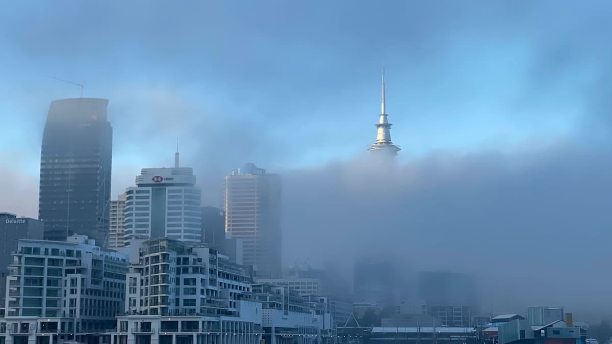
Met Office issues extended yellow fog warning
The Met Office has placed much of central England, including the West Midlands, under a yellow warning for fog running from 6pm on Monday 9 November to 10am on Tuesday 10 November. Publicly available forecast information indicates that fog is expected to redevelop after dusk, becoming dense at times overnight with visibility in some areas falling below 100 metres.
The alert covers the wider West Midlands region, including Herefordshire, Shropshire, Staffordshire, Warwickshire, Worcestershire and the West Midlands conurbation, which takes in Birmingham, Wolverhampton and surrounding towns. The warning also extends into parts of eastern Wales and central and eastern England, forming a broad corridor of poor visibility across the heart of the UK.
This latest warning follows similar alerts over the weekend, when fog patches formed readily on Saturday night and Sunday morning, lingering in places into the late morning. Forecast data shows that a persistent area of high pressure, light winds and clear skies has allowed repeated overnight fog formation, with only weak November sunshine available to disperse it during the day.
National forecast guidance published on Monday indicates that this is expected to be the last widespread night of dense fog before cloud, wind and outbreaks of rain move in from the southwest later in the week, gradually breaking up the stagnant conditions over central Britain.
Road users facing low visibility and longer journeys
The yellow warning advises that journey times are likely to be slower, particularly on major routes such as the M5, M6 and M42, together with A-road corridors that link the West Midlands conurbation with Shropshire, Herefordshire and Warwickshire. Public guidance linked to the warning notes an increased chance of disruption where visibility drops sharply and remains low for several hours.
Motoring organisations routinely recommend that drivers plan for longer travel times when dense fog is forecast, leave extra distance between vehicles and make sure fog lights are in working order before departure. The risk is expected to be greatest late on Monday evening and through the early hours of Tuesday, when cold air and light winds make it easier for thick fog to form in low-lying areas, river valleys and stretches of open countryside.
Regional forecasts show that temperatures in the West Midlands are expected to fall close to freezing overnight, raising the possibility that damp road surfaces could become slippery in places. While no separate ice warning has been issued for the region, travel advice associated with the fog alert highlights that any combination of limited visibility and cold road surfaces can make braking distances more unpredictable.
Commuters heading into Birmingham, Coventry, Wolverhampton and other large centres on Tuesday morning are being encouraged by transport operators and publicly available travel bulletins to check live conditions before setting out, with some local bus and coach services already signalling that journey times may be extended during the morning peak.
Potential knock-on effects for rail and air travel
Alongside the impact on roads, the fog warning notes that there is a chance of delays to bus and train services and possible disruption to flights. In practice, this can range from slower running on open stretches of railway to changes in schedules at regional airports when visibility drops below defined safety thresholds.
Birmingham Airport, which serves the wider West Midlands and central England, has previously experienced minor delays and schedule adjustments during similar fog episodes when runway visibility has been reduced. According to published aviation guidance, dense fog can affect the spacing between arriving and departing aircraft, leading to temporary backlogs even when the runway remains open.
Rail passengers using key intercity and regional routes that cross the warning area, including services linking Birmingham with London, Manchester, Shrewsbury and Hereford, are being advised in public travel updates to check operator channels for the latest information. Low visibility can slow trains on some sections, particularly where there are level crossings or speed restrictions linked to signalling and track conditions.
Coach operators serving long distance routes through the Midlands corridor have also highlighted the potential for extended journey times overnight and on Tuesday morning, especially where fog forms repeatedly in valley stretches and around river crossings.
Weather pattern behind the prolonged fog episode
Meteorological briefings describe the current setup as dominated by a broad area of high pressure sitting close to the UK, bringing light winds, clear skies and stable air. Under these conditions, heat built up at the surface during the day escapes rapidly after sunset, cooling the air near the ground and allowing moisture to condense into fog.
In November, the sun angle is low and daylight hours are short across the West Midlands, which means that any fog formed overnight can be slow to disperse, especially where air pollution and moisture levels are higher. Forecasts from the national weather service suggest that some patches may linger through much of Monday and Tuesday morning in sheltered locations, even as visibility improves elsewhere.
Outlook guidance for the week ahead indicates that, after the current fog episode, a more unsettled pattern is likely to develop. Cloud, strengthening winds and bands of rain are expected to move in from the southwest, reducing the risk of further widespread fog events but introducing a different set of travel challenges, including spray on the roads and gusty crosswinds on exposed routes.
For the West Midlands, regional forecasts point to a shift from fog and light winds early in the week to cooler and more changeable conditions later, with nighttime frosts possible in rural areas once skies clear behind passing weather fronts.
Advice for travellers planning journeys through the region
Travel guidance associated with the yellow fog warning urges anyone with journeys planned between 6pm Monday and 10am Tuesday to build in additional time, consider whether non-essential trips can be rescheduled and stay closely tuned to updated forecasts. Weather warnings are reviewed regularly as new observational data arrives, and the affected area can be adjusted if conditions change.
Drivers are encouraged in public safety campaigns to use dipped headlights rather than full beam in fog, switch on rear fog lights when visibility is severely reduced and switch them off again once conditions improve to avoid dazzling other road users. Keeping windscreens and mirrors clear of condensation, and avoiding sudden braking or acceleration, can also help reduce the risk of collisions when visibility is variable.
For those using public transport, the main rail and bus operators in the West Midlands provide real time updates through their usual customer information channels, while airports publish current flight status information for departures and arrivals. Travellers making early morning connections, including international departures from Birmingham Airport, are being advised by publicly available guidance to check their service status before leaving home.
Forecasts emphasise that while the yellow alert denotes a lower level of impact than more severe warning categories, the combination of darkness, dense fog and busy commuter traffic means conditions across the West Midlands could still be challenging through the late evening and morning rush hour, particularly on untreated minor roads and in rural districts.