


More news on this day
Flights at Hartsfield-Jackson Atlanta International Airport are slowly recovering after a weather-related ground delay, as severe thunderstorm warnings across parts of north Georgia expired and storms shifted out of the Atlanta metro area early Saturday.
Get the latest news straight to your inbox!
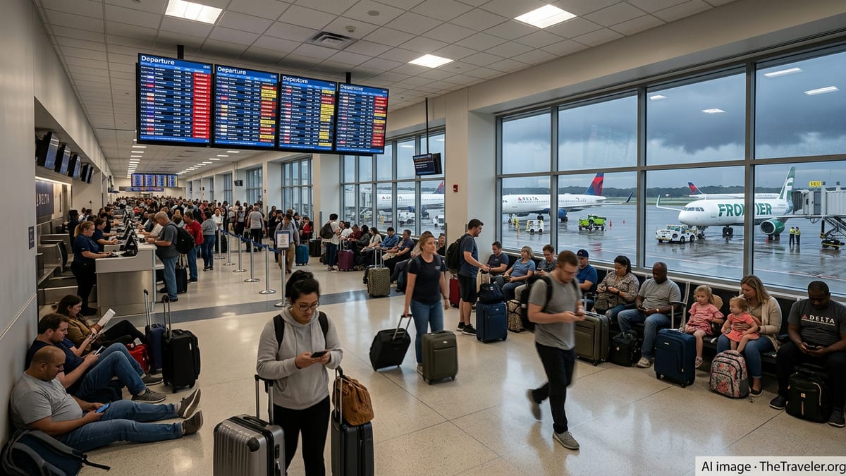
Ground delay at Atlanta eases after earlier disruption
Air traffic management data for Saturday shows Atlanta’s primary airport operating under improving conditions after a period of ground delay linked to thunderstorms in the region. Earlier in the day, arrivals into Hartsfield-Jackson were metered as storm cells moved across north and central Georgia, reducing the rate at which aircraft could safely land and depart.
Ground delay programs are routinely used at major hubs during convective weather to regulate the flow of traffic into constrained airspace. Publicly available Federal Aviation Administration advisories for recent weeks show Atlanta listed among multiple large airports facing thunderstorm related initiatives during active summer patterns, with flights held on the ground at departure points until arrival slots become available.
On Saturday, some individual departures and arrivals into Atlanta continued to show schedule adjustments and minor delays even as overall operations improved, reflecting the time it takes for airlines and air traffic managers to work through earlier backups. Tracking data for select flights in and out of Atlanta indicated scheduled operations with modest or no delay once storms began to clear the immediate area.
Travelers passing through the world’s busiest hub remain advised by airlines and airport communications to monitor flight status closely, particularly during peak afternoon and evening hours when renewed storm development is still possible in the Southeast during midsummer.
Severe thunderstorm warnings expire across north Georgia
The easing of aviation constraints coincides with an improving short term weather picture across north Georgia. Early morning forecast discussions and hazard outlooks from the National Weather Service office serving the Atlanta region indicate that the most intense storms that affected far northern counties have weakened or moved out of the state, allowing earlier severe thunderstorm warnings to expire.
Meteorologists note that the environment over Georgia remains seasonably humid and unstable, keeping the door open for scattered thunderstorms later in the day, especially during the warmest afternoon and early evening hours. However, the broader severe weather threat that prompted warnings overnight and into the early morning has diminished, with any new storms expected to be more isolated and shorter lived.
The transition from organized severe storms to more scattered convection is typical of midsummer patterns in the Southeast. Bursts of heavy rain, lightning and localized gusty winds can still affect outdoor activities and transportation, but the risk of widespread damaging winds or large hail generally declines as the main disturbance moves away from the region.
Residents and visitors in north Georgia are being encouraged through public forecast messaging to remain weather aware, particularly in higher terrain and urban corridors where brief downpours can quickly reduce visibility and pond water on roads even after severe alerts have ended.
What a ground delay means for passengers in Atlanta
Ground delay programs differ from ground stops in that flights are not completely halted, but are instead assigned controlled departure times from their origin airports in order to manage congestion at a busy hub. Research on delay propagation in the national airspace system describes these initiatives as a key tool for balancing airport capacity with demand during periods of adverse weather, construction or other constraints.
For passengers, a ground delay connected to storms around Atlanta can show up as a late departure from another city even when local conditions there appear calm. Departure times may be pushed back in increments as updated arrival rate forecasts are issued, leading to rolling schedule changes that can add up to significant waits over the course of a day with unsettled weather.
Operational planning documents and airport contingency plans for Hartsfield-Jackson outline how aircraft already on the ground in Atlanta may be repositioned to hardstand areas or held at gates to keep taxiways clear when arrival surges meet limited available parking. During prolonged disruptions, airlines may prioritize flights by factors such as connecting passenger volume and crew duty limits as they rebuild schedules.
Airport planning reports also highlight how ongoing construction and maintenance work can reduce runway or taxiway capacity at certain times of year, intensifying the impact of storms. When lightning or heavy rainfall overlaps with temporary infrastructure constraints, delays can lengthen as safety procedures limit ramp activity and runway configurations.
Stormy pattern underscores summer travel risks
The latest thunderstorms affecting Atlanta come amid a broader pattern of active summer weather across the eastern United States, with repeated rounds of convection disrupting air travel at multiple major hubs in recent weeks. Public traffic management advisories have frequently cited thunderstorms as a primary factor behind ground delays and arrival metering at airports from the Southeast to the Northeast.
Weather briefings produced by the National Weather Service office serving Atlanta have highlighted an ongoing risk of strong to occasionally severe storms on several recent days, particularly in the afternoon and evening when daytime heating combines with abundant Gulf moisture. These briefings describe potential impacts ranging from frequent lightning and gusty winds to localized flooding in low lying or urban areas.
Airlines and aviation planners often characterize Atlanta as especially sensitive to convective weather because of its role as a central connecting hub and its location in a region prone to frequent summer thunderstorms. When storms line up along key arrival corridors into the airport, the effective capacity of the hub can drop sharply, with ripple effects that extend across domestic and international networks.
Recent academic work examining ground delay strategies and airport capacity forecasting has emphasized the growing use of data driven and machine learning approaches to anticipate how storms will interact with runways, taxiways and airspace flows. These tools are designed to help fine tune delay programs in real time, potentially reducing the overall disruption experienced by travelers during convective weather events.
What travelers should expect through the rest of the weekend
With the most recent round of severe thunderstorm warnings in north Georgia now expired, near term aviation forecasts point toward a gradual normalization of operations at Atlanta’s main airport, barring new storm development directly over key arrival and departure routes. Travelers with flights later on Saturday and into Sunday are likely to encounter a more typical pattern of summertime delays, centered on isolated storms and peak demand periods.
Public planning information suggests that airlines will continue working through residual delays from the earlier ground delay window, particularly for aircraft and crews that were out of position. Connection banks scheduled around the height of the disruption may see gate changes and tighter transfer times as carriers work to reconnect passengers to their destinations.
Travel advisories published in connection with recent thunderstorm outbreaks along the East Coast have encouraged passengers to build extra time into their itineraries, favor early day departures when possible and stay informed through airline communication channels. Similar guidance remains relevant for those traveling through Atlanta while the broader stormy pattern persists across the Southeast.
As the weekend progresses, the balance between improving weather over north Georgia and the potential for additional scattered storms will continue to shape airport performance. For the moment, the expiration of severe warnings and the easing of the ground delay program represent a welcome shift toward more stable conditions at one of the nation’s key air travel gateways.