
More news on this day
Kochi’s city map is undergoing a quiet but striking transformation as new metro links, electric ferry routes and smart-city corridors redraw how residents and visitors navigate the coastal metropolis.
Get the latest news straight to your inbox!
From Historic Port to Multimodal Hub
Once read largely as a strip of mainland straddling the backwaters and the Arabian Sea, Kochi now appears on transport maps as a dense mesh of rail, road and water routes. Publicly available information shows that the city’s expansion has pushed beyond the traditional mainland core of Ernakulam into satellite IT parks, residential suburbs and island communities, all of which are being reconnected through coordinated mobility planning.
Transport studies describe Kochi as one of India’s earliest adopters of an integrated public transit model combining metro rail, buses and ferries. Recent data on urban development programs indicate that this approach is central to the city’s wider smart-city ambitions, where land-use planning and climate-conscious transport investment are intended to move commuters away from private vehicles and toward shared systems.
On contemporary city maps, this shift is visible in the prominence of transit nodes such as Vyttila Mobility Hub and the Aluva and Petta metro terminals, which act as gateways between long-distance services and local networks. These hubs are replacing older, fragmented landmarks like standalone bus stands as the reference points from which residents and visitors orient their journeys across Kochi.
The result is that the cartography of Kochi is less defined by municipal boundaries and more by corridors of movement that arc between heritage quarters, commercial districts and new residential zones. For travelers, understanding the city increasingly begins with understanding these lines and interchanges.
Kochi Metro Rail Reshapes the Urban Spine
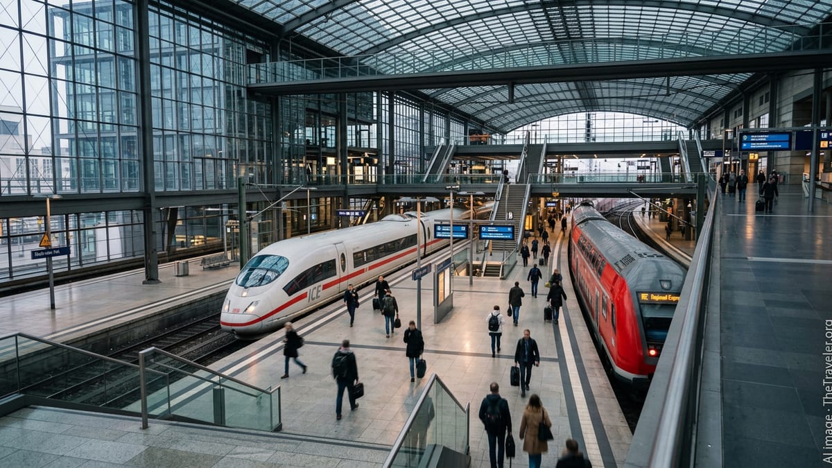
The Kochi Metro has become the dominant line on most modern city maps, tracing a north–south axis that ties together the airport corridor, older city streets and emerging business districts. Guide material published in June 2026 highlights a network of 25 operational stations on a single main line, with an extension toward Infopark at Kakkanad targeted for completion around 2026.
The metro’s alignment effectively redraws how the city is perceived in scale and time. Neighborhoods that once seemed distant on paper, such as Aluva and Pettah, now sit less than an hour apart by rail. Planning documents describe the system as designed to link with bus interchanges and ferry terminals, creating a framework where a single smart card can be used across multiple modes of travel.
For visitors, the metro map doubles as a simplified city map, with stations marking off key commercial and cultural stops. Locations such as M.G. Road, Maharaja’s College, Ernakulam South railway station and the stadium precinct appear as anchor points along the line, making it easier for travelers to overlay their sightseeing plans on top of the rail grid.
The forthcoming extension to Kakkanad, where technology campuses and the SmartCity Kochi IT zone are concentrated, is expected to thicken this spine into a T-shaped network. Urban planners note that this will place office parks and residential enclaves more clearly within the mental map of central Kochi rather than as peripheral add-ons.
Water Metro Puts Island Clusters Back on the Map
The launch of the Kochi Water Metro has reintroduced the backwaters as a primary feature on the city’s map rather than a scenic backdrop. Electric ferries now trace designated corridors between the mainland and island communities, visually connecting areas that once appeared as isolated fragments in the estuary.
Reports in early 2026 indicate that a key new link is planned between the High Court terminal and the Kadamakkudy island cluster, with operations projected to start around April. Route descriptions suggest that this corridor is intended to cut travel times dramatically while opening an ecotourism path to villages known for their wetlands and sunset views, reinforcing Kadamakkudy as a named destination on updated tourist maps.
National policy discussions have also begun referencing Kochi’s Water Metro as a model for other Indian coastal and river cities. Draft proposals for a wider water-metro framework present the city’s network as proof that inland waterways can serve as regular public transit rather than remain limited to sightseeing cruises, a recognition that further solidifies the backwaters’ place in the cartographic story of Kochi.
For mapmakers and app developers, the inclusion of piers, terminals and on-water routes means that the apparent distance between Fort Kochi, Mattancherry, Vypeen and mainland Ernakulam is shrinking. On navigation screens, blue channels now appear as functional paths threaded with icons of boats and terminals, guiding residents and tourists toward ferry-based commutes.
Heritage Quarters and New Cultural Axes
While transport corridors dominate the latest visualizations of Kochi, the historic quarters of Fort Kochi and Mattancherry remain critical anchors on the city map. Tourism-focused planning documents highlight these districts as the western edge of the metropolitan grid, where colonial-era streets, spice markets and waterfront promenades align with key jetty points and bus connections.
Recent coverage of state budget allocations points to new cultural and entertainment projects planned for the wider metropolitan region, including an international film city and upgraded creative infrastructure. Such projects are expected to generate additional mapping of film studios, performance venues and exhibition spaces that will draw lines of movement beyond the established tourist triangle of Fort Kochi, Mattancherry and the city center.
The combination of heritage sites and new cultural investments is gradually producing a layered map where centuries-old churches, synagogues and palaces sit alongside multiplexes, convention centers and creative hubs. For travelers, this means navigation tools are increasingly likely to suggest mixed itineraries that cross historic and contemporary landmarks in a single day using metro, ferries and feeder buses.
As these layers accumulate, the perception of Kochi shifts from that of a single old port town to a polycentric urban region where culture, commerce and daily life are distributed across multiple nodes rather than concentrated in a single downtown core.
Smart-City Corridors and the Future Kochi Map
Kochi’s participation in national smart-city and low-carbon mobility programs is also influencing how the city is drawn and marketed on planning maps. Documents produced under these initiatives describe priority corridors for walking, cycling and public transport that run parallel to the metro and water networks, often focusing on traditionally congested arteries.
Recent surveys of mobility projects in Kochi show efforts to integrate dedicated feeder bus services with metro stations, digital ticketing platforms and real-time information systems. These elements do not always appear on static printed tourist maps, but they are increasingly central to the digital maps that residents use daily on mobile devices.
Forward-looking transport and budget reports point to proposed metro extensions, upgraded roads and additional ferry routes that could be realized over the next decade. If implemented, these projects would further thicken the lines that bind Kochi’s islands, suburbs and industrial pockets into a single navigable urban field.
For travelers planning trips in 2026 and beyond, the evolving map of Kochi suggests a city best understood not as a fixed layout of neighborhoods, but as a network of intersecting transit and cultural corridors. Reading the city now involves tracing these lines across water and land, revealing a metropolitan area in the midst of a significant cartographic reimagining.