
More news on this day
As Tehran and neighboring Karaj grow into a single urban corridor, a new generation of maps, metro diagrams, and digital tools is redefining how residents and visitors navigate the two cities.
Get the latest news straight to your inbox!
A Corridor Turning Into a Single Urban Landscape
Tehran and Karaj, long treated as separate cities in guidebooks, are increasingly functioning as parts of one extended metropolitan landscape. Publicly available planning documents describe the Tehran–Karaj corridor as one of Iran’s busiest transport axes, carrying daily commuter traffic as well as regional road and rail links. Updated city and regional maps now routinely frame both destinations within the same panel, underscoring how closely connected they have become.
Tehran’s north–south mountain backdrop and east–west sprawl shape how any city map is read. The capital has spread along the base of the Alborz range, while Karaj lies to the west on the same plain. Road atlases and tourist sheets typically use this geography as a reference line, placing the mountains at the top of the map, the Tehran–Karaj freeway and suburban rail lower down, and the urban fabric of the two cities filling the space between. For visitors, understanding this simple north–south orientation can make even a dense street grid feel more legible.
Recent printed maps produced for travelers highlight how suburban growth has filled in once‑separate spaces between the two cities. Inset panels now show industrial estates, satellite towns and new residential quarters along the freeway and rail line that were previously blank or lightly sketched. That cartographic shift reflects years of construction, but it also changes the mental map for visitors, who increasingly see Tehran and Karaj as adjoining districts of a single urban region rather than distinct, distant stops.
For travel planners, the corridor perspective matters. It emphasizes that airports, intercity bus stations, and long‑distance rail services serving Tehran can also be practical gateways for Karaj, and that metro, suburban rail and expressways are part of one integrated diagram. On current city maps, that is more visible than ever.
Tehran Metro Expansion Redraws the Capital’s Map
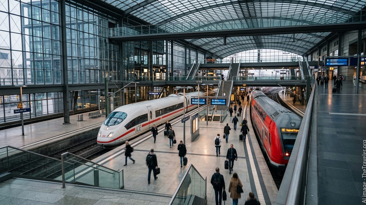
The most prominent feature on any recent Tehran city map is the metro network. According to updated network summaries, the system today spans more than 300 kilometers of track across seven main lines, with additional corridors under construction and extensions in various stages of completion. The dense tangle of colored metro routes now rivals the street grid as the primary reference layer on many tourist and commuter maps.
New diagrams show not only central lines serving downtown Tehran but also cross‑city routes that run deep into residential districts. Cartographers have begun to adapt to this, enlarging the core of the city on schematic plans so that station names can be read more easily and interchange hubs can be clearly marked. For visitors, this makes planning multi‑leg journeys, such as from museums in central Tehran to bus terminals on the periphery, significantly simpler than it was a decade ago.
Future extensions are also starting to appear as dotted lines on unofficial diagrams and draft planning maps. Publicly available information on long‑term transport strategies refers to ambitions to grow the metro network toward roughly 500 kilometers of track by 2040, with several new lines and tangential routes designed to relieve congestion in outer districts. Even before projects are finished, the way they are depicted influences travel behavior, encouraging people to see emerging hubs and development zones as part of their navigable city.
For map‑makers, the challenge is to combine geographic accuracy with clarity. In practice, many Tehran city maps now feature a more schematic representation of the metro, with straightened lines and shifted station positions for legibility, while retaining a realistic street and neighborhood base. The result is a hybrid style that aims to give both visitors and residents a clear sense of where they are, and how the metro can get them to the next stop on their itinerary.
Karaj’s Growing Role on the Regional Map
Across the provincial border in Alborz, Karaj has long appeared on regional maps as a satellite of Tehran, but the picture is gradually changing. Demographic data and planning reports describe Karaj as one of Iran’s largest cities in its own right, with a substantial industrial base and residential neighborhoods that have expanded well beyond the historic core. Current tourist and transport maps now allocate more space to the Karaj street grid, labeling main boulevards, riverside parks and key public facilities that were previously indicated with only a symbol or a name.
Rail connections are a central part of that evolving cartography. The suburban rail corridor widely known as Tehran Metro Line 5 doubles as Karaj’s primary rapid transit spine, with stations in the city treated as part of both the Tehran metro and the emerging Karaj metro network. Newer references to Karaj’s transport plans describe additional north–south urban lines in development, and some city maps already reserve space for future stations and routes.
On the ground, this means that the Karaj panels in printed atlases and digital mapping apps now show a more complex set of layers, including rail alignments, major highways, and local bus terminals. For travelers, it becomes easier to plan, for example, a journey from a Tehran hotel to a Karaj industrial estate or university campus, visualizing the transfer from metro to taxi or bus in a single, continuous frame.
Even leisure‑oriented maps are adapting. Guides to the scenic Karaj–Chalus road and nearby mountain resorts increasingly position Karaj not simply as a gateway from Tehran, but as a base with its own accommodation clusters and urban services. That subtle shift in representation supports the city’s aspirations to attract visitors who may previously have treated it as only a transit stop.
Digital Navigation and Multilingual Mapping for Visitors
While printed maps remain common in hotels, bookshops and transport hubs, digital navigation tools are now the primary reference for many travelers in Tehran and Karaj. Major international mapping platforms, as well as local navigation apps, display detailed street layouts, live traffic information on the main freeways, and transit overlays for metro and rail lines. For visitors, the ability to switch between Persian and Latin scripts on many services can significantly ease orientation.
Publicly available information indicates that official transport agencies and private operators have been updating their base data sets to reflect new stations, adjusted bus routes and one‑way street patterns. The lag between an infrastructure opening and its full appearance in all navigation apps can still be noticeable, but the overall effect is a steadily more accurate digital city map. For example, recently completed metro infill stations and incremental extensions on the edge of Tehran now appear in most mainstream routing engines, allowing automatic calculation of multi‑modal journeys that combine walking, metro and road transport.
For non‑Persian‑speaking visitors, one challenge remains the inconsistency of transliteration. Street names and station labels may appear with different spellings across platforms and even within the same app. Newer printed and digital maps are increasingly adopting standardized romanization schemes, pairing Persian script with a single Latin rendering to help bridge that gap. Some hotel and tourism guides now reproduce those standardized spellings directly on their city inserts to reduce confusion.
Travel planners advise that visitors who rely on smartphones in Tehran and Karaj should download offline map sections, given the potential for connectivity gaps and roaming limitations. In practice, combining an offline vector map with locally produced paper diagrams, particularly for the metro, offers a resilient way to navigate both cities, especially during peak periods when stations and roads become crowded.
Reading the Tehran–Karaj Map as a Traveler
For travelers preparing an itinerary, the contemporary Tehran and Karaj city map offers several distinct layers to interpret. At the broadest scale, regional maps show how the Tehran–Karaj freeway, suburban rail line and river valleys stitch the two urban areas together. Zooming in, city‑level plans highlight neighborhood grids, mountain foothills, and green axes such as riverside parks, helping visitors identify districts that may suit different types of stays, from historic quarters to newer residential zones.
Transport diagrams then provide another layer of understanding. The metro and suburban rail network effectively functions as the skeleton of the Greater Tehran area, with interchange nodes acting as anchors around which commercial districts, bus terminals and shopping centers cluster. For a first‑time visitor, picking accommodation close to one of these nodes, as indicated on current maps, can significantly cut down on cross‑city travel times.
Finally, thematic maps aimed at tourists continue to evolve. New editions feature curated points of interest in both Tehran and Karaj, from museums and bazaars in the capital to parks, dams and viewpoints in the Alborz foothills. Insets devoted to airport access, intercity bus terminals and railway stations help travelers understand not only where attractions lie on the map, but how each is connected to national and regional transport networks. As these mapping tools grow more detailed and interconnected, the picture of Tehran and Karaj that emerges is one of a single, complex urban system that is easier to read than ever before.