


More news on this day
A thick blanket of fog forecast over London early on Sunday has prompted a yellow weather warning for much of England, raising the prospect of slower road journeys and disruption to rail and air travel during the morning rush.
Get the latest news straight to your inbox!
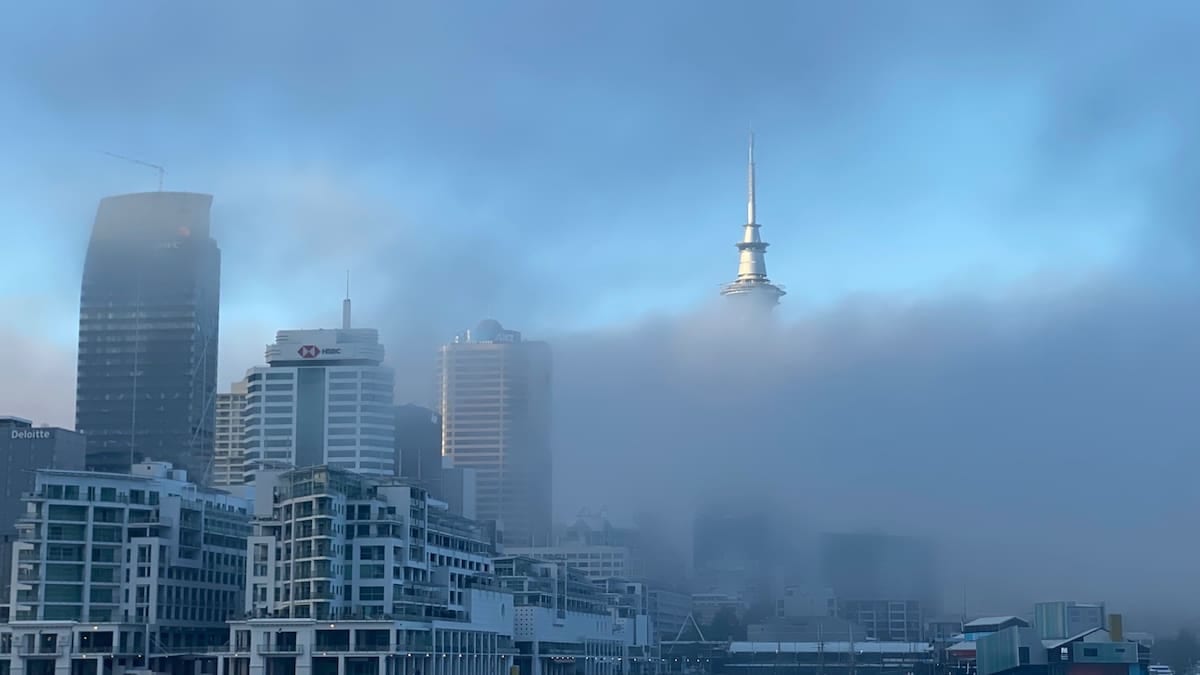
Yellow fog warning covers London and large swathes of England
Publicly available information from the Met Office shows a yellow warning for fog in force across London and South East England on Sunday 1 November, with similar alerts extending into the East Midlands, East of England, South West, North West, West Midlands, Wales and Yorkshire and the Humber. The alert window runs through the early hours until 10:00, spanning the period when many commuters, airport passengers and coach travellers are setting out.
The warning text indicates that fog has developed widely overnight and is expected to persist into Sunday morning before gradually lifting. Visibility is described as varying significantly from place to place, with some dense patches lowering it to below 100 metres. That level of restriction can quickly snarl traffic on major approach roads into the capital and complicate operations at London’s busiest transport hubs.
Recent Met Office forecast discussions highlight a shift to calmer, drier conditions under high pressure for the start of November, a pattern that favours the development of overnight mist and fog where skies are clear and winds are light. Guidance issued in late October already flagged London as particularly prone to dense fog during early morning periods at the end of the month and into the first days of November.
Data collated by specialist monitoring site FloodRadar, which archives official UK weather alerts, confirms that the fog warning was issued late on Saturday evening and categorised as yellow, the lowest tier in the national system. Yellow alerts are used to signal that weather impacts are possible and that travellers may need to allow more time and check conditions before setting out.
Road users urged to expect slower journeys and poor visibility
The primary concern for early Sunday travel in and around London is road safety. The official warning material lists slower journey times, with possible delays to bus services, as a likely impact. On motorways and major routes such as the M25 orbital, M1, M4 and A2 corridors, sudden transitions between relatively clear conditions and thick fog banks can lead to rapid braking and increased collision risk, particularly where drivers fail to adjust speed and following distances.
Transport-focused coverage from London-based media notes that visibility in the most affected spots may drop below 100 metres, a threshold at which front and rear fog lights become essential and normal headlight use can create additional glare. In built-up areas, glare from streetlighting and vehicle headlights can further reduce contrast, making it harder for drivers, cyclists and pedestrians to judge distance and speed.
Guidance reproduced from official safety leaflets recommends that drivers switch on dipped headlights and, where fitted, fog lights when visibility falls below 100 metres, while avoiding use of full beam because it reflects back from the fog. Motorists are also encouraged to keep windshields clear of condensation, use demisters early in the journey and maintain larger gaps between vehicles to compensate for reduced reaction times.
With temperatures in London hovering close to seasonal averages and no widespread sub-zero readings forecast for the city itself, the risk of freezing fog on the main routes is currently assessed as low. However, separate material from national weather agencies highlights that in more rural or sheltered spots, especially north and west of the capital, surface temperatures can briefly dip near freezing, allowing moisture in fog to deposit on bridges and untreated roads and create unexpectedly slippery patches.
Potential knock-on effects for rail and air travel
The Met Office impact matrix for the current yellow warning flags “delays to bus and train services” as possible outcomes, with “a chance of delays or cancellations to flights” during the morning period. While most mainline rail services can operate in fog, speed restrictions and longer braking distances at signals can lengthen journey times into central London termini such as Waterloo, Liverpool Street, London Bridge, King’s Cross and Paddington.
Published advice from rail and urban transport operators typically encourages passengers to check live departure boards before leaving home during fog events, as dense patches can slow approaches to key junctions and cause minor congestion across the network. Services on exposed commuter lines into the Home Counties and along the Thames estuary can be particularly affected when visibility drops sharply around junctions, level crossings or river crossings.
Air travel is even more sensitive to visibility thresholds, which are measured using runway visual range equipment rather than estimates from nearby roads. The yellow warning notes a risk of flight delays or cancellations, and media reports on previous dense fog episodes in London show that even a relatively brief deterioration in conditions can cause aircraft to divert or hold, creating knock-on disruption for several hours. Heathrow and London City, both operating in tightly constrained airspace, are especially prone to schedule changes when visibility protocols are triggered.
As of early Sunday, airport operational updates indicate that major London airports are operating but monitoring conditions closely. Travellers with early flights are being advised through airline channels to arrive as normal but to keep an eye on text and app notifications for gate changes, revised departure times or rebooking options should fog banks drift across runways during peak departure waves.
Why fog risk is elevated at this time of year
Seasonal analysis published by the Met Office explains that autumn is one of the peak periods for radiation fog in the UK. After sunset, longer nights allow the ground to cool rapidly under clear skies. The air in contact with the surface also cools, and if it contains enough moisture, its temperature can drop to the dew point, causing water vapour to condense into millions of tiny droplets suspended near the surface. Light winds prevent this layer from mixing away, allowing thick, shallow fog banks to develop before dawn.
London’s dense urban landscape adds extra complexity. Heat stored in buildings, paved surfaces and the Underground network can keep central districts slightly warmer overnight, occasionally limiting fog formation in the core while allowing it to thicken on the city’s fringes and surrounding countryside. Archived observational reports from recent autumn mornings show that outlying areas such as outer South London, parts of Essex, Hertfordshire, Kent and Surrey can wake up under thick fog while the very centre of the capital sees only mist or low cloud.
In the current pattern, high pressure centred close to the UK is leading to lighter winds and fewer frontal systems, conditions that favour repeated episodes of overnight fog. A Met Office ten day trend issued in late October highlighted the likelihood that fog could become a “key feature” for parts of England and Wales into early November, with some patches slow to clear even into the late morning.
Once the early November sun gains strength, fog over London is expected to thin gradually, often first breaking into low cloud before dispersing completely. Forecast material for Sunday suggests that most locations should see visibility improve by late morning, even if some sheltered valleys and river corridors hold onto murky conditions a little longer.
Practical steps for travellers as conditions evolve
Travel and weather agencies stress the importance of checking live information on the morning of travel, as fog can change quickly over short distances. For those heading to airports such as Heathrow, Gatwick, Luton or Stansted, monitoring airline apps or text alerts before leaving home can provide early notice of any boarding delays or security queue adjustments created by shifting visibility limits.
Coach and long distance bus passengers are also being encouraged through operator bulletins to allow additional journey time to reach London’s Victoria Coach Station and other pick up points. Even short delays at motorway speeds can accumulate across regional routes feeding into the capital, potentially causing some early services to arrive later than timetabled.
Within Greater London, transport providers typically respond to dense fog by adjusting headways, revising speeds on certain sections and using station announcements and platform staff to manage crowding where minor delays develop. For travellers, simple measures such as leaving slightly earlier, building extra interchange time into itineraries and considering alternative routes can help reduce the stress of last minute changes.
Weather monitoring services note that the current fog warning is time limited and expected to expire by late morning. However, with high pressure likely to remain in place over the coming days, further episodes of early morning mist and fog cannot be ruled out. Travellers planning dawn departures from London in the week ahead may benefit from keeping an eye on updated forecasts, particularly on nights that are clear, calm and cool.