


More news on this day
A five-hour Met Office yellow warning for fog is in force across 36 areas of the UK, with dense patches of freezing fog expected to bring early morning disruption to key road, rail and air corridors.
Get the latest news straight to your inbox!
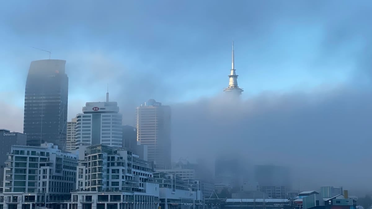
Five-hour warning targets busy commuter window
According to publicly available Met Office information and travel coverage, the current yellow fog warning is scheduled over a concentrated five-hour period during the early morning, overlapping with one of the busiest commuting windows of the week. Within that timeframe, visibility in some locations is expected to fall below 100 metres, particularly in low-lying areas and along river valleys where cold, still air allows fog to thicken rapidly.
Reports indicate that car, bus and rail journeys across the warning area may take longer than usual, as transport operators adjust speeds and timetables in response to reduced visibility. On the roads, rolling banks of fog can cause abrupt changes in sightlines, prompting drivers to slow sharply and increasing the risk of congestion on major approaches into towns and cities.
Although the official alert is limited to five hours, forecasters and recent Met Office outlooks note that where fog forms under clear skies and light winds, it can persist well beyond the warning window. In those pockets, visibility may only improve gradually through the late morning as the sun gains strength, prolonging localised disruption for late commuters and early leisure travellers.
36 areas from East Midlands to Welsh borders affected
Published summaries of the Met Office warning show a broad band of 36 local authority areas under the alert, stretching from the East Midlands through eastern England and into the Welsh borders and northern England. In the East Midlands, the warning covers Derby, Derbyshire, Leicester, Leicestershire, Lincolnshire, Northamptonshire, Nottingham, Nottinghamshire and Rutland, bringing much of the M1 corridor and connecting A-roads into focus.
Further south and east, Bedford, Central Bedfordshire, Cambridgeshire, Hertfordshire, Norfolk and the city of Peterborough fall within the fog zone. These areas include sections of strategic cross-country routes such as the A1, A14 and A47, where patches of dense fog can quickly slow traffic and complicate overtaking on single-carriageway stretches.
The alert also extends into parts of the South East and north-west England. Buckinghamshire and Milton Keynes are named, alongside Cheshire East and Cheshire West and Chester. On the England-Wales border, Denbighshire, Flintshire, Powys and Wrexham are included, reflecting the potential for thick fog to form in sheltered valleys and along busy trunk routes including parts of the A55.
Across northern and central England, the warning takes in Shropshire, Staffordshire, Stoke-on-Trent, Telford and Wrekin, the East Riding of Yorkshire, Kingston upon Hull, North East Lincolnshire, North Lincolnshire, North Yorkshire, South Yorkshire, West Yorkshire and the city of York. This wide footprint includes heavily used sections of the M1, M6 and other north–south and east–west links that are important for both commuter and freight movements.
What a yellow fog warning means for travellers
Documents describing the Met Office National Severe Weather Warning Service explain that yellow warnings signal the potential for low to moderate impacts, rather than widespread shutdowns. For fog, the emphasis is on reduced visibility leading to slower journeys, localised delays and a higher likelihood of minor incidents, particularly where drivers or transport operators encounter sudden changes in conditions.
Publicly available guidance linked to yellow alerts typically advises road users to allow extra time, moderate their speed, and increase following distances when driving through fog. Drivers are also urged in that guidance to use dipped headlights rather than full beam, which can reflect off water droplets and further reduce visibility, and to rely on fog lights only when visibility is severely restricted.
For rail passengers, travel reports note that dense fog can prompt signalling and speed restrictions on some routes, resulting in extended journey times even when services continue to operate close to their normal schedules. On the aviation side, low cloud and fog can restrict take-off and landing operations, occasionally leading to delayed departures, diversions or early-morning cancellations where visibility drops below safety thresholds on approach paths and runways.
Advisory information compiled from previous fog events highlights that ferry services may also face disruption if visibility is poor in estuaries or coastal approaches. However, current coverage around the present warning places most emphasis on inland routes and airports serving the affected band of central and northern England and the Welsh borders.
Recent storms set the stage for fog-prone conditions
The new fog alert follows several days of unsettled weather across the UK associated with recent named storms, including Austen and Boelo. Met Office outlooks and explainer articles describe how those systems delivered bands of heavy rain, high river levels and strong winds, particularly across parts of western and northern Britain, before conditions began to calm.
As those low-pressure systems have moved away, Met Office analysis indicates that high pressure is building over or near the UK, bringing lighter winds and clearer overnight skies to many central and eastern areas. With ground surfaces still damp from earlier rainfall and cool air in place, that pattern creates ideal conditions for radiation fog to form during the hours of darkness.
Blog material and week-ahead forecasts from the Met Office in recent days have flagged a shift from storm-driven hazards to more persistent mist and fog, especially in central and eastern England. These outlooks point to the possibility that early morning fog episodes could become a recurring feature into the coming week, even on otherwise calm and dry days, meaning travellers may need to check for further short-notice warnings.
While the current alert focuses on visibility rather than wind or rain, the preceding spell of severe weather is still influencing travel. In areas where roadsides remain wet and temperatures dip close to freezing, patches of freezing fog can develop, combining very poor visibility with the potential for icy stretches on untreated surfaces.
Practical steps for passengers and drivers this morning
Travel bulletins and safety guides responding to the current warning encourage anyone setting out early to plan for slower progress and to check the latest information before leaving home. Motorists are advised in those materials to review their route for higher-risk segments such as river valleys, open fields and elevated sections of motorway, where fog banks tend to form or linger.
Publicly available advice from motoring and safety organisations also recommends ensuring windscreens, mirrors and lights are clean before departure, using ventilation or air conditioning to reduce internal condensation, and avoiding reliance on rear lights of the vehicle ahead as a guide in thick fog, which can encourage unsafe tailgating. On high-speed roads within the warning area, variable message signs may be used by operators to highlight fog hazards and prompt lower speeds.
Rail and coach passengers travelling through the 36 affected areas are urged in published travel information to allow extra time for transfers and connections, particularly during the morning peak when minor delays can have a cascading effect. Keeping tickets, identification and any necessary documentation accessible can help smooth last-minute platform or gate changes if services are adjusted.
For air travel, recent coverage of similar fog events stresses the importance of monitoring airline apps, text alerts and airport departure boards throughout the morning, as visibility conditions can change quickly. Even when a yellow warning is assessed as low to moderate impact overall, early departures and inbound flights into regional hubs near the warning zone can be among the first to experience disruption if fog thickens unexpectedly along approach routes.