


More news on this day
North and central Georgia are bracing for another round of severe thunderstorms, with the National Weather Service highlighting a risk of damaging winds and warning that travelers should expect delays at Hartsfield-Jackson Atlanta International Airport.
Get the latest news straight to your inbox!
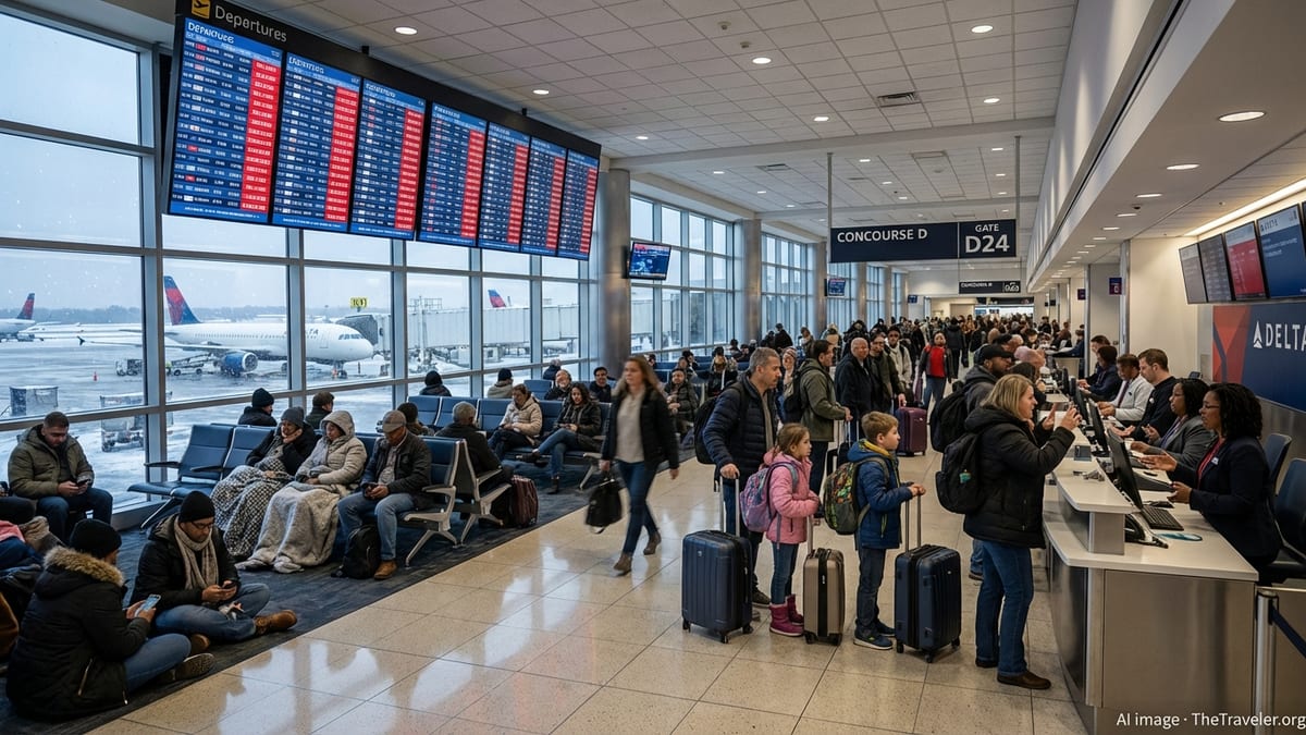
Storm system targets north and central Georgia
Forecast discussions and outlooks issued late Sunday and early Monday indicate that a moist, unstable air mass over Georgia is combining with an approaching disturbance to produce widespread thunderstorms across the northern half of the state. The National Weather Service highlights north and central Georgia, including the Atlanta metro, as areas where storms are likely to become strong or severe at times.
Publicly available outlooks point to damaging straight-line winds as the primary concern, along with heavy rain, frequent lightning and pockets of small hail. The risk is expected to evolve through the day as daytime heating intensifies storms and outflow boundaries help organize clusters of thunderstorms moving across the region.
Short-term guidance suggests several waves of storms rather than a single organized line, raising the possibility that some communities could see multiple rounds of downpours and gusty winds. While tornado potential currently appears low, forecasters emphasize that even non-rotating storms may produce wind gusts strong enough to down tree limbs and power lines.
The timing of the strongest activity is projected from the afternoon into the evening, aligning with both the road and air travel rush. That overlap raises the potential for a disruptive period for commuters on interstates around Atlanta and for passengers connecting through the nation’s busiest airport.
Damaging wind threat and local impacts
The severe weather setup over Georgia favors damaging straight-line winds as the dominant hazard rather than large hail or tornadoes. Thunderstorms forming in a hot, humid environment can quickly produce powerful downdrafts as rain-cooled air rushes toward the ground and spreads out, creating intense wind gusts at the surface.
Reports from recent storm events in the region show that similar patterns have led to scattered tree damage, power outages and blocked roadways across multiple counties. Emergency planning documents for Georgia note that severe thunderstorms in this part of the state regularly generate wind damage comparable in spots to weaker tornadoes, particularly along organized lines of storms that sweep through during the late afternoon and evening.
In the current setup, communities stretching from the Alabama border across the Atlanta metro and into central Georgia are at risk for downed limbs, isolated structural damage and localized power interruptions. Residents are being urged through local media and public safety messaging to secure outdoor items that could become projectiles in strong winds and to remain weather aware through the most active period.
Heavy, repeated downpours could also trigger brief urban and small-stream flooding, especially where storm cells train over the same areas. Low-lying roadways, underpasses and poor-drainage spots around metro Atlanta are particularly vulnerable to ponding water during intense rainfall.
Airport delays likely at Atlanta’s main hub
The same thunderstorms threatening damaging winds across north and central Georgia pose a significant challenge for air traffic operations at Hartsfield-Jackson Atlanta International Airport. According to published flight information and Federal Aviation Administration advisories, storms in recent days have already prompted ground stops and ground delay programs in Atlanta as lightning and low clouds disrupted normal traffic flow.
Updated coverage from local and national outlets on Sunday evening reported average departure delays near 30 minutes at Atlanta as thunderstorms moved across the area, with some flights experiencing longer waits during the most active periods. With another day of storms forecast, operational plans point to the likelihood of additional flow restrictions whenever thunderstorm clusters move close to departure and arrival corridors.
Thunderstorms can trigger a cascade of impacts on air travel, from extended taxi times and reroutes around convective cells to temporary suspensions of ramp operations when lightning is detected in the vicinity. These steps are designed to protect passengers and ground crews but often lead to backups that ripple across an airline’s network, especially at a major connecting hub such as Atlanta.
Travelers connecting through Hartsfield-Jackson are being advised by airlines and travel platforms to monitor their flight status frequently, build extra time into itineraries and be prepared for gate changes or rolling delays as the weather pattern evolves through the day and into the evening.
Travelers urged to plan for disruption on the ground and in the air
With storms poised to affect both surface and air transportation, transportation agencies and travel services are encouraging a cautious approach for anyone moving through north and central Georgia. Motorists may encounter reduced visibility, standing water on roadways and sudden wind gusts that make driving difficult, particularly on elevated sections of interstates and bridges around Atlanta.
Travel guidance shared through media outlets and transportation briefings recommends allowing extra time for commutes, avoiding flooded roads and paying close attention to rapidly changing conditions. Drivers are urged to slow down during heavy downpours, increase following distance and be alert for debris such as fallen branches or downed power lines after storms pass.
For rail and bus systems in the Atlanta area, heavy rain and lightning can also disrupt schedules, especially when localized flooding or power interruptions occur along key corridors. Passengers using regional transit connections may see delays or temporary service adjustments as agencies respond to weather-related issues.
Given the potential for back-to-back rounds of storms, travel experts note that conditions may improve between thunderstorm clusters only to deteriorate again later in the day. That on-and-off nature of the weather may make it tempting to start trips during brief lulls, but forecasts indicate that hazards could redevelop quickly until the main disturbance shifts east of Georgia.
What to watch for as the storm threat evolves
As the severe weather risk continues, forecasters are closely following the evolution of outflow boundaries, instability and wind patterns that determine where the most intense storms will form. Updates from the National Weather Service and national severe weather centers are refining the corridor of highest risk, with north and central Georgia remaining a focus area.
Travelers and residents are encouraged to pay attention to updated forecasts, radar imagery shared by local media and any watches or warnings issued for their specific locations. While the broad risk area covers a large portion of the state, individual counties may experience very different impacts depending on how individual storm cells track during the afternoon and evening.
Airline operations teams and airport managers will also continue to adjust their plans in response to changing conditions, using traffic management initiatives to balance safety with the need to keep flights moving. Passengers may see rolling waves of delays that correspond closely with the passage of individual storm clusters near the airport.
With the atmosphere primed for more storms and the region still recovering from recent weather disruptions, north and central Georgia face a busy and potentially turbulent travel day. The combination of damaging wind potential, heavy rain and a high-volume transportation network means that even brief thunderstorms can have outsized effects on schedules for both residents and visitors moving through this key Southern hub.