


More news on this day
Storm Austen, the first named storm of the 2026–27 windstorm season, is battering parts of the United Kingdom with gusts approaching 80 mph on Friday, 23 October, as a wide yellow wind warning remains in force and transport disruption, power cuts and hazardous coastal conditions are reported in several regions.
Get the latest news straight to your inbox!
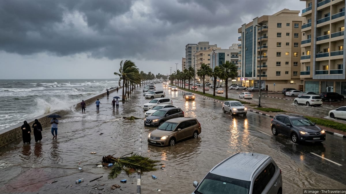
Yellow wind warning in force across large swathes of the UK
Publicly available information from the Met Office shows that a broad yellow warning for wind associated with Storm Austen is in effect through Friday across southwest England, south Wales and parts of central England, with additional areas under rain warnings as the system tracks east and north.
The yellow wind warning window for many southern and western areas runs from shortly after midnight until early afternoon, with the strongest conditions focused during the morning commute period. Forecast guidance suggests inland gusts widely in the 50 to 60 mph range, with 70 mph or higher possible along exposed stretches of the English Channel and Celtic Sea coasts.
Yellow warnings indicate a risk of travel disruption, difficult driving conditions and isolated damage, but they also signal that impacts are expected to be more limited and patchy than under amber or red alerts. The advisory coverage for Storm Austen nevertheless spans several hundred miles, reaching from Cornwall and Devon through south Wales and into the Midlands, and has been updated repeatedly over the past 24 hours as the storm path has become clearer.
For Saturday into Sunday, the focus of the yellow wind risk is expected to shift northwards ahead of a second system, Storm Boelo, with mainland Scotland, the Western Isles, Orkney and the far north of England highlighted for further blustery conditions once Austen clears.
Travel disruption and power cuts as 80 mph gusts hit coastal regions
Broadcast and online reports from UK media outlets on Friday morning describe a rapidly deteriorating situation along parts of the southwest peninsula, where exposed headlands in Cornwall and Devon have seen estimated gusts close to 80 mph as the core of Storm Austen moves inland from the Atlantic.
Regional coverage from southwest England indicates that thousands of properties have experienced short-duration power cuts or voltage dips as strong crosswinds and falling branches affect overhead lines. Electricity network operators have published updates warning that further interruptions are possible where saturation of already-soft ground increases the likelihood of trees coming down.
Road travel has been affected on some key routes into and out of tourist destinations in Devon and Cornwall, including sections of the A30 and A38, where fallen debris and surface water have prompted temporary lane closures. Rail operators serving the south coast and Great Western main line have issued online advisories of speed restrictions in exposed sections, extending journey times for services linking London with Bristol, Cardiff and Penzance.
Ferry operators in the Channel Islands and along the south coast have adjusted schedules or cancelled some crossings as steep waves and crosswinds make conditions marginal for safe operations. Travellers heading to and from popular coastal towns such as Falmouth, Plymouth, Weymouth and Portsmouth are being encouraged through operator channels to check the latest service status before setting out.
Impacts for travellers: roads, rails, ferries and flights
For visitors currently touring the UK, Storm Austen is most disruptive where plans rely on early-morning coastal travel in southwest England, south Wales and parts of the English Channel coast. The combination of sidewinds and standing water on rural A-roads is creating challenging driving conditions for high-sided vehicles and campervans often used by overseas visitors exploring Cornwall and Devon.
Rail passengers are encountering reduced line speeds through exposed sections of the Great Western and South Western networks, with journey planners showing extended travel times and a higher likelihood of missed connections. In some cases, services into smaller coastal stations are subject to short-notice alteration as operators concentrate resources on keeping main intercity routes open.
Domestic and short-haul European air services into airports such as Newquay, Exeter, Bristol and Southampton are experiencing occasional delays as aircraft contend with gusty crosswinds on approach and departure. Aviation meteorological data published overnight indicated peak gusts around 40 to 50 knots at several coastal airfields in the storm’s path, a level that typically requires additional spacing between arrivals and may lead to temporary suspensions when squall lines pass over runways.
Ferry links to the Isles of Scilly, Channel Islands and cross-Solent services to the Isle of Wight are particularly sensitive to the steep seas and strong gusts associated with Storm Austen. Operator statements on Friday morning reference a mix of cancellations, revised timings and warnings of very rough conditions on sailings that proceed, which may be of concern to travellers prone to motion sickness.
Coastal hazards and advice for outdoor plans
Along the coast, the main hazards linked to Storm Austen are large waves, overtopping and localised coastal flooding around high tide. Forecast guidance from national meteorological services highlights an increased risk of wave spray and occasional overtopping on exposed promenades and harbour fronts in southwest England and south Wales while the core of the storm passes.
For walkers, surfers and photographers, the combination of strong onshore wind, heavy swell and intermittent downpours is making some usually popular beauty spots unsafe. Cliff-top paths in Cornwall, Pembrokeshire and along the Jurassic Coast are experiencing squally gusts strong enough to make walking difficult, particularly for those carrying large backpacks or camera gear.
Local councils and harbour authorities have published reminders advising people to stay well back from seafront railings and harbour walls where waves are breaking, and to avoid attempting to drive through flood water on coastal roads. Visitors with caravan or motorhome stays near exposed beaches are being encouraged via site notices and social media posts to secure awnings, move vehicles away from overhanging trees and remain alert to any updated warnings.
Inland, heavy bursts of rain wrapped into the system are causing surface water issues on some low-lying roads, adding to delays and complicating onward journeys for those travelling between regional hubs. While rainfall totals so far remain below the thresholds associated with widespread river flooding, forecasters are cautioning that repeated showers on already wet ground could lead to a few localised incidents, particularly where drainage is poor.
What Storm Austen means for the days ahead
Meteorological briefings published this week describe Storm Austen as a rapidly deepening North Atlantic low, energised by a strong upper-level jet stream and marking a clear shift from the relatively settled conditions earlier in October. The system was named on 20 October after forecast models converged on a high-confidence signal for impactful winds across southwestern parts of the UK.
As the storm continues to track east and then north through Friday, conditions are expected to gradually improve across southern counties, with winds easing from the west later in the day. However, residual showers and brisk breezes are likely to persist into Friday evening for many central and eastern areas, keeping temperatures feeling cooler than recent days for those out sightseeing or dining outdoors.
Attention is already turning to Storm Boelo, another deep Atlantic low forecast to affect northern parts of the UK over the weekend. Weather graphics shared in national coverage indicate the potential for a new swathe of strong winds and heavy showers across Scotland, Northern Ireland and northern England from Saturday evening into Sunday, accompanied by a separate yellow wind warning.
For travellers planning multi-day itineraries that include both southern coastal regions and Scottish cities such as Glasgow, Edinburgh or Inverness, the evolving forecast suggests a period of unsettled weather stretching through much of the weekend. Travel planners and tourism businesses are urging customers in public posts to allow extra time for journeys, remain flexible with outdoor activities and monitor updated forecasts and service information as the sequence of autumn storms plays out.