
More news on this day
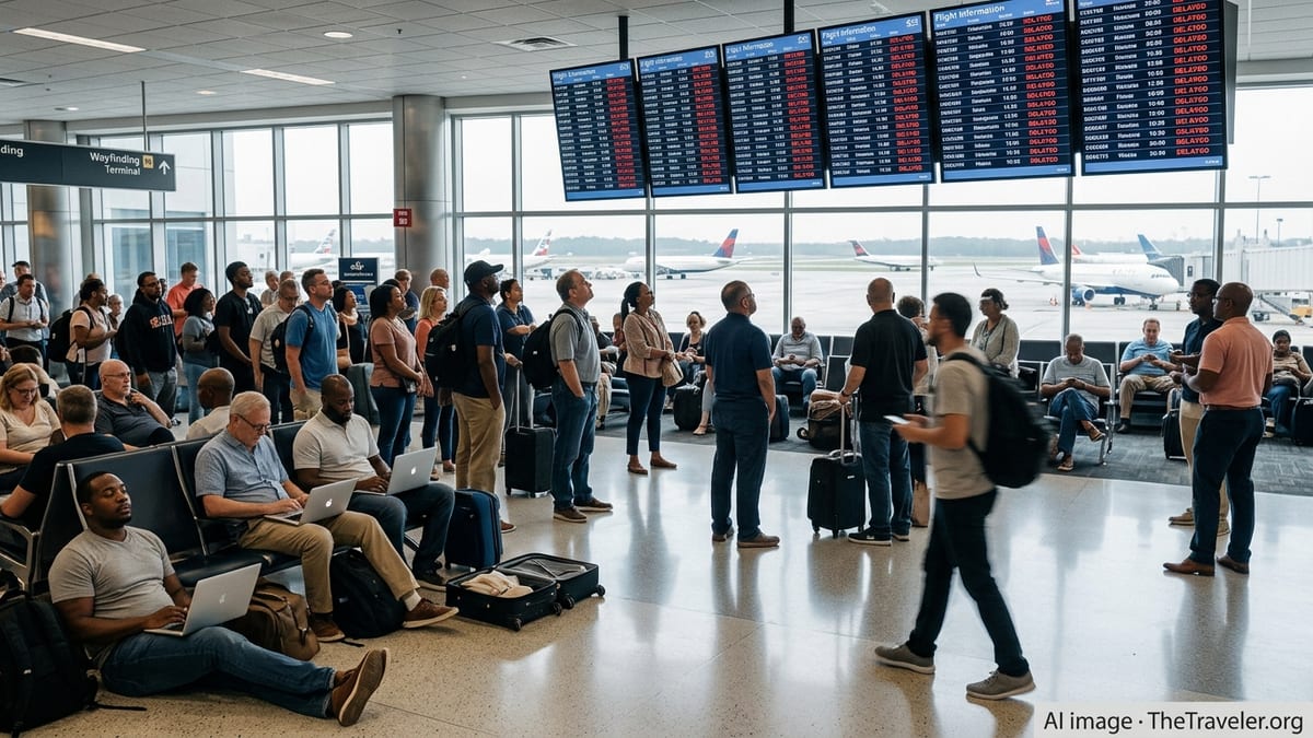
Air travelers across the Midwest are facing another stretch of flight delays and cancellations as severe thunderstorms collide with ongoing air-traffic control and airport-capacity constraints at some of the region’s busiest hubs.
Get the latest news straight to your inbox!
Thunderstorms Disrupt Operations at Chicago and Other Hubs
Across the central United States, a fresh round of spring thunderstorms is disrupting operations at major Midwest airports, particularly around Chicago. Publicly available aviation data for Chicago O’Hare International indicates intermittent ground delay measures and arrival slowdowns tied to convective weather in recent days, extending taxi times and pushing back departure slots.
Meteorological outlooks from national forecasters show a broad corridor of unstable air stretching from the southern Plains into the Great Lakes, with damaging winds, hail and heavy rain possible from late afternoon into the evening hours. That pattern increases the likelihood of additional airborne holding, reroutes and temporary halts to departures bound for affected airports as storms flare along key jet routes.
The weather impact is not limited to Illinois. Storm systems tracking through Iowa, Missouri, Wisconsin and Michigan are forcing airlines to pad schedules, swap aircraft and occasionally cancel rotations outright when crews or planes are trapped on the wrong side of a storm line. Travelers connecting through regional hubs like Minneapolis–St. Paul, Kansas City and St. Louis are experiencing rolling delays as carriers attempt to reset networks day by day.
Recent national coverage of severe weather has highlighted how quickly convective outbreaks can cascade through the air transport system, with thousands of flights delayed or canceled on peak days this month as storms marched from the Plains into the Midwest and onward to the Northeast.
Ground Stops and Delay Programs Amplify Disruptions
While individual thunderstorms can disrupt a single airport for an hour or two, broader traffic-management initiatives often amplify the effect across the region. The Federal Aviation Administration’s real-time status dashboard has periodically shown ground stops and ground delay programs targeting major hubs when storm cells or low ceilings sharply reduce arrival rates.
In recent days, a notable ground stop at Dallas–Fort Worth because of thunderstorms sent ripple effects through Midwest schedules as connecting flights to Chicago, Des Moines and other cities left late or were scrubbed altogether. Industry analysis notes that when a large hub is paused, flights destined for secondary Midwest airports may be among the first to be trimmed to preserve capacity on the strongest trunk routes.
Reports from passenger forums and flight-tracking services also describe temporary ground delay programs at O’Hare linked both to thunderstorm activity and air-traffic staffing constraints. Under these programs, departures from outstations are metered into fixed arrival slots, often resulting in pushback delays of an hour or more even when local conditions at the origin airport appear calm.
Because the Midwest’s main hubs sit at the intersection of east–west and north–south corridors, these traffic initiatives can quickly create bottlenecks. Flights from the East Coast bound for Denver, Phoenix or the West Coast frequently pass through the same airspace used by shorter regional hops, compressing demand into a limited number of usable routes when storms build along the primary tracks.
Stormy Spring Extends a Season of Disruption
The latest wave of delays comes at the tail end of a turbulent late winter and spring across the region. In March, a powerful cross-country storm system brought blizzard conditions to portions of the Upper Midwest and High Plains while fueling severe thunderstorms farther south, temporarily shutting down interstates and forcing widespread flight cancellations and diversions at Midwestern airports.
More recently, a string of severe weather episodes in April and May has included large tornado outbreaks and multiple days with enhanced severe-storm risk over the central United States. Historical summaries compiled by meteorologists show that tornado and hail activity tends to peak across the Midwest in May, meaning the current pattern of weather-driven disruption is consistent with a climatological high point for convective hazards.
Forecast outlooks from private-sector and reinsurance analysts suggest that the 2026 severe-convective storm season could produce above-average thunderstorm and straight-line wind events, particularly from late April into early summer. For aviation, that raises the prospect of repeated episodes where lines of storms force ground stops, altitude restrictions and route closures across the central corridor of the national airspace system.
Aviation planners emphasize that even when a given storm lasts only a few hours, recovery can stretch well into the next day as aircraft and crews return to position and as maintenance inspections are completed on aircraft that may have flown through turbulent or hail-prone airspace.
Staffing, Construction and Structural Challenges at Midwest Gateways
Weather is only part of the story. The Midwest’s largest airports are also navigating structural challenges that can exacerbate delay patterns when storms strike. Federal capacity reports point to ongoing construction and modernization projects at Chicago O’Hare, where runway and taxiway work is being phased over multiple years. While designed to improve long-term efficiency, such work can temporarily reduce available capacity or limit the flexibility to shift configurations when winds or storms change direction.
In parallel, the air-traffic control system continues to manage staffing shortages that became more visible in recent years. Pilot and passenger accounts circulating online describe days when Chicago-area facilities have operated with reduced staffing, prompting the use of cautious arrival and departure rates even in otherwise manageable weather. When thunderstorms escalate, those tighter margins can quickly translate into extended holding patterns and long lines for takeoff.
Other Midwest airports face similar constraints. Regional gateways that handle a mix of cargo, regional jets and mainline traffic, such as Indianapolis or Cincinnati, often balance runway maintenance and terminal projects with seasonal surges in demand. Publicly available performance data show that when these airports experience disruptions, tightly banked connecting schedules can unravel, sending knock-on delays into smaller communities across the region.
Industry observers note that federal efforts to smooth operations, including temporary flight reductions at some of the most congested hubs, may provide modest relief but will not fully offset the strain when major storm systems intersect with peak travel periods.
What Travelers Can Expect in the Coming Days
With the broader storm pattern expected to linger from the southern Plains into the Midwest and Great Lakes, travelers should be prepared for continued day-to-day variability in schedules. Forecasts call for additional rounds of thunderstorms capable of producing strong winds, heavy rain and low cloud ceilings along many of the region’s primary flight corridors.
Airlines are publicly encouraging passengers to monitor flight-status tools closely, consider earlier departures when possible and make use of flexible rebooking options when travel waivers are in place. Experience from recent severe-weather days shows that morning flights often have a better chance of operating on time before afternoon instability triggers the most intense storms.
Travel analysts also point out that disruptions in the Midwest can quickly affect itineraries well beyond the region. Because cities like Chicago, Detroit and Minneapolis handle substantial connecting traffic, a delay there can leave passengers in coastal markets waiting for aircraft and crews that are stuck in the heartland. Even travelers on seemingly unrelated routes may feel the effect through aircraft swaps, crew reassignments or rolling delays.
For now, publicly available operational data indicate that airlines and air-traffic managers are focused on managing each new wave of storms as it arises, using ground stops and delay programs to balance safety with throughput. As the heart of the severe-weather season continues, Midwest travelers are likely to face a bumpy stretch of weeks in the skies before conditions stabilize later in the summer.