
More news on this day
Violent rainstorms and a looming tropical system have thrown air travel across Texas into turmoil, with Houston’s George Bush Intercontinental Airport emerging as one of the hardest hit hubs as delays ripple through the state’s already strained aviation network.
Get the latest news straight to your inbox!
Ground Delays Grip Houston as Storm Bands Sweep In
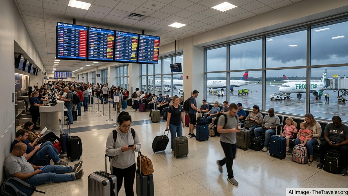
Severe thunderstorms sweeping across the Houston region at the start of the week triggered a wave of schedule disruptions at George Bush Intercontinental Airport, where departing flights were slowed by weather-related traffic management programs. Federal aviation advisories described airport scheduling delays in Houston of around 30 to 45 minutes during peak storm activity, with many departures pushed back further as carriers worked through mounting congestion.
Published coverage from local outlets indicates that heavy rain, lightning and low clouds repeatedly forced operations to throttle back on Monday and into Tuesday, turning taxiways into bottlenecks as aircraft waited for clearance. Passengers reported extended holds at gates and on the tarmac as arriving flights circled or diverted and departures faced rolling delay estimates.
Meteorologists in Houston describe the storms as part of a broader, moisture-rich pattern fueling intense downpours over Southeast Texas. Forecast discussions point to repeated bands of thunderstorms tracking over the metro area, with visibility swings, wind shear and lightning all contributing to a difficult operating environment for the region’s airports.
Travelers moving through Houston’s secondary airport, William P. Hobby, have also faced intermittent slowdowns as convective cells drift across the city. While disruption there has generally been less severe than at the larger international hub, publicly available flight boards show clusters of delayed departures tied directly to passing storm cores.
Flood Watch and Disaster Declarations Amplify Risk
The air travel chaos is unfolding against a backdrop of escalating weather alerts across Texas. A statewide disaster proclamation issued this week cites severe storms beginning June 14 that brought heavy rainfall, flash flooding, hail and tornado threats to dozens of counties, including Harris County, home to Houston’s two commercial airports.
Houston-area forecasts label the current stretch as a high-impact rain event, with a flood watch in effect and some communities warned to prepare for potentially life-threatening flash flooding as multiple inches of rain fall in a short window. Local meteorologists expect the heaviest totals to concentrate along the upper Texas Gulf Coast, directly overlapping key aviation corridors feeding Bush Intercontinental and Hobby.
State emergency bulletins highlight that the same slow-moving system soaking Southeast Texas is interacting with deep tropical moisture. The National Hurricane Center has begun tracking a potential tropical cyclone centered over South Texas, raising concerns that additional rounds of intense rainfall and gusty winds could push airport infrastructure and staffing to their limits over the coming days.
Publicly available information from the Texas Division of Emergency Management shows round-the-clock operations at the state’s emergency coordination center as river levels rise and low-lying roads flood. For air travelers, that means not only turbulence and airborne holds but also access issues on the ground as key highways leading to Houston’s airports periodically back up or close due to high water.
Ripple Effects Across Texas Aviation Hubs
The strain is not isolated to Houston. In North Texas, weekend storms brought similar turmoil at Dallas Fort Worth International Airport, one of the nation’s largest connecting hubs and a crucial partner in Texas’s aviation network. Coverage from Dallas indicates that on Sunday alone more than 700 flights into and out of DFW were delayed, with well over a hundred cancellations as thunderstorms fired repeatedly along a passing front.
Those disruptions in Dallas, combined with the evolving storm threat in Houston, have compounded the challenge for airlines trying to reposition aircraft and crews around the state. With both major hubs experiencing weather-related slowdowns within the same multi-day period, the available slack in schedules has quickly evaporated, leaving little room to recover from each new round of convective storms.
Regional airports in Central and South Texas have also seen bouts of turbulence in operations as feeder routes into Houston and Dallas adjust. Published reporting from Austin, San Antonio and coastal communities notes scattered delays and diversions as carriers reroute aircraft around the worst of the storms and grapple with tight crew duty limits triggered by extended ground holds.
Industry observers point out that early summer is already a high-demand period in Texas, amplified this year by major international events drawing visitors through the state’s gateways. That added volume, combined with reduced runway and taxiway flexibility during heavy rain and lightning, has increased the likelihood of cascading delays once any single hub begins to back up.
World Cup Crowds and Construction Magnify the Chaos
The timing of the storms could scarcely be more challenging for Houston. With the city hosting early FIFA World Cup matches, local airport systems are bracing for millions of additional passengers over the tournament window. Airport planning documents and recent city budget materials reference expectations of sharply higher facility usage and passenger counts tied to the global event.
Travel discussion forums and social media posts from recent days describe packed terminals, long security lines and tight turnaround times at both Bush Intercontinental and DFW even before the latest storms intensified. With fan traffic layering on top of routine summer travel, each new delay now ripples through itineraries involving multiple connections, international arrivals and time-sensitive match schedules.
At the same time, federal airport construction impact reports indicate that Bush Intercontinental has been managing reduced capacity on certain taxiways and runway-adjacent infrastructure in recent months. While such projects are designed to improve long-term efficiency, they can temporarily lower the threshold for delay when severe weather constrains available airspace and ground routes.
The result is a fragile operating environment where thunderstorms or tropical downpours can quickly transform routine congestion into widespread disruption. Airlines have issued periodic travel waivers for Houston in recent weeks as earlier storm systems passed through, signaling that carriers were already attuned to the heightened risk of schedule volatility heading into this period.
What Travelers Can Expect in the Coming Days
Forecast guidance suggests that Southeast Texas, including the Houston metro area, may face additional rounds of heavy rain through at least Thursday, with the precise track and intensity of the developing tropical system still evolving. That uncertainty means aviation disruptions are likely to continue in fits and starts, with windows of normal operations punctuated by ground stops, reroutes and sudden cancellations.
Airlines are continuing to encourage customers to monitor their flight status frequently and to build extra time into connections across Texas hubs. Publicly available advisories from carriers indicate that same-day reaccommodation options can disappear quickly once storms flare, especially on routes tied to major events or popular vacation destinations.
For those starting or ending trips in Houston, travel planners recommend watching not only airport departure boards, but also regional flood watches and roadway conditions. With localized street flooding already reported in parts of the metro area, reaching the airport can in some cases prove as difficult as getting airborne, particularly during rush-hour storms.
As Texas navigates yet another week of volatile early-summer weather, the combination of flood risk, tropical moisture and record passenger demand is testing the resilience of its aviation network. For now, travelers across the state’s major hubs face an unsettled forecast both in the skies and on the departure boards.