


More news on this day
Thunderstorms moving across the Chicago area early Sunday prompted a brief ground stop at Chicago O’Hare International Airport, slowing the first wave of departures and arrivals before conditions began to improve later in the morning.
Get the latest news straight to your inbox!
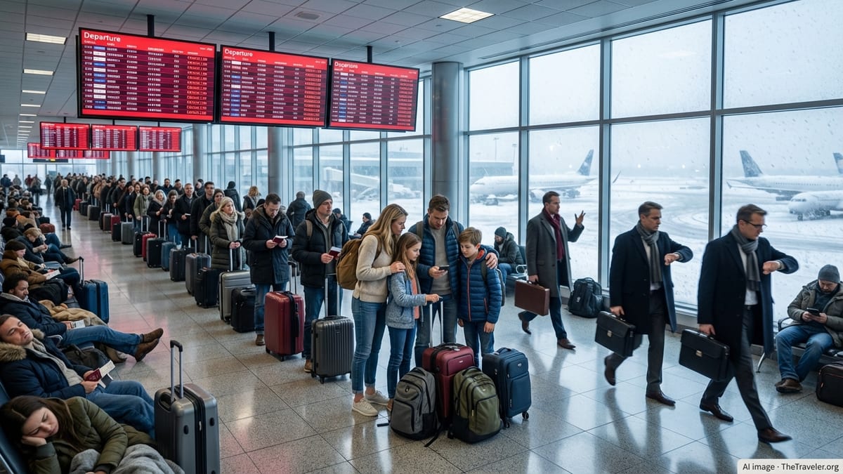
Early storms disrupt first wave of flights
Storms tracking over northern Illinois around daybreak on Sunday led to a temporary halt in flights at Chicago O’Hare International Airport, one of the nation’s busiest hubs. Published coverage indicates that the Federal Aviation Administration issued a ground stop for O’Hare into the early morning hours, pausing some departures and arrivals while cells passed near the airfield.
According to reports, the ground stop extended to approximately 7:15 a.m. Central time, affecting primarily the first bank of morning flights. Airlines typically rely on these early departures to position aircraft and crews across their domestic networks, so even a short suspension can ripple into later schedules as planes and staff fall out of sequence.
Radar and surface observations around O’Hare showed early-morning storms and showers in the region, with low to moderate clouds and pockets of rain before daylight. Publicly available airport and weather data for the O’Hare area indicated mostly cloudy skies and gusty southerly winds in the pre-dawn hours, consistent with a passing disturbance tied to the thunderstorms.
By mid-morning, FAA airport status information showed a shift from the ground stop to broader traffic management measures, signaling that operations were resuming but still subject to weather-related spacing and routing constraints.
Traffic Management Program keeps delays in place
Once the initial ground stop expired, O’Hare moved into a Traffic Management Program, a standard FAA tool for handling high-volume airports during unsettled weather. Publicly available FAA status pages listed thunderstorms as the primary factor, noting that some arriving flights into O’Hare were being metered to reduce airborne congestion over the Chicago terminal area.
Under a Traffic Management Program, air traffic controllers can adjust arrival rates, reroute aircraft around storms, and impose holding patterns as needed. This approach is designed to maintain safety margins while allowing flights to continue operating at a reduced pace, rather than stopping all movements entirely. For passengers, that often translates into moderate delays, generally measured in minutes rather than hours, once the most intense storms have moved away.
Advisories tied to recent thunderstorm events at O’Hare show that arrival traffic in these situations can experience holding or delays of up to 30 minutes when cells line up along major approach paths. On Sunday, FAA updates indicated that arrival delays were limited, with general arrival holds reported in the range of 15 minutes or less as the weather gradually improved.
Departing flights can also be affected when arrival rates are trimmed, since gate availability and ground congestion depend on a steady flow of inbound aircraft. The FAA notes that departure schedules may be adjusted during traffic management periods, and travelers are encouraged to check directly with their airline for flight‑specific information.
Morning weather gives way to warmer, breezy afternoon
Forecasts for the Chicago area on Sunday called for scattered showers and isolated thunderstorms during the morning, followed by a much warmer and breezy afternoon. Coverage from local outlets highlighted the expectation of highs in the mid-80s Fahrenheit, with wind gusts potentially reaching 25 miles per hour once the main storm line passed.
National Weather Service observations for the O’Hare station early Sunday showed temperatures in the 70s, with mostly cloudy skies and moderate southerly winds. These readings aligned with the transition from active thunderstorms to a more humid, late-summer pattern, which can still create occasional turbulence and crosswind considerations for operations but is generally less disruptive than active lightning and heavy downpours.
Short-lived storm complexes like the one affecting O’Hare on Sunday are common during late August across the Midwest. While they often move through quickly, their timing relative to peak departure and arrival periods can determine how visible the impact becomes for travelers. A similar thunderstorm pattern earlier in the summer produced a separate ground stop and arrival delays into O’Hare, underscoring how frequently convective weather intersects with the airport’s high traffic volumes.
For Chicago-bound passengers later in the day on Sunday, publicly available status boards and FAA summaries pointed to improving conditions, with the primary impacts confined to the early-morning timeframe when storms were most concentrated near the airfield.
Why O’Hare is especially sensitive to storm timing
As one of the country’s primary connecting hubs, Chicago O’Hare handles a dense schedule of simultaneous arrivals and departures on multiple parallel runways. FAA briefings on the airport’s operations describe a complex airspace structure that depends on tightly choreographed flows of traffic into and out of both its north and south airfields.
When thunderstorms develop near the airport, air traffic managers may reduce the number of active runways, temporarily suspend certain approach paths, or shift departures to avoid cells. Ground stops are typically used in the most constrained period, when routing options are limited and there is a desire to keep aircraft from launching into conditions that could require extended airborne holding or diversions.
Past advisories for O’Hare show that thunderstorm‑driven constraints can quickly translate into hundreds of delayed flights if convective cells linger over key arrival fixes or along common en route corridors. Even when the most severe weather stays west or south of the airport, nearby lightning, wind shear, or low‑level wind shifts can necessitate more conservative spacing between aircraft.
The early timing of Sunday’s ground stop likely helped limit the scale of disruption, occurring before the busiest mid‑day and late‑afternoon travel windows. Once the initial line of storms moved away from the immediate vicinity of the airport, traffic management tools allowed operations to ramp back up more gradually while maintaining weather buffers around remaining showers.
What travelers can expect the rest of the day
By late morning on Sunday, publicly available FAA data showed O’Hare operating under a traffic management regime rather than a full ground stop, with only modest arrival delays and an advisory that some departures could still be affected. Airlines often respond to these conditions by building in extra time on flight plans, swapping aircraft, or rebalancing crews to keep later flights running as close to schedule as possible.
Passengers with Sunday itineraries through O’Hare can typically expect that the bulk of early disruption will manifest as residual delays rather than widespread cancellations, particularly once thunderstorms have cleared the immediate approach corridors. That said, connections scheduled close together in the morning may remain tight if inbound aircraft departed late due to earlier restrictions.
Travelers are generally advised, based on historical patterns and current FAA updates, to monitor airline apps and airport information screens closely on storm‑impacted days. While system‑wide tools such as ground stops and Traffic Management Programs are visible on federal status pages, flight‑specific rebooking options, waivers, and gate changes are managed directly by carriers.
With warm, breezy weather forecast to dominate the rest of Sunday, and only scattered showers expected beyond the early storms, operational impacts at O’Hare were trending toward improvement as the day progressed. For many travelers, the most noticeable effects of the morning’s weather were likely to be longer‑than‑usual taxi times, slightly adjusted arrival estimates, and crowded departure gates during the recovery period.
CBS Chicago coverage of Sunday morning storms and ground stop
FAA real-time status for Chicago O’Hare International Airport
National Weather Service current conditions at Chicago O’Hare (KORD)