
More news on this day
A yellow thunderstorm warning is set to affect Northern Ireland, with slow-moving downpours and lightning bringing a risk of localised flooding, hazardous driving conditions and disruption to road, rail and ferry travel.
Get the latest news straight to your inbox!
When the thunderstorm warning is in force
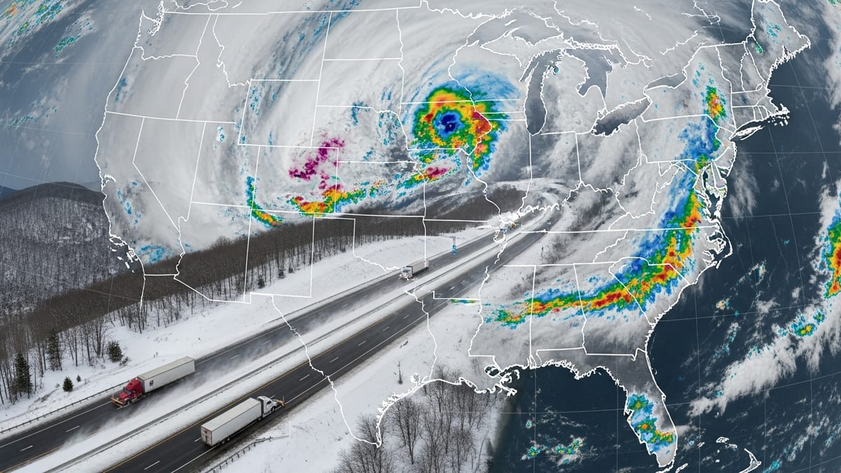
Forecast guidance indicates that a yellow thunderstorm warning will be in force across much of Northern Ireland through this afternoon and evening, with the most intense showers expected during the warmest part of the day. The alert covers counties including Antrim, Down, Armagh, Tyrone and Derry, where slow-moving storms are most likely to develop.
The warning period signals the hours when heavy, thundery downpours are most likely to impact travel, generally from early afternoon into late evening. Showers are expected to be scattered, meaning not every location will see severe weather, but areas that do experience thunderstorms could see intense rainfall in a relatively short time.
Publicly available information from the UK Met Office suggests the focus is on convective storms forming over land as heat and humidity peak, before gradually easing overnight as temperatures fall. Conditions may remain unsettled into the following day, with further showers possible even after the main warning period expires.
Travellers are advised to check forecasts and live transport updates close to departure, as the precise timing and track of individual thunderstorms can change at short notice.
Potential travel disruption on roads, rail and air
Yellow thunderstorm warnings typically highlight the risk of sudden surface water flooding on major routes, reduced visibility and difficult driving conditions. Heavy rain in a short space of time can overwhelm drainage systems, leading to standing water on roads, spray and a heightened risk of aquaplaning, especially on motorways and fast dual carriageways.
On rural and local roads, intense downpours may wash debris onto carriageways and create large puddles in dips and under bridges. Drivers are urged, in widely shared safety advice, to slow down in heavy rain, leave extra braking distance and avoid driving through floodwater where the depth is uncertain.
Rail passengers may also face disruption if localized flooding impacts key sections of track or if lightning affects signalling systems. Previous yellow thunderstorm events in Northern Ireland and elsewhere in the UK have led to speed restrictions, short-notice cancellations and extended journey times on some routes when downpours have coincided with peak travel hours.
Air travel is not expected to see widespread cancellation, but thunderstorms in the vicinity of airports can cause short delays to takeoffs and landings for safety reasons. Travellers heading through Belfast International, Belfast City or City of Derry airports are advised to allow extra time and monitor airline updates, particularly during the core hours of the warning.
Flooding risk and impacts on communities
The primary hazard associated with the current yellow thunderstorm warning is the risk of localised flooding from intense, short-lived rainfall. Weather service guidance for such alerts notes that some homes and businesses may be affected by flash flooding, with water potentially entering properties where drains and small watercourses are overwhelmed.
Urban areas, including parts of Belfast and other larger towns, can be particularly vulnerable when heavy rain falls on already saturated ground or onto hard surfaces that shed water quickly. Surface water can build up around low-lying junctions, underground car parks and underpasses, temporarily cutting off access or making walking and cycling hazardous.
Rural communities could see minor river and stream responses, with small watercourses rising rapidly during the heaviest bursts of rain. Reports from previous thunderstorm episodes in Northern Ireland indicate that flooding tends to be highly localized, with one area experiencing significant impacts while neighbouring locations remain largely unaffected.
Emergency planners advise that residents in flood-prone spots move valuables off ground floors where possible, keep gullies and drains clear where it is safe to do so, and remain alert for updates from local councils, transport operators and national weather services during the warning period.
Advice for travellers and outdoor plans
Travel and safety guidance issued for similar thunderstorm warnings across the UK and Ireland emphasises basic precautions for anyone on the move. Road users are encouraged to plan extra time for journeys, check for any reported incidents before setting out and be prepared for rapidly changing conditions, including intense rain, lightning, gusty winds and hail in the most active cells.
Those using public transport are advised to keep an eye on operator announcements and social media feeds, as heavy downpours can trigger short-notice changes to timetables. Where possible, flexible tickets and alternative routes may help mitigate disruption if flooding or lightning affects a particular line or corridor.
For people with outdoor plans, including hiking, coastal visits or large events, the combination of lightning and heavy rain presents additional risks. Safety agencies routinely recommend moving indoors if thunder is heard nearby, avoiding open hilltops, isolated trees, metal structures and water during a storm, and delaying activities until at least 30 minutes after the last rumble of thunder.
Organisers of outdoor gatherings in Northern Ireland are expected to monitor the warning closely, with contingency plans such as temporary pauses, sheltering arrangements or adjusted start times where necessary to protect participants and staff.
What yellow thunderstorm warnings mean
The yellow alert currently covering Northern Ireland forms part of the UK National Severe Weather Warning Service, which uses a colour-coded system to flag the likelihood and potential impact of hazardous conditions. Yellow warnings signal that severe weather is possible and may cause some disruption to travel and day-to-day activities, particularly where showers become slow-moving and very heavy.
In the case of thunderstorms, yellow status is generally associated with the risk of lightning strikes, torrential downpours, small hail and sudden gusts of wind. While the overall threat level is lower than for amber or red alerts, previous events have shown that even yellow thunderstorms can lead to flash flooding, transport delays and occasional power interruptions.
Publicly available guidance advises the public to stay weather aware during the warning period, follow forecast updates and consider how heavy rain and lightning could affect individual plans. This may include allowing extra travel time, adjusting departure times to avoid the most intense showers, and preparing for the possibility that some routes or services will be temporarily affected.
With the warning window covering key commuting and leisure hours, travellers across Northern Ireland are being urged by forecasters and safety organisations to remain vigilant, avoid unnecessary risks in flood-prone locations and keep checking the latest information as the thunderstorms develop and move through the region.