
More news on this day
Thunderstorms over the Houston area on June 15 led to a ground delay program at George Bush Intercontinental Airport, disrupting morning operations and forcing airlines to slow the flow of arriving flights.
Get the latest news straight to your inbox!
Weather Disruptions Constrain Arrivals at IAH
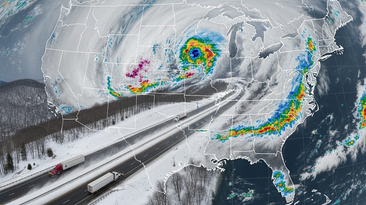
Publicly available aviation data show that a series of thunderstorms around George Bush Intercontinental Airport reduced the airport’s arrival capacity, prompting federal traffic managers to institute a ground delay program for inbound flights. The measure is designed to meter traffic into Houston by holding some departures at their origin airports, rather than allowing long airborne holding near the terminal area.
Forecast discussions and terminal aerodrome forecasts for Houston on June 15 indicated a risk of thunderstorms in the vicinity of the airport at various points in the day, with periods of reduced visibility and convective activity. These conditions typically lower the number of aircraft that can safely land each hour, which in turn triggers formal delay programs when demand exceeds that reduced capacity.
Airport status dashboards tracking national airspace programs reflected a ground delay designation for Houston during the affected period, listing weather as the primary factor. These tools, which aggregate data from the Federal Aviation Administration, are widely used by dispatchers and travelers to understand when programs such as ground delays, ground stops, or reroutes are impacting operations.
While departures from Houston continued for much of the morning, the reduction in arrival throughput translated into a visible pattern of delayed inbound flights, with some aircraft pushed back to later arrival slots to match the lower airport arrival rate.
Impact on Airlines and Passengers
Flight-status boards for George Bush Intercontinental on Monday showed a growing list of delayed arrivals, particularly among regional and domestic flights scheduled in the early morning and midmorning windows. Some flights remained en route with relatively minor delays, while others faced extended arrival times as the ground delay program adjusted their expected landing slots.
Airlines that rely heavily on Houston as a connecting hub appeared to be most exposed to the disruption. When inbound aircraft are slowed by weather-related programs, the knock-on effect can cascade across an airline’s network, complicating crew scheduling and aircraft rotations and increasing the risk of missed connections for passengers.
Travel information pages maintained by major carriers have recently highlighted flexible rebooking options when severe weather is forecast along key routes or at major hubs. These advisories, which are updated frequently, encourage customers to monitor their flight status, use airline apps or self-service tools, and consider adjusting their plans during periods of heightened weather risk.
For travelers already at the airport, the ground delay translated into longer waits at gates and shifting departure times for connecting flights. For those yet to depart for Houston, departure holds at origin airports meant spending more time in terminals before takeoff as dispatchers synchronized flights with the constrained arrival flow into IAH.
How Ground Delay Programs Work
According to publicly available descriptions of the Federal Aviation Administration’s traffic management initiatives, a ground delay program is a tool used when projected demand at an airport exceeds the number of arrivals that can be handled safely under the prevailing conditions. Weather episodes such as thunderstorms, low ceilings, or reduced visibility are among the most common triggers.
Under a ground delay program, flights destined for the affected airport are assigned controlled departure times based on an airport arrival rate that has been temporarily reduced. The goal is to keep the number of inbound aircraft aligned with what air traffic controllers can safely accommodate, while avoiding excessive airborne holding and diversions near the destination.
Each flight receives an expected departure clearance time that may be later than its scheduled departure. As the weather evolves and capacity estimates are refined, those times can be adjusted, either increasing or decreasing delays. Once conditions improve and the airport arrival rate is raised, the program can be scaled back or canceled, allowing airlines to gradually resume more normal operations.
While the system often feels opaque to passengers, industry analyses emphasize that ground delay programs are intended to distribute delays more evenly and predictably, concentrating the wait on the ground rather than in the air and reducing the risk of last-minute cancellations.
Broader Weather Pattern Across the Region
The thunderstorms affecting Houston formed part of a wider convective pattern across portions of Texas, with recent coverage describing rounds of rain and storms affecting other major hubs in the state. Similar weather over the weekend had already led to extensive delays and cancellations in North Texas, illustrating how rapidly changing conditions can place pressure on multiple airports at once.
Infrastructure reports for Bush Intercontinental note that the airport operates a complex runway and taxiway system that can see reduced efficiency when certain surfaces are constrained or when weather limits the use of parallel approaches. During periods of thunderstorms, controllers may be required to increase spacing between arrivals and adjust runway configurations, further reducing throughput.
With international sports events and peak summer travel combining to boost passenger volumes across the state, any reduction in capacity at a major hub like Houston can quickly generate congestion. High load factors mean fewer open seats on alternative flights, making it more difficult for affected passengers to be re-accommodated later in the day.
Travel-planning tools that aggregate historical delay patterns by airport have consistently flagged summer afternoons in storm-prone regions as higher-risk windows for operational disruption, a trend that appears to be playing out again as the 2026 travel season intensifies.
What Travelers Can Expect for the Remainder of the Day
As is typical with convective weather, the duration and severity of impacts at Houston will depend on how quickly storms move through the area and whether new cells redevelop along key approach paths to the airport. Forecasts for the day point to periods of improvement interspersed with additional chances for thunderstorms in the vicinity.
Travelers with flights into or out of Bush Intercontinental are being advised through airline communication channels and public airport-status tools to monitor their flight numbers closely, arrive early, and be prepared for schedule changes. Same-day rebooking options may be available in some cases, particularly where carriers have issued weather-related waivers.
Even after the formal ground delay program is lifted, operations often take several hours to fully normalize as airlines work through backlogs, reposition aircraft, and reestablish regular crew rotations. Connections scheduled shortly after the most disrupted periods may remain vulnerable to knock-on delays.
Industry data show that when weather-related delay programs are in force at a major hub, follow-on effects can ripple across the national network well into the evening. For travelers, that means maintaining flexibility, using digital tools to track options, and preparing for the possibility that disruptions in one storm-affected city may influence flights hundreds or even thousands of miles away.