


More news on this day
Persistent thunderstorms sweeping across Western Washington on Thursday led to significant ground delays at Seattle-Tacoma International Airport, disrupting flight schedules and forcing airlines to slow departures as lightning moved through the region.
Get the latest news straight to your inbox!
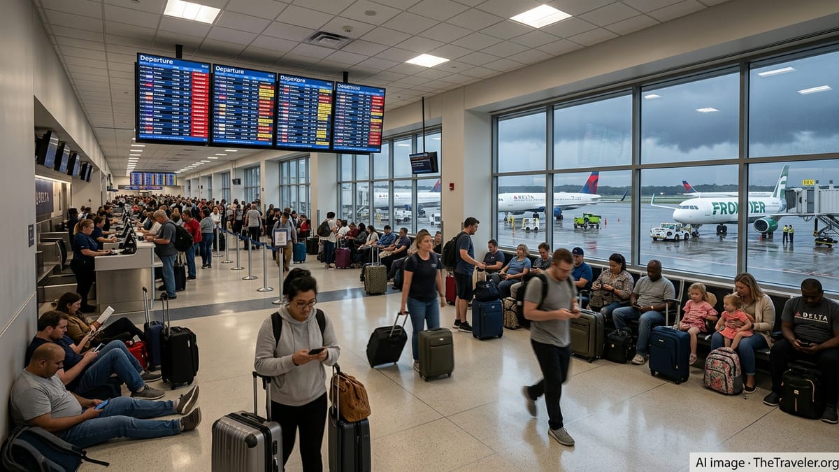
Storm Cells Stall Departures at Major Northwest Hub
Publicly available flight-tracking and airport-status data on July 16 indicate that Seattle-Tacoma International Airport experienced a sharp uptick in departure queues as thunderstorms formed over the central Puget Sound region. A combination of heavy showers, lightning, and low ceilings reduced the rate at which aircraft could safely take off and land, prompting air traffic managers and airlines to meter traffic into and out of the airport.
Current-condition dashboards for the airport showed rain and reduced visibility around midday, while local meteorological reports described a band of showers and thunderstorms moving across Western Washington. The timing coincided with a busy mid-morning and early-afternoon departure bank at Seattle-Tacoma, amplifying the operational impact for airlines and passengers.
Reports from travelers and aviation-enthusiast communities described departure lines stretching across the ramp and aircraft waiting for clearance as lightning approached. Several accounts referenced ground crews temporarily leaving the ramp area when electrical activity was detected nearby, an established safety practice that can quickly slow boarding, pushback, and baggage handling.
Informal accounts also pointed to a buildup of airborne holding patterns as arrivals were spaced farther apart during the most active periods of the storm. While most flights were able to operate, the reduced arrival and departure flow led to mounting delays that spilled into the afternoon schedule.
How Ground Delay Programs Work in Severe Weather
Ground delays in these conditions are generally part of a structured system used across the United States to protect safety and manage congestion when weather degrades airport capacity. Federal aviation guidance describes a ground delay program as an initiative that holds flights on the ground at their departure airports, assigning each flight an expected departure time that aligns with the reduced rate of arrivals that a storm-affected airport can safely handle.
In practice, this means that when thunderstorms approach a hub like Seattle-Tacoma, the arrival rate for the airport is temporarily lowered. Once the new capacity figure is established, departure times for inbound flights are adjusted so that aircraft are not launched into airspace they cannot enter without extended airborne holding. This is designed to lessen the risk of aircraft circling near storms and to avoid gridlock in the skies around the airport.
During convective weather, these programs are often updated repeatedly as forecasters and traffic managers gain new information about storm movement and intensity. If the worst of the lightning and downpours passes more quickly than expected, some flights can be pushed earlier. If storms linger over key approach corridors, additional delays or reroutes may be necessary.
The approach reflects national experience that severe weather is one of the primary drivers of air travel disruption. Longstanding analyses from transportation agencies and inspectors general have documented how thunderstorms can trigger chain reactions of delays across the National Airspace System, particularly when they affect major hubs or busy coastal corridors.
Travelers Report Longer Waits and Diversions
Individual traveler accounts from the Seattle area on Thursday described an unusual and prolonged period of thunder and lightning for the region, with some passengers noting that their aircraft remained at the gate for extended periods as crews waited for clearance to push back. Others reported sitting in long departure lines on taxiways while storms moved through, with pilots providing updates about weather-related flow restrictions.
On social platforms frequented by aviation observers, images and flight-tracking screenshots showed a dense departure queue streaming from Seattle-Tacoma during the late morning hours. Commenters noted that the airport had become one of the more disrupted major facilities in the country for a time, as the combination of thunderstorms and seasonal traffic compressed operations into narrower weather windows.
Some accounts referenced flight diversions to alternate airports when arrival slots into Seattle-Tacoma tightened. Such diversions are a common tool during active thunderstorms, allowing aircraft to refuel or wait out weather away from the most congested airspace, before reentering the flow once capacity improves.
While diversion reports appeared limited compared with more severe national weather events, the pattern underscored how quickly localized thunderstorms in the Pacific Northwest can reverberate through an increasingly busy summer travel system.
Regional Weather Pattern Unusual for Mid-July
Weather coverage from local Seattle outlets on July 16 highlighted the day’s thunderstorms as a leading story, describing showers and embedded storm cells tracking across Western Washington. These reports pointed to pockets of lightning and heavier downpours affecting communities from Tacoma north toward the greater Seattle metro area.
Residents and long-time observers in regional forums emphasized the rarity of such sustained thunderstorm activity for mid-July, with several noting that the day’s storms ranked among the more intense events they had experienced in recent years. Thunderstorms are not unheard of in the Puget Sound region, but the area more commonly sees steady rain or light showers rather than extended convective systems.
For an airport built to handle frequent low clouds and drizzle, a day dominated by lightning presents a different challenge. Ramp workers are typically required to halt many outdoor tasks whenever electrical activity is detected within a defined radius, which can quickly freeze aircraft turns. Combined with temporary traffic flow restrictions in the air, the result is a rapid accumulation of delays that can take hours to unwind even after the heaviest cells move on.
Forecast discussions suggested that while rainfall totals for the day would generally remain modest, isolated thunderstorms would remain possible into the afternoon. That outlook left airlines planning for continuing, if intermittent, constraints on operations at Seattle-Tacoma as they navigated the remainder of the day’s schedule.
Broader Impact on Summer Air Travel
The disruption at Seattle-Tacoma on Thursday unfolded against a backdrop of already strained summer air travel across the United States. Federal air traffic summaries for July 16 highlighted thunderstorms as a leading cause of potential delays nationwide, particularly at other major hubs in the Southeast and along the East Coast.
Recent seasonal briefings from aviation agencies have stressed that convective weather remains a central challenge for managing record passenger volumes. National traffic reports frequently point to ground stops, ground delay programs, and reroutes tied to thunderstorms, especially during the afternoon and evening hours when heating and instability peak.
For travelers using Seattle-Tacoma and other large hubs, the events of the day reinforced standard guidance to build extra time into itineraries during the summer storm season. Public resources maintained by federal agencies and airlines continue to encourage passengers to monitor flight status frequently, sign up for alerts, and be prepared for changing departure and arrival times when convective weather threatens key air corridors.
As operations at Seattle-Tacoma gradually stabilized later in the day, attention turned to how quickly airlines could reset their schedules and reposition aircraft and crews. The pace of that recovery would determine whether the region’s thunderstorm-triggered ground delays remained a localized, single-day disruption or evolved into schedule ripple effects extending into the weekend.