
More news on this day
A fast-moving storm system sweeping across the Northeast has prompted a tornado watch for parts of New York, Vermont and Massachusetts today, with airlines warning of mounting flight delays and schedule disruptions at major airports serving the region.
Get the latest news straight to your inbox!
Tornado Watch Extends Across Three Northeastern States
Publicly available alerts show a tornado watch in effect through this afternoon for broad areas of central and eastern New York, much of Vermont and western Massachusetts. The watch period covers a corridor from the eastern Finger Lakes and Mohawk Valley through the Capital Region and into the Green and Berkshire mountains, where forecasters highlight overlapping risks of damaging winds, brief tornadoes and torrential downpours.
Discussion threads that aggregate official bulletins indicate that the watch window generally runs until midafternoon, with some counties in New York and Vermont under alerts until about 3 p.m. Eastern time. Reports describe a strong low-level jet of winds a few thousand feet above ground interacting with warm, humid air at the surface, a setup that can quickly spin up rotating thunderstorms.
Early day radar imagery and local broadcast coverage point to storms already moving out of western and central New York and into the Catskills, Adirondacks and Champlain Valley, with additional development expected along and ahead of an advancing cold front. Weather segments from regional television outlets in Burlington and Albany emphasize that even fast-moving, short-lived cells could produce severe conditions.
Across Massachusetts, social media posts referencing statewide alerts describe most of the Commonwealth as being within the watch area, especially the Connecticut River Valley and western highlands. Residents have been reminded that a watch signals favorable conditions for tornadoes and severe storms, even if no tornado is currently observed.
Airports Brace for Thunderstorms and Wind Shear
The severe weather risk is centered over a swath that includes several key air travel hubs, among them Albany International Airport in New York and Burlington International Airport in Vermont, along with smaller commercial fields in Plattsburgh, Syracuse, Ithaca and western Massachusetts. Aviation-focused forecast discussions highlight the likelihood of rapidly changing ceiling and visibility conditions as thunderstorms track across approach and departure corridors.
According to publicly available aviation planning tools, strong crosswinds and potential wind shear near thunderstorms are the primary concerns for pilots and air traffic managers. Even when storms remain just outside terminal control areas, arriving flights may be placed in holding patterns or rerouted to avoid the most intense cells, while departures face temporary ground stops when lightning or severe wind gusts approach the field.
New York City’s major airports are currently positioned south of the highest tornado probabilities, but broader convective bands linked to the same storm system are expected to move through the region during the day. That pattern often leads to volume-related slowdowns and flow-control programs that ripple outward across the national network, affecting flights connecting through LaGuardia, John F. Kennedy International and Newark Liberty.
In northern New England, Burlington and other regional airports along Lake Champlain are forecast to see the strongest storms from late morning through the afternoon. Local meteorologists warn that any severe cell passing close to the field could temporarily halt ramp operations, delaying both boarding and baggage handling until lightning clears.
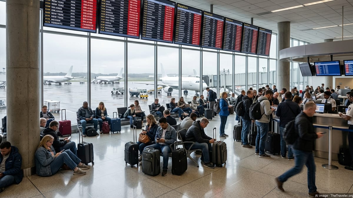
Flight Delays Already Emerging Across the Network
Real-time tracking dashboards used by travelers and airlines show delays building on routes into and out of upstate New York and northern New England as the storm line advances. While many disruptions remain under an hour, some midmorning and early afternoon services have already been pushed back significantly as carriers slow operations during peak thunderstorm windows.
Experience from previous severe weather days in the Northeast suggests that relatively modest delays at smaller airports can cascade into longer hold times later in the schedule. Aircraft arriving late from storm-affected cities may miss their next departure slot, forcing airlines to reshuffle equipment and crews. In addition, any extended ground stop at a major hub such as New York or Boston can quickly back up departures from airports in Albany, Burlington and western Massachusetts.
Travel industry analysis of historical data shows that convective weather in the New York airspace complex is a leading driver of nationwide delay spikes, particularly on busy summer travel days. With today’s tornado watch overlapping an already active mid-June schedule, observers expect an uptick in missed connections and same-day rebookings, especially for travelers using New York City as a connecting point to or from the affected region.
Some carriers have begun posting general advisories urging passengers to check their flight status frequently and to allow additional time at the airport. While no broad fee-waiver programs specific to this tornado watch had been widely publicized by midday, airlines often introduce flexible rebooking options if storms trigger prolonged disruption at one or more hubs.
What Travelers Flying Today Should Expect
For passengers flying into or out of New York, Vermont and Massachusetts today, the most immediate impacts are likely to be departure holds, gate changes and in-flight reroutes around stronger storms. Short-haul flights within the Northeast are especially vulnerable to temporary pauses in operations, as there is less slack in the schedule to absorb delays.
Travel planning resources recommend that passengers traveling this afternoon and evening monitor airline apps or text alerts closely and consider checking in earlier than usual in case security or boarding procedures are adjusted due to lightning or heavy rain. Those with tight connections through New York or Boston may want to look at alternative later flights or backup itineraries, particularly if their inbound leg passes directly through the current watch area.
Ground travel around affected airports could also be challenging at times. Forecasts for the watch region highlight the potential for sudden downpours that reduce visibility and lead to ponding on highways leading to terminals. Brief power interruptions or flooded access roads, already reported in parts of upstate New York during earlier storms this season, remain a possibility as today’s system moves through.
Travelers with flexibility are being encouraged by general advisory services to shift nonessential trips outside the peak storm window where possible, or to consider rebooking for Friday once the cold front has cleared the region and conditions stabilize. For those who must fly today, experts emphasize the importance of preparing for delays as a likely part of the experience.
Storm Threat Expected to Diminish by Evening
Outlook discussions from national and regional forecasting centers indicate that the severe threat across New York, Vermont and Massachusetts should gradually wane by early evening as the frontal boundary moves east and cooler, drier air filters into the region. As instability diminishes, the risk of tornadoes and widespread damaging winds is expected to drop, though a few lingering showers and storms may persist into the night.
Once the most intense convection shifts into northern New England and the Canadian Maritimes, air traffic managers typically begin easing flow restrictions, allowing airlines to work through backlogs of delayed departures and arrivals. Recovery can still take several hours, and late-night and early-morning flights on Friday may reflect repositioning efforts as aircraft and crews return to their normal patterns.
Even after the watch expires, aviation forecasters will remain focused on residual wind gusts and low cloud ceilings that can temporarily keep arrival and departure rates below normal. However, current projections suggest a broad improvement in flying conditions across the Northeast corridor on Friday, with only isolated disruptions compared with today’s widespread weather-related slowdowns.
For now, travelers are being advised by public information outlets to stay weather-aware, build extra time into their plans and anticipate that flights touching New York, Vermont and Massachusetts may experience delays as the tornado watch and associated storms move through the region.