


More news on this day
Scotland is braced for major travel disruption this weekend as Storm Boelo brings forecast gusts of up to 80 mph, prompting widespread rail cancellations, road warnings and severe weather alerts across much of the country.
Get the latest news straight to your inbox!
Amber wind warnings and severe weather forecast
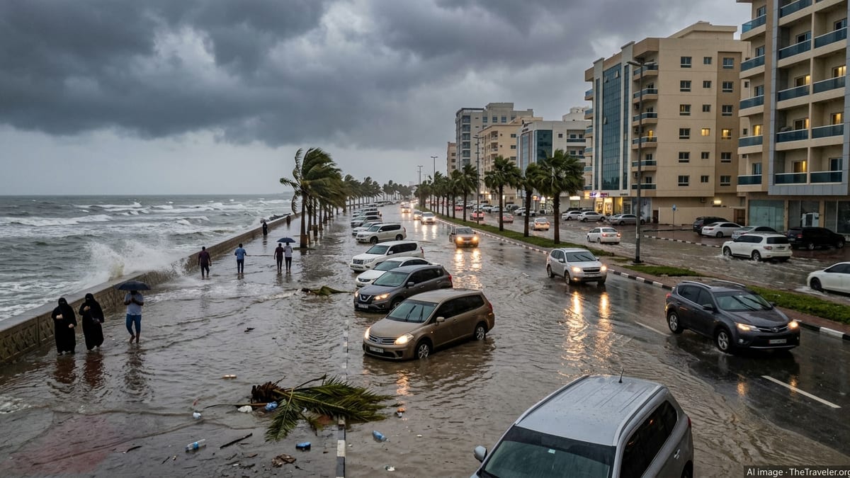
The Met Office has issued an amber wind warning covering most of mainland Scotland over Saturday 24 and Sunday 25 October, signalling a high likelihood of power interruptions and transport disruption as Storm Boelo crosses the country. Forecasters expect southerly winds to strengthen on Saturday before more intense westerlies arrive later, combining with heavy rain and hill snow over higher ground.
Guidance published ahead of the storm indicates that coastal and upland areas in the west and north are most exposed, with widespread gusts of 60 to 70 mph and potential peaks around 80 mph along Atlantic coasts and on higher routes. The upgraded alert follows earlier yellow warnings for wind and rain that had already highlighted the risk of difficult driving conditions and localised flooding.
Publicly available information stresses that weather warnings may change at short notice as Storm Boelo develops, and travellers are being urged to monitor forecasts for the specific area and time of their journey. The storm follows a week in which Storm Austen affected southern parts of the UK, but Boelo is expected to focus its strongest impacts on Scotland, Northern Ireland and the far north of England.
Local authorities, including councils in the northeast, have warned that combined strong winds and heavy rain over the weekend could lead to longer journey times, cancellations across road, rail, air and ferry networks, and possible restrictions on exposed bridges and causeways.
Rail lines to close across west and north Scotland
Scotland’s rail network is preparing for significant disruption, with Network Rail setting out pre planned line closures and speed restrictions in response to the amber warning. Rail lines in the west and north of the country are scheduled to close during the height of Storm Boelo, with services suspended on key rural and coastal routes to reduce the risk from falling trees, debris and flooding.
According to operational summaries, services south and west of Kilwinning in Ayrshire are due to stop from around 21:00 on Saturday, while the Oban and Mallaig lines on the West Highland network are expected to close from roughly 22:00. On Sunday, the line between Kyle of Lochalsh and Achnashellach, as well as the route between Wick and Helmsdale in the far north, are planned to remain closed from the start of service while inspections take place.
In addition to full closures, reduced speed limits will be enforced across large parts of the Scottish network from late Saturday into Sunday. Slower running allows drivers more time to spot obstructions and reduces the likelihood of damage if trains encounter debris, but it also lengthens journey times and reduces the number of services that can operate.
National Rail has issued separate disruption notices for long distance operators serving Scotland, including London North Eastern Railway, Avanti West Coast and TransPennine Express. These advisories point to amber and yellow weather warnings across Scotland and northern England on 24 and 25 October and flag that services north of key hubs such as Edinburgh, Glasgow and Preston may be cancelled or heavily amended on Sunday.
Ticket flexibility and limited alternatives for passengers
Service updates for the weekend indicate that ticket easements will be in place for many affected rail journeys. National Rail information for long distance operators states that customers with tickets for trains cancelled because of Storm Boelo can generally use them on alternative services run by participating train companies, typically within a two hour window either side of the original departure time, subject to space being available.
For some Scottish routes, particularly between Edinburgh and Aberdeen, published notices explain that rail replacement coaches will not operate during the peak of the storm due to the risk of high sided vehicles being affected by strong crosswinds or blocked roads. Passengers are being advised that, where no safe alternative transport can be provided, they may be able to travel on another day instead, in line with each operator’s specific disruption policy.
Information from TransPennine Express and other cross border operators describes the weekend as a period for essential travel only on certain northern routes, reflecting the combination of high winds, heavy rain, and the potential for flying debris or flooding near the tracks. Travellers are being encouraged to consider whether journeys can be postponed until after the amber warning expires.
Those who need to connect between multiple operators are being urged, through publicly available travel advice, to check each leg of their journey before setting out and to allow extra time for missed connections. With speed restrictions and inspections likely to continue into Sunday, rail planners expect knock on delays even after the strongest winds begin to ease.
Road network on alert for high winds and hazardous driving
Transport agencies in Scotland are highlighting the risk of difficult and dangerous driving conditions while the amber wind warning is in force. Traffic Scotland’s storm guidance notes that strong crosswinds can be particularly hazardous on exposed routes, high level bridges and viaducts, with a heightened risk for high sided vehicles, motorcycles and vehicles towing caravans or trailers.
Police travel advice reproduced through national traffic channels warns of a high risk of disruption for road users in the areas covered by the amber alert. Restrictions or closures are possible on major bridges and causeways if gusts reach thresholds where vehicles could be destabilised. Drivers are being encouraged to listen for broadcast traffic updates and to check digital road condition maps before deciding whether to travel.
Local authorities in northeast Scotland have cautioned that surface water and spray from heavy, persistent rain may combine with leaf fall at this time of year to reduce visibility and increase stopping distances. In rural and upland areas, minor roads are considered especially vulnerable to fallen branches, debris and localised flooding, raising the possibility of diversion or temporary closure while crews clear hazards.
Guidance from official road safety campaigns linked to previous storms in Scotland stresses that, if travel is unavoidable, motorists should reduce speed, increase the distance to the vehicle in front and be prepared for sudden gusts when passing gaps in roadside shelter or when overtaking larger vehicles. Travellers are also being advised to carry warm clothing and basic supplies in case congestion or blocked routes lead to extended delays.
Air, ferry and tourism plans face storm uncertainty
The impact of Storm Boelo is also expected to extend beyond road and rail, with transport updates warning of likely disruption to air and ferry services serving Scotland’s islands and more remote coastal communities. Public notices compiled by Traffic Scotland and local councils note that high winds and large waves may force last minute changes to timetables on key ferry crossings, particularly on routes across the Minch and to the Northern Isles.
Airports and airlines operating domestic services within Scotland and to the rest of the UK are assessing the risk of crosswinds exceeding safe landing and take off limits at times over the weekend. While detailed schedules are being handled directly by carriers, travel advisories suggest that passengers check the status of flights before leaving for the airport and be prepared for aircraft to divert to alternative airports if wind conditions deteriorate.
For visitors, the storm is likely to affect scenic driving routes and popular coastal destinations, especially along the west coast and in the Highlands and Islands, where exposed single track roads and viewing points may be unsafe during the strongest gusts. Tourism businesses that rely on outdoor activities, island access or high level walks are monitoring the forecast closely and may adjust or cancel excursions at short notice.
Travel information services are stressing that, while many journeys will still be possible, flexibility is essential over the weekend of 24 and 25 October. Travellers are being encouraged to keep itineraries adaptable, build in additional time for connections, and consider rescheduling non essential trips until the worst of Storm Boelo has passed and engineers have been able to check key routes for damage.