


On my first visit to Guavate, I did what most people do: I drove up Puerto Rico’s famous Pork Highway, ate far too much perfectly crisp lechón, and rolled back to San Juan in a happy food haze. On my second trip, I finally did what locals and Discover Puerto Rico have been suggesting for years and combined Guavate with a nature stop in the Cayey mountains. I paired a classic lechonera lunch with a walk in Bosque Estatal de Carite and a swim at Charco Azul, and that combination changed how I think about Guavate entirely.
Get the latest updates straight to your inbox!
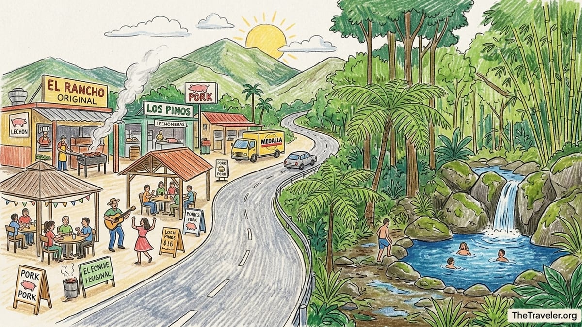
Getting From San Juan To Guavate, Then On To Carite
I started the day in San Juan and picked up a rental car near the Condado area just before 9:30 a.m. From there, the route to Guavate was straightforward: I took PR-52 south toward Ponce and followed the signs for Cayey. After about 35 to 40 minutes on the toll highway, I exited near the Monumento al Jíbaro, a giant sculpture honoring Puerto Rico’s mountain farmers that you can spot from the expressway. From that exit, local roads led a short distance to PR-184, the two-lane mountain road everyone calls the Pork Highway, in the Guavate barrio of Cayey. In total, it took a little under 50 minutes of driving from central San Juan to the first lechoneras, which matches the roughly 45-minute estimate often cited by local tourism sources.
PR-184 quickly shifted from ordinary country road to sensory overload. Within a few minutes, hand-painted signs for lechoneras appeared, music drifted from open-air pavilions, and the smoke from wood-fired pork grills hung in the air. The drive itself did not feel dangerous, but it did demand attention: the road twists along the hillsides, has some narrow sections, and fills up on weekends. I was glad to have a small car that could easily slide into tight parking spots and around buses and vans stopping for groups.
Guavate is also the main access corridor into Carite State Forest, a 7,000-acre reserve that spreads across several municipalities in southeastern Puerto Rico and shelters rivers, cloud forest, and the deep-blue Charco Azul pool. Road PR-184 does double duty here. The first several kilometers form the Pork Highway lined with lechoneras, then the same road continues south, gaining altitude and slipping into the forest on the way toward the Patillas side of the mountains. That overlap is what makes it so tempting to treat Guavate as one half of a combined food-and-nature itinerary.
From the cluster of well-known lechoneras around kilometer markers in the mid-20s, it was about a 15 to 20 minute drive further along PR-184 to reach the Charco Azul recreation area in Carite. The change in scenery was dramatic. Salsa and merengue faded behind me and the road narrowed under a canopy of bamboo and tall trees. The pavement here showed more scars from heavy rains and landslides in recent years, with patched sections and the occasional rough spot or small rock on the asphalt, but it remained passable in a normal sedan under the dry conditions I found that day.
Choosing The Order: Forest First Or Pork First?
Before the trip, I debated the order of the day. Some locals I spoke with in San Juan swore by hiking first, then rewarding themselves with pork and cold beer. Others said they preferred to eat early before the biggest crowds and live bands, then walk off lunch in the cooler mountain air later in the afternoon. Tourism guides that pair Guavate with Carite often build in a hefty lunch followed by a shorter, low-impact forest walk and swim instead of a long hike, essentially treating the nature time as a gentle digestif.
In the end, I chose nature first. I left San Juan just before 9:30 a.m. and drove straight through Guavate without stopping to eat, reaching the Charco Azul parking area a little after 10:30 a.m. The logic was simple. I wanted an empty stomach for the humid forest, the flexibility to spend more time at the river if it was quiet, and the peace of mind that comes from tackling mountain driving and trail conditions early in the day rather than racing the afternoon thunderstorms that often bubble up in Puerto Rico’s interior.
That choice paid off. Temperatures at that hour were warm but manageable, and the trail to Charco Azul was shaded and mostly dry. By the time I returned to the car, I had earned a serious appetite, and driving back downhill to Guavate felt easier with the day’s “work” already done. When I finally reached the lechoneras around 1:00 p.m., they were lively but not yet in full weekend chaos, which made ordering and finding a table simpler.
Having tried both orders on separate visits, I would now recommend most travelers tackle Carite and Charco Azul first if they plan to swim or walk more than a short distance, especially in the wetter summer months. Hiking after a heavy plate of rice, beans, pork, morcilla sausage, and a couple of Medallas is technically possible but far less pleasant, particularly for those not used to tropical humidity or twisty mountain roads.
Driving, Parking, And Safety Along PR-184
PR-184 itself tells the story of how Guavate and Carite are intertwined. Near the northern end by Cayey, the road feels almost festive, with bright signs shouting the names of lechoneras like El Rancho Original, Los Pinos, and others that have been feeding families for decades. Parking here is informal but abundant. Many lechoneras have their own paid lots, charging just a few dollars in cash. In my case, I paid a small fee equivalent to a couple of U.S. dollars to park directly behind the restaurant I chose, guided by an attendant in a fluorescent vest.
Continuing south toward Carite, the infrastructure shifts from festive to functional. The lane markings fade, guardrails give way to concrete edges and vegetation, and the number of houses thins as the forest closes in. The road surface in this section had visible repairs from previous storm damage, and there were small rock fragments and leaves in some corners. Under dry weather, the drive felt slower but not intimidating, as long as I watched for oncoming traffic in the tighter bends and stayed alert for sudden stops where the forest opens and people pull off near the river.
Parking at Charco Azul was straightforward but basic. The recreation area sits off PR-184 near kilometer 17 to 18, signaled by roadside signage, a gate, and a cluster of concrete shelters. The parking area itself is unpaved in parts and a bit uneven, with space for several dozen vehicles. There were no attendants the day I visited, and parking was free, but I saw evidence of previous facilities like gazebos and restrooms that have suffered storm damage and are in various states of disrepair. Recent local reports confirm that some infrastructure in Carite and Guavate’s older picnic areas still has not fully recovered from Hurricane Maria.
From a safety standpoint, the main concerns were the usual mountain-driving issues: sudden rain showers that can slick the surface, low visibility around bends, and occasional fallen branches. Landslides remain a seasonal risk in the central range, particularly after prolonged rain, and local emergency management plans for Cayey and surrounding municipalities flag parts of PR-184 as areas to monitor. On a clear, dry day, though, I saw plenty of families in compact cars navigating the same route without trouble.
The Trail To Charco Azul: Conditions, Footwear, And Insects
The walk to Charco Azul begins at the recreation area gate and heads into Carite State Forest along a well-used path paralleling a small river. Official tourism descriptions often describe this access as a short, low-impact walk rather than a strenuous hike, and that matched my experience. From the parking area to the pool took me about 15 to 20 minutes at a leisurely pace, with short pauses to photograph tree ferns, vine-wrapped trunks, and small cascades upstream.
The path mixes concrete sections, packed dirt, and rocky patches. In several places, footbridges cross the stream, some metal and some concrete, with railings in variable condition. After storms, mud and leaf litter can make these sections slick, and portions near the water can flood or wash out temporarily. On my visit during a relatively dry spell, the trail surface was damp in shaded pockets but mostly firm. I wore closed-toe hiking sandals with good grip and was glad I did. Sturdy sneakers would also work well as long as travelers do not mind getting them wet at the edges. Flip-flops would have been a bad idea, especially for older visitors or anyone carrying gear.
Insects were present but manageable. Mosquitoes are common in Puerto Rico’s interior, particularly near standing water, but constant water flow through this section of river and a light breeze kept the worst of them away. I had applied a standard DEET-based repellent before leaving the car and reapplied once at the pool, and I left with only a couple of bites. Tiny gnats occasionally swarmed closer to the water, especially when I stood still taking photos, but a hat and sunglasses helped keep them out of my face.
One subtle factor that guests sometimes overlook is the effect of recent rain on water clarity and current. On the day I visited, the river ran clear enough to see the pale rocks under the surface and the darker basin of the pool. After heavy storms, locals say the water can turn brown with sediment and the flow can quicken. Those conditions make Charco Azul less idyllic as a swimming hole and require extra caution, especially with children. Given the dynamic nature of Puerto Rico’s weather, I would always ask a Guavate lechonera staffer or a forest worker about recent conditions before committing to a long drive just for a swim.
Swimming At Charco Azul And Crowd Levels
Charco Azul itself felt like a hidden amphitheater of rock and water. The name refers to the deep-blue tint the pool takes on when the light hits it right, framed by mossy boulders and a small cascade at the far end. The day I arrived, there were only a handful of other visitors: a family with two school-age children and a trio of young adults who had clearly come straight from a late breakfast in Guavate, still laughing about the pork portions as they spread towels on the rocks.
I eased into the water from a gently sloping edge near one of the rock shelves. The temperature was refreshingly cool, maybe a little under typical ocean temperature at the island’s beaches that time of year, enough to jolt my system but not uncomfortably cold once I started moving. The pool is deep near the waterfall side, and several people took turns jumping from an accessible ledge while others stayed in the shallower shelf along the rim. There were no lifeguards, and supervision here is entirely up to visitors, so I would be extra cautious with non-swimmers and small children.
Even at low crowd levels, noise travels in the rock bowl, but it felt more like a happy echo chamber than a party scene that morning. Locals told me weekends and holiday afternoons bring a very different atmosphere, with bigger groups, portable speakers, and a busier trail. For those seeking a quieter communion with nature, visiting on a weekday morning or early afternoon, ideally outside major holiday weekends, is the best strategy.
Was Charco Azul worth the detour beyond Guavate? For me, absolutely. The additional 15 to 20 minute drive each way and a total of 60 to 90 minutes on the trail and in the water turned what could have been a purely culinary pilgrimage into a fuller portrait of the Cayey mountains. The chance to rinse off in fresh water, listen to the river, and then pivot back to music and pork felt like a complete day rather than a single indulgent meal.
Back To Guavate: Eating After The Forest
By the time I drove back up PR-184 from Charco Azul toward the lechoneras, my appetite was in full roar. I opted for one of the classic names in the mid-stretch of the Pork Highway, a lechonera known both for its riverside setting and for drawing steady weekend crowds. The parking lot was busy but not overflowing, and a helpful attendant guided me into a tight space in exchange for a few dollar bills.
Inside, the routine followed a familiar mountain rhythm. I joined the line at the meat counter, where whole roast pigs glistened under heat lamps, skin crackling as the carver’s machete came down. I ordered a plate of lechón, arroz con gandules, yuca al mojo, and a thin slice of pavochón, the turkey marinated like pork that some lechoneras are famous for, plus a local beer. The price for a very generous plate with sides and a drink landed around the cost of a mid-range meal in San Juan, but the portion could have easily fed two modest eaters.
Eating after swimming felt different from arriving already full from a big city breakfast and sitting down immediately. My body was pleasantly tired, my legs humming from the trail, and the food felt like a reward rather than an indulgence stacked on top of a sedentary morning. The live music kicked in as I found a table: a small band playing salsa and música jíbara, with a few couples already dancing between the plastic tables and the river. Tucking into roast pork while damp swimsuit fabric dried under my clothes, I understood why tour operators have leaned into this pairing.
From a digestion standpoint, doing the forest first was the right call. The combination of pork, rice, beans, and fried sides can be heavy, especially if you are not used to it. Facing a humid, sometimes slippery trail in Carite after eating that much would have required more effort and increased the risk of sluggish steps or twisted ankles. I left Guavate late in the afternoon content and ready for an easy highway drive back to San Juan, not a hike.
Weather, Seasonality, And When To Go
Weather shaped my day more than any timetable on paper. Puerto Rico’s Cayey mountains sit high enough that they tend to catch passing showers and afternoon thunderstorms, especially from late spring through early fall. Mornings, however, are often clearer, with clouds building over the peaks as the day warms. That pattern held when I visited: blue skies on the highway, a few cottony clouds over Guavate, and then thicker clouds gathering above Carite by the time I was drying off at Charco Azul.
Going early to the forest also offered more flexibility if something went wrong. Had the trail been washed out in a section or the river running too high and brown to swim, I could have still enjoyed the walk to a viewpoint or turned back without feeling that my entire day hinged on the pool. In that case, Guavate’s lechoneras become the fallback plan, an experience that rarely disappoints even when nature does not cooperate fully.
On the food side, Guavate has a different rhythm depending on the day. Weekends and holidays bring big crowds, live bands, and heavy traffic on PR-184. Plates of roast pork sell quickly, and parking lots fill early. Midweek, more lechoneras are either closed or running on reduced hours, but those that remain open offer a calmer, more local scene. For a combined Guavate and Carite outing, I found a weekday or a non-holiday Friday ideal: enough atmosphere at the lechoneras for music and energy, but more manageable crowd levels at both the restaurants and Charco Azul.
Temperature in the mountains is typically a few degrees cooler than on the coast, with Guavate benefitting from mild weather compared to San Juan’s urban heat. I noticed the difference as soon as I stepped out of the car, especially under shade near the river. That cooler air made both the walk in Carite and the hearty meal afterward feel far more comfortable than they might in an exposed coastal setting in mid-afternoon.
What I Would Change Next Time
As much as I enjoyed pairing Guavate with Carite and Charco Azul, the day was not perfect. I underestimated how long I would want to linger by the river and at the swimming hole. Between the walk in, time in the water, and simply sitting on a rock listening to the falls, I spent nearly two hours in the forest, longer than I had penciled in. That compressed my Guavate time on the tail end of the day, leaving less room to sample multiple lechoneras or move between spots for coffee and dessert.
Next time, I would leave San Juan 60 to 90 minutes earlier, aiming to arrive at the Charco Azul parking lot by 9:30 a.m. at the latest. That would give me time to enjoy the forest while it is at its quietest, swim before the day warms fully, and still reach Guavate around lunchtime, when the lechoneras swing fully into gear. I would also pack a more deliberate bag for the forest: a dry bag for valuables, a lightweight microfiber towel instead of a bulky beach towel, and water shoes in addition to sandals for better traction on slick rocks at the pool’s edge.
I would also plan my Guavate stops more intentionally. On this combined outing, I committed to one main lechonera for lunch, then grabbed a quick coffee and dessert at a second stop before heading back to San Juan. There is a strong argument for choosing two or three lechoneras with different strengths, perhaps one known for its pavochón, another for its morcilla or longaniza, and a final stop that excels at sweets and coffee. With a designated driver in the group to keep alcohol intake modest, that kind of lechonera hop can round out the day without feeling excessive.
Lastly, I would communicate even more with locals about current conditions before going. In mountain environments that see regular rain, road repairs, and evolving rules about parking and recreation areas, the latest information from Guavate restaurant staff, forest workers, or recent visitors can make the difference between a smooth day and unexpected closures or detours.
Standalone Pork Pilgrimage Or Broader Cayey Mountains Outing?
After experiencing Guavate both alone and paired with Carite, my answer is that it depends on what kind of traveler you are and how much time you have. As a standalone food day, Guavate delivers in spades. You can leave San Juan late morning, arrive by lunchtime, wander between lechoneras following your nose and your ears, nibble on roast pork, yucca, and pasteles, and be back in the city by evening, full and satisfied. For visitors who have limited time on the island or who are traveling with people who are not interested in walking or swimming, that approach makes sense.
But when I layered in Carite State Forest and Charco Azul, Guavate shifted from a single note to part of a chord. The Pork Highway is not just a strip of restaurants but also a gateway into a mountain ecosystem of rivers, cloud forest, and cooler air. Walking to Charco Azul confronted me with the source of some of the water that feeds the Guavate River and the valleys below. Swimming in fresh water made the subsequent taste of crisp pork and smoky rice stand out more vividly, like alternating hot and cold plunges.
If your itinerary allows for a full day and you are comfortable driving mountain roads, I would now recommend treating Guavate as one half of a broader Cayey mountains outing rather than as a standalone destination. Do the forest and river first, then eat, drink, and perhaps dance your way through an afternoon at the lechoneras. You will end the day with not only a memory of exceptional pork but also a deeper sense of Puerto Rico’s interior, where food, music, and nature are inextricably linked.
For return visitors or those building longer stays in Puerto Rico, the Guavate plus Carite combination can even serve as a blueprint for other pairings along the island’s mountain corridors, where roadside food culture and protected natural spaces press up against each other in similarly enticing ways.
The Takeaway
Combining Guavate’s Pork Highway with a stop in Carite State Forest and a swim at Charco Azul transformed what had been a single-purpose eating pilgrimage into a fuller day in Puerto Rico’s Cayey mountains. The logistics worked: a sub-one-hour drive from San Juan to Guavate, a 15 to 20 minute continuation up PR-184 into the forest, and a short, manageable walk to a river pool that feels genuinely removed from the highway’s bustle.
Doing nature first then lechón proved to be the smart sequencing, especially given the humidity, trail conditions, and the weight of a proper Guavate meal. Reasonable road conditions, informal but workable parking, and moderate insects made the outing accessible to anyone comfortable with gentle hiking and fresh-water swimming, though caution is still warranted during or after heavy rains.
Most of all, the day clarified Guavate’s place in a broader landscape. The lechoneras are not a roadside gimmick isolated from their environment but part of a larger story about mountain communities, forest reserves, and rivers that tie highlands to coastal plains. In that context, Guavate works best not as a standalone food day but as a flavorful anchor to a wider exploration of the Cayey mountains, where a plate of roast pork tastes even better with river water still drying on your skin.
FAQ
Q1. How long does it take to drive from San Juan to Guavate and then to Charco Azul?
From central San Juan to the main Guavate lechoneras on PR-184 typically takes about 45 to 60 minutes by car, depending on traffic. From that lechonera cluster, continuing along PR-184 into Carite State Forest to reach the Charco Azul recreation area adds roughly 15 to 20 minutes of driving.
Q2. What are the road conditions like on PR-184 between Guavate and Carite?
The section of PR-184 through Guavate is paved and busy, with frequent stops and slow traffic on weekends. South of the lechoneras, the road narrows and shows more patchwork from past storm damage but remains passable in normal sedans during dry weather. Drivers should watch for sharp curves, fallen debris after rain, and occasional landslide repairs.
Q3. Is parking available at the Guavate lechoneras and at Charco Azul?
Most Guavate lechoneras have their own parking lots, often with attendants who charge a small cash fee to guide cars into spaces. At Charco Azul, parking is in a basic, unpaved recreation-area lot off PR-184, typically without attendants. Space can be limited on busy weekends, so arriving earlier in the day is wise.
Q4. How difficult is the trail to Charco Azul, and what footwear is recommended?
The walk to Charco Azul is generally considered easy to moderate, taking about 15 to 20 minutes along a mix of concrete, dirt, and rocky sections with several small bridges. Closed-toe shoes with good grip, such as hiking sandals or sturdy sneakers, are recommended. Flip-flops are not ideal due to slippery patches and uneven terrain.
Q5. Are there facilities like restrooms or changing rooms at Charco Azul?
The Charco Azul recreation area shows evidence of older facilities, but some structures have suffered storm damage and may not be fully maintained. Travelers should not count on functioning restrooms or formal changing rooms and may want to arrive dressed for hiking and swimming, bringing a towel and dry clothes to change into discreetly if needed.
Q6. Is swimming at Charco Azul safe, and are there lifeguards?
Swimming at Charco Azul is at visitors’ own risk. There are no lifeguards, and water depth varies, with deeper sections near the waterfall and shallower shelves around the edges. Conditions can change after heavy rain, affecting current and clarity. Strong swimmers comfortable in natural freshwater settings tend to enjoy it most, and extra caution is advisable with children.
Q7. When is the best time of day to visit Carite and Charco Azul in combination with Guavate?
Visiting Carite and Charco Azul in the morning, before midday heat and potential afternoon thunderstorms, works well. Arriving at the trailhead by late morning allows time to hike and swim, then drive back to Guavate around lunchtime or early afternoon for a meal at the lechoneras, avoiding the heaviest traffic and crowds.
Q8. Are insects a major issue on the Charco Azul trail and at the pool?
Mosquitoes and small gnats are present, especially in shady, damp areas near the river, but conditions vary with weather and season. Applying insect repellent before starting the walk and carrying a small bottle for reapplication usually keeps bites manageable.
Q9. Can Guavate work as a standalone day trip without visiting Carite or Charco Azul?
Yes. Many travelers visit Guavate solely for the Pork Highway experience, spending several hours moving between lechoneras, enjoying live music, and relaxing by the river before returning to San Juan. For visitors with limited time or those not interested in walking or swimming, Guavate alone makes a satisfying day trip.
Q10. Is it better to visit the forest and Charco Azul before or after eating in Guavate?
Based on firsthand experience and local advice, most travelers will find it more comfortable to visit Carite and Charco Azul first, then eat in Guavate afterward. Tackling the short hike and any swimming on a relatively empty stomach avoids hiking in the heat after a heavy pork meal and makes the food feel like a well-earned reward.