
More news on this day
With California’s Highway 1 through Big Sur restored after years of intermittent closures, the classic Pacific Coast Highway road trip from San Francisco to Los Angeles is returning to the top of many travelers’ wish lists for 2026.
Get the latest news straight to your inbox!
Highway 1 Reconnected, With Changing Conditions To Watch
The coastal route between San Francisco and Los Angeles has long been marketed as one of the most scenic drives in the United States, but repeated storm damage and landslides in recent years forced travelers to detour inland or cancel coastal itineraries. Publicly available information from state transportation updates and regional tourism councils indicates that as of early 2026, uninterrupted travel is again possible between Carmel and Cambria, restoring the full coastal link that underpins this iconic journey.
Reports from local organizations along the Central Coast highlight that the critical 6.8 mile stretch near Regent’s Slide, which had been closed on and off since 2023, reopened in mid January. The reopening followed extensive slope stabilization and road rebuilding, described in state engineering summaries as one of the more complex repair efforts undertaken on this corridor. Regional tourism bodies now describe Highway 1 as open end to end for standard passenger vehicles between the Bay Area and Southern California.
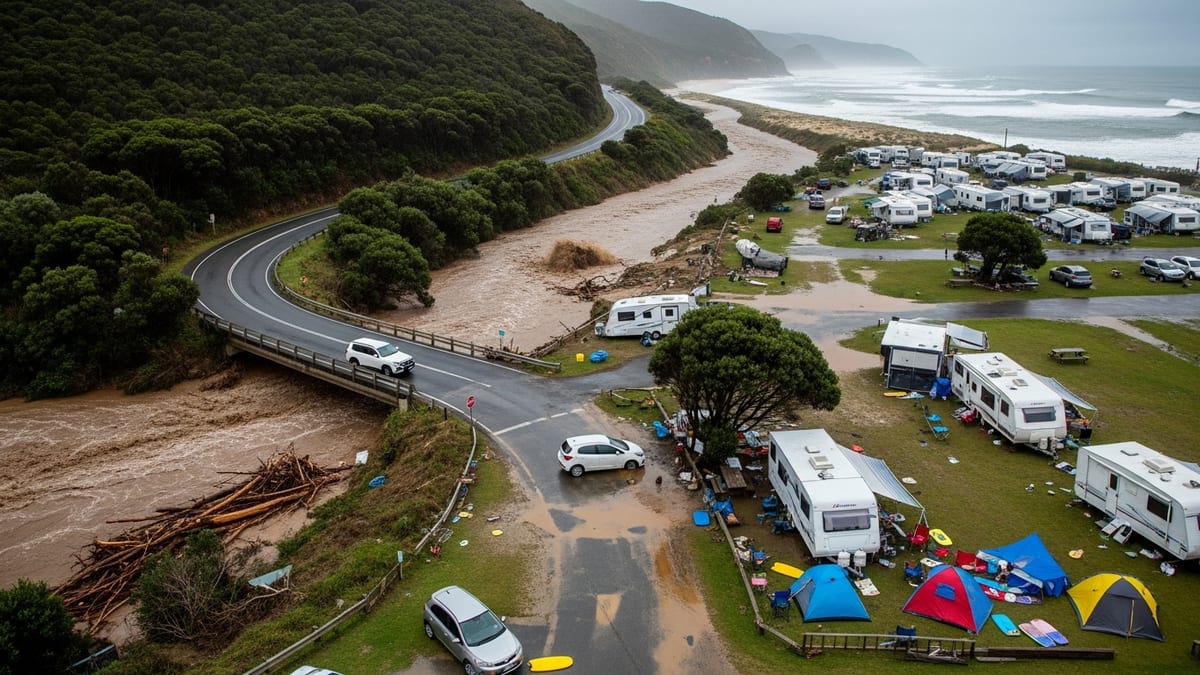
At the same time, transportation bulletins and regional news coverage stress that winter and early spring continue to bring short notice disruptions. Rockfalls and debris have already prompted temporary closures near Big Sur and Ragged Point in February 2026 before reopening within days. Travelers planning a Pacific Coast Highway trip this year are being urged, through public advisories and destination websites, to monitor conditions right up to departure and to build flexibility into their schedules.
From San Francisco’s Oceanfront To Santa Cruz’s Surf Scene
Most itineraries begin in San Francisco, where drivers typically pick up Highway 1 near the city’s western edge and follow the coastline past Ocean Beach and the windswept bluffs south of the city. Travel guides describe this first segment as an easy introduction to coastal driving, with frequent viewpoints overlooking the Pacific and pullouts popular with local walkers and cyclists.
South of the city, Half Moon Bay has emerged in recent coverage as a favored first stop, offering sheltered beaches, seasonal pumpkin fields in autumn and a small downtown with cafes and bakeries. The area’s harbor and nearby surf breaks, including the famed Mavericks, provide an early glimpse of the Pacific’s power on this route, even for visitors who never leave the shoreline.
Santa Cruz, roughly two hours’ drive from San Francisco with stops, is frequently identified as the first major overnight option. Travel features highlight its combination of classic boardwalk amusements, a historic wooden roller coaster, and a strong surf culture centered on breaks such as Steamer Lane. The town’s blend of university energy, beach culture and redwood groves in nearby hills makes it a natural pause before the road curves toward the Monterey Peninsula.
Monterey, Carmel And The Reopened Big Sur Coast
The stretch from Santa Cruz to Monterey and Carmel concentrates several of the trip’s most visited attractions in a short distance. Monterey’s Cannery Row and aquarium continue to rank among California’s best known family stops, while nearby Pacific Grove offers quieter waterfront paths and historic Victorian architecture. Scenic drives such as 17 Mile Drive, which loops through the coastal forests and golf courses of Pebble Beach, add optional detours for those with extra time.
Just south, Carmel by the Sea is portrayed in many travel guides as a storybook town, with cottage style architecture, art galleries and a broad, dog friendly beach. Its compact center and upscale inns make it a common jumping off point for exploring Big Sur, now that the coastal highway beyond has fully reopened after years of disruption.
Big Sur itself is the emotional centerpiece of the San Francisco to Los Angeles route, a roughly ninety mile stretch where the Santa Lucia Mountains drop sharply into the ocean. Updated destination materials from local chambers and tourism councils note that motorists can once again drive the entire run between Carmel and Cambria without detouring inland, experiencing viewpoints such as Bixby Creek Bridge, Pfeiffer Big Sur State Park and Julia Pfeiffer Burns State Park in sequence. Roadside commentary now often emphasizes both the privilege of returning to this landscape and the importance of driving cautiously on narrow, cliff hugging pavement that remains vulnerable to weather.
Wildlife, Wine Country And Beach Towns On The Central Coast
South of Big Sur, the landscape softens into rolling ranch land and low coastal terraces as Highway 1 approaches San Simeon and Cambria. Recent travel coverage points to Hearst Castle’s hilltop estate as a major draw, with guided tours of its historic pools and grand rooms still attracting visitors who break their drive for half a day or more.
Along the nearby shoreline, the Piedras Blancas elephant seal rookery has become a headline wildlife stop. Nature organizations and regional tourism offices describe how hundreds of elephant seals haul out on the beach throughout the year, with peak activity during winter breeding season. Viewing platforms adjacent to the highway allow travelers to watch the animals without disturbing them, making this one of the few major wildlife spectacles on the route accessible without a long hike.
Farther south, Cambria, Cayucos and Morro Bay continue to receive attention as laid back alternatives to larger cities. Cambria’s forested hills and boardwalk lined Moonstone Beach, Cayucos’s wooden pier and surf breaks, and Morro Bay’s harbor framed by the volcanic dome of Morro Rock all feature prominently in current destination marketing. Inland, Paso Robles and San Luis Obispo’s wine country increasingly appear in Pacific Coast Highway itineraries, with visitors detouring briefly from the coast for vineyard tastings before rejoining Highway 1 toward Pismo Beach and beyond.
Final Stretch To Los Angeles: Classic Piers And Coastal Neighborhoods
As the Pacific Coast Highway swings past Pismo Beach, Santa Maria and the Gaviota Coast toward Santa Barbara, the scenery gradually shifts from open ranch land to more densely developed shoreline. Travel reports describe Santa Barbara as a key final stop, with its Spanish style architecture, palm lined waterfront and nearby wine country in the Santa Ynez Valley drawing both domestic and international visitors.
South of Santa Barbara, drivers encounter a nearly continuous string of beach communities, from Carpinteria and Ventura to Malibu, many of them familiar from film and television. Publicly available visitor data indicates that the Malibu stretch, with its narrow beaches, celebrity homes and state park trails, remains one of the most photographed sections of the journey.
Entering the Los Angeles area, the route typically transitions from the quieter coastal highway to urban traffic, concluding near Santa Monica and its landmark pier. Recent travel features suggest timing the final approach to arrive outside peak rush hours, preserving a last look at the Pacific from the bluff top parks or the pier before turning inland. With Highway 1 once again open along Big Sur, the full run between San Francisco and Los Angeles offers, at least for now, a continuous chain of seascapes, small towns and state parks that many travelers consider the ultimate American road trip.