


More news on this day
Thick overnight fog has triggered a Met Office yellow warning for parts of Northern Ireland today, with visibility in some western areas dropping below 100 metres and prompting cautions over potentially slower and more hazardous travel.
Get the latest news straight to your inbox!
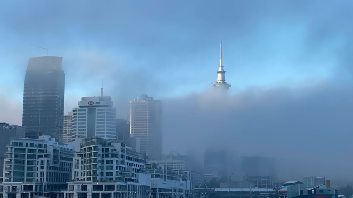
Yellow warning targets western counties as visibility plunges
The latest National Severe Weather Warning, issued by the Met Office for Tuesday 3 November, highlights western parts of Northern Ireland as most at risk from thick fog, including sections of County Fermanagh, County Londonderry and County Antrim. Forecast maps indicate a broad swath of reduced visibility extending from around Enniskillen northwards toward the north coast, with local variations in how dense the fog becomes.
According to publicly available information, visibility could fall below 100 metres at times, crossing the threshold that meteorologists class as thick or dense fog. In these conditions, familiar landmarks and road features can disappear from view within seconds, particularly on higher ground, near river valleys and close to inland lakes, which are common across the affected region.
The warning is scheduled to cover the early morning period, from around 04:00 to 10:00, when commuter and school traffic typically begins to build. The timing raises particular concern for drivers heading toward larger centres such as Derry/Londonderry, Omagh and Coleraine, as well as those navigating rural routes where lighting and road markings are limited.
Met Office guidance indicates that yellow warnings signal a risk of travel delays and day to day disruption, rather than widespread damage. For fog events, that disruption usually takes the form of slower journey times and increased collision risk, particularly on fast moving roads when drivers fail to adjust speed and spacing for the conditions.
Road travel: slower journeys and localised hazards
Publicly available travel bulletins for Northern Ireland already flag the potential for delays on key routes through the warning area, including sections of the A4 near Enniskillen, the A5 corridor linking Omagh northwards, and stretches of the A6 and A26 serving the north west and north coast. Reduced visibility can be especially challenging on undulating rural roads where sharp bends, junctions and agricultural access points are common.
Transport agencies in the region typically advise drivers to use dipped headlights rather than full beam in fog, as stronger lights can reflect back off the water droplets and further reduce visibility. Front and rear fog lights are generally recommended only when visibility drops below about 100 metres and should be switched off once conditions improve, to avoid dazzling other road users.
For visitors travelling by hire car from Belfast or Dublin toward destinations such as the Fermanagh Lakelands or the Causeway Coast, the dense pockets of fog may come as a surprise after leaving clearer conditions behind. Travel information services emphasise allowing additional time for journeys into the warning area, building in flexibility for slower speeds on approach to junctions, roundabouts and built up areas.
Publicly available safety advice also highlights the risk around lay-bys, service areas and smaller country lanes, where stationary vehicles, cyclists and pedestrians can be harder to spot. In particularly dense patches, guidance encourages drivers to be prepared to pull over in a safe location if visibility becomes too poor to continue comfortably.
Potential knock on effects for air and public transport
Fog of the intensity described in the current warning has the potential to affect flight operations at airports serving Northern Ireland, particularly City of Derry Airport in the northwest and, to a lesser extent, Belfast International and Belfast City. Aviation guidance from the Met Office notes that thick fog can disrupt arrivals and departures when visibility on the runway or at key navigation points falls below specified minima.
Airlines and airport operators typically respond by increasing separation between aircraft movements, which can lead to knock on delays, or by diverting flights to airports with better visibility. While published schedules for this morning still show services operating, passengers are being advised through airline and airport communication channels to check the latest status of their flights and to allow extra time for travel to and from terminals in fog affected areas.
On the ground, public transport systems may also feel secondary effects. Bus and coach operators generally keep services running during fog but may adjust timetables where speeds need to be reduced for safety, particularly on inter urban express routes west of the River Bann. Rail services across Northern Ireland are less directly affected by fog, although lower visibility can require additional caution at level crossings and around trackside works.
For cross border travel, separate yellow fog advisories from Met Éireann cover parts of the Republic of Ireland, including counties adjacent to Northern Ireland. This raises the prospect of slower road conditions on main approaches into the region such as the N3/A509 and N2/A5 corridors, which are widely used by both local commuters and visitors.
How rare are Met Office fog warnings in the UK?
Recent Met Office commentary on its National Severe Weather Warning Service notes that fog warnings are issued less frequently than those for wind and rain across the UK. Small differences in temperature, wind speed, cloud cover and moisture can mean the difference between dense, travel affecting fog and relatively harmless mist, making high confidence forecasts harder to achieve until close to the event.
The current yellow warning in Northern Ireland follows a spell of more unsettled, stormy weather across the north of the UK earlier in the season. As Atlantic weather systems lose strength and winds ease, clearer skies and light breezes can allow surface temperatures to drop overnight, encouraging the rapid formation of radiation fog in low lying areas.
Publicly available Met Office material explains that impacts from fog are highly localised. One valley can sit under a persistent bank of low visibility for hours, while nearby hillsides remain largely clear. That patchiness affects both how the warning areas are drawn on forecast maps and how travellers experience conditions on the road or runway.
For travellers planning trips across the island of Ireland, the rarity of formal fog warnings does not diminish their importance. When they are issued, especially during busy commuting windows or school runs, transport planners and travel providers pay close attention because experience shows that a relatively small geographic area of dense fog can still cause significant disruption to wider networks.
Practical guidance for travellers and visitors
Travel information services in Northern Ireland encourage anyone with early morning journeys to stay updated using trusted weather and traffic channels while the yellow warning remains in effect. The Met Office and national meteorological services advise that warnings can be updated, extended or cancelled as new observational data and model output become available through the morning.
For self drive visitors heading to scenic areas such as Lough Erne, the Sperrin Mountains or the north coast, the main messages are to slow down, increase following distances and take particular care near water, forested areas and open farmland, where fog can cling longest. Accommodation providers in affected counties often share general safety reminders with guests, including allowing extra time to reach tour departures, golf tee times or ferry crossings.
Those connecting to early sailings from ports such as Belfast and Larne are being advised through operator channels to factor in the possibility of slow moving traffic on approach roads. While ferry services are generally less sensitive to fog than aviation, reduced visibility in harbour approaches can still lengthen manoeuvring times and contribute to minor schedule changes.
With the warning expected to expire late in the morning, forecasters anticipate gradual improvement as the sun gains strength and light winds begin to mix the lower atmosphere. However, publicly available outlooks for the coming days suggest a pattern of calmer, cooler nights that could allow further episodes of mist and fog to form, meaning travellers across Northern Ireland may need to remain attentive to early morning visibility for the rest of the week.