


More news on this day
Thick fog has led to a yellow weather warning across much of Northern Ireland this morning, with visibility reported to be below 100 metres in places and travel operators advising passengers to prepare for delays.
Get the latest news straight to your inbox!
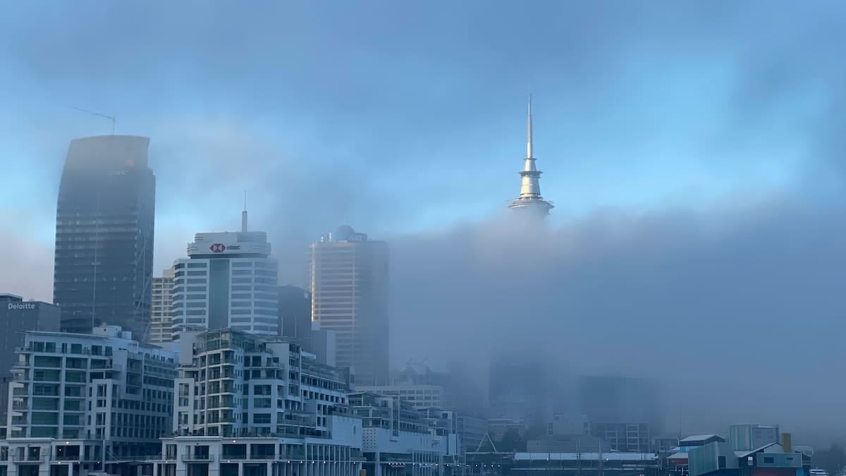
Yellow fog alert in place across all six counties
The Met Office has issued a yellow warning for fog covering all six counties of Northern Ireland, effective from 03:48 to 10:00 on Tuesday 3 November 2026. Publicly available forecast data indicates that areas of fog, locally dense, are expected to affect western and central parts in particular, with visibility reduced to less than 100 metres at times.
The warning area extends across County Antrim, County Armagh, County Down, County Fermanagh, County Londonderry and County Tyrone. Met Office mapping for locations such as Portrush in County Antrim and Draperstown in County Londonderry highlights a broad swathe of risk, although conditions may vary sharply over short distances.
Guidance linked to the National Severe Weather Warning Service describes yellow alerts as indicating a high likelihood of weather that could cause travel delays or disruption to normal routines. For this event, the emphasis is on slower journey times, particularly during the morning commute, and a risk of disruption on the region’s road, rail, air and ferry networks.
Advisories from Met Éireann, which references the same UK warning for Northern Ireland, also note patches of dense fog and the potential for travel disruption during the early part of the day, underlining the cross-border relevance for travellers moving between the Republic and Northern Ireland.
Travel disruption risk for roads, airports and ferries
Public information from the Met Office indicates that fog this thick can quickly reduce visibility and create difficult conditions on motorways and rural routes alike. When visibility drops below 100 metres, drivers may struggle to see road markings, pedestrians and other vehicles, leading to sharply lower speeds and increased hazard at junctions and roundabouts.
Regional operators have not announced widespread closures, but travel advice published this morning points to slower road journeys and possible timetable changes. Travellers using key corridors such as the M1 between Belfast and Dungannon, the A6 towards Derry Londonderry or routes around Lough Neagh are being encouraged, through publicly available guidance, to leave extra time and be prepared for localised patches of dense fog.
The Met Office warning also highlights a chance of delays or cancellations to flights. Belfast International, Belfast City and City of Derry airports can all be affected when visibility falls below aircraft operating thresholds, particularly during early-morning arrival and departure banks. Past guidance on fog and aviation notes that low visibility procedures can require increased spacing between aircraft, which tends to slow operations even if flights are not cancelled outright.
Ferry passengers are also advised that sailings on the Irish Sea may experience schedule adjustments when visibility is significantly reduced near ports and coastal approaches. While many services continue to operate in fog, publicly available information from previous events shows that captains may reduce speed or alter approach patterns, which can add to travel times for crossings linking Northern Ireland with Scotland and northern England.
What thick fog means in practice for travellers
According to explanatory material from the Met Office, fog is defined for public forecasts when visibility drops below around 180 to 200 metres, with dense fog classed as visibility below 100 metres. It is this dense category that is referenced in today’s yellow warning for Northern Ireland, with the potential for very short sight lines on exposed roads, valley bottoms and near inland lakes and rivers.
Travel advice based on official highway guidance states that headlights should be used when visibility falls below 100 metres. Drivers are urged, in publicly available safety information, to ensure fog lights are working before setting out, to reduce speed, to avoid sudden braking and to maintain longer distances from the vehicle ahead. These measures are particularly relevant on routes where fog can appear patchy, leaving clear stretches followed abruptly by very poor visibility.
For rail users, dense fog can slow operations where line-side visibility is important for drivers and track workers. While modern signalling systems provide protection, historic disruption summaries from previous fog events in the UK indicate that some services may run at reduced speed in affected areas, stretching journey times and tightening connections at major interchanges such as Belfast Lanyon Place.
Air passengers are being encouraged, in line with standard public travel advice, to check the latest status of flights before leaving for the airport, especially for early departures. When fog is present around airfields, even minor knock-on effects can ripple through the day, affecting later services as aircraft and crews are repositioned.
Seasonal patterns and the current weather setup
The warning comes at a time when high pressure is dominating the UK weather pattern. A Met Office outlook for the week ahead, issued on 3 November 2026, notes that Scotland, Northern Ireland and parts of northern England are closer to the centre of a large high pressure system, bringing lighter winds along with an increased chance of overnight frost, mist and fog.
Fog is more common in autumn and winter, when long nights allow the ground to cool and clear skies help surface temperatures drop to the dew point. When this happens, moisture in the air condenses into tiny droplets suspended close to the surface, forming what is essentially a cloud at ground level. Under calm conditions, this fog can become dense and linger well into the morning until sunshine and mixing in the lower atmosphere are strong enough to disperse it.
Background information from the Met Office indicates that fog warnings are less frequent than warnings for heavy rain or strong wind because the phenomenon is highly localised and can be difficult to predict precisely. Small changes in temperature, wind speed and humidity can determine whether a night produces dense fog, patchy mist or relatively clear conditions, which means forecasts are regularly updated as new observations come in.
For travellers, this means that conditions can vary significantly over short distances in Northern Ireland today. A journey that begins under clear skies near the coast can quickly transition into thick fog inland, particularly around low-lying areas and along river valleys, before clearing again further on.
Practical planning tips for visitors and commuters
For those travelling today, publicly available guidance from weather and transport bodies suggests allowing additional time for any journey crossing the warning area, and considering re-timing non-essential trips to later in the morning once the fog is expected to thin. Local forecasts indicate that conditions should gradually improve after around 10:00, although some sheltered spots may take longer to clear.
Visitors driving hire cars from Belfast or regional airports are advised to familiarise themselves with vehicle light controls before setting off, particularly fog lamps and rear lights, and to keep speeds moderate on unfamiliar rural roads. Mapping services may not reflect temporary speed reductions or minor diversions put in place when visibility is very poor, so staying alert to roadside information signs and variable message boards is important.
Those using public transport can reduce the risk of missed connections by checking operator apps or station displays for live running information. Where onward rail or bus links are tight, selecting slightly earlier departures can provide a buffer if services along key routes such as Belfast to Derry Londonderry or cross-border coach lines from Dublin are affected by slow-moving traffic in fog-prone stretches.
Travel news outlets and forecast providers emphasise that weather warnings can change as new data becomes available. Anyone with time-critical journeys across Northern Ireland today, such as flights from Belfast or ferry departures from Larne and Belfast, is advised to review the latest forecast and transport updates before departure so that alternative routes or later services can be considered if conditions deteriorate.