


More news on this day
Severe thunderstorms sweeping across the Denver metro area and eastern Colorado plains have triggered widespread disruption at Denver International Airport, with hundreds of flights delayed as a tornado watch and intense lightning forced ground stops and slowed arrivals.
Get the latest news straight to your inbox!
Stormy afternoon brings ground delays and bottlenecks
The latest round of severe weather began building over the Denver area on the afternoon of June 8, when unstable air, heat and high moisture combined to produce powerful thunderstorms across the Front Range and eastern plains. Publicly available weather briefings described a risk of large hail, damaging winds and isolated tornadoes, including in areas surrounding Denver International Airport.
As storms intensified, a ground delay program was put in place for Denver, limiting the rate at which flights could land and depart. Federal aviation advisories attributed the restrictions to thunderstorms in the region, prompting holding patterns for inbound aircraft and slowing departures out of the busy hub.
By the end of the day, data compiled from airport operations and flight-tracking services indicated that Denver International had recorded roughly one thousand disrupted movements, with well over nine hundred flights delayed and only a small number canceled outright. The pattern suggested that aircraft were largely able to operate, but at a significantly reduced pace as controllers spaced traffic around active storm cells.
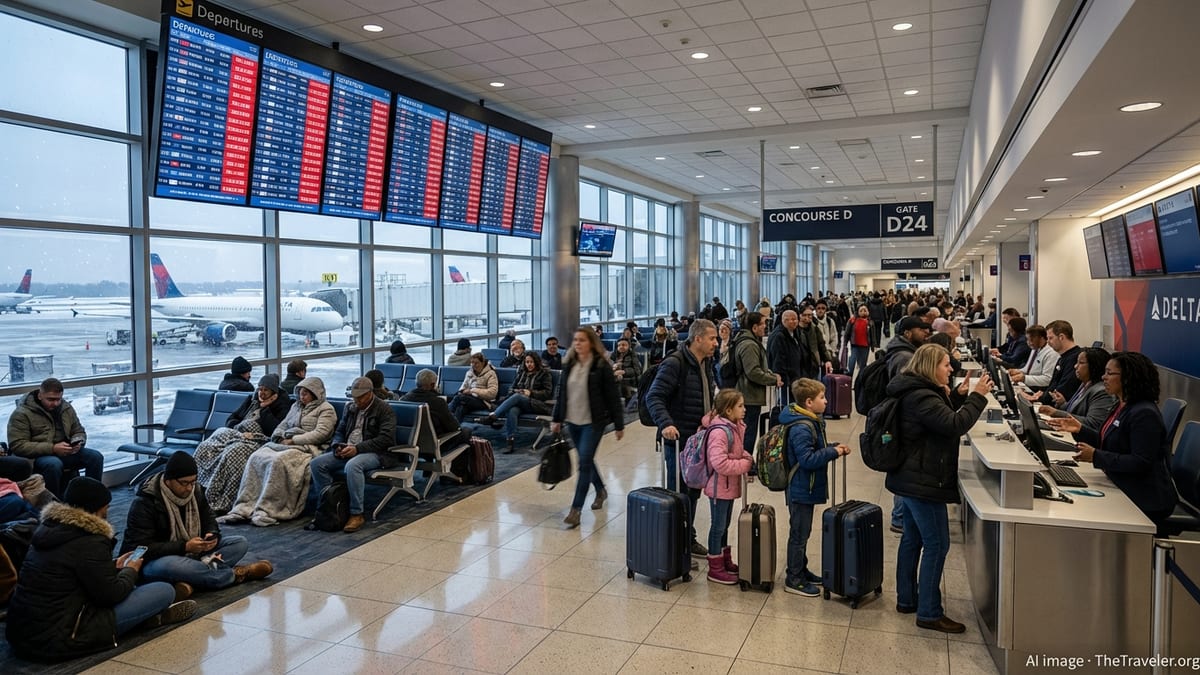
The combination of arrival metering, ramp closures for lightning and periodic ground stops quickly translated into crowded gate areas, long lines at concessions and rolling delays on departure boards. Passengers reported waits stretching from one to several hours as crews and aircraft struggled to cycle through the constrained system.
Tornado watch and sirens heighten anxiety
Adding to the tension for travelers, the National Weather Service issued a tornado watch covering the Denver metro area and much of northeastern Colorado into the evening hours. Forecast discussions highlighted the potential for rotating supercell storms capable of producing tornadoes and very large hail, particularly near and east of the city, including the airfield corridor.
While the watch signaled conditions that were favorable for tornado development rather than confirmation that a tornado was occurring, the wording and accompanying radar imagery drew widespread attention on social media. Some weather discussions referenced warnings southeast of the city and close to the airport vicinity, underscoring the rapidly evolving nature of the storms.
In Denver itself, confusion grew when tornado sirens sounded across parts of the city despite the absence of an active tornado warning for the downtown area. Subsequent explanations from city emergency management pointed to human error in the activation process, noting that the sirens coincided with ongoing severe thunderstorm warnings and the broader tornado watch.
For air travelers already facing delays, the sirens and phone alerts added an extra layer of uncertainty. Some passengers arriving from other regions shared accounts of hearing alerts during descent or just after landing, prompting questions about whether it was safe to remain in the terminal or board connecting flights while storms rumbled nearby.
Hundreds of flights delayed, few cancellations
Operational statistics compiled after the storms show the scale of the disruption. Aggregated reports from flight status services and passenger rights organizations indicate that on June 8 more than one thousand flights connected to Denver International experienced some form of disruption, with the overwhelming majority categorized as delayed rather than canceled.
Across both arrivals and departures, the number of delays ran into the high hundreds, reflecting the cascading impact of each thunderstorm cell that passed through the airport’s approach and departure paths. Airlines ranging from major network carriers to low cost operators faced knock-on effects as aircraft scheduled to leave Denver late then arrived behind schedule at downline airports.
Despite the large number of affected flights, only a handful of services were removed from the schedule entirely during the peak of the weather event. Aviation analysts note that this pattern is typical for convective storms in the central United States, where airlines and air traffic managers often choose to slow the system substantially rather than cancel large blocks of service outright when conditions are expected to improve within several hours.
For individual travelers, however, the distinction between a delay and a cancellation offered little comfort. With storms persisting into the evening, some passengers missed connections or arrived at their destination well past midnight, while others opted to seek hotel rooms in Denver and rebook for the following day.
What travelers experienced on the ground
Accounts shared publicly by passengers at Denver International describe a familiar pattern during severe summer weather on the High Plains. Departures were held at gates or on the taxiways as lightning moved through, while ramp workers temporarily cleared open areas due to safety protocols that restrict ground handling whenever electrical activity is detected within a certain radius.
Inside the terminal, visual displays cycling through updated departure times showed delay increments of 15 to 30 minutes that, in many cases, accumulated to multiple hours. Some connecting flights to smaller markets waited on inbound aircraft that had been diverted or slowed earlier in the afternoon when the most intense cells passed near the airport.
For those already in the air bound for Denver, flight tracking data suggested holding patterns northeast and southeast of the city while controllers sequenced arrivals into limited windows between lightning and heavy rain. Several inbound services landed with modest runway delays compared to schedule, but passengers often still faced extended waits at the gate as the broader network worked through the backlog.
Travelers who were able to depart described departures threading between storm clouds and encountering brief but sharp turbulence on climb-out, typical of summertime convection near the Rockies. Many airlines advised customers through their digital channels to monitor flight status closely, arrive early at the airport and consider rebooking if their travel plans were flexible.
Ongoing summer storm risk for Denver flyers
The disruptive storms at Denver International this week underline a seasonal reality for travelers using one of the nation’s busiest inland hubs. From late spring through early autumn, the combination of high elevation, upslope winds and frequent cold fronts supports near-daily thunderstorm chances along the Front Range.
Meteorologists have noted that storm systems similar to the one affecting Denver on June 8 can develop quickly in the afternoon and persist into evening hours, creating a window of heightened risk for lightning, hail and sporadic tornadoes just as peak travel periods unfold. Forecast outlooks for the coming days continue to highlight at least a marginal risk of additional strong storms across parts of eastern Colorado.
Consumer advocates point out that weather-related disruptions are generally classified as outside airline control, which limits eligibility for monetary compensation under many regulatory regimes. Even so, airlines are expected to provide care such as food vouchers, rebooking assistance and, in some cases, overnight accommodations when severe weather strands passengers far from home.
With the heart of the summer travel season approaching, aviation observers suggest that flyers into and out of Denver build extra buffer time into itineraries, especially for tight connections, and keep a close eye on local forecasts and airline alerts on days when severe thunderstorms are in the outlook.