
More news on this day
Severe thunderstorms over southeast England have led to widespread disruption at London Gatwick Airport, with hundreds of flights delayed or cancelled and knock-on effects continuing into Sunday, June 28.
Get the latest news straight to your inbox!
Thunderstorms Hit a Busy Summer Weekend at Gatwick
Publicly available flight data and media coverage show that storm systems moving across southeast England on Saturday brought extensive disruption to both Heathrow and Gatwick, two of Europe’s busiest international hubs. The combination of intense lightning, heavy rain and reduced visibility prompted air traffic flow restrictions in the region’s already congested airspace.
Reports indicate that on Saturday, June 27, hundreds of services were affected across the two London airports, with delays in some cases stretching to several hours. Gatwick, which typically operates close to its runway capacity during the summer peak, proved particularly vulnerable once arrival and departure rates were cut for safety reasons.
By early Sunday, June 28, data from flight-tracking services showed residual delays and scattered cancellations still affecting Gatwick’s schedules. Aircraft and crew were out of position after the previous day’s weather-related disruption, leading to late-running morning departures and knock-on delays for passengers starting their journeys or attempting to return home.
According to analysis by aviation-focused outlets, the most intense weather cells and the heaviest traffic bottlenecks were concentrated in airspace between southeast England and northwestern Europe. This corridor links Gatwick with major hubs and holiday destinations, magnifying the impact on the airport’s largely short-haul, leisure-focused network.
Scale of Delays and Cancellations on June 28
While the worst of the thunderstorms passed through on Saturday, Sunday’s flight programme at Gatwick remained under strain. Real-time departure and arrival boards showed a busy morning period marked by a mix of on-time services and significant hold-ups, with some departures delayed well over an hour.
Airline networks were still working through aircraft that had been held on the ground, diverted or cancelled the previous day. Industry briefings and media reporting suggest that more than 900 flights across Heathrow and Gatwick experienced disruption during the peak of the storms, leaving airlines with limited spare capacity to rebuild their schedules quickly.
At Gatwick specifically, passengers reported extended waits in departure lounges, late gate changes and, in some cases, same-day cancellations on routes to European holiday destinations. Published coverage highlighted that some travelers endured delays of up to six hours on Saturday, with a subset of those flights turning into early Sunday departures as crews and aircraft became available again.
The lingering disruption meant that even travelers departing under clear skies on June 28 could face complications. Missed connections, late inbound aircraft and displaced crews were all cited in consumer-facing travel advisories as ongoing causes of disruption unrelated to weather conditions on the day itself.
Why Thunderstorms Disrupt Gatwick So Quickly
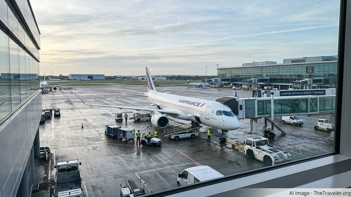
Operational reports and airport documentation show that London Gatwick runs one of the busiest single-runway operations in the world. Under normal conditions, this highly optimised schedule allows the airport to handle large numbers of flights each day, but it leaves relatively little buffer when events force controllers to slow the rate of arrivals and departures.
In the case of the June storms, controllers in UK and European airspace applied spacing restrictions between aircraft to maintain safe operations near active thunderclouds. These measures, which reduce the number of flights that can land or take off in a given period, quickly created queues both in the air and on the ground.
Once departures are held, arriving aircraft can struggle to find an available stand, triggering further delays as pilots wait on taxiways for gates to be vacated. Travel discussion forums over the weekend described aircraft being held on the ground and, in some instances, diverted to alternate airports when Gatwick became temporarily saturated.
Gatwick’s own risk disclosures note that severe weather can significantly reduce capacity, increase delay minutes and cause cancellations, particularly when heavy rainfall, lightning and low cloud coincide. The June 27 thunderstorm pattern over southeast England, arriving at the height of a summer travel weekend, reflected many of those risk factors.
Passenger Experience and Travel Advice
Social media posts and travel forums on Saturday and Sunday described crowded terminals at Gatwick, with long queues forming at airline service desks as passengers sought rebooking options and information. Some reported overnight stays after missed connections, while others documented diversions that resulted in unplanned arrivals at alternative UK airports before being repositioned to London.
Consumer-rights organisations and travel-compensation platforms reminded passengers affected by the thunderstorms that eligibility for financial compensation can depend on whether the disruption is considered outside an airline’s control. Weather is frequently cited as an example of extraordinary circumstances, although carriers may still be required to provide care such as refreshments or accommodation during extended delays.
Travel experts advised that passengers due to fly through Gatwick on Sunday, June 28, and into the early part of the week should monitor their airline’s app or website closely and allow extra time at the airport. With aircraft and crews still rebalancing after the storm, some late-notice schedule changes remain possible even after conditions improve.
Several independent travel guides encouraged passengers to keep boarding passes, receipts and documentation of any extra expenses incurred as a result of delays or cancellations. Such records can support later claims with airlines or travel insurers, particularly in cases where disruption extends beyond initial weather events into broader operational issues.
Wider European Weather Patterns Add Pressure
The Gatwick disruption forms part of a larger weather-related pattern affecting European transport at the end of June. Meteorological agencies and aviation coordination bodies have pointed to a combination of early-summer heat and volatile storm systems moving across northwestern Europe, creating challenging conditions for air traffic managers.
Regional air traffic data shows that the most severe delays in recent days have clustered in airspace stretching from southeast England across the North Sea corridor towards northern Germany and the Low Countries. This zone includes many of Gatwick’s busiest routes, increasing the likelihood that a single storm system can affect multiple flights in quick succession.
Elsewhere in Europe, rail networks and regional airports have also experienced weather-related interruptions, underscoring how rapidly changing conditions can ripple across interconnected transport systems. For passengers at Gatwick, the result has been a weekend of uncertainty, with clear skies on Sunday not always translating into smooth journeys.
With the peak summer holiday season only just beginning, aviation analysts note that the June 27 to 28 disruption will serve as an early test of Gatwick’s resilience to extreme weather and of airlines’ ability to restore normal service when storms strike one of Europe’s most tightly scheduled airfields.