
More news on this day
Two swift but intense rounds of thunderstorms rolled across the Chicago area Monday, toppling a small plane at Midway International Airport, cutting power to thousands of customers and briefly disrupting air travel across the region.
Get the latest news straight to your inbox!
Storms Sweep Through in Two Rounds
Publicly available weather data and local coverage indicate that the Chicago area saw two main waves of thunderstorms on Monday, May 18. The first moved in during the early morning hours, followed by a second, stronger line around midday. Both brought torrential downpours, frequent lightning and abrupt, powerful wind gusts that raced across the metro area.
According to published coverage from regional outlets, the fast-moving complexes developed along a warm, humid air mass already in place over northern Illinois, with temperatures near or above seasonal norms. The Storm Prediction Center had placed the region under a slight risk for severe weather, highlighting damaging winds and hail as the primary hazards as the system tracked east.
As the storms pushed through, radar imagery showed bowing segments and pockets of enhanced wind signatures over Cook County and nearby communities. While the most intense cells were relatively short-lived, they produced localized damage that suggested bursts of severe-level winds in parts of the city and suburbs.
Behind the second round, cooler and somewhat drier air began filtering into the area, but forecasters noted that the broader storm pattern over the central United States remained active, with additional thunderstorm chances expected on Tuesday for portions of northern Illinois and northwest Indiana.
Small Plane Toppled at Midway Airport
Among the more striking impacts from Monday’s storms was damage at Chicago Midway International Airport, where a small aircraft was toppled on the airfield as strong winds surged through. CBS-affiliated reports described the plane as being flipped over during one of the thunderstorm bursts, underscoring how rapidly conditions deteriorated at the airport.
Imagery shared in local newscasts showed the aircraft resting on its back near a hangar area, with other small planes nearby that appeared to remain in place. There were no immediate reports in published coverage of injuries associated with the incident, and the damage appeared confined to the affected plane and surrounding pavement.
The episode occurred as winds strengthened in the wake of a passing line of storms, a scenario that forecasters sometimes refer to as a wake low, which can tighten the pressure gradient behind a departing thunderstorm complex. In such environments, gusts can spike suddenly even after the heaviest rain begins to ease, catching unsecured objects and light aircraft particularly off guard.
Midway, which handles significant commercial and general aviation traffic on Chicago’s Southwest Side, has experienced damaging wind events in past storm systems, but a small plane being fully flipped remains a relatively unusual sight that highlights Monday’s volatile conditions on and around the airfield.
Power Outages and Damage Across the Region
Beyond the airport, the storms left a trail of scattered damage and power outages across the Chicago area and into northwest Indiana. NBC-affiliated reporting, citing utility data, indicated that nearly 12,000 ComEd customers lost power at one point on Monday, with the largest concentration of outages in Cook County and additional pockets in Will County.
Farther east, outage maps from regional provider NIPSCO showed several thousand customers without electricity in northwest Indiana communities such as East Chicago, Portage and St. John. The pattern of disruptions matched the path of the strongest wind cores and the heaviest rain, which swept from west to east across the metro area through late morning and early afternoon.
Early reports and images compiled by local outlets showed downed tree limbs, scattered branches on roadways and minor structural damage to roofs and siding in some neighborhoods. In at least one Chicago neighborhood, a large tree came down onto a home, crushing part of the roof and attic and leaving debris strewn across the yard.
Utility companies began restoration efforts shortly after the storms moved out, rerouting crews to the hardest-hit corridors. While most customers were expected to see power restored gradually through the afternoon and evening, some locations with more extensive line and pole damage were preparing for longer waits as assessments continued.
Flight Disruptions and Ground Stops
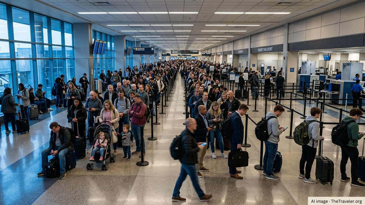
The turbulent weather disrupted air travel at both of Chicago’s major airports. According to public data from the Federal Aviation Administration and coverage from local broadcasters, a ground stop was implemented at O’Hare International Airport on Monday morning as thunderstorms with lightning and strong winds moved directly over the airfield.
The measure temporarily halted arriving flights into O’Hare to ensure that aircraft could avoid the most hazardous conditions around the airport and on approach paths. Departures also experienced delays as ramp operations slowed during periods of frequent lightning, when workers are often pulled back from exposed areas for safety.
At Midway, the same storms that toppled the small plane contributed to delays and intermittent operational pauses as visibility dropped and gusts surged across runways and taxiways. Arrival and departure banks during the strongest cells were reported to be especially affected, with some flights holding or rerouting until conditions improved.
By early afternoon, FAA status information showed improving conditions, and coverage from Chicago television outlets described ground stops being lifted and traffic gradually resuming more typical patterns. Travelers, however, were advised through airline and airport communications to expect residual delays as schedules recovered from the morning disruptions.
More Storms Possible After Brief Lull
While Monday’s storms swept out relatively quickly, forecasters signaled that the broader pattern would remain unsettled for the Chicago area in the short term. Weather outlooks from regional television meteorologists and national centers pointed to another chance of strong thunderstorms on Tuesday, particularly south and east of the city.
The same frontal system that helped trigger Monday’s storms is expected to linger nearby, providing a focus for additional thunderstorm development as daytime heating returns. Forecast discussion materials highlighted the potential for renewed clusters of storms with heavy rain and gusty winds, though confidence in the exact placement of the strongest cells remained limited.
Beyond Tuesday, forecast models suggested a notable cool-down for northern Illinois as the front eventually shifts farther east and a cooler, drier air mass settles over the Great Lakes. That change would likely tamp down thunderstorm chances for the latter half of the workweek, bringing a brief respite after several days of active weather.
For residents and travelers around Chicago, Monday’s swift but potent storms served as a reminder of how quickly conditions can deteriorate during the late-spring severe weather season. Publicly available guidance from meteorological agencies continued to emphasize the importance of monitoring forecasts and alerts, particularly on days when multiple rounds of storms are possible.