
More news on this day
Air travelers across New York and New England are facing mounting delays on June 18 as a fast-moving storm system under a tornado watch disrupts operations at several major airports and ripples across the national air network.
Get the latest news straight to your inbox!
Storm System Brings Tornado Risk to the Northeast
Publicly available outlooks from national forecasters describe a volatile atmosphere stretching from upstate New York into New England on Thursday, with scattered severe thunderstorms capable of damaging wind gusts and a low but notable tornado risk. Discussion summaries highlight a corridor where warmer, humid air is colliding with a passing cold front, creating conditions favorable for rotating storms and rapid intensification.
Social media and weather discussion forums tracking the event point to tornado watches and warnings being issued through parts of central and eastern New York during the morning and midday hours, then expanding into portions of New England as the line of storms moves east. Observers are reporting strong, fast-moving cells, brief torrential downpours, and frequent lightning along the squall line, with localized power outages in some communities.
Meteorologists monitoring the system describe it as part of a broader pattern of early-summer severe weather that has also affected parts of the Midwest and Ohio Valley this week. While the strongest tornado potential is focused farther west and south, the overlap of strong winds, wind shear, and daytime heating across the interior Northeast has been sufficient for a targeted tornado watch over New York and New England.
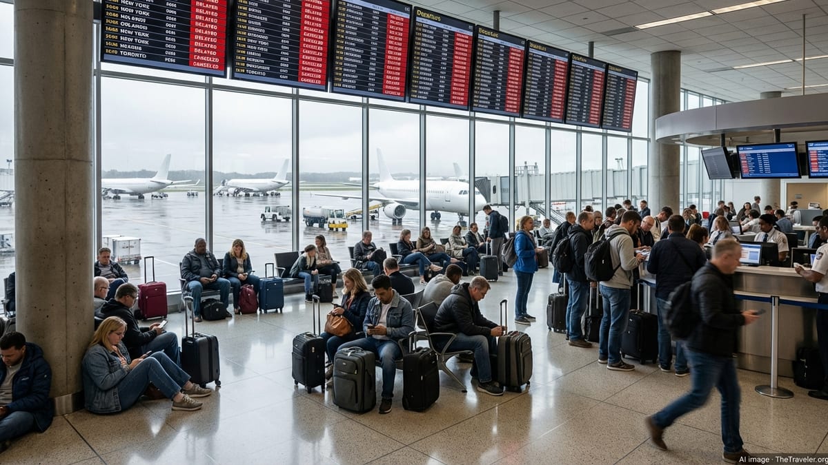
Major Northeast Hubs See Cascading Flight Delays
As storms push through the region, flight-tracking dashboards show significant delays mounting at major hubs including New York’s John F. Kennedy International, LaGuardia, and Newark Liberty, as well as Boston Logan. Ground stops and flow-control programs, used to slow or temporarily halt arrivals and departures during convective weather, are being applied intermittently as thunderstorm cells move directly over approach and departure paths.
Data visible on national aviation monitoring tools indicate departure delays of 45 minutes or more at times from New York-area airports, with some flights held at the gate while crews wait for lightning to clear the immediate vicinity. Arrivals into Boston and smaller New England airports are also being spaced out as air-traffic managers work to route aircraft around the most intense cells and avoid turbulence and wind shear in the storm cores.
Regional carriers operating turboprop and regional jet services into secondary airports such as Albany, Syracuse, Hartford, and Providence appear to be particularly affected. When convective weather triggers a tornado watch or warning, these smaller fields often implement more conservative spacing and can lack the runway and taxiway flexibility of the largest hubs, leading to quick backlogs when thunderstorms repeatedly train over the same area.
The resulting congestion is feeding into the broader U.S. system, with aircraft and crews arriving late into connecting hubs outside the Northeast. As the afternoon progresses, the pattern is contributing to missed connections and rolling delays for travelers with tight itineraries involving New York or Boston.
Travelers Confront Cancellations and Longer Connection Times
Schedules posted by major U.S. airlines show dozens of cancellations and a growing number of significant delays on routes into and out of New York and New England as the severe weather window continues. Short-haul flights along the busy Northeast Corridor and shuttle-style services between New York, Boston, Washington, and other nearby cities are bearing much of the impact, due to their frequency and reliance on tight turnaround times.
Industry analysts note that even a brief tornado watch period can disrupt these dense schedules because aircraft must sometimes be repositioned away from storm-affected airports, leaving gaps in later rotations. Once storms clear, ramp operations can take time to restart, as ground crews inspect equipment, manage de-icing or refueling queues if needed, and work through a buildup of delayed departures.
For passengers, the practical effect is longer-than-normal layovers, rebooked itineraries, and in some cases overnight stays when the last flights of the day are canceled. Publicly available airline advisories indicate that several carriers are waiving change fees for affected routes in the Northeast, allowing travelers to move their trips to later in the week when conditions are expected to stabilize.
Travel planners suggest that those who have not yet departed review their reservations repeatedly during the day, as real-time schedule adjustments often appear only a few hours before departure. Same-day changes to earlier or later flights can reduce the risk of being stranded during the peak of the severe weather window.
Operational and Safety Measures During a Tornado Watch
Airports in tornado-prone conditions typically follow established severe-weather protocols that prioritize safety for passengers, crews, and ground staff. When lightning is detected within set distances, ramp operations may pause, preventing baggage handling and fueling while storms pass. If rotation signatures strengthen or a tornado warning is issued in the vicinity, some facilities move travelers and staff away from exposed concourses and large windows into interior shelter areas until the threat diminishes.
Air-traffic controllers rely on real-time radar and communication with flight crews to route aircraft around the most intense sections of storms. Published guidance emphasizes that pilots may choose to delay pushback or hold outside the storm’s core rather than risk flying too close to rapidly developing cells, especially when low-level wind shear or microburst potential is present near the runway environment.
The combined effect of these cautionary measures is a temporary slowdown in operations, even when an airport remains officially open. While this can be frustrating for passengers watching the clock on tight connections, aviation safety experts point out that conservative decision-making is central to the industry’s safety record, particularly during fast-evolving severe weather events such as today’s tornado watch.
What Passengers Should Do If Traveling Today
For travelers scheduled to fly into or out of New York and New England on June 18, aviation and weather guidance commonly stresses the importance of monitoring conditions closely. Checking both airline apps and local forecasts several times before leaving for the airport can provide early warning of ground stops, extended delays, or cancellations tied to the tornado watch and associated thunderstorms.
Experts in air-travel planning frequently recommend allowing extra time for connections through New York or Boston when severe weather is in the forecast, as even minor schedule adjustments can quickly translate into missed onward flights. Booking itineraries with longer layovers or selecting nonstop options, where available, can help reduce exposure to cascading disruptions during stormy periods.
Passengers already at the airport are typically encouraged to stay near their gate or within view of departure boards, since rebookings and aircraft swaps often occur on short notice once weather windows open. Keeping mobile devices charged and opting in to airline text and email alerts can help ensure travelers receive timely updates as the tornado watch evolves and storms move through the region.