


More news on this day
Heavy rain linked to the remnants of Hurricane Isaias has unleashed dangerous flooding across parts of the southeastern United States, with at least one death reported and local leaders urging residents to stay home as swollen rivers, inundated roads and downed power lines create hazardous conditions.
Get the latest news straight to your inbox!
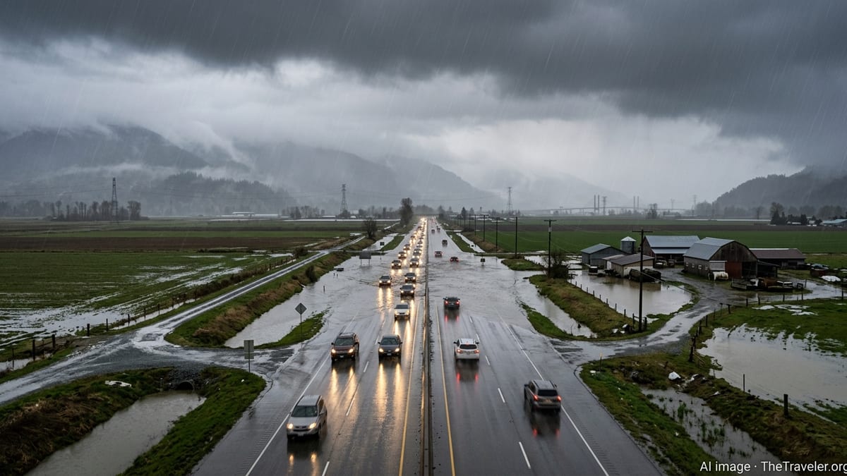
Deadly flooding spreads across multiple states
Publicly available information indicates that flooding intensified over the weekend as the storm system that once was Hurricane Isaias moved inland over the Southeast, dropping several inches of rain across parts of Florida, Georgia, Alabama and the Carolinas. The combination of tropical moisture and slow-moving rain bands produced flash flooding in urban areas and along smaller rivers and creeks.
Coverage from regional and national outlets describes water overtopping banks, vehicles stranded in rising water and neighborhoods cut off as low-lying roads became impassable. In parts of the Florida Panhandle and southern Alabama, local emergency bulletins listed multiple road closures and advised residents to avoid all non-essential travel while crews assessed damage and cleared debris.
According to detailed reporting from weather-focused media, at least one person in Pensacola, Florida, died after being exposed to generator fumes while widespread power outages affected the region. That fatality has become an early marker of the storm’s human toll, while assessments continue on whether floodwaters directly contributed to other injuries or deaths across the affected states.
Rain and embedded thunderstorms also extended north and east into Georgia and the Carolinas, where saturated ground from earlier rainfall increased the risk of landslides and rapid runoff. Hydrological summaries show rivers responding quickly to the deluge, with gauges in some basins registering sharp rises in just a few hours.
‘Stay home’ messages as power cuts and road closures mount
As conditions deteriorated, a number of local leaders and emergency managers used broadcast briefings and social media posts to urge residents to stay home if they could safely do so. Published coverage of these appeals describes a strong focus on keeping people off flooded roads, reducing pressure on first responders already dealing with water rescues, downed lines and blocked routes.
In coastal and inland communities alike, authorities issued flash flood warnings, tornado watches and high-wind advisories. The layered alerts reflected the complex nature of the hazard, with threats ranging from fast-rising creeks to falling trees and scattered tornadoes embedded in the outer rain bands of the former hurricane.
Power outage maps compiled by utilities and energy-tracking services showed tens of thousands of customers without electricity at the height of the storm across parts of Florida and neighboring states. With many traffic signals dark and debris littering smaller roads, official advisories emphasized that staying at home, when possible, was often the safest option until crews could restore service and verify that main routes were clear.
Public information statements also encouraged residents to report blocked drains, fallen trees and damaged power infrastructure through established hotlines rather than attempting to move obstacles themselves. The combination of standing water and live lines created additional dangers that are not always obvious to people surveying damage near their homes.
Travel disruption for road, air and coastal routes
The flooding and high winds caused significant disruption to travel across the Southeast, affecting everything from neighborhood roads to major interstates and key airports. Local traffic updates cited sections of heavily used commuter routes where water covered multiple lanes, with some underpasses and low-lying stretches completely submerged.
Airport operations were also affected. Aviation tracking data and local media reports indicated a pattern of delays and cancellations at several regional airports where intense downpours and low visibility repeatedly forced ground stops and runway inspections. At larger hubs, including those serving major Southeastern cities, airlines consolidated flights and warned passengers to expect cascading delays as aircraft and crews were repositioned.
Along the coast, strong onshore winds combined with higher-than-normal tides to create hazardous conditions at inlets and marinas. Harbor advisories highlighted the risk to small craft, while some ferry services curtailed operations or adjusted schedules in response to choppy seas and reduced visibility. For coastal communities that rely on bridges and causeways, crosswinds and surface water further complicated travel and emergency access.
Rail operators monitoring the situation reported temporary speed restrictions or pauses on lines where flooding or debris on the tracks was suspected. In some low-lying freight corridors, waterlogged track beds and potential erosion required inspection before trains could safely resume.
Emergency response and evolving risk outlook
State and local emergency agencies across the region activated flood response plans as the rain intensified, drawing on lessons from previous hurricanes and inland flooding events. According to publicly available briefings and situation reports, response actions ranged from pre-positioning swift-water rescue teams to opening temporary shelters for residents who could not safely remain in their homes.
National hydrological and meteorological centers continued to issue updated outlooks on river levels and additional rainfall expected as the remnants of Isaias moved northeast. Forecast discussions highlighted the potential for renewed flash flooding where heavy bands trained repeatedly over the same communities, especially in areas with poor drainage or extensive paved surfaces.
In rural regions, saturated soils raised concerns about the stability of smaller earthen dams and the possibility of localized levee overtopping along agricultural drainage canals. Water managers used near-real-time gauge data to watch for rapid changes, while urging residents living near vulnerable waterways to pay close attention to local alerts and be prepared to adjust travel plans at short notice.
Insurance industry analysts and disaster modeling firms began releasing early estimates of potential losses, noting that even moderate-depth flooding across a wide area can generate substantial damage to homes, vehicles and public infrastructure. These assessments are expected to evolve as more detailed claims data and on-the-ground surveys become available in the coming days.
Safety guidance and what travelers should know now
As cleanup begins in some neighborhoods and heavy rain lingers in others, public guidance across the Southeast continues to stress personal safety and cautious travel. National and state agencies consistently warn drivers not to enter flooded roadways, pointing to long-standing data showing that a significant share of flood-related deaths in the United States occur in vehicles.
Residents and visitors in the affected states are being urged, through widely shared advisories, to monitor trusted weather and emergency information channels for updates on river levels, road closures and power restoration. Travelers with imminent flight, train or long-distance bus plans are advised to verify their itinerary status directly with carriers, since schedules may change at short notice as the system moves north and infrastructure inspections continue.
Cleanup activities also bring new risks. Public health and safety guidance highlights the dangers of using portable generators indoors or too close to living spaces, as carbon monoxide buildup can be fatal even when flooding itself does not enter a building. The reported death in Pensacola from generator fumes has reinforced repeated warnings to place generators outside, away from windows and vents, and to ensure that homes have working carbon monoxide alarms.
For those planning upcoming trips to the Southeast, the broader tourism infrastructure, including major airports, highways and popular destinations, is expected to remain open, but conditions may vary widely from one locality to another. Travel experts recommend allowing extra time for overland journeys, checking hotel policies on weather-related changes and keeping flexible backup plans as the full impact of the floods and ongoing weather pattern becomes clearer.