


More news on this day
Heavy rain from Storm Adam has triggered severe flooding across the south of France, with residents urged to stay home as major road and rail links are cut and further downpours forecast.
Get the latest news straight to your inbox!
Storm Adam unleashes overnight deluge
Publicly available information indicates that Storm Adam moved into France from Spain on Monday, October 19, bringing a band of very heavy rain across Mediterranean departments from Occitanie to Provence-Alpes-Côte d’Azur and on toward Corsica. The system intensified overnight, with strong convection drawing moist air from the sea onto already saturated ground.
Regional coverage from outlets in southern France reports that parts of the Gard department recorded around 200 millimetres of rain during the night into Tuesday, October 20, with intense cells repeatedly tracking over the same areas. Localised flash flooding followed, quickly overwhelming drainage networks and low-lying roads.
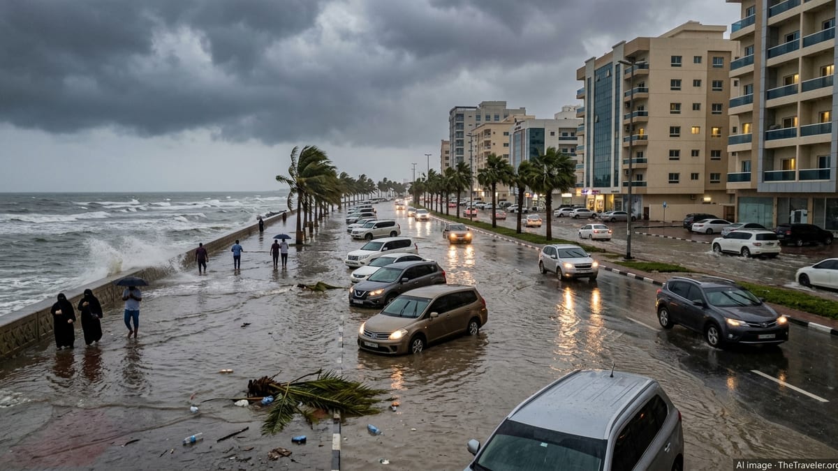
Images shared by regional media show streets in small towns transformed into fast-flowing torrents, with parked vehicles half-submerged and ground floors of homes inundated. The rapid onset of the flooding has prompted renewed attention to the speed at which Mediterranean storm episodes can evolve in the early autumn travel season.
Meteorological briefings describe the event as part of an “episode méditerranéen”, a pattern in which slow-moving storm systems tap into very warm sea temperatures and produce intense, repeated downpours over a relatively narrow corridor, often impacting the same valleys and coastal plains that draw large numbers of visitors.
Transport networks under strain as A9 and rail links close
Travel across parts of southern France has been severely disrupted. Reporting from regional news site The Connexion describes the A9 motorway being closed in both directions between Nîmes and Montpellier after floodwater submerged sections of the carriageway in the early hours of Tuesday. Traffic has been diverted onto secondary routes where conditions allow, although many local roads are also affected by standing water and mudflows.
Rail services have also been hit. Coverage from national broadcasters and rail alerts indicates that sections of the main line linking Occitanie and Provence experienced delays and cancellations on Tuesday morning because of flooded tracks and signalling faults. Some TER regional services were suspended around Nîmes and Montpellier, with replacement buses only able to operate on limited stretches where roads remained passable.
In coastal zones, reports highlight flooded underpasses, closed seafront roads and car parks, and damaged beach infrastructure. Travellers heading for popular resort towns along the Mediterranean, including those using the A9 and A54 corridors, are being advised through publicly available information to check the latest traffic and rail bulletins before setting out and to expect longer journey times and potential last-minute cancellations.
The disruption follows a series of earlier heavy-rain events in late September and early October that had already softened riverbanks and hillsides. Weather services and travel operators are noting that this background saturation has increased the vulnerability of transport infrastructure to the current episode.
High alert levels from Météo-France and flood services
Météo-France’s vigilance map on Tuesday, October 20, shows a swathe of southern and southeastern departments under heightened alert for rain and flooding. According to the national bulletin, Haute-Corse is in red vigilance for rain-flooding, while additional departments in Corsica and along the Mediterranean coast are in orange vigilance for intense rainfall, flash floods and strong thunderstorms.
A technical update from Météo-France explains that the episode which began over Hérault and Gard on Monday has shifted east, now affecting the Provence-Alpes-Côte d’Azur region and Corsica with particularly heavy accumulations. Forecasts point to further intense showers and storms through at least Tuesday evening, with locally violent gusts of wind, hail and significant lightning activity.
France’s flood-monitoring services are also tracking rapid rises on small rivers and coastal streams. Publicly accessible river data show fast-responding catchments in low-lying plains and around urban areas moving toward or exceeding designated flood stages on Tuesday morning, raising concerns for additional property damage and potential evacuations if the heaviest cells stall.
Weather and civil protection agencies are using their standard alert channels to advise residents in red and orange vigilance zones to remain extremely cautious near watercourses, avoid underground and low-lying structures such as tunnels and underpasses, and keep up to date with evolving forecasts as the storm band continues to move.
Evacuations, rescues and localised damage
Regional press reports from the Gard department describe dozens of people being brought to safety overnight as rising water entered homes and cut access to hamlets and campgrounds. Rescue operations focused on flooded ground-floor apartments, isolated rural properties and campsites close to rivers that rose sharply after the most intense downpours.
Across the broader south and southeast, recent coverage from national outlets notes vehicles swept from roads, inundated streets in low-lying districts and damage to small businesses where water and mud have reached shopfronts and storage areas. In the Bouches-du-Rhône, near Marseille, reports on Tuesday detail at least one fatality linked to the wider storm system impacting the region.
Power cuts and telecommunications disruptions have been reported in scattered communities where substations or overhead lines have been affected by water and wind. Utility operators are working from publicly available statements to prioritise restoration in areas where critical services, such as health facilities and emergency coordination centres, have experienced outages.
Tourism businesses, including campsites and coastal holiday rentals, are assessing damage at the tail end of the season. After multiple heavy-rain events this autumn, some operators have already begun adjusting opening calendars and contingency plans to reflect the increasing likelihood of disruptive storms in late September and October.
What travellers in the region need to know now
For visitors currently in the affected parts of southern France, public information from meteorological and transport services converges on one key message: avoid unnecessary journeys until conditions stabilise. With sections of the A9 closed, local roads flooded or blocked by debris, and regional rail links disrupted, overland travel between Occitanie, Provence and the Italian border is subject to sudden changes.
Airports along the Mediterranean coast remained open on Tuesday morning, according to airline and airport bulletins, but some flights have faced delays due to thunderstorm activity and ground-handling constraints during the heaviest rainfall. Travellers with departures or arrivals at regional airports are being encouraged to monitor their carrier’s live updates and allow extra time for transfers given the state of local road networks.
Those staying in coastal resorts, rural gites or campsites are advised by publicly available safety guidance to move vehicles away from riverbanks and dry riverbeds, avoid walking or driving through floodwaters, and keep important documents and essential items ready in case of a precautionary evacuation. Many communes in flood-prone areas maintain local alert systems, which visitors can follow through town-hall notices and regional media.
Forecasters expect the most intense phase of the current episode to ease gradually from late Tuesday into Wednesday. However, with soils already saturated and some rivers running high, the risk of renewed flooding from additional showers will persist even after the heaviest rain moves away. Travellers planning near-term trips to the south of France are therefore being urged, through widely available advisories, to review bookings, stay flexible with itineraries and track official weather and transport information closely over the coming days.