


More news on this day
As cooler months set in, a familiar pattern returns to airports around the world: clear skies above, a blanket of fog at ground level, and a growing list of delayed or diverted flights. Understanding why fog is more common and persistent in winter helps explain why even modest weather can ripple through airline schedules for hours.
Get the latest news straight to your inbox!
Why fog thrives in colder months
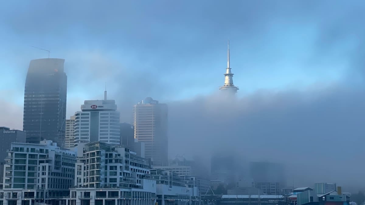
Fog is essentially a cloud that forms at ground level when air near the surface becomes saturated and water vapor condenses into tiny droplets. In winter, this saturation point is reached more quickly because cold air cannot hold as much moisture as warm air. As temperatures fall overnight, just a small additional cooling can push the air to 100 percent relative humidity and produce dense fog.
Long winter nights are another key ingredient. With more hours of darkness, the ground has more time to lose heat to space, a process known as radiative cooling. Publicly available guidance from national meteorological agencies notes that this favors “radiation fog,” which forms under clear skies and light winds when the surface cools sharply and chills the air directly above it.
In valleys and low-lying areas, colder, denser air tends to pool and remain trapped beneath a layer of warmer air aloft, creating a temperature inversion. This stable setup, common in winter, allows fog to become thicker and more persistent, as seen in recurring “tule fog” events in California’s Central Valley that can last for days.
Closer to coasts, winter also favors “advection fog.” This occurs when relatively mild, moist air flows over colder ground or sea surfaces and is chilled to its dew point. Aviation meteorology references describe this type of fog as particularly stubborn, sometimes extending over hundreds of kilometers and lasting well into the day or even several days when light winds and high humidity persist.
Radiation, advection and freezing fog: what matters for aviation
Not all fog behaves the same way from an operational perspective. Radiation fog typically forms in the pre-dawn hours over land and often begins to thin after sunrise as the ground warms. However, during midwinter when sun angles are low and days are short, the warming effect can be weak, and visibility may remain below airport operating minima for much of the morning.
Advection fog is often considered more disruptive for airports because it can be deeper, cover larger areas and be slower to dissipate. Studies applied to North Atlantic and Channel Island air routes describe cases where sea fog and low stratus reduced visibility and cloud bases for extended periods, forcing airlines to adjust schedules and reroute aircraft.
A further complication in winter is freezing fog. In this situation, the air temperature is below 0 degrees Celsius, but fog droplets remain liquid and can freeze on contact with exposed surfaces. Technical literature and recent research highlight that freezing fog can affect airport operations in two ways: by reducing visibility and by contributing to ice accretion on runways, taxiways and aircraft, which demands additional de-icing and increased safety margins.
Research published in 2025 on U.S. aviation weather observations notes that mixing freezing fog with snowfall can create uncertainty in de-icing guidance and lead to cautious decisions on the ground. When conditions are poorly observed or classified, airlines and airports tend to build in extra time for de-icing and safety checks, increasing the likelihood of delays and missed connections.
How low visibility slows takeoffs and landings
Commercial aircraft are certified to land and take off in remarkably low visibility, supported by advanced navigation systems and carefully trained crews. Yet every runway has strict visibility thresholds. When fog pushes conditions below those published minima, operations are reduced or temporarily halted even if winds are light and turbulence is absent.
In low-visibility procedures, air traffic control must increase spacing between aircraft, which reduces the number of arrivals and departures an airport can handle per hour. Aviation regulators and training materials emphasize that fog does not usually threaten aircraft performance directly in the way severe storms or strong crosswinds might, but it does limit what is legally permitted in terms of safe operations.
At many airports, only a subset of runways is equipped with the most capable instrument landing systems and runway lighting. When dense fog is aligned unfavorably with the available approaches, or when ground infrastructure is under maintenance, the effective capacity of the airfield can drop dramatically. Publicly available guidance from aviation authorities stresses that even minor technical outages become more consequential when fog is present, because they constrain which low-visibility procedures can be used.
This combination of regulatory limits, reduced runway capacity and equipment constraints means that even a few hours of fog at a major hub can generate knock-on disruption across an airline’s network. Flights may depart late, divert to alternates or require additional holding, all of which consume fuel and crew time.
Winter patterns that make delays longer
Because fog is most likely to form overnight and during the early morning, it often coincides with the first wave of daily departures. Aviation meteorology guidance from North American and European providers notes that morning fog events can be particularly disruptive because they delay aircraft that are scheduled to operate multiple flights throughout the day.
When departures in the early hours are held on the ground due to low visibility, aircraft and crews miss their planned slots at downline airports. The effects can cascade for many hours, even after conditions improve. Some airlines build additional buffers into winter schedules in regions known for frequent fog, but high utilization of aircraft and crews limits how much redundancy can be added.
Seasonal traffic patterns intensify the impact. In the northern hemisphere, the boreal winter coincides with busy holiday and ski travel periods. Historical analyses of winter operations show that fog events around major hubs, combined with cold-related de-icing demands, can quickly exhaust spare gate space and push airlines to pre-emptively cancel or consolidate flights to keep the rest of the network moving.
In some coastal regions, such as parts of the Gulf Coast and western Europe, winter advection fog can also coincide with low cloud and drizzle, keeping visibility and cloud ceilings borderline for much of the day. This kind of marginal weather forces continuous re-assessment of arrival rates and runway use, contributing to rolling ground delay programs rather than a single, clear break in operations.
Improving forecasts, but limits remain
Advances in satellite sensing and high-resolution models are helping forecasters better anticipate fog formation and dissipation. Agencies highlight recent examples where geostationary and polar-orbiting satellites have been used to monitor low cloud and fog fields overnight and in the pre-dawn hours, improving warning lead times for aviation and surface transport.
Researchers are also experimenting with machine learning approaches tailored to low-visibility events near airports. A study released in late 2025 described physics-informed models that incorporate atmospheric profiles and local terrain features to improve short-term predictions of fog and low cloud ceilings, with the goal of offering more reliable guidance to air traffic managers.
Despite these advances, fog remains one of the more challenging weather phenomena to forecast precisely. Small differences in surface moisture, wind speed or cloud cover can determine whether an airport experiences a brief patch of mist or several hours of dense fog. Publicly available training materials for pilots note that visibility can change rapidly along the length of a runway, complicating real-time decisions about whether conditions meet regulatory thresholds.
For travelers, that uncertainty translates into a familiar winter message on departure boards worldwide. As long as cold, calm nights and moist air continue to align near busy airports, fog will remain a recurring, hard-to-predict trigger for delays across the global aviation system.