


More news on this day
Dense autumn fog has settled over large parts of the East of England this morning, with a Met Office yellow weather warning in force and travellers facing reduced visibility and slower journeys on key road and rail routes.
Get the latest news straight to your inbox!
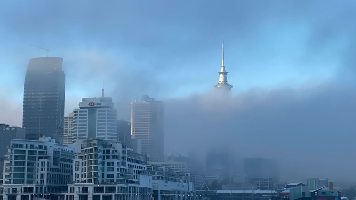
Yellow fog alert in force across the region
Publicly available information from the Met Office indicates that a yellow warning for fog is active across the East of England on Friday 30 October 2026, with the alert valid from 4:18 a.m. to 10:00 a.m. local time. The warning highlights the risk of dense fog patches, with visibility in places dropping below 100 metres, particularly during the morning commute.
The East of England warning region currently includes Bedfordshire, Cambridgeshire, Central Bedfordshire, Essex, Hertfordshire, Luton, Norfolk, Peterborough and Suffolk. Local monitoring services that syndicate Met Office data, such as regional weather watch sites, are flagging the same yellow alert and emphasising that fog is most widespread around inland low-lying areas and transport corridors.
Forecast guidance from the Met Office suggests that the fog will slowly thin, lift and clear as the morning progresses, although some rural spots may see poor visibility persisting into the early afternoon. The warning text advises that conditions can vary significantly over short distances, with clearer stretches of road suddenly giving way to very dense patches of fog.
Travel disruption for drivers, rail passengers and flyers
According to published coverage of the warning, the main impacts this morning are being felt on the transport network, where slower speeds and occasional delays are being reported. On the roads, the combination of darkness and thick fog in the early hours has led to a cautious start on major routes serving the region, including the A1, A11 and A14, with reduced speed and greater spacing between vehicles.
Reports from travel updates indicate that motorists are being reminded to use dipped headlights, avoid relying solely on daytime running lights and switch on rear fog lights only when visibility falls below about 100 metres. Safety guidance referenced by UK road and safety organisations also stresses leaving extra stopping distance, avoiding sudden braking and being prepared for slower-moving traffic, particularly near river valleys and open farmland where fog can linger.
Rail services across parts of East Anglia and the Home Counties are operating, but some operators are cautioning that dense fog can occasionally lead to minor delays where drivers proceed at reduced speeds for safety. Publicly available information from airports in and around the warning area suggests that early-morning operations are under review, with the risk of low-visibility procedures at regional airports such as Norwich and London Stansted if fog persists close to runway level.
Weather pattern behind the murky conditions
Met Office forecast commentary for the end of October highlights a shift to calmer, more settled conditions over the United Kingdom, as an area of high pressure builds following a period of stormier weather in the north. Under this more tranquil pattern, winds across central and southern England have eased and skies have partially cleared at night, creating ideal conditions for fog formation.
With light winds and residual moisture near the surface, temperatures have fallen back overnight, allowing mist and fog to develop widely across eastern and southern England. Regional forecasts for the East of England point to areas of thick fog, particularly across Cambridgeshire and neighbouring counties, before brighter spells gradually develop later in the day once the low cloud lifts.
Met Office outlooks indicate that fog may remain a recurring feature into the weekend in southern and eastern parts of the country, especially where evenings are calm and skies are clear. Travellers planning early starts on Saturday and Sunday are therefore being encouraged, through public forecasts and media reports, to keep checking the latest updates before setting out.
What the yellow warning means for travellers
The National Severe Weather Warning Service describes a yellow warning as an alert for weather that may cause low-level impacts in some places, including travel disruption, while allowing many people to continue with normal activities. In the case of today’s fog warning, the primary concern is slower and more hazardous travel on roads, and the potential for minor delays to public transport and flights where visibility drops sharply.
Guidance linked to Met Office warnings advises road users to plan extra time for journeys, consider whether alternative routes might be less exposed to fog-prone valleys, and check live traffic and public transport updates before departure. Drivers are also advised to ensure windows are fully demisted, headlights are correctly set, and speed is matched to the limited visibility rather than the posted limit.
For rail and air travellers, operators commonly recommend monitoring departure boards and notification apps during yellow fog warnings, as schedules can be adjusted at short notice if low-visibility procedures are brought in. Passengers connecting through hubs on the edge of the warning area, such as London, may also experience knock-on effects from delays elsewhere in the network.
Practical tips for visitors and locals in the East of England
For visitors exploring the East of England’s coastal towns and cathedral cities, the foggy start provides a reminder of how quickly autumn conditions can change. Tourism information channels are suggesting that travellers keep flexible plans this morning, with outdoor excursions such as coastal walks and countryside drives scheduled for later in the day once visibility improves.
Urban centres such as Cambridge, Norwich and Peterborough may see the fog lifting a little more quickly than surrounding rural areas as traffic and slightly higher urban temperatures help disperse the murk. However, low-lying routes near rivers, fens and open farmland can stay foggy for considerably longer, so local knowledge and up-to-date forecasts remain useful when plotting a route.
For those staying in the region over the coming days, meteorological outlooks point to largely dry weather but the continued risk of overnight fog and mist under clear skies. Travellers are therefore encouraged by publicly available guidance to keep a close eye on the Met Office forecast pages and regional media bulletins, particularly before early-morning departures, until the current spell of settled but fog-prone weather shifts.