


More news on this day
A dense blanket of fog is causing disruption to early morning travel across the East of England on Friday 30 October, as a Met Office yellow warning for fog limits visibility on key road, rail and air corridors through the region.
Get the latest news straight to your inbox!
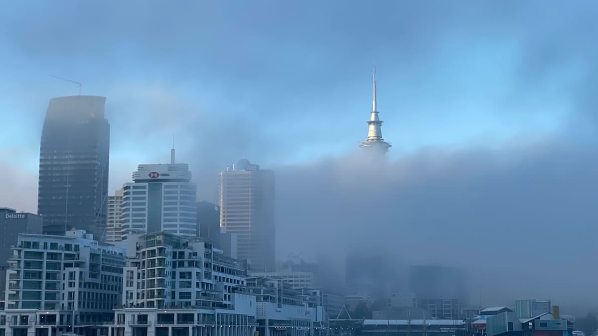
Yellow fog warning in force across eastern England
Publicly available information from the Met Office shows a yellow warning for fog in effect from 04:18 to 10:00 on Friday 30 October, covering the East of England as well as the East Midlands, West Midlands and London and South East England. The advisory highlights the risk of visibility dropping below 100 metres in places, with some patches described as dense and slow to clear during the morning.
The East of England warning area includes counties such as Cambridgeshire, Norfolk, Suffolk, Essex, Hertfordshire and Bedfordshire. Regional forecasts indicate areas of mist and fog are particularly widespread around Cambridgeshire and adjacent parts of East Anglia, with some rural locations expected to remain grey and murky into the early afternoon before conditions steadily improve.
Met Office outlooks issued earlier in the week pointed to a shift from recent stormy conditions to a calmer pattern dominated by high pressure, creating ideal conditions for overnight fog to form and persist. Forecast discussions highlight central and eastern England as among the areas most prone to repeat episodes of fog through the end of October, with light winds, clear skies and moist air combining to trap low cloud at the surface.
Separate summaries compiled from Met Office updates and independent warning trackers indicate that the current yellow alert is part of a broader run of fog warnings spanning from Thursday 29 October through to early next week for parts of eastern and central England. Travel services and safety advisers are drawing attention to the potential for renewed disruption around dawn on several days where similar conditions are expected.
Road traffic slows as visibility drops below 100 metres
Motorists across the A1, A11 and A14 corridors, along with local routes linking Cambridge, Peterborough, Norwich and Ipswich, are facing slower than usual journeys as visibility falls sharply in pockets of dense fog. Travel guidance based on the current warning encourages drivers to allow extra time, use dipped headlights, and avoid sudden braking or lane changes in low visibility.
Traffic monitoring services early on Friday report lower average speeds and heavier congestion than on a typical weekday morning on several radial routes heading into major towns and cities in the region. In particular, stretches of dual carriageway across open countryside are seeing the most abrupt changes in visibility, as banks of fog form in river valleys and low lying farmland before thinning again over slightly higher ground.
Safety organisations referencing the warning are underscoring the added risks at junctions, roundabouts and pedestrian crossings, where reduced sightlines can make it harder for drivers to judge gaps and spot vulnerable road users. Motorway and trunk road operators are maintaining standard speed limits but using roadside signs to remind drivers to keep greater distances between vehicles and to be prepared for patches of thick fog.
Publicly accessible transport resilience documents for the Anglia region note that reduced visibility is a known hazard on routes built through flat, reclaimed or agricultural land. These reports describe how fog can obscure signals, signage and hazards, leading to an increased emphasis on defensive driving and, in some cases, temporary speed management on the busiest stretches that feed into ports, logistics hubs and regional airports.
Rail services operate with caution under low visibility
As of early morning on 30 October, National Rail disruption information does not list major fog related cancellations on the main routes serving the East of England. However, the yellow warning and dense patches of fog are prompting operators to run with additional caution on certain sections, particularly on lines crossing exposed fenland and river plains.
The region’s key intercity and commuter corridors include the Great Eastern Main Line from London Liverpool Street through Chelmsford, Colchester and Ipswich towards Norwich, and routes from London King’s Cross and St Pancras into Cambridgeshire, Hertfordshire and Bedfordshire. Network planning documents for the Anglia route set out how visibility related hazards such as fog can require closer operational monitoring where lineside signals, level crossings and junctions are more difficult to see.
Industry guidance contained in Network Rail’s network statements and weather resilience plans explains that in foggy conditions, signallers and control teams track train movements carefully, with particular attention to level crossings and sections with complex signalling. The documents describe fog as one of several adverse weather factors that can contribute to delays when combined with other issues such as infrastructure faults or congestion.
Independent commentary from rail passenger groups and recent performance reports indicate that the East of England network has experienced a series of disruptions during the autumn due to storms, infrastructure works and other incidents. While the current fog episode has not triggered widespread cancellations this morning, travellers are being advised to check for short notice alterations, especially on early departures that cross multiple warning areas between the Midlands, London and East Anglia.
Air travel and regional airports monitor low cloud and fog
Fog can have a significant impact on flight schedules where low visibility procedures are required for take offs and landings. For the current warning period, regional airports serving the East of England such as London Stansted, Luton, Norwich and Southend are operating within the forecast fog risk zone, with early flights most exposed to potential disruption.
Past government transport resilience reviews highlight that major airports in southern and eastern England typically experience several fog affected days each autumn and winter, occasionally leading to delays or diversions. These documents note that even modest reductions in visibility can slow operations as aircraft require greater spacing on approach and departure, while ground movements of aircraft and vehicles around aprons and taxiways must be carefully managed.
Publicly available travel advice ahead of this morning’s warning encourages passengers to allow additional time for journeys to and from airports in the region and to stay in close contact with airlines and airport information channels. Early indications on Friday show that many flights are operating, but with some services using low visibility procedures that can modestly extend turnaround times during the busiest periods.
Air navigation and airport operators in the United Kingdom generally rely on a combination of instrument landing systems, runway lighting and surface movement radar to keep operations running safely in fog. The current episode is being watched closely as a test of how quickly conditions improve from mid morning onwards, when forecasts suggest visibility will gradually return to more typical late October levels.
What travellers can expect in the days ahead
Met Office outlooks for the coming days indicate that high pressure is likely to remain a dominant feature, favouring further calm, settled weather across much of England. Forecasts suggest that while daytime conditions in the East of England will often be dry with some sunny spells, repeated overnight fog formation is possible where skies clear and winds stay light.
Weekly briefings from the national forecaster describe this pattern as a shift from the recent period of strong winds and heavy rain associated with Atlantic storms to a quieter regime featuring chilly nights, mist and fog. For travellers, that means a reduced risk of widespread wind related disruption but an increased need to plan for slower than usual starts to the day as fog forms and then gradually lifts.
Travel planners and transport operators use these longer range signals to adjust staffing, timetables and maintenance windows. For example, early morning services may be monitored more closely on days flagged for a higher fog risk, while night time engineering work is coordinated to ensure that signalling and lighting systems are fully available ahead of the peak commute.
For those heading through the East of England over the next few mornings, the main message from publicly available forecasts and travel updates is to build extra time into itineraries, keep checking for updates before setting out, and be prepared for very changeable visibility from one stretch of road or rail line to the next as dense patches of fog drift and thin across the region.